Saturday 31 August 2019

1000 views

Well, it's taken nearly 5 months, but the first 1000 page views have been reached on the blog. Thanks to all the people who've read it. 
Keep coming back.

I've gone from 1893, and the founding of the Association, as far as 1932, when the President was Dr. Hugh Robert Mill. There are still many more Presidents to come, with their amazing stories and contributions to the development of the subject, and of geography in schools.

Tomorrow, the 1st of September 2019, I will start my own Presidential journey, by starting my post as Junior Vice President of the Association, which will be followed by posts as Vice President, President (2021-22) and Past President.

I am following Susan Pike, who has been JVP this year, and will be particularly supported by Stephen Scoffham, who was President for 2018-19 and finishes his Presidential year today.

Wednesday 28 August 2019

1932: Young People's Geographies

I am proud to have been involved in the Young People's Geographies project - 2006-11
I will be talking about that more when we get to that period, and the involvement of Mary Biddulph.
Of course, the thinking behind the project was not necessarily a new idea... there aren't any really.
Researching this blog has meant reading through over 100 years of journals, and back in 1932, there was an article by L Garrard.


References

Garrard, L. “SCHEMES OF WORK IN GEOGRAPHY MADE BY CHILDREN.” Geography, vol. 17, no. 4, 1932, pp. 293–295. JSTOR, www.jstor.org/stable/40558511.

Tuesday 27 August 2019

1932: Dr Hugh Robert Mill

Last updated July 2023

Hugh Robert Mill
was a Scottish Geographer and meteorologist, and a very important figure in the history of the GA and the RGS, as well as a Polar historian.


He was born in Thurso in Caithness, and educated in Edinburgh.
Follow this link to see an image

As with other Presidents of the GA, there is a strong connection with other organisations, notably the RGS, where he was Librarian from 1892. At this time, the RGS was based at 1, Savile Row in London.

There was also a strong exploration link as well, as with several other GA Presidents.

He was particularly linked with the Royal Scottish Geographical Society as well, when it was founded in 1885. This brought him into contact with all the main travellers of the day, as Mill was particularly involved with the RSGS throughout this time.

He held the post of secretary to the Royal Geographical Society during the Society's involvement with the leading British Antarctic expeditions of the late 19th and early 20th centuries.
He was a friend and confidant to Scott, Shackleton, and especially to William Speirs Bruce, who led the Scottish National Antarctic Expedition, 1902–04 (Wikipedia entry)

Early in the century he also became President of the British Rainfall Association. That's an Association I could get behind.

He published a very useful compilation called 'Hints to Teachers of Geography on the Choice of Books for Research and Reading' in 1897. He actually gave copyright of this book to the GA, which started off the GA's publishing work.

This can be read on this Internet Archive entry along with other of Hugh Robert Mill's books.
Here's a spicy little entry.


In 1921, he gave the Herbertson Memorial Lecture to the Manchester Branch of the GA. I have also had that privilege - in 2008. His was on the Value of Regional Geography.


Herbertson himself (see my earlier blog post on Herbertson in 1915) was grateful for Mill's help with his own work on the Oxford OS Sheet which formed part of his courses. He used the approach that Mill had used on his own local area of SW Sussex, which was the first to do an in-depth study of an OS sheet "from the viewpoint of the teachers' requirements".


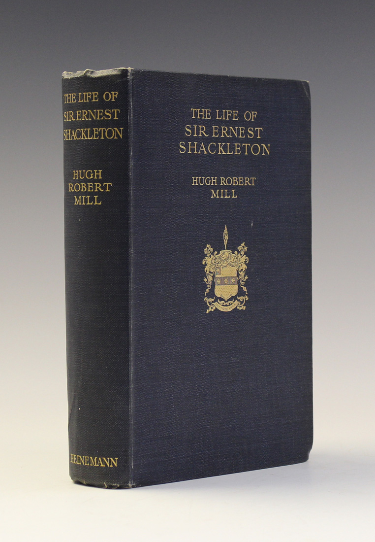
In 1923 he produced the first full-length biography of Sir Ernest Shackleton, a noted explorer and who was also connected with the RSGS. If you can find a copy be prepared to pay around £500. He wrote this with the assistance of Shackleton's widow.

He also wrote the introduction to Shackleton's book "The Heart of the Antarctic' about the 1907-9 expedition.
In his Presidential Address, he started with a nice image of the significance of geography.

The Address was called "An Approach to Geography", and he described geography as being like a picture of the world in the opening lines.


In 1934, Hugh Robert Mill gave another address to conference which is well worth reading. This time he had a focus on Scotland.
He was also connected with Imperial College.

He also had a connection with Antarctica, and the SPRI.


He has a glacier named after him in Antarctica, a branch of the Beardmore Glacier.
Frank Debenham, who we will meet in several decades time, also had some land named after him in Antarctica.

His likeness is also shown on a medal which is awarded by the Royal Meteorological Society for research into rainfall.

Mill died in 1950, in his 89th year: another GA president to live to an old age. I hope he set a precedent for future Presidents.

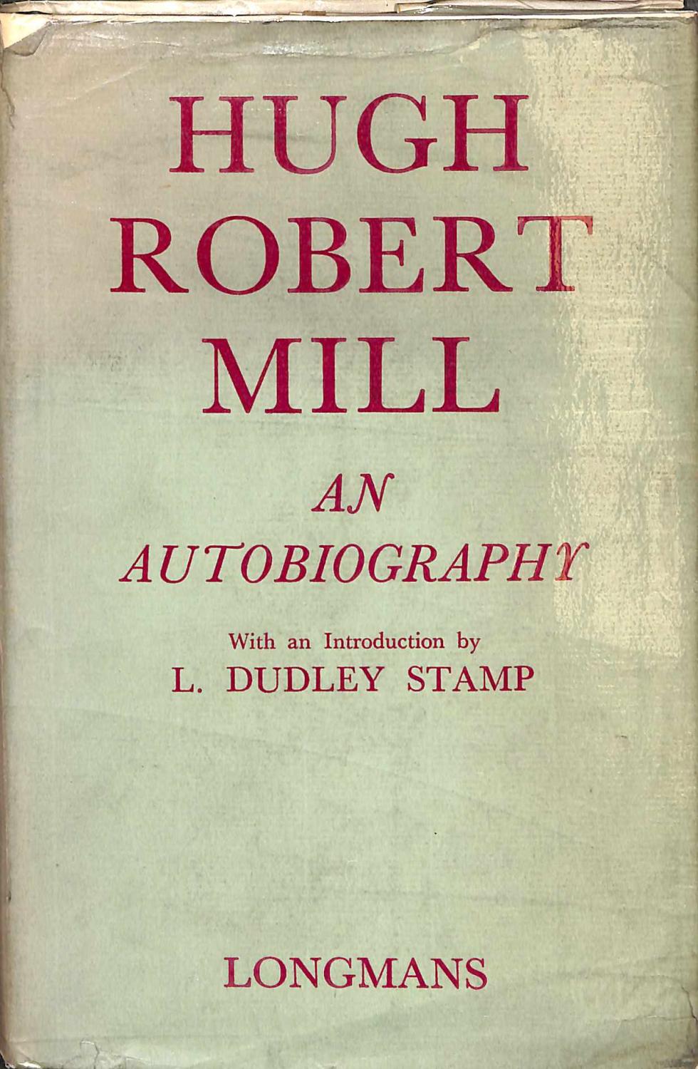
He also published his autobiography, which would be worth obtaining to find out even more about his time at the GA.

 There is apparently a copy in the Fleure collection that he donated to the GA.

He also left a legacy to the GA, which helped ensure its financial stability at a crucial time.

When he died, Balchin reminds us, he had been associated with the GA from the start - over 50 years of service to the Association.

References

Wikipedia: https://en.wikipedia.org/wiki/Hugh_Robert_Mill - shared under CC license and extracts used on this page.

Edited to add the GA Presidency role.

MILL, HUGH ROBERT. “ADDRESS TO THE GEOGRAPHICAL ASSOCIATION.” Geography, vol. 18, no. 1, 1933, pp. 1–16. JSTOR, www.jstor.org/stable/40560362.
Internet Archive searches. http://www.archive.org

Archibald Geikie: https://babel.hathitrust.org/cgi/pt?id=umn.31951000910377x;view=1up;seq=7

Obituary: Brown, R. N. Rudmose, and H. J. Fleure. “OBITUARY: Hugh Robert Mill.” Geography, vol. 35, no. 2, 1950, pp. 124–127. JSTOR, www.jstor.org/stable/40563009 

From the above:


Mill, Hugh Robert. “The Value of Regional Geography.” The Geographical Teacher, vol. 11, no. 2, 1921, pp. 7–19. JSTOR, www.jstor.org/stable/40555902

Please get in touch if you have anything further to add.

Updated October 2019

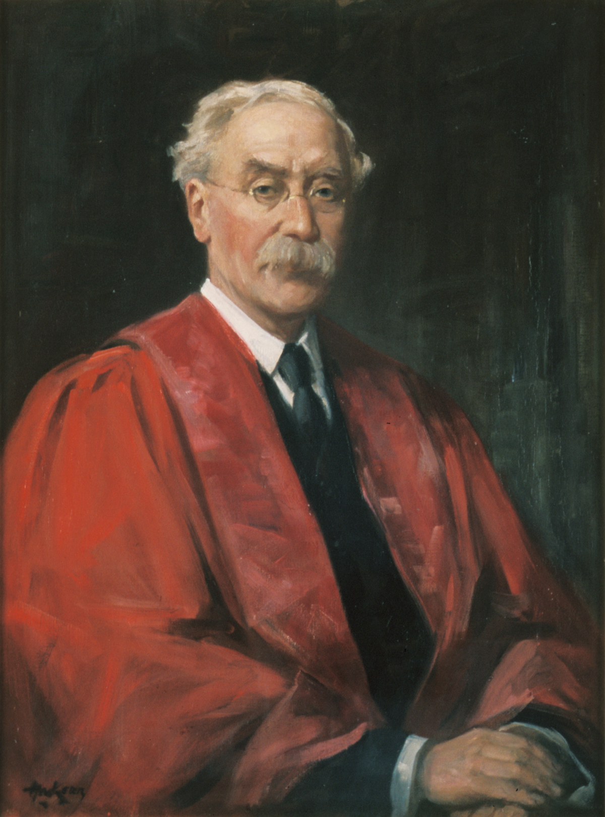
While investigating some resources for the entry on a later president, Percy Maude Roxby,  I came across a chronology of Geography in the 20th century written by G. R. Crone, at the time the librarian of the RGS, and it had an image of Hugh Robert Mill as shown below.... a fine moustache - perhaps I need to grow one for my Presidential year...

The article also outlines how Mill wrote the entry on Geography for the 11th edition of the Encyclopaedia Brittanica, which means that he could provide his own thoughts on what the subject actually was...
Source of image: 
Crone, G. R. “British Geography in the Twentieth Century.” The Geographical Journal, vol. 130, no. 2, 1964, pp. 197–220. JSTOR, www.jstor.org/stable/1794582. - available to read with a free JSTOR account.

Mill wrote an autobiography which was called 'The Life Interests of a Geography - an experiment in Autobiography'.

This was published privately by friends in the USA. 
A copy was presented to the Association - I tracked it down in the archive. A signed copy.

Details of this are provided in an article by another former GA President T C Warrington. 
Update: I found some letters related to this in the GA archive.


It seems his final years were one of reflecting on what he had achieved against a variety of challenges.


Warrington, T. C. “THE AUTOBIOGRAPHY OF HUGH ROBERT MILL.” Geography, vol. 32, no. 4, 1947, pp. 166–168. JSTOR, www.jstor.org/stable/40562610.

Not only was he a connection right back to the early days of the GA, when he died in 1950, he also left what is described by another future President: Alice Garnett as a bequest made from Mill's will which helped reduced anxiety about rising costs, and staff salaries

Source: Garnett, Alice. “GEOGRAPHICAL ASSOCIATION.” Geography, vol. 36, no. 1, 1951, pp. 57–62. JSTOR, www.jstor.org/stable/40563090.

JSTOR articles: https://www.jstor.org/action/doBasicSearch?Query=hugh+robert+mill&filter=


Mill, Hugh Robert. “Proposed Geographical Description of the British Islands Based on the Ordnance Survey.” The Geographical Journal, vol. 7, no. 4, 1896, pp. 345–356. JSTOR, www.jstor.org/stable/1773547

and discussion afterwards
Wilson, Charles, et al. “Proposed Geographical Description of the British Islands Based on the Ordnance Survey: Discussion.” The Geographical Journal, vol. 7, no. 4, 1896, pp. 356–365. JSTOR, www.jstor.org/stable/1773548.


Updated November 2019

https://books.google.co.uk/books?id=N81mDwAAQBAJ&lpg=PT67&ots=RtCfAEEQvA&dq=charles%20close%20OS%20geographer&pg=PT79#v=onepage&q=charles%20close%20OS%20geographer&f=false


Updated December 2019

I found another reference to his autobiography while researching Frank Debenham

H.R. Mill, Life interests of a geographer 1861-1944: an experiment in autobiography, self-issued 1946, 122. 
In print Mill felt compelled to refute media characterizations of the expedition as an “advertising stunt” as “quite unjust” – although the presence of two Boy Scouts on its crew – chosen from a nationwide competition in cooperation with the tabloid Daily Mail – might truly be described as one aspect of the expedition that was ahead of its time. 
Mill, The life of Sir Ernest Shackleton (London: Heinemann, 1923), 271. The competition to attract the Scouts is described in Frank Wild and Alexander H. Macklin, Shackleton’s last voyage: the story of the Quest (New York: Frederick A. Stokes, 1923), 14-15

In it, he described Shackleton's last voyage to the Antarctic.

ABE BOOKS has a wide range of books written by Mill. He seems to have been prolific
https://www.abebooks.co.uk/servlet/SearchResults?an=hugh%20robert%20mill&cm_sp=det-_-bdp-_-author

Mill and Debenham seem to be tied up in a number of things connected with the SPRI.
The thesis by Peder William Chellew Roberts in 2010 features a number of references to Mill.

A book by Charles Withers quotes Mill's memories of his childhood, which perhaps shows an early interest in Geography.

https://books.google.co.uk/books?id=DGRrF0CV8BYC&lpg=PA194&ots=ALTTdk_XQs&dq=Life%20interests%20of%20a%20geographer%201861-1944%3A&pg=PA194#v=onepage&q=Life%20interests%20of%20a%20geographer%201861-1944:&f=false


New image

Updated April 2021
A book that I came across...

Last updated August 2021


I found a copy of a self-published autobiography in the archive of the GA which had lots of interesting snippets on Shackleton, the 'Titanic' and his time at the RGS, including how he funded the payment for the statue of Shackleton that sits outside the RGS.

https://victorianweb.org/sculpture/jagger/1.html

Last updated August 2022

I discovered a bath of letters which had been written to 'Mill' as he seems to have been referred to in most of the letters from the great and the good of the GA. These were passed to the GA in 2000 and now reside in the archive. There are pictures of quite a few of them in this Flickr album.

There are quite a few from the time that he was asked to be the GA President for 1932 and he seems to have been quite reluctant at first.

This letter from B B Dickinson sent in 1931 expresses his thanks when Mill finally said that he would take the role on.

And here's one from Fleure in May 1931 asking him to come and talk about his proposed Presidential theme and mentioning some of the people who had been invited and others who couldn't make it.

One was Professor Gerhard Schott who it turns out was a renowned German oceanographer.

Also a famous geologist Percy Fry Kendall.

Apparently Sir Wilfred Grenfell was out of the country - probably in Newfoundland.

A prolific letter writer and who travelled a great deal it seems. 

Mill was GA President 90 years before my own tenure. 

Updated April 2023

Some more detail on Mill in this post on the Facebook group I am a member of called 'Sir Ernest H Shackleton Appreciation Society'. Mill has featured a number of times in fact.

Updated July 2023

The RMetS Award named after Hugh Robert Mill was awarded to Ed Hawkins this year, originator of the important Climate Stripes.

Sunday 25 August 2019

Definition of Geography of the Day

Geography is "....that part of mixed mathematics which explains the state of the earth and of its parts, depending on quantity - viz. its figure, place, magnitude and motion, with the celestial appearance".
Varenius

Saturday 24 August 2019

1932: Handbook for Geography Teachers

1932 saw the publication of a new 'Handbook for Geography Teachers' under the direction of Miss D. M. Forsaith.


Image; Alan Parkinson, shared under CC license

Here's a review from the 'Geographical Journal'


Friday 23 August 2019

Thought for the Day

"The amount of more or less repetitive work a teacher has to face in a long series of years makes a stimulant desirable to keep the mind fresh and active. The study of our immediate surroundings gives special opportunities in this direction. Many things that have been thought just ordinary are seen to be of special interest..."
H. J. Fleure

Thursday 22 August 2019

1931: Sir (William) Leslie Mackenzie

Last updated August 2023

Sir Leslie Mackenzie.jpg
Sir Leslie Mackenzie was a medical administrator who didn't have an obvious link with Geography at first glance.

His work did however help develop the sub-field of medical geography.

We now have plenty of interest in the geography of disease, and the use of GIS, with John Snow's cholera map, to the present day use of mapping and statistics (by the late Hans Rosling and others) to stem the spread of the Ebola virus.

He was born in Scotland, and educated in Aberdeen, before teaching at a girls' school. He graduated in Classics and Philosophy from Aberdeen University.

He became interested in medicine, trained in medicine and then became the Medical Officer the Wigtown and Kirkcudbright area. He had expertise in the water supply and link to health and tackled a local Smallpox outbreak. He dealt with tuberculosis infections, and became a Medical Officer on the Board of Health for Scotland before retiring in 1928.

Mackenzie was considered a radical by his peers in terms of promoting a movement of personal fitness rather than trying to control the environment. His colleagues regarded him “with awe, as a radical philosopher who saw medicine not as a palliative nor a means of private gain, but as an instrument of social development”.
(Via Wikipedia entry under CC license)

He was also a proponent of council housing. This was certainly an important area, and one that should be returned to reduce several issues we have currently.

Mackenzie served on a number of other commissions during his long and productive career. One of the most notable was the royal commission on housing between 1913 and 1917. 
He actively drafted topics to be addressed and even took an interest in drafting the 1919 Housing Bill itself. His champion cause was to introduce state-subsidised council housing. He was considered by his peers to have played an effective role in the inclusion of this issue.

Another important contribution was to help introduce school meals.

He demonstrated the poor condition of inner city children and presented it to the royal commission after he surveyed 600 schoolchildren. His report led to the introduction of a school meals service and medical inspection after much debate in Parliament. Something else we have to thank him for.

He also travelled to Kentucky - as described here:

He was knighted before taking up the GA Presidency.

His Presidential Address was unsurprisingly on the theme of medical geography. See later for some more details on the content:


In it, he outlined some of the ideas that he had developed during his career related to the control of disease, introducing ideas which are still taught at 'A' level in particular.
He was apparently known for his "pawky humour".

Mackenzie died in 1935, just a few years after the end of his Presidency. His wife continued similar work after his death.

His death was announced in Nature in 1935
https://www.nature.com/articles/135364a0.pdf

References
Wikipedia page: https://en.wikipedia.org/wiki/William_Mackenzie_(doctor)

I edited this page to add the GA Presidency role to it.

Mackenzie, Leslie. “A HEALTH ADMINISTRATOR'S ATTITUDE TO GEOGRAPHY.” Geography, vol. 17, no. 1, 1932, pp. 1–10. JSTOR, www.jstor.org/stable/40558124 - Presidential Address.
Image source: Wikimedia - CC licensed

https://www.ncbi.nlm.nih.gov/pmc/articles/PMC5309662/ - obituary
https://archive.org/details/healthschoolchi00mackgoog/page/n4

https://www.ncbi.nlm.nih.gov/pmc/articles/PMC5309662/pdf/edinbmedj75109-0045.pdf

If anyone has any further information on this GA President's role, please get in touch. This is quite a brief entry, and I'd like to add more if possible.

Updated August 2021
It seems that Mackenzie had a lot of useful thoughts on public health that were ahead of their time. He hated spitting as he felt it helped spread TB. He also tried to reduce overcrowding for health benefits.

Updated August 2023

A report on Leslie Mackenzie's GA Conference, including details of his address in 1932: It's interesting to see that some of the lectures were attended by over four hundred people!

Twenty six firms also took part in the publishers' exhibition.

https://www.nature.com/articles/129138a0.pdf 


Tuesday 20 August 2019

BBC: educational broadcasts

Geography teachers have always been enthusiastic viewers of videos. The connections that the GA has with the production of these goes back to the beginning.

The BBC first started to explore educational broadcasts in 1924, shortly after it was founded. Sir Francis Younghusband (who I have mentioned elsewhere on the blog) contributed to a film called "Climbing Everest". Talks between the GA and the BBC included Fleure, Dudley Stamp, James Fairgrieve and G. R. Taylor. 'Travel Talks' were developed, and the early radio shows were hampered by a lack of visuals, which were needed for context.


References

“How B.B.C. Lectures and Films Are Utilised.” Geography, vol. 15, no. 8, 1930, pp. 672–672. JSTOR, www.jstor.org/stable/40559754.

Fairgrieve, J. “USE OF BROADCASTING IN TEACHING GEOGRAPHY IN SCHOOLS.” Geography, vol. 16, no. 1, 1931, pp. 34–44. JSTOR, www.jstor.org/stable/40557798.

Monday 19 August 2019

1925: On the Geography Classroom

Back in 1925, Miss Celia Evans, from Barry shared her thoughts on how the Geography classroom should be laid out. I'm not sure my current room shares this specification in any aspect other than its aspect: it faces south. I like the requirements: a balcony, plenty of storage for plasticine, plenty of visual spaces - backed with green baize etc. Check out the full specification the JSTOR link.


Reference
Evans, Celia. “A MEMORANDUM ON THE SCHOOL GEOGRAPHY ROOM.” The Geographical Teacher, vol. 13, no. 3, 1925, pp. 233–236. JSTOR, www.jstor.org/stable/40556270.

Sunday 18 August 2019

Quote of the Day

"Stock taking and self-examination are salutary exercises for the teacher, .particularly so in a rapidly changing subject.... it is well to pause from time to time and survey both the objective at which we are aiming and the path or paths by which we may reach it."
Clement Cyril Carter, GA President 1939-1941

Saturday 17 August 2019

1930: Basil Bentham Dickinson

Updated August 2021

As I created this blog certain names kept recurring in the documents I was reading from the time.

One person who finally became President in 1930 but was a supporter of the Geographical Association from its origination, perhaps even its 'prime' instigator was B B Dickinson.

This coincided with a change in the way that GA Presidents were chosen: from high profile figures who might be champions of the subject towards acknowledging the long-term service of key officers of the Association.

Dickinson's name was on the bottom of the letter which announced the meeting in Oxford where the GA was founded.

Interestingly, H. J. Fleure, in his look back at the GA, talks about the fact that after a decade or so of appointing high profile Presidents it now "felt strong enough during the decade 1930-40 to choose presidents belonging to its inner circle from time to time".

Basil Bentham Dickinson was a master at Rugby School, at a time when it was Independent schools that were at the forefront of keeping the flame of Geography alight in schools, and looking to support the subject as an academic discipline.

He worked for many years in the classroom, and was also connected with the RGS. He was the Honorary Secretary of the GA from 1893 (when it was founded) until 1900.

He then had to wait 30 years before he became the President.

The year before he had been unwell, and 'Geography' had a piece explaining that he had recovered his health enough to take up the offer of being the President.

Following the Association's founding, Dickinson spent a lot of time working on a geography syllabus that could be the basis for improving school geography, and worked tirelessly for the Association in a number of different roles for the next few decades. Some of these are outlined in this description below, taken from a book on 'Modern Geography' by Gary Dunbar, where he is described as a "prime mover" in the formation of the Association.


1930, when Dickinson finally took office, was a year of great change in the Association, as outlined in Fleure's retrospective of the first 60 years of the Association, and Balchin's Centenary History.

The Honorary Secretary (H. J. Fleure) was appointed to a post at Manchester University (which meant another change in the location of Fleure's Library as space was offered by Spurley Hey.)
When I was a schoolboy, there was a school in Sheffield called Spurley Hey, and it seems there may have been several as he was the Chief Education Officer of the city at the time.
The printing of the GA's journals was also transferred to a new printer at this time: to Percy Brothers in Manchester. The building where they operated, later known as Hotspur Press is still standing, just behind Oxford Street station, where I usually alight when visiting the GA Conference.

There was also the start of some changes to the Primary curriculum in 1930. In several areas, Primary schools which had formerly dealt with pupils up to the age of 14 were made into junior schools for pupils up to the age of 11.

In 1930, his Presidential Address was called 'Reminiscences' and looked back at his time working with the GA, and his thoughts on how geography had developed. He referenced many previous Presidents.


Dickinson died in 1941.

In this obituary, printed in 'Geography' in 1941, he was remembered therefore (quite rightly) as someone without whom the GA may not even exist.


References
DICKINSON, B. BENTHAM. “B. BENTHAM DICKINSON.” Geography, vol. 26, no. 1, 1941, pp. 39–39. JSTOR, www.jstor.org/stable/40489910.

Fleure's 60th piece reference

Fleure, H.J. (1953) "Sixty years of geography and education", Geography, vol.38, pp.231-264

FRESHFIELD, DOUGLAS W. “VALEDICTORY ADDRESS.” The Geographical Teacher, vol. 6, no. 1, 1911, pp. 5–9. JSTOR, www.jstor.org/stable/40554086.

https://rsgs.org/wp-content/uploads/2018/06/RSGS-The-Geographer-Spring-2018.pdf - RSGS journal article on the 125th Anniversary of the GA

Image: Copyright - Royal Geographical Society - taken from Balchin's Centenary of the Royal Geographical Society.

If you know more about B B Dickinson and his work for the GA, please get in touch. I'm sure there is more to discover about him.

Updated August 2021
I discovered his first name was Basil not Brian as I had thought.
His death was announced in the Rugby School Digital Archive in 'The Meteor' in 1941.


Thursday 15 August 2019

Lantern Slides and Diagram Maps

These were an important part of the 'Pictorial Method' which was discussed at the meeting where the GA was created. They had been around for some time before the GA was formed, being in use from around 1850. They were used with a powerful lantern, which projected an image onto a screen or wall at a larger scale for an audience to view.
I have some smaller format lantern slides, which date from the middle part of the 20th Century, so they don't have any great age, but are of interest nevertheless.
In the late 1890s, the Royal Mail introduced postcards, and these were also used by teachers as a resource for a while.

The photography of Francis Frith was influential at the time, and Peter Fox (who will appear in a future post) has suggested that he was one of the early 'promoters' of Geography. To begin with, the GA encouraged the sharing of lantern slides, but also realised that there was a market for some ready-made sets of slides. This was done using a company, which was set up for the purpose.


The Diagram Company was set up in the early 20th century.

They produced sets of Lantern slides, and associated lesson materials.
This relationship with the GA continued until the late 1930s, when the company was closed.

Peter Fox wrote about this period in an article for 'Geography' in 2005, which also identified a range of other images which were used at the time.
At the 125th Anniversary conference in Sheffield, an exhibition of lantern slides was available for delegates to browse and a set of cards has also been made available for purchase from the GA shop featuring images from the archive.

References
Descriptions by Douglas Freshfield:

Peter Fox article:
FOX, PETER S. “Images in Geography — Great Expectations.” Geography, vol. 90, no. 1, 2005, pp. 3–17. JSTOR, www.jstor.org/stable/40574025

LYDE, L. W. “THE TEACHING OF GEOGRAPHY AS A SUBJECT OF COMMERCIAL INSTRUCTION.” The Geographical Teacher, vol. 4, no. 4, 1908, pp. 163–168. JSTOR, www.jstor.org/stable/41552643.
Image: Slide from GA Collection - used in the 125th Anniversary collection.

1930s: Land Utilisation Survey

The GA established a Regional Survey Committee in the 1920s and running into the 30s when it worked on finalising the Land Utilisation Survey.
This was instigated by Laurence Dudley Stamp, who was to become GA President later.

He had previously completed other land use work, and was interested in the publication of a map of Northamptonshire, published by the OS after the work of a geography teacher called Mr. E. E. Field.

Dudley Stamp according to 'Billy' Balchin, "was quick to realise the potential value of a national Land Utilisation Survey for GB as a whole and immediately proposed through the GA committee the establishment of a central organisation at the LSE"

This had representatives from the GA, OS, Ministry of Agriculture and Education Authorities. The GA couldn't afford to fund the survey, and in 1930, it became a separate Association under the Directorship of L Dudley Stamp.

During the 1930s, the survey continued, with the rural areas being easier to complete. The Six Inch survey was completed first, followed by the One Inch survey, funded by county sponsorships and help from individual LEAs (remember those?)

The survey was carried out by teachers, pupils, Scouts and Guides, students, WI members and even nuns. Those involved were convinced that if the land could be used better, Britain would be better - some great pre-War optimism.
Once the surveys were undertaken, the maps were returned to the office. They were transcribed by hand, and Dudley Stamp went out to many parts of the country to check them for accuracy. The Survey was funded by the royalties from Stamp's books. As the maps from the survey were published, Stamp wrote memoirs for each county that had been covered.

Stamp estimated, according to Rex Walford, that a quarter of a million schoolchildren were involved in the Land Utilisation Survey. It was later repeated under the helm of Alice Coleman (more on that to come in a later blog post), and finally in 1996 (more on that to come later too). James Fairgrieve (another former President was also involved according to Fleure's reports on the Survey in 1953
The layer was made available online, so it can be accessed.
It can be seen in the Visions of Britain website.

Here is the layer for Ely, for example.


Some sections of the country have a more 'hand-drawn' look to them.

A later survey was featured in a piece by Rex Walford which I have blogged about and will appear here in time.

Reference
Rex Walford (2001) - Land Utilisation Survey is featured in detail on pp. 108-112

Stamp, L. Dudley. “THE LAND UTILISATION SURVEY OF BRITAIN.” Geography, vol. 16, no. 1, 1931, pp. 44–51. JSTOR, www.jstor.org/stable/40557799.

Fleure, H. F:  (1953) https://www.jstor.org/stable/40564702 "Sixty years of geography and education"

Wednesday 14 August 2019

1930s: Geography and Films

During the 1930s, a new classroom aid appeared in the shape of educational films.
The 1928 conference saw the arrival of some work in this area as having great potential.
This was spearheaded by a future GA President: James Fairgrieve.
Fairgrieve worked with volunteers to explore the potential of cinema, even hosting an event at the Annual Conference in 1928.

People like Jon Grierson started to make documentary films, which had more geographical potential than other films. Films like 'Night Mail' (1936) were the result of his work. These were less than 30 minutes and were useful in the classroom. Modern teachers like short clips rather than feature length films (unless it's the last week of term).

Fairgrieve worked widely with London based teachers to promote the use of films.

Radio broadcasts were also started around this time too. I remember tuning in to the assembly at Primary school, and having the programme lead what we did.

In 1931, Fairgrieve wrote about the use of films.


This was well before Bernard Clarke and the rest...

References

“How B.B.C. Lectures and Films Are Utilised.” Geography, vol. 15, no. 8, 1930, pp. 672–672. JSTOR, www.jstor.org/stable/40559754.

Fairgrieve, J. “USE OF BROADCASTING IN TEACHING GEOGRAPHY IN SCHOOLS.” Geography, vol. 16, no. 1, 1931, pp. 34–44. JSTOR, www.jstor.org/stable/40557798.

Monday 12 August 2019

1930: Moving to Manchester

MANCHESTER: 1930 - 1946

In 1930, Professor H J Fleure took up the newly-established Chair of Geography at the University of Manchester and the GA moved with him. This meant finding a new place for the 4000 volumes that were now in the Association's Library, along with the Assistant Secretary who ran it and dealt with correspondence.


The Chief Education Officer in Manchester, Spurley Hey generously gave the GA free office and library accommodation in the Manchester High School of Commerce, which was gratefully accepted. Miss R M Fleming wanted to stay in Aberystwyth, and was replaced by Miss M. E. Owen. She proved herself to be just as efficient and skilful in her work.

When this became unavailable, temporary accommodation was provided at 103 Princess Street, Manchester, close to where the GA currently has its conference every three years or so.

This was a challenging time for the Association, with economic recession, and less demand for specialist teachers.
Despite that, the library's new location and premises allowed it to become a reference library, and use of it increased steadily.
T. C. Warrington took over as Honorary Librarian after stepping down as Headteacher of Leek Grammar School.

Sunday 11 August 2019

1929: Colonel Sir Henry G Lyons FRS

Last updated August 2023

Colonel Henry Lyons was another President with a varied CV and an interesting one. He was particularly linked with museums, and Polar exploration, and was also director of the Science Museum for a time.


He was born in 1864, and died in 1944, so also had a long life - as have many Presidents it seems.

He was educated at Wellington College, and then went to the Military Academy at Woolwich, before being elected to the Geological Society. He was commissioned as a Lieutenant in the Royal Engineers (a few GA Presidents had served with them) and was posted to Cairo.

The Royal Society obituary describes the source of his interest in geology:

He attributed his first interest in science to an acquaintance made during holidays in 1879-1880 with a neighbour at his Dublin home, who was then being ‘crammed’ for Sandhurst and taking Geology as a subject. The two boys collected fossils from blocks of Carboniferous Limestone lying on the canal wharves, and, with his interest thus aroused, young Lyons spent all his spare time at Wellington in reading Lyell’s Elements of Geology and then the same author’s Principles, being encouraged in these voluntary studies by the science master, Rev. B. A. Irving

From 1909 - this changed things a little when I found this document. I presume this is the same Henry Lyons.

At a meeting of the University Court, the highest decision-making body in the University of Glasgow, on 14 January 1909,

[I]t was announced that Capt. Henry George Lyons, FRS, FRGS, (Hon.) DSc Oxford & Dublin, at present Director-General of the Survey Dept. of Egypt, had been appointed Uni. Lecturer in Geog. for a period of four years from 1st Oct, 1909, at an annual salary of £250. (CM, 1908–09, C1/1/16, p. 46f)

While forms of ‘Geography’ had been taught previously in the University, at different times and as part of other courses of instruction – Ronald Miller (1972, 17) suggests that from at least 1577 it was present on Glasgow curricula – these words in January 1909 formally instituted Geography as an identifiable subject for teaching and, by implication, scholarly inquiry within the University. As noted at an earlier Court Meeting deliberating on the conclusions of a Committee set up to consider this matter, the appointment of a ‘Lecturer in Geography’ meant that Geography would now be taught ‘on a standard equal to a graduating course for Arts or Science’ (CM, 1907–08, C/1/1/15, p. 116f). A later Court meeting of 6 May 1909 also noted a proposal from the University General Council for ‘the addition of the subject of Geography under Depts. of Study’ (CM, 1908–09, C1/1/16, p. 98f). While the term ‘Department’ here does not quite mean what we now routinely understand by it (see Lorimer & Philo, 2009) the effect was still to put Geography on a relatively firm footing within the organisational structure of the University. 

Source: (2009) Guest Editorial, Scottish Geographical Journal, 125:3-4, 221-226, DOI: 10.1080/14702540903364260

Lyons was appointed as a Director of the Science Museum in 1920.
It seems he was a particularly impressive Director. The Science Museum's Facebook page describes his impact:

A strong believer in the needs of the ordinary visitor being more important than those of the specialist, Sir Henry Lyons was hugely important to broadening the Science Museum’s appeal and popularity.
Lyons introduced the first interactive exhibits and the first ever gallery designed specifically to engage children with science and technology.

Between 1921 and 1932 – a year before he retired – the number of visitors to the Science Museum per year increased from about 400,000 to nearly 1.25 million. Today, just under 3 million people visit the Museum each year.

He took over as Honorary Treasurer of the GA in 1926 following the death of E. F. Elton, who had held the post since 1908. He retired from the council when he joined the Science Museum, and the post passed to Sir William Himbury, the Chief Officer of the British Cotton Growing Association.

His Presidential Address was called 'The Geographer and his Material'. it was delivered in January 1929 at the London School of Economics (as were many Addresses during the first part of the Century, before the change to the Easter conference). 

He started by sharing the great honour that he felt at being the President, and spoke glowingly of the impact of Vaughan Cornish's presidency.


He talked about the role of specialist knowledge and skills in supporting the teaching of geography.

Here he is on Cartography, for example...


Because of a change in the time when the President made his address from the very start of the year to later in the year, Lyons ended up doing two addresses.

Lyons, H. G. “Relief in Cartography.” The Geographical Journal, vol. 43, no. 3, 1914, pp. 233–248. JSTOR, www.jstor.org/stable/1778611. Accessed 23 Nov. 2020.

His 2nd was in 1930.
He was elected as a Fellow of the Royal Society.
His obituary was published in various journals.

I like this description of him from one of them.


He died, aged 80 in Great Missenden, later home of Roald Dahl.

References

Wikipedia: https://en.wikipedia.org/wiki/Henry_George_Lyons
I amended this entry to reflect his
Obituary: https://royalsocietypublishing.org/doi/10.1098/rsbm.1944.0023

Correspondence in SPRI archive: https://archiveshub.jisc.ac.uk/search/archives/ea55fcaa-eb80-3fc8-b57b-d7f991aaf417 (I really need to take a trip there)

https://science.sciencemag.org/content/78/2028/429
Ernest M. Dowson. “Colonel Sir Henry Lyons, F.R.S.” The Journal of Egyptian Archaeology, vol. 31, 1945, pp. 98–100. JSTOR, www.jstor.org/stable/3855389.

I know relatively little about Henry Lyons' time as President, so if anyone has further information please get in touch.

Image - there is one linked to here, I am still looking for a CC licensed one

Presidential Address:

Lyons, Henry G. “THE GEOGRAPHICAL ASSOCIATION. THE PRESIDENT'S ADDRESS.” Geography, vol. 15, no. 5, 1930, pp. 353–359. JSTOR, JSTOR, www.jstor.org/stable/40559150.

Fleure, H.J. (1953) "Sixty years of geography and education", Geography, vol.38, pp.231-264

Cabinets of curiosities were mentioned by my colleague Claire Kyndt in her GA Conference session in 2015, which was excellent. Search Slideshare for the presentation.
This book explains more:
Read Chapter 6 by geographer David Matless.

Lyons introduced the first visitor-operated models in museums - the interactive displays we are so used to these days and which are found in most modern museums with a few exceptions, such as the Pitt Rivers (which has links to another former GA President Linton Myres of course).

Updated November 2020
From an obituary in a journal devoted to Egyptian Archaeology
Ernest M. Dowson. “Colonel Sir Henry Lyons, F.R.S.” The Journal of Egyptian Archaeology, vol. 31, 1945, pp. 98–100. JSTOR, www.jstor.org/stable/3855389. Accessed 23 Nov. 2020.


Updated July 2022
There is a book titled 'The rise of the Science Museum under Henry Lyons' which was published in the 1970s.
You can read a review here. via Google Books.

Updated August 2023


Henry George Lyons was born on 11 October 1864 in London. He was educated at Wellington College, and in 1882 entered the Royal Military Academy in Woolwich. In 1884, he attended a two-year course of military engineering at Chatham, after which he was posted to Gibraltar and then to Egypt, where he studied geology in his spare time. In 1901, Lyons retired from the army and was appointed director of the geological survey in Egypt, a post he held until 1909 when he returned to Britain. During the First World War, Lyons served with the Royal Engineers, retiring with the rank of colonel in 1919, and in the same year was appointed secretary-general of the International Union of Geodesy and Geophysics. In 1920, he became director of the Science Museum in London, where he remained until his retirement in 1933. He was knighted in 1926 and died on 10 August 1944 at Great Missenden.

This Royal Society documented provides all the information you would want to know about him. It doesn't mention his Presidency of the Geographical Association, which is disappointing...

It includes his work on meteorology during World War I, showing how vital weather information was militarily.

It includes an excellent image of an older Lyons shown here.


Also President of IUGG. (PDF download)


From the archive - Fleure to Mill 2 - Christmas 1933

Another letter from H J Fleure to Hugh Robert Mill. I love these old letters in the GA Archives. I plan to go up to Solly Street this comin...