Showing posts with label David Linton. Show all posts

Monday, 20 November 2023

Aerial Intelligence in WWII

There have been several GA Presidents who have been revealed as working in aerial intelligence during the Second World War. This is explored in their entries.

For example, Michael Wise graduated in 1939, and served in the Army in Europe and the Middle East during the Second World War, reaching the rank of Major and was awarded the Military Cross.

Wise was awarded the Military Cross for his conduct in the fierce battle of the Argenta Gap in April 1945 (see Jackson and Gleave 1988). His company’s forward ground was overrun by a surprise enemy attack and its headquarters were under threat. The citation for his medal refers to his ‘calm and confident bearing … [as] an inspiration to all members of his company, and his manner of dealing with a most difficult and dangerous situation is beyond praise’. 

During the war of 1939–45, intelligence was gleaned from aerial photographs by a newly founded organization that developed into the Allied Central Interpretation Unit. This was based primarily at Danesfield House (known as Royal Air Force Medmenham) some 50 km west of London, in Buckinghamshire.

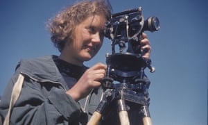
David Leslie Linton gets a mention here. I know that he was involved in suggesting launch sites for the 'V1 and V2' weapons.

Work at Medmenham, although important for the war effort, required interpreters familiar with aerial photographs rather than geology as such – but geology did assist the search for storage sites for ‘V’ weapons, terrain interpretation for the 1944 Allied landings in Normandy, and in guiding plans to bomb German industrial complexes hidden underground.

W G V Balchin wrote a useful summary which I have mentioned in a previous blogpost. He mentioned some of those involved and why geographers were useful.

Geography has always been vital to the prosecution of war, in three ways: first, intelligence is critical; secondly logistics (geographical factors influence the deployment of men, materials and firepower); thirdly, in action (geographical factors enter in decisions on the disposition of forces, where to attack or defend, what routes to follow, where to land invasion craft and so on.

References

Balchin, W. G. V. “United Kingdom Geographers in the Second World War: A Report.” The Geographical Journal, vol. 153, no. 2, 1987, pp. 159–80. JSTOR, https://doi.org/10.2307/634869. Accessed 1 Nov. 2023.

https://www.proquest.com/openview/a4b517a601813d3c3c3fc825fb1fb8fb/1?pq-origsite=gscholar&cbl=1818801 - Linton's work


World War One.

Charles Close was of course involved in World War I.

In Great Britain, a Topographical Section, later renamed Geographical Section, was assigned to the general staff in 1904 (Geographical Section, General Staff or GSGS). Until 1911, this section was headed by Charles Frederick Close (1865-1952), who reformed organisation and training based on his experiences of surveying in India; after that, he took over as Director General of the Ordnance Survey.

The OS remembers the staff it lost every Remembrance Sunday.

Friday, 3 November 2023

Michael Cross' memories

I enjoyed this account of going to Oxford University in the 1950s... by Michael Cross.

There are mentions of quite a few former GA Presidents along the way.


A few extracts

There were also, I remember, the Admiralty Handbooks. These were written by geographers in both Oxford and Cambridge during the War years to inform the military of the history, geography and culture of countries in the sphere of war.

We were all well aware of the Davisian cycle of erosion and it seemed almost to be geomorphologically 'fashionable' to look for erosion surfaces - they seemed to play such a major part in the interpretation of landscapes. Wooldridge and Morgan's Geomorphology along with Wooldridge and Linton's Structure, Surface and Drainage in South East England were necessary 'reads'. We were also made aware of a new (to most of us) hypothesis challenging Davis's, one formulated by Penck - summarised by "wearing back as opposed to wearing down". Little were we to realise that over the decades to follow another half dozen or so hypotheses would be suggested by competing geomorphologists. (I have often thought that it would be true to say that wherever two geomorphologists are gathered together, they will disagree!)

Research on frontal systems had only properly got underway in the inter-War period. Air masses were new to us. The then latest edition of Austin Miller's Climatology had what appeared to be an added chapter, Air Masses, and we were advised to buy this edition and avoid older second-hand copies without it. I find it remarkable that today it is routine for TV weather forecasters to refer to air masses in their forecasts. Similarly, most had not heard of the jet stream. I believe some empirical knowledge of jet streams was gained by fighter pilots over Japan in WW2 but it only 'filtered through' to the general public with the growth of high-level airline flights in the 1960s and beyond. During my three years I cannot recall any mention being made, detailed or otherwise, of the jet stream.

Jean Brunhes 'classic' text La Geographie Humaine, although nearly forty years old, was recommended reading, as was The British Isles by Dudley (later Sir Dudley) Stamp - aka 'Deadly Dudley'! 

I wonder why he was Deadly Dudley... as in deadly dull?

In 1954, the annual meeting of the British Association was held in Oxford and thus the accompanying volume The Oxford Region was an up to date source. Edited by my tutor A F Martin and by R W Steel, other familiar names are listed on the Contents page (Dr Steel left midway through my time at Oxford and went on to become Professor of Geography at Liverpool.)

Reference:

https://www.geog.ox.ac.uk/alumni/news/181127-mcross-1950-geog.html

Saturday, 14 August 2021

Spring Conference Programmes

A few from the archives at Solly Street.

Spring Conferences were a theme for some decades. Some well known names and former Presidents involved in these particular events. More detail to come as time permits once I visit Solly Street again.


The last one was held in the year I was born. Note the address of the GA at the time: at the Park Branch Library on Duke Street.

Also note Marguerita Oughton, who has been mentioned on the blog.

Wednesday, 5 August 2020

1974: Professor Harry Thorpe, OBE

Prof Harry ThorpeLast updated August 2023.

Harry Thorpe was a Professor of Human Geography at the University of Birmingham, where he spent his career.

Sheila Jones kindly provided me with some detail, including his first name. She said he was very supportive of her when she became President the following year. This also led me to a few other additions which has fleshed out the entry for Professor Thorpe.

Harry was born in Chesterfield, and went to Chesterfield Grammar School and then went to Durham University where he won their Maltby Prize as an undergraduate. As with many geographers at the time, he saw service in the war, and it's also good to see that he spent time as a school teacher at Accrington Grammar School, prior to the war.


In 1969, Professor Thorpe became the second chair of Geography at the University of Birmingham.

He made a particular study of Rural Settlements, and contributed chapters to a number of texts. I love the opening paragraph to this chapter to explain why places are different.


Professor Thorpe also wrote other books on this theme.
Harry Thorpe was also involved in a government review of allotment ownership. A specific area to be interested in, but allotments have proved their worth for many during lockdown.

The decline in allotments led to a Government review of allotment provision in the UK chaired by Harry Thorpe, Professor of Geography at the University of Birmingham. Thorpe and his committee were responsible for establishing a new vision for post-war allotment provision, a radical shake-up with allotments to be seen as a rewarding, leisurely recreational activity.

From this University of Birmingham page.

As part of the ‘Dig for Victory’ and ‘Grow More Food’ campaigns, allotment holding had peaked during World War II to 1,452,000 plots over 143,000 acres in England and Wales. War time regulations regarding allotments had ended by 1950. The rise of the affluent society, the TV set and the motor car all contributed to the immediate post war down turn in allotments.
During the 1950s and 1960s allotments went into decline as people sought to buy their food from the new supermarkets and convenience stores rather than grow their own. The national decline led to a Government review of allotment provision in the UK chaired by Harry Thorpe, Professor of Geography at The University of Birmingham. Thorpe and his committee were responsible for establishing a new vision for post-war allotment provision in England and Wales
Alison Smith wrote this account, which has some references to Professor Thorpe.

At this time, as for most of the GA's history, the President was only involved for the one year, rather than the current structure which is that they serve as Junior Vice, Vice and Past Presidents either side of their Presidential year.

He was the Chairman of the GA's Birmingham Branch from 1953, making it one of the largest in the country. He was also President of the Worcester Branch, one of several that I have had the pleasure of speaking at.
He sadly died unexpectedly, following a protracted illness in February 1977, aged 64.

He was awarded the OBE for his services to allotments the previous year. I often think of Harry when I see a good set of allotments.

His obituary was published in 'Geography' and written by Gordon Warwick.

This provided a range of useful additional information on Harry's work for the GA as well.

References

No Wikipedia entry 

Cadbury's: https://theironroom.wordpress.com/2013/01/15/allotments-then-and-now/ - source of the image.
Image: Prof Harry Thorpe. Courtesy of Cadbury Research Library: Special Collections, University of Birmingham [UA10/10]


https://www.birmingham.gov.uk/directory_record/182654/harry_thorpe_professor_of_geography_at_the_university_of_birmingham

Obituary:
Warwick, Gordon T. “Obituary: HARRY THORPE, 1913-1977.” Geography, vol. 62, no. 3, 1977, pp. 222–223. JSTOR, www.jstor.org/stable/40568739. Accessed 20 July 2020.

If anyone knows any more about Professor Thorpe, please get in touch - this is a rather brief entry.

Updated November 2020
I followed a lead to his work on allotments - he was described by one person as the 'Beeching' of allotments because of his work on them which led to some disappearing ultimately...


This has a biography:

Harry Thorpe was born in Derbyshire in 1913 and was educated at Chesterfield Grammar School and Bede College, Durham. He was awarded a first class honours degree and the Maltby Prize. He was a demonstrator at Durham from 1933 to 1936 and began work on the historical geography of the county with particular reference to rural settlement. He gained an MLitt degree but his research was interrupted by the outbreak of war in 1939. He worked as a schoolteacher in Accrington for a short time, before being called up to the Royal Engineers. He served in the Geographical Section of the General Staff, later the Directorate of Military Survey, and in Sri Lanka, India, and Burma. He ended the war as Major, and gained a technical grasp of the map making process which helped him in his command, after the war, of a Territorial Army Squadron in Birmingham.

In 1946 he was chosen by R. H. Kinvig to be his senior assistant in the development and expansion of the department of geography at the University of Birmingham and he remained there for the rest of his career. He was appointed senior lecturer in 1951, reader in 1954, and professor in 1964. He was Head of Department from 1971. He continued his work in historical geography and gave special attention to the problems presented by rural settlement forms in the British Isles, undertaking comparative studies of rural settlement forms in north-west Europe, particularly Denmark. He also carried out research into the historical geography of settlement in the West Midlands and made studies of patterns of land use in Birmingham, Lichfield and Wormleighton. He worked with P. D. A Harvey on printed maps of Warwickshire. 

He was President of the Birmingham and Warwickshire Archaeological Society 1974-1976, and served as president of both the Birmingham and Worcester branches of the Geographical Association. He was president of the national Association from 1974-1975.

In the mid 1960s he was asked to serve as Chairman of a Departmental Committee in the Ministry of Housing and Local Government to inquire into the state of allotments and to suggest changes in policy. Many of the suggestions made in the Report were adopted. He continued this work and became recognised as a leading advocate in the campaign to transform the allotment into the 'leisure garden'. 

He was President of the National Society of Leisure Gardeners from 1970-1976, and President of the International Federation of Leisure Gardeners in 1974. 

He was awarded an OBE for his services in 1976. 

He first became ill in 1976 and died on 14 February 1977

http://calmview.bham.ac.uk/GetDocument.ashx?db=Catalog&fname=US137+Papers+of+Harry+Thorpe.pdf - PDF download

Source: Obituary in The Geographical Journal, Vol 143, No. 2 July 1977 pp.364-365 http://www.jstor.org/stable/1795950 accessed December 2012

Updated August 2023

Archive papers - books and jourmal articles listed.

Thursday, 18 June 2020

G H Dury, David Linton and the CIU

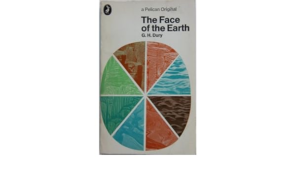
THE FACE OF THE EARTH.: Amazon.co.uk: G.H. DURY: 9780140204476: BooksWhen I took my'A' level Geography back in 1980-1982 - doesn't seem possible but it's true - I was asked to buy a Penguin copy of 'The Face of the Earth' by G H Dury. It was actually the same edition as the one shown here on the right.

George Harry Dury's name has cropped up in association with several GA Presidents.

Dury was a hydrologist, interested in rivers. and more widely in geomorphology. He was born in Northants, and studied at the University of London. He taught geography at Birkbeck College. He developed models which extended Bradshaw's Model for rivers.

Like David Leslie Linton, he was involved in air photography interpretation during the war - see Brendan Conway's excellent post on RAF Medmenham for more details on this. Also Balchin's report on wartime geographers features Medmenham. The Central Interpretation Unit (CIU) also included Professor Frank Debenham for example.

Thanks to Brendan Conway for some excellent additional research here as well on G H Dury's work in wartime. Here's what Brendan sent me a few months ago when I mentioned David Linton's wartime work.


One thing about the David Linton profile I found particularly interesting was his WWII work in photographic interpretation, especially in identifying the underground V-weapon factory in northern France (now La Coupole https://www.lacoupole-france.co.uk/history-centre.html).

It reminded me of something that I've noticed cropping up a few times - the role of geographers in WWII intelligence in places such as RAF Medmenham. Linton is one of several who played key roles in intelligence in a similar way to GIS experts in the Bellingcat organisation now.

Other geographers involved in similar WWII activity included H Clifford Darby and Kenneth Mason in Naval Intelligence (https://www.thebritishacademy.ac.uk/humanities-scholars-who-worked-military-intelligence-second-world-war) and G H Dury (George Harry Dury) in photographic interpretation (RAF Medmenham) (https://rgs-ibg.onlinelibrary.wiley.com/doi/abs/10.1111/j.0020-2754.1997.00398.x).

There's a good book about such work, including interesting references to RAF Medmenham by Jeremy Harwood called 'World War II from Above'. Harwood wrote an article about it 'Spies in the Skies: How Aerial Surveillance Tipped the Balance of WWII'. Here are some quotes indicating links with geographical expertise and how it was used:

'The staff—mostly an eclectic mix of boffins and academics with quite a few women among them—comprised some of the best brains in the country...Glyn Daniel, the first Cambridge archaeologist to be recruited to the Medmenham operation, described his new colleagues as "an ill-assembled collection of dons, artists, ballet designers, newspaper editors, and writers'.

'...the students were introduced to stereoscopic viewing. They were taught how to handle a stereoscopic viewing frame—this was universally referred to simply as a "Stereo." The two photographic prints that fitted into it were termed a "Stereo Pair." '

​Would Linton have worked with Constance Babington Smith?

'Constance Babington Smith was one of them. As well as being the photographic interpreter who first spotted a V1 Flying Bomb on its way for testing, she was the first to spot the Messerschmitt Me 163 rocket fighter, the Heinkel He 28, the world's first jet fighter, and the revolutionary Messerschmitt Me 262, the twin-engine jet fighter that, fortunately for British and American airmen, Hitler insisted be redesigned to be deployed as a fighter-bomber. She and her team detected other top-secret German aircraft prototypes into the bargain'.

Painstaking interpretation would culminate in the meticulous creation of 3D landscape models used to prepare for bombing raids and battles. There's an interesting reference to the challenging geographical learning required by aircrews:

'By the time the war ended, Medmenham's model makers had churned out more than 1,400 models. Some, like the models of the Möhne, Eder, and Sorpedams used to brief the Dam Busters prior to their famous 1943 air attack, were extremely elaborate. Such was the reliance Bomber Command placed on them that, according to Paul Brickhill, author of The Dam Busters, the aircrews taking part in the attack were instructed to "look at these until your eyes stick out and you've got every detail photographed on your mind." '

It's also known that Ronald Lampitt, much admired by geographers and certainly one of my favourite artists, worked in this area of intelligence. His 'geographical eye' and recurring tendency to view almost everything he illustrated from above seems likely to have been strongly influenced by his wartime work, but perhaps also by working with geographers? I'd never been able to find out much about his role during the war until last week when I stumbled across reference to his work by the scientific military intelligence expert RV Jones in his book 'Most Secret War'. It seems that he was very close to the V-weapon investigations as well, so there would be a possibility that he worked with Linton at some point. I summarised the findings in this thread:

Lampitt was recruited by Albert Hugh Smith, who was clearly very close to RV Jones. He later went on to become Professor of English at UCL and acclaimed scholar of Scandinavian Studies and English placenames, so he clearly had geographical interests. Perhaps he had links with Bill Mead at UCL who was also a Scandinavian expert?
Image

Delighted to see the link to Ronald Lampitt - a favourite of mine who I wrote about for the Ordnance Survey's magazine back in the day. I have a much loved copy of the book, and it will definitely have a place in my Presidential lecture in 2022.
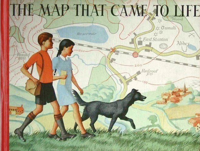
Lampitt's illustrations were included in the book which came out in 1948
I wonder if the author also worked in the same sort of setting.
In The Map that Came to Life the map is portrayed as an objective, precise and above all truthful mirror of nature. And this inherent trustworthiness enabled maps to become important features of the lives of successive generations of people.

More on the author and the book here.

Lampitt’s war service was spent with RAF Intelligence. He created meticulous, hand-drawn maps for allied bomber crews, based on aerial reconnaissance photographs. It was this period of his life that started Lampitt’s fascination with aerial views, which he would later use to great effect in The Map That Came To Life.
Sources: 
Wikipedia page.
https://en.wikipedia.org/wiki/G._H._Dury

Balchin, W. G. V. “United Kingdom Geographers in the Second World War: A Report.” The Geographical Journal, vol. 153, no. 2, 1987, pp. 159–180. JSTOR, www.jstor.org/stable/634869. Accessed 16 June 2020.

Dury, G. H. “Geography and Geomorphology: The Last Fifty Years.” Transactions of the Institute of British Geographers, vol. 8, no. 1, 1983, pp. 90–99. JSTOR, www.jstor.org/stable/622279. Accessed 16 June 2020.

Thanks to Brendan Conway for the additions to this post.
If anyone knows more about these wartime geographers please get in touch.

Thursday, 11 June 2020

Cuchlaine A M King

Professor Cuchlaine Audrey Muriel King died in December 2019.
She was an expert in glaciation and I remember using her book on periglaciation when I started teaching in the late 1980s and wondering how you pronounced her name... She was very proud of her name.
There was also her book with John Cole, who I blogged about recently, on Quantitative Methods which I also remember being in the departmental library back then.
She studied at Cambridge University and earned her bachelor's degree in geography in 1942. She then joined the Women's Royal Naval Service and became a meteorologist and surveyor for the duration of World War II. After her service, she returned to Cambridge and researched sand movement on beaches, earning her doctorate in 1949.

King spent her career studying the influence of glaciers on landscape evolution. She went on expeditions to Skaftafell in Iceland in 1953 and 1954 to study the glaciers there. It was unusual at that time for young women to be allowed to participate in fieldwork in such remote, rudimentary areas of Iceland. The expeditions resulted in a series of papers in 1955 and 1956. Because of her gender, her participation in fieldwork trips was discouraged. However, she participated in research on Baffin Island in the 1960s and the Austerdalsbreen glacier in Norway, and led fieldwork expeditions of her own throughout the Arctic. She published several books throughout her career.

A Yorkshire Post piece said:
With characteristic modesty, she said more than once that her “only achievement” had been to “pave the way for gender equality in Arctic exploration,” recalling the research she undertook on Baffin Island in the far north of Canada in the mid-1960s with the eminent geologist, Prof Jack D Ives, a former student of hers at Nottingham University.

This piece threw up another link:

King was taught by Professor Frank Debenham, another former GA President - from 1952 in fact.
In 1959, King began teaching at the University of Nottingham, where she remained for the rest of her career. A research laboratory is named in her honour.
King was one of the earliest women to become a professor of geography in the United Kingdom, and she retired in 1982 - she may have gained that honour earlier if not for discrimination. Cuchlaine King was honoured with the David Linton Award of the British Society for Geomorphology in 1991.

Cuchlaine King specialised in physical geography. She learned topographic surveying and had a special interest in beach sand movement, completing a doctorate on the topic in 1949

The Linton Award is named after the former GA President who has appeared already on this blog.
A full obituary was published in the latest issue of the Geographical Journal of the RGS-IBG.

To finish, a story I liked:

Enjoying a picnic while on a field trip to Lunedale in the Pennines, Cuchlaine King and her group of geography students were approached by an inquisitive sheep. It came close enough for Cuchlaine to offer it a bite of her sandwich, which it accepted with gusto.
“That was so sweet,” one of the students said. “What sort of sandwich was it?” “Lamb,” came the reply.

Sources
Wikipedia page: https://en.wikipedia.org/wiki/Cuchlaine_King

https://books.google.co.uk/books?id=9Pc-KlQ3I54C&lpg=PA90&dq=cuchlaine%20king%20nottingham&pg=PA90#v=onepage&q&f=false

Brian Whalley wrote an obituary for 'The Guardian'

Monday, 27 April 2020

1964: Professor David Leslie Linton

Last updated October 2023

"Mankind must be made much more aware of the world it lives in, its rigorous limitations and its limited possibilities. Above all it must be assisted and persuaded to think of the world as a whole"
D. L. Linton

David Leslie Linton was a Professor of Geographer at the University of Sheffield, and a renowned geomorphologist. His name lives on in the form of prizes in this field.


He was a close colleague of Professor Alice Garnett who, we will discover, was the beating heart of the GA for many years, following her taking up the post of Honorary Secretary in 1947 and overseeing the GA's move to Sheffield in 1950.

Alice Garnett later became GA President four years after Linton.

Linton was a geomorphologist, and also did some influential work with another former GA President: Sidney Wooldridge.

He was born, apparently, in a grocers' shop on the Old Kent Road, to Irish parents, and went on from there to Haberdasher's Aske's school. 
He was a gifted musician, and apparently wanted to do a degree in Chemistry originally. 
He was also a keen artist, and sketched the landscape, from where the geomorphological features emerged, waiting to be explained. In the 1930s, he was active with the Le Play Society, leading fieldtrips to locations including Iceland. This Society was very much tied up with the early history of the GA.

Linton went to King's College, London and was persuaded by Sidney Wooldridge (who was working as a Demonstrater at the time) to add geography to his subjects for his degree, and he was drawn into the exciting geomorphology work that was being done at the time. This university has been linked to quite a few GA Presidents, notably another geomorphologist Denys Brunsden.

He spent the war (1940-1945) with the Royal Air Force Volunteer Reserve working in aerial photography interpretation - solid work for a geographer, and which gave him a deep knowledge of landscapes. There is definitely a book here to trace the work of the geographers who were later linked with the GA in the post-war period. It seems that he was rather good at this sort of work as his obituary explained:


After the war, he went over to check out the sites, and was just about tracked down by the University of Sheffield, who wanted to interview him for a post there where he was appointed as Professor of Geography.

Summary of his career:
King's College London, BSc (Geography), 1927, MSc, 1930; DSc 1945; Demonstrator in Geography and Geology, University of London, 1927-1929; Lecturer in Geography, University of Edinburgh, 1929-1945; served in the RAF (Photographic Intelligence), 1940-1945; Professor of Geography, University of Sheffield, 1945-1958; DSc, 1955; Professor of Geography, University of Birmingham, from 1958; William Evans Visiting Professor, University of Otago, 1959; Honorary Editor of Geography, the Quarterly Journal of the Geographical Association , 1945-1965; President of the Institute of British Geographers, 1962, and of the Geographical Association, 1964; Fellow of King's College London (FKC), 1971; received the Murchison Award, Royal Geographical Society, 1943.

What an impressive CV...

At a meeting in Sheffield (with Wooldridge and others) in 1958, he was a founder member of what became the British Geomorphological Research Group, which he chaired in 1961, and also a founder member of the Institude of British Geographers. He became President of the IBG in 1962.

Linton was honorary editor of the GA's 'Geography' journal too, between 1947 and 1965, and his name appears in numerous copies of 'Geography' in the front matter and also in the pages.

He contributed a range of articles to the journal 'Geography' through the 1940s and 1950s. One was on the rise of the million city - I wonder what he would have made of the rapid rise of megacities, particularly in China.


He also wrote a piece on Geography and the Social Revolution in 1957 in 'Geography'.
His Presidential Address. published in 1965 was on 'The Geography of Energy'


The address included some classic illustrations such as this one.


It also finished with an important message for all teachers.


I remember that he also developed a theory of the formation of Tors, and was taken to the quarry where this theory was apparently first visualised when on an undergraduate fieldtrip at Two Bridges on Dartmoor.
I've visited the quarry here. It's on the path to Wistman's Wood.


Tor formation theory is shown below, in an influential textbook of the time by David Waugh, who is mentioned elsewhere on the blog.


In 1964, he became President of the Geographical Association - probably quite a coup for the GA at the time given how prominent and busy he was.

Linton died unexpectedly in 1971, when he was nearing retirement at the end of a long career while in post at the University of Birmingham. He was still very active.


Obituary published in several journals.

A tribute to him was written by Alice Garnett and published in 1966 on the occasion of his retirement as Honorary Editor.


He received the RGS's Murchison Award.

References
Wikipedia
https://en.wikipedia.org/wiki/David_Linton_(geographer)

I amended this to add in his GA Presidency, as I have done to all entries for former Presidents.

Address: LINTON, D. L. “The Geography of Energy.” Geography, vol. 50, no. 3, 1965, pp. 197–228. JSTOR, www.jstor.org/stable/40567042
Obituary:
“David Leslie Linton.” Transactions of the Institute of British Geographers, no. 55, 1972, pp. 171–178. JSTOR, www.jstor.org/stable/621729

Garnett, Alice. “A Tribute to D. L. Linton: Honorary Editor 1947-65.” Geography, vol. 51, no. 1, 1966, pp. 65–66. JSTOR, www.jstor.org/stable/40566046. Accessed 12 Apr. 2020.
LESZCZYCKI, STANISLAW, and David L. Linton. “The Development of Geography in the People's Republic of China.” Geography, vol. 48, no. 2, 1963, pp. 139–154. JSTOR, www.jstor.org/stable/40565574.

LINTON, DAVID L. “Geography and the Social Revolution.” Geography, vol. 42, no. 1, 1957, pp. 13–24. JSTOR, www.jstor.org/stable/40563897

LINTON, DAVID L. “Millionaire Cities To-Day and Yesterday.” Geography, vol. 43, no. 4, 1958, pp. 253–258. JSTOR, www.jstor.org/stable/40564208
Linton, David L. “THE LANDFORMS OF LINCOLNSHIRE.” Geography, vol. 39, no. 2, 1954, pp. 67–78. JSTOR, www.jstor.org/stable/40564569
https://www.ed.ac.uk/geosciences/about/history/school-history


Image of Haytor - copyright Alan Parkinson, shared under CC license
Image of Linton from the Balchin Centenary Book

Update August 2020
In 2017, my own degree tutor and former lecturer at Huddersfield Polytechnic: Professor Tim Burt was awarded the Linton Award
https://www.dur.ac.uk/geography/news/allgeognews/?itemno=31007

Updated October 2023 with a quote at the start of the post.

He worked to locate V1 and V2 launch sites which is a remarkable period of history for him to have been involved with.

Wednesday, 22 April 2020

1964: A Scilly excursion

1964: Nearly disastrous expedition from the Falmouth Spring Conference to the Scilly Isles, in the SS Scillonian - one of the roughest passages for many years. 

This passage in Peter Fox's chronology intrigued me.
At the time there were some summer and spring field excursions, which were very popular as they predated (just) the main travel agents / package holiday business.

The excursion formed part of the 1964 Spring Conference in April, which took place in Cornwall.


You woll see reference to many former Presidents in the speakers list, including David Leslie Linton. who will be coming up next in 1964, talking about tors and granite, which must have been a great pleasure for those involved.

It seems that there was a voyage on a ship to the Scilly Isles which encountered particularly rough weather.


Source: “The Geographical Association.” Geography, vol. 49, no. 3, 1964, pp. 346–348. JSTOR, www.jstor.org/stable/40566391. Accessed 22 Apr. 2020.

Sunday, 5 January 2020

Thought for the Day

"Mankind must be made much more aware of the world it lives in, its rigorous limitations and its limited possibilities. Above all, it must be assisted and persuaded to think of the world as a whole".
David Linton, 1960

Source
Shepherd, W. H. “A One-Day Conference on the Teaching of Geography: A REPORT.” Geography, vol. 45, no. 4, 1960, pp. 300–303. JSTOR, www.jstor.org/stable/40565188

Friday, 25 October 2019

1947: Moving to Sheffield

PARK LIBRARY, SHEFFIELD: 1947 - 64 

Post-war developments forced the GA to relinquish its accommodation in Manchester as the area was redeveloped.
Dr. Alice Garnett (the Honorary Secretary at the time) and Professor David Linton (Honorary Editor) were both based in Sheffield, so a move there was agreed, and made possible by the Sheffield City Librarian’s generous offer of free office and library space at Park Library, Duke Street.

This is another on the list of places to visit during my time as President.

In October 1950, the GA’s new offices were officially opened.


Image: Google Earth - copyright is held by the various image providers, and image used under Fair Use.

Margaret Mackintosh RIP

Updated post. Sad news at the end of last week from colleagues who have organised the Charney Conference over the years of the passing of Ma...