Showing posts with label Images. Show all posts

Thursday, 18 September 2025

A few new updates

I've tickled away at the site over the summer and updated the entries for quite a few people. 

I'm keen to keep the site up to date as the years progress since my own Presidential year. 

If you are reading this and you have been a GA member for a while or have a story (or pictures) from a previous GA Conference, or anecdotes relating to past GA Presidents,  please get in touch.

GA Conference - 2001 - University of Sussex

Thanks to Joseph Kerski for the image

Monday, 23 December 2024

Ronald Lampitt - 'geographer'

Back in 2020, Brendan Conway responded to a post on this blog which mentioned the wartime work of quite a few former Presidents, often in aerial photography interpretation, although this is not an area that has been researched in any detail. 

It finished with a mention for the artist and illustrator Ronald Lampitt.

It's also known that Ronald Lampitt, much admired by geographers and certainly one of my favourite artists, worked in this area of intelligence. His 'geographical eye' and recurring tendency to view almost everything he illustrated from above seems likely to have been strongly influenced by his wartime work, but perhaps also by working with geographers? 

I'd never been able to find out much about his role during the war until recently when I stumbled across reference to his work by the scientific military intelligence expert RV Jones in his book 'Most Secret War'. It seems that he was very close to the V-weapon investigations as well, so there would be a possibility that he worked with Linton at some point. I summarised the findings in this thread:


https://twitter.com/mildthing99/status/1256611375411073024

Lampitt was recruited by Albert Hugh Smith, who was clearly very close to RV Jones. He later went on to become Professor of English at UCL and acclaimed scholar of Scandinavian Studies and English placenames, so he clearly had geographical interests. Perhaps he had links with Bill Mead at UCL who was also a Scandinavian expert?


There are plenty of examples of Lampitt's illustrations on the Ladyburd Fly Away Home website and social media feeds.

https://ladybirdflyawayhome.com/ronald-lampitt/

During the war he worked in Intelligence and although (perhaps inevitably) the nature of this work is unknown, it is possible that his wartime work helped develop his exceptional topographical accuracy and the ability to animate technical drawings into something visually rich and appealing.

The blog explores the wartime careers of quite a few post-war GA Presidents.

Mike Dempsey's blog post also shares his love of Lampitt and his work.

I can see that there is a potential book in unpicking the contributions made by several post-war Presidents, including Michael Wise, who was also President of the RGS, and an important post-war Geographer that many people will not be familar with.

Illustrations: Ronald Lampitt

Monday, 10 June 2024

150 000 page views

This blog has been a labour of love and taken many hundreds (even thousands) of hours over the last five years that it has been taking shape. 

There are now well over 800 posts, and I've referenced hundreds of issues of GA journals and other books and have a fleshed out biography of over 100 GA Presidents.

We've now passed 150 000 page views - another small milestone to have passed. Thanks for your interest, and as always if you have any additional information on any previous (or present) GA President, please get in touch. I'm still always keen to receive pictures taken at previous GA Conferences.

Thursday, 12 October 2023

COVIC and Alfred Hugh Fisher

COVIC has been mentioned before on the blog.

It is the Colonial Office Visual Instruction Committee, and GA Presidents were involved in its work at the time.

This article in the Cambridge University Special Collections blog describes some work carried out at the start of the 20th century.

It was written by Sabrina Meneghini.

It describes a journey made around the British Empire by an artist called Alfred Hugh Fisher.

He was hired to take photographs and make paintings in order to create a visual record of the people, landscapes and geography of the vast empire. From these images COVIC produced a series of illustrated lectures and textbooks which were to be presented as geography lessons to schoolchildren.

The 6 books that resulted are held in the library.
The Indian volume was written by Halford MacKinder... who was not a native of India...


MacKinder was appointed for the supervision of the whole project, including the preparation of the textbooks. In 1910 he entered Parliament and consequently had less time to commit to COVIC, therefore the succeeding textbooks were authored by the economist Arthur John Sargent.

The texts inside each of the books are rich in historical and geographical descriptions. The front covers, with the illustrations and the titles showing either the natural products, the animals or the distinctive landscapes of the countries, provide information of the inside arousing readers’ curiosity.

The textbooks were accompanied by sets of lantern slides (no less than 350 per book) and the complete lists can be found at the end of each book.


In 1902 the Colonial Office was charged with creating a visual record of the British Empire. The COVIC produced sets of lantern slides which were to be presented as a series of geography lessons to school children. The project’s cultural exchange aims were twofold: British schools would receive images of the colonies, while colonial school children would receive and see slides from the Mother Country. In 1907 the Committee hired Alfred Hugh Fisher, an artist and newspaper illustrator, for a duration of three years. He was given the responsibility of creating a visual description of Britain’s overseas territories.

This was quite a commission.

The first two posts were from 2018, but there is a follow up from April 2023 by Sabrina, updating on her PhD research.

Sabrina recently completed her PhD at DeMontfort University, entitled Classroom Photographic Journeys: Alfred Hugh Fisher and the British Empire’s Development of Colonial-era Visual Education, which made heavy use of the Library’s Royal Commonwealth Society photographic collections.
Congratulations!

There are also diary and letter images.

His journey started in October 1907 in South Asia where he visited India (at the time of Fisher’s journey the term India included the areas in the Indian subcontinent administrated by the United Kingdom and ruled by the British Raj. It extended over present-day India, Pakistan, Bangladesh, Myanmar, and Sri Lanka), Burma [present Myanmar], Aden, Somaliland, and Cyprus. From July 1908 to May 1909, he travelled to Canada, Newfoundland, Weihaiwei, Hong Kong, Borneo, the Malay Peninsula and Singapore. In his last journey, from October 1909 to August 1910, he sailed from Gibraltar and Malta to Australia, New Zealand, Tasmania, and Fiji. COVIC purchased images from places he was not able to visit such as the West Indies [Caribbean], and South Africa. Some were acquired from official bodies, others from amateur photographers.

Fisher was the first and only photographer employed by COVIC.

Sabrina says that:
British geographer Halford John Mackinder, attempted to influence how Fisher’s work would shape COVIC’s with instructions on how and what to photograph. Fisher did not always follow these instructions and his own vision of the Empire can be seen through his artistic works.

In the section on India.

The type of images requested by Mackinder to Fisher in India had to show the stability and order of the colonial society. It was important to illustrate to British pupils the Empire’s most valuable possessions and the achievements accomplished by British in the Indian subcontinent. Fisher documented the various forms of cults in India, ancient buildings, princes and rulers from different Indian states, railways, engineering infrastructures, and scenes depicting the development of the colonial economy to demonstrate the good functioning of the Empire and the subservience of its subjects.

Fisher sent his documents in the hope that his biography would be written.
Some of the material can be accessed in digital form by following links from the main page above. Fascinating stuff.

This is a fascinating story and I'll try and track down the PhD in full as it sounds like it will be well worth finding out more...

Monday, 22 August 2022

Centenary Royal patronage in 1993 - the Centenary year

In 1993, Princess Anne visited the GA's Centenary conference as a result of an invitation, which I came across when looking in the GA Archives earlier in the week. 

She was asked to be Patron of the GA's Centenary celebrations. I came across a number of original letters relating to this visit.

Here's the invitation to her, written by Simon Catling from the GA Archive - copyright with the GA as with all archive images, newspaper and journal extracts etc.

I also found the original version of the image below, which has been reproduced elsewhere.... I recognised Simon Catling on the right but not the other two gentlemen. 

It turns out that the person on the left in this image is Paul May, who was teaching at Wickersley Comprehensive School at the time. This was the school I went to (and left in 1982 to start my degree).

Here's the caption that I came across:

She is seen holding a copy of the GA's 'Teaching Geography' journal, and also a copy of W G V Balchin's Centenary volume, which has been a major source of information for many of the entries on this blog.

There was a report on the visit in the GA News. I came across a complete bound copy of all early issues of GA News.


Princess Anne spoke for 25 minutes, and pointed out the value of Geography in several different ways. 

Source:

Boardman, David, and Michael McPartland. “A Hundred Years of Geography Teaching Towards Centralisation: 1983—1993.” Teaching Geography, vol. 18, no. 4, 1993, pp. 159–63. JSTOR, http://www.jstor.org/stable/23754550. Accessed 19 Aug. 2022.

Saturday, 23 July 2022

Lantern Slides

I've previously been helped by a number of researchers and posted their questions and feedback on previous blog posts.

Sue Bird is a researcher who got in touch about some images which may involve the GA.

She has been looking at slides with accompanying sketch drawings which also exist within the Oxford HEIR archive (e.g. record 49990 here http://heir.arch.ox.ac.uk/pages/search.php) and trying to source their provenance, which she believes may be with us.


“From my research I am increasingly of the opinion that the typed caption slides were the result of the work of the Lantern Slide Committee of the GA."

G.W. Palmer of Bristol was instrumental in setting this up and first proposed this in 1906 

Source:
GEOGRAPHICAL LANTERN SLIDES / G. W. PALMER : The Geographical Teacher , Spring, 1906, Vol. 3, No. 4, pp. 177-178.

This was taken up by B.B. Dickinson, who compiled a set about the Rhine Valley & arranged an Exhibition of these slides at the annual meeting of the G.A. that year LANTERN SLIDES OF THE RHINE BASIN / B. B. DICKINSON : Geographical Teacher , Autumn, 1907, Vol. 4, No. 3, pp. 133-141.

His introductory remarks to that exhibition refer to the work of the Lantern Slide Committee, esp p. 161 THE USE OF LANTERN SLIDES IN TEACHING / B. B. DICKINSON : Geographical Teacher , Spring, 1908, Vol. 4, No. 4, pp. 161-163

This will then tie in with the 1910 article which mentions the construction of the catalogue I am trying to trace and the fact that the Diagram Co. was responsible for the sale & hire of the slides. I understand that this arrangement lasted until 1939.

NEW VIEW SLIDES PREPARED FOR THE GEOGRAPHICAL ASSOCIATION / Anon : Geographical Teacher, Vol. 5, No. 6, pp. 294-295.

Some very useful information here to follow up on. Any thoughts welcome.

Our Geographers Gaze project is launching soon hopefully, in time for the new academic year.

Wednesday, 11 August 2021

Geographical Pictures

Molly Long's work was linked to children's conception of geography, and pedagogy, around initial teacher education at the IoE. She was GA President in 1970.

She wrote several papers on the theme of exploring how young children conceptualise places, and how they respond to images. I am part of a group of people including former GA President Peter Fox who are working on a project called the Geographers Gaze.

As part of that work we have been exploring how to make better use of the GA's Lantern Slide collection.

See previous posts on magic lantern slides.

References

Wednesday, 28 July 2021

Images for Warrington

Another find from the GA Archives at Solly Street. In 1938, Thomas Cotterill Warrington was seemingly asking a whole range of GA volunteers to send him images from wherever they were travelling, or perhaps of specific locations for a book that he was compiling. I discovered a whole stack of replies to his request. This envelope was sent by Stanley Beaver, who was later to become GA President. At the time, the GA was based in Manchester as you can see from the address on the envelope.


This was labelled as mid-Severn. There were several pictures in the envelope, which also included pictures of Ironbridge Gorge from Stanley Beaver taken in 1938. Here's one below. The quality of reproduction is really good on these little prints.

Here is a letter from Percy Rowley, who was the Honorary Secretary of the Shewsbury and District Branch at the time, accompanying some images that he had provided.

And here are some images which were sent by James Fairgrieve, showing the South Wales valleys and coal mining villages.


I will return to these images on my next visit to Solly Street and investigate further.

Useful additional colour for the 'A Geographer's Gaze' project.

Thomas Cotterill Warrington was GA President from 1942-1945.

Thursday, 11 February 2021

Name the President

A puzzle for you. 

Which GA President is this, at Temple Meads Railway Station with a group of students in 1975?

In the days when British Rail offered very cheap group day return tickets for school groups.

Image supplied by the President in question...

Thursday, 18 June 2020

G H Dury, David Linton and the CIU

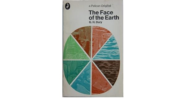
THE FACE OF THE EARTH.: Amazon.co.uk: G.H. DURY: 9780140204476: BooksWhen I took my'A' level Geography back in 1980-1982 - doesn't seem possible but it's true - I was asked to buy a Penguin copy of 'The Face of the Earth' by G H Dury. It was actually the same edition as the one shown here on the right.

George Harry Dury's name has cropped up in association with several GA Presidents.

Dury was a hydrologist, interested in rivers. and more widely in geomorphology. He was born in Northants, and studied at the University of London. He taught geography at Birkbeck College. He developed models which extended Bradshaw's Model for rivers.

Like David Leslie Linton, he was involved in air photography interpretation during the war - see Brendan Conway's excellent post on RAF Medmenham for more details on this. Also Balchin's report on wartime geographers features Medmenham. The Central Interpretation Unit (CIU) also included Professor Frank Debenham for example.

Thanks to Brendan Conway for some excellent additional research here as well on G H Dury's work in wartime. Here's what Brendan sent me a few months ago when I mentioned David Linton's wartime work.


One thing about the David Linton profile I found particularly interesting was his WWII work in photographic interpretation, especially in identifying the underground V-weapon factory in northern France (now La Coupole https://www.lacoupole-france.co.uk/history-centre.html).

It reminded me of something that I've noticed cropping up a few times - the role of geographers in WWII intelligence in places such as RAF Medmenham. Linton is one of several who played key roles in intelligence in a similar way to GIS experts in the Bellingcat organisation now.

Other geographers involved in similar WWII activity included H Clifford Darby and Kenneth Mason in Naval Intelligence (https://www.thebritishacademy.ac.uk/humanities-scholars-who-worked-military-intelligence-second-world-war) and G H Dury (George Harry Dury) in photographic interpretation (RAF Medmenham) (https://rgs-ibg.onlinelibrary.wiley.com/doi/abs/10.1111/j.0020-2754.1997.00398.x).

There's a good book about such work, including interesting references to RAF Medmenham by Jeremy Harwood called 'World War II from Above'. Harwood wrote an article about it 'Spies in the Skies: How Aerial Surveillance Tipped the Balance of WWII'. Here are some quotes indicating links with geographical expertise and how it was used:

'The staff—mostly an eclectic mix of boffins and academics with quite a few women among them—comprised some of the best brains in the country...Glyn Daniel, the first Cambridge archaeologist to be recruited to the Medmenham operation, described his new colleagues as "an ill-assembled collection of dons, artists, ballet designers, newspaper editors, and writers'.

'...the students were introduced to stereoscopic viewing. They were taught how to handle a stereoscopic viewing frame—this was universally referred to simply as a "Stereo." The two photographic prints that fitted into it were termed a "Stereo Pair." '

​Would Linton have worked with Constance Babington Smith?

'Constance Babington Smith was one of them. As well as being the photographic interpreter who first spotted a V1 Flying Bomb on its way for testing, she was the first to spot the Messerschmitt Me 163 rocket fighter, the Heinkel He 28, the world's first jet fighter, and the revolutionary Messerschmitt Me 262, the twin-engine jet fighter that, fortunately for British and American airmen, Hitler insisted be redesigned to be deployed as a fighter-bomber. She and her team detected other top-secret German aircraft prototypes into the bargain'.

Painstaking interpretation would culminate in the meticulous creation of 3D landscape models used to prepare for bombing raids and battles. There's an interesting reference to the challenging geographical learning required by aircrews:

'By the time the war ended, Medmenham's model makers had churned out more than 1,400 models. Some, like the models of the Möhne, Eder, and Sorpedams used to brief the Dam Busters prior to their famous 1943 air attack, were extremely elaborate. Such was the reliance Bomber Command placed on them that, according to Paul Brickhill, author of The Dam Busters, the aircrews taking part in the attack were instructed to "look at these until your eyes stick out and you've got every detail photographed on your mind." '

It's also known that Ronald Lampitt, much admired by geographers and certainly one of my favourite artists, worked in this area of intelligence. His 'geographical eye' and recurring tendency to view almost everything he illustrated from above seems likely to have been strongly influenced by his wartime work, but perhaps also by working with geographers? I'd never been able to find out much about his role during the war until last week when I stumbled across reference to his work by the scientific military intelligence expert RV Jones in his book 'Most Secret War'. It seems that he was very close to the V-weapon investigations as well, so there would be a possibility that he worked with Linton at some point. I summarised the findings in this thread:

Lampitt was recruited by Albert Hugh Smith, who was clearly very close to RV Jones. He later went on to become Professor of English at UCL and acclaimed scholar of Scandinavian Studies and English placenames, so he clearly had geographical interests. Perhaps he had links with Bill Mead at UCL who was also a Scandinavian expert?
Image

Delighted to see the link to Ronald Lampitt - a favourite of mine who I wrote about for the Ordnance Survey's magazine back in the day. I have a much loved copy of the book, and it will definitely have a place in my Presidential lecture in 2022.
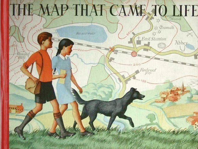
Lampitt's illustrations were included in the book which came out in 1948
I wonder if the author also worked in the same sort of setting.
In The Map that Came to Life the map is portrayed as an objective, precise and above all truthful mirror of nature. And this inherent trustworthiness enabled maps to become important features of the lives of successive generations of people.

More on the author and the book here.

Lampitt’s war service was spent with RAF Intelligence. He created meticulous, hand-drawn maps for allied bomber crews, based on aerial reconnaissance photographs. It was this period of his life that started Lampitt’s fascination with aerial views, which he would later use to great effect in The Map That Came To Life.
Sources: 
Wikipedia page.
https://en.wikipedia.org/wiki/G._H._Dury

Balchin, W. G. V. “United Kingdom Geographers in the Second World War: A Report.” The Geographical Journal, vol. 153, no. 2, 1987, pp. 159–180. JSTOR, www.jstor.org/stable/634869. Accessed 16 June 2020.

Dury, G. H. “Geography and Geomorphology: The Last Fifty Years.” Transactions of the Institute of British Geographers, vol. 8, no. 1, 1983, pp. 90–99. JSTOR, www.jstor.org/stable/622279. Accessed 16 June 2020.

Thanks to Brendan Conway for the additions to this post.
If anyone knows more about these wartime geographers please get in touch.

Wednesday, 8 April 2020

1970: One for the classroom...


Does anyone remember using one of these? I remember using the smaller fold down ones with paired images.

Sunday, 29 March 2020

1961: Mr. George Joseph Cons

Updated September 2023

Just a note on the 1961 Presidency from 'Geography'. 
It appears that Mr. George Joseph Cons was due to have been the president for this year, but unfortunately died quite suddenly in 1960 so was unable to take up the post.


Mr. G J Cons was the author of a Handbook on teaching, and was also a member of the Standing Committee for Visual Aids (which later become Teaching Aids)

He was a Senior Lecture in Geography at Goldmsiths' College.

Balchin's Centenary volume talks about him playing an active role in the Association for many years.
He is quoted in a paper on the teaching of war and peace.
Front Cover
Cons wrote that Geography is probably the best equipped subject for training the young in ‘world citizenship’ and internationalism (Cons, 1932)

This quote was included in a GA Handbook edited by Miss D M Forsaith

Cons also Chaired a number of events over the years, including a debate on the future of Geography at the 1945 conference.

He was the editor of a handbook for Geography Teachers, published by Methuen in the 1950s

Mr. Geoffrey Hutchings was elected as President in his place at the Spring meeting of the GA Council.

I noticed that he was obviously involved in helping make a number of short TV pieces.
I noticed a few fieldwork related pieces on the channel called Talking Pictures TV which shows brief vintage documentaries and films in between vintage films.


An Obituary was published in 'Geography'


Thanks to Brendan Conway for the tipoff to these films in these tweets.
Here's the 2nd tweet


And here is the film, from the Huntley Film Archives


References

W. Wallace (1956) Geography in further education, The Vocational Aspect of Education, 8:16, 40-46, DOI: 10.1080/03057875680000061

“GEOGRAPHICAL ASSOCIATION. Annual Conference Discussions on the Future for Geography.” Geography, vol. 30, no. 2, 1945, pp. 50–62. JSTOR, www.jstor.org/stable/40563427

Bull, G. B. J. “GEORGE JOSEPH CONS.” Geography, vol. 45, no. 1/2, 1960, pp. 123–124. JSTOR, www.jstor.org/stable/40565120
If anyone knows more about Mr. G. J. Cons, or has an image of him that would be appreciated.


Updated September 2023

The McNair Report gets a mention here.

H was linked with the NW Kent Branch of the GA.
He served for many years on the Education Committee of the GA.


https://www.raremaps.com/mapmaker/6716/G_J_Cons - an article that describes his map collecting.

Cons was a pioneer in pioneer in the field of geography films for schools and authored ‘Films and Living Geography’, Sight and Sound, 4/14 (Summer 1935)

The following is excerpted from Traces

A very different proposal comes from one of the few professional geographers involved in animated mapmaking for documentary films – G. J. Cons, who collaborated with the British Film Institute as scientific consultant for the production of educational documentaries. Referring to the series Indian Town Studies made by Gaumont-British Instructional, Cons highlights that ‘these films were made effective geographically by the use of animated maps’. It is evident that this effectiveness is based on the power of the trace since it allows a purely explanatory discourse which consists of the plain transmission of data and information even though no element really legitimises it. For him, there is little difference here between animated maps and informational images; the constitutive properties of motion and animation, whose consequences are far from being neutral, is relegated to a blurry allusion to a ‘living accurate’ vision. Does this prove the ineffectiveness of the attempt to acquire animated maps into the project of geography for ordering the world, or does it confirm Cons’ statement that ‘the genius of documentary film reveal[s] the screen as a magic casement through which our geographical vision of the Earth and its peoples is heightened’? In other terms, does the author’s faith in documentaries negate any concerns about the fabricated spectacle that animated maps present?

Apparently, and with a certain naivety, Cons seems to advocate a perfect analogy between the map, the mirror, and the screen – a position that may surprise coming from a professional geographer. However, as explained by Priya Jaikumar in an insightful essay on the series, the result is not the faithful and plain reproduction of Cons claims but rather an attestation of the role of animated maps in the building of that ideology that put together positivist, modernist, and colonial contents: ‘[t]owns in India were visualised to make them intelligible and transparent, with vision transforming a place, its people and fullness of their lives, into abstract space.’ Again, thanks also to the power of the trace the pretensions of correct visualisation and geographical accuracy have been overthrown and transformed into something completely different: the colonial fiction of mastery and control through alleged scientific instruments used in narrative and visual devices for making this very same fiction true.

Giuseppe Fidotta: Animated maps and the power of the trace.

He also participated in the creation of visual maps such as the one here.

https://www.raremaps.com/gallery/detail/65476/the-peopling-of-the-usa-cons


If anyone can find an image of G J Cons that would be appreciated.

Saturday, 7 December 2019

A classroom through the decades

In pursuit of Leonard Brooks (GA President 1951), I contacted the archivists / historians of William Ellis School and received this amazing sequence of images of the same classroom from Chris Willey, for which I am very grateful.
Here's the room, with some images showing how it changed, or didn't very much, over the years, along with some of the teachers who occupied the room for a while. 

I always remember that even if I have been at a school a long time (I spent 20 years in one school) I am only really 'passing through' in the longer term, and if I went back now some years later (as I have) most people wouldn't have a clue who I was.

Here's the room on Allcroft Road at William Ellis School in 1929.


Fast forward to 1939, with a teacher identified as V. C. Spary


Fast forward to 1953 and Mr. J. Jackson was in the room.


And here in 1953 is Mr. A P Smith helping a student in the Allcroft Road classroom.


The images have a credit to the London Metropolitan Archive apart from the final image which is has the copyright Ian Lyons.

The London Metropolitan Archive is a huge resource, and I need to delve into this a little to find some images that might be lurking there of former GA Presidents.

The image section of the site is called COLLAGE.


I did some preliminary searches to see whether I could find more similar classroom images, and ended up finding quite a few.
Some geography classrooms here.

Margaret Mackintosh RIP

Updated post. Sad news at the end of last week from colleagues who have organised the Charney Conference over the years of the passing of Ma...