Boundaries are the inevitable product of advancing civilisation; they are human inventions not necessarily supported by nature's dispositions, and as such they are only of solid value so long as they can be made strong enough and secure enough to prevent their violation and infringement.
Sir Thomas Hungerford Holdich (1916)
 Last update, August 2023
In 1917, Sir Halford Mackinder returned to focussing on his MP duties, although he was still heavily active in various roles at the GA, and continued to be so for many years, acting as President of the GA's Council through into the 1930s.
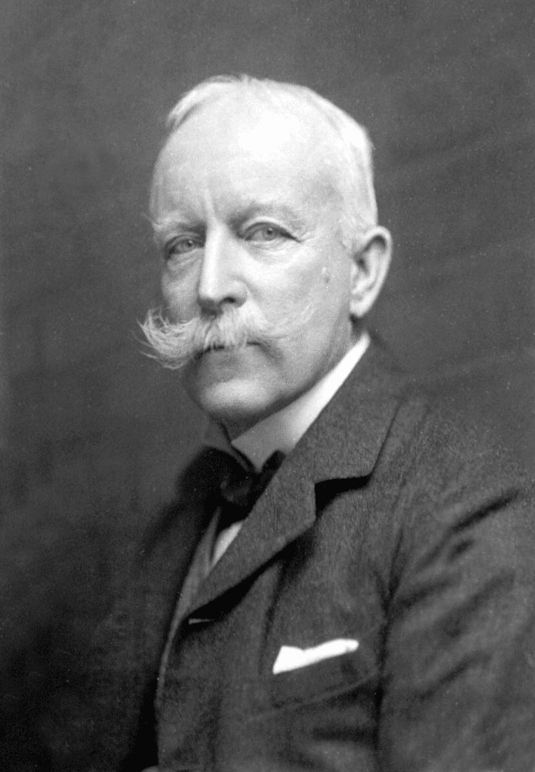
The new President for 1917 was Colonel Sir Thomas Hungerford Holdich. He was very much a military man - with a suitably impressive moustache as can be seen from the image.
When he took over as GA President, he was also serving as Vice-President of the RGS, with which he had been associated for over 50 years - another impressive service to geography being shown.
He was educated at Godolphin Grammar School and the Royal Military Academy, obtaining a commission in the Royal Engineers in 1862.
He saw active service in the Bhutan expedition of 1865, the Abyssinian campaign of 1867-68 and the Second Afghan War of 1878-79.
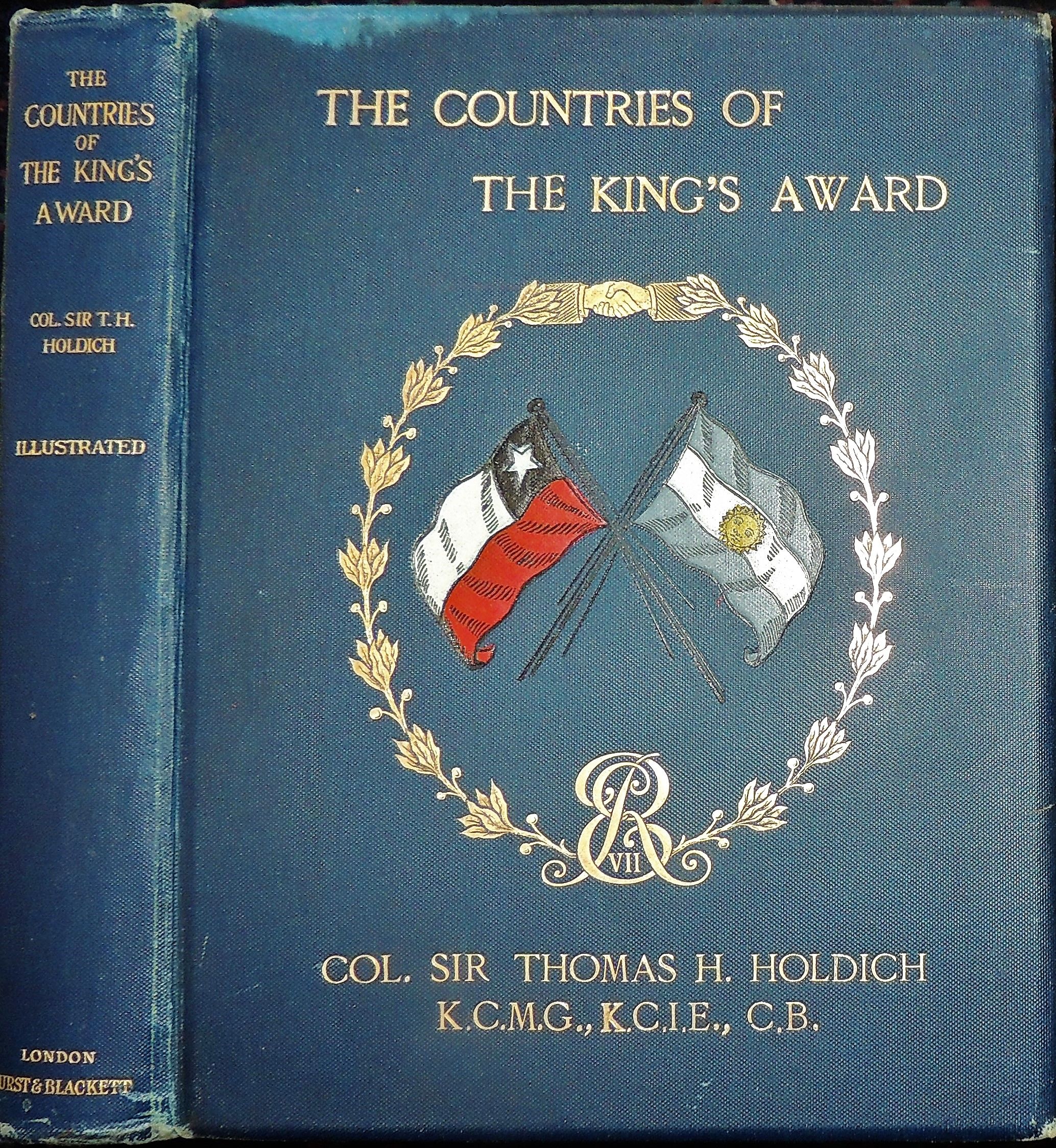
During peacetime, he was largely occupied with the survey of India, and served on the Afghan Boundary Commission of 1884-86, the Tasmar Boundary Commission of 1894, the Pamir Boundary Commission of 1895 and the Perso-Baluchistan Boundary Commission of 1896. He was also engaged in The Cordillera of the Andes Boundary Case by the governments of Argentina and Chile in 1902 to define the boundary along the Andes Mountains.
Holdich was awarded the Royal Geographical Society’s Gold Medal in 1887 and knighted in 1896.
As mentioned, Colonel Holdich was also Vice President of the Royal Geographical Society at the time, another person to have strong connections with both organisations.
As a military man, Colonel Holdich seemed to have a specific view on the value of Geography, particularly maps - bearing in mind these were produced by the Ordnance Survey, so had a military background to them as well.
"The science of geography covers so vast a field in all its varied aspects that it is impossible for any one man to be capable of expressing a useful opinion on many of the important questions involved in that careful consideration of the science as a whole which must necessarily result from a deep study of it such as you, as teachers of geography, have doubtless accorded to it. To put it shortly, you are far more capable of instructing me than I am of instructing you." (Holdich, 1917)
Holdich described the war as being "a geographical education in itself" and invited the GA's members and volunteers to prepare for the post-war period. This would be a period of upheaval and challenge for all organisations.
He is described in an earlier Bibliographical Study as "a distinguished imperial surveyor", which was his particular area of interest.
https://books.google.co.uk/books?id=itckCwAAQBAJ&lpg=PT30&ots=Plar_gEAgW&dq=charles%20close%20OS%20geographer&pg=PT35#v=onepage&q=charles%20close%20OS%20geographer&f=false
Update
Holdich also referred to the importance of a home education, "which takes young children out of doors to observe natural features" and which teaches Boy Scouts to take stock of topographical details.
 In retirement he wrote about Indian and Afghan geography and his own experiences.
He was also an accomplished artist.
Holdich died in 1929, and his obituary was published in 'Geography'. It referred to his military service of course, as well as the other achievements.
References
Wikipedia: https://en.wikipedia.org/wiki/Thomas_Holdich
I edited the Wikipedia entry to add the fact that Colonel Holdich was the President of the Geographical Association. I shall do that for each President, as hardly any of their entries mentioned that before I started the blog.
Holdich, T. H. “PRESIDENTIAL ADDRESS TO THE GEOGRAPHICAL ASSOCIATION, 1917.” The Geographical Teacher, vol. 9, no. 1, 1917, pp. 13–24. JSTOR, JSTOR, www.jstor.org/stable/40554527.
Obituary: “SIR THOMAS HUNGERFORD HOLDICH. Ob. November 4th, 1929.” Geography, vol. 15, no. 4, 1929, pp. 308–308. JSTOR, www.jstor.org/stable/40557380.
“Colonel Holdich, a true gentleman, immediately captivated everyone by his presence, his cordial treatment, impartiality and rectitude. The result of his intellectual restlessness and the affection that he had for South American countries was the work that he published in London under the name The Countries of the Kings Award. In it, in addition to recounting his trip, he describes in their geographical, social and political aspects the countries he visited ”.
Thomas H. Holdich was superintendent of Frontier Surveys in India from 1842 to 1848. At the beginning of the twentieth century, he was selected to establish the boundary between Argentina and Chile in Patagonia. He successfully used geographical methods in the solution of a particular set of problems, arising out of territorial disputes between Russia and Afghanistan; Argentina and Chile.
Even the delimitation of the McMahon Line on the map (8 inch to the mile) by Great Britain and Tibet, delimiting the Tibet-Assam boundary in 1914 at Simla was another example of the application of geographical principles and skill to solve the vexed problem of the boundary which had remained ill-defined for centuries.
It was an example of ‘applied’ work, because it was designed to resolve the problem of boundary delimitation in the Eastern Himalayan region. The British geographers and scholars who were in India during their colonial period had done extensive works of ‘applied’ nature.
During peacetime, he was largely occupied with the survey of India, and served on the Afghan Boundary Commission of 1884-86, the Tasmar Boundary Commission of 1894, the Pamir Boundary Commission of 1895 and the Perso-Baluchistan Boundary Commission of 1896. He was also engaged in The Cordillera of the Andes Boundary Case by the governments of Argentina and Chile in 1902 to define the boundary along the Andes Mountains.
Holdich was awarded the Royal Geographical Society’s Gold Medal in 1887 and knighted in 1896.
As mentioned, Colonel Holdich was also Vice President of the Royal Geographical Society at the time, another person to have strong connections with both organisations.
As a military man, Colonel Holdich seemed to have a specific view on the value of Geography, particularly maps - bearing in mind these were produced by the Ordnance Survey, so had a military background to them as well.
He was a Royal Engineer, and had a role supervising surveying in India, as well as other locations in his career.
Holdich's Presidential address aparently had no obvious title.
He starts the address by talking about the concerns he had about speaking to geography educators.
He starts the address by talking about the concerns he had about speaking to geography educators.
"The science of geography covers so vast a field in all its varied aspects that it is impossible for any one man to be capable of expressing a useful opinion on many of the important questions involved in that careful consideration of the science as a whole which must necessarily result from a deep study of it such as you, as teachers of geography, have doubtless accorded to it. To put it shortly, you are far more capable of instructing me than I am of instructing you." (Holdich, 1917)
On the subject of maps he says:
"I say, with all confidence, that it is maps which afford us the surest
outward and visible sign of a very real growth of public interest in the
science of geography. They are indeed our best advertisement at present."
(Holdich, 1917)
Quite a bit of his Presidential Address dwelt on the present conflict (the First World War) and possible outcomes for different parts of the world, and the influence of these on the future map of the world. On the matter of geopolitics, which was perhaps beyond the realm of the classroom, he said to those attending:
"You are a band of geographical thinkers. I expect that many of you are what Mr. Mackinder calls 'map thinkers'. It is for the Geographical Association which you represent, and for the Geographical Society and schools of geography generally, to impress, and if possible educate, public opinion in important questions such as these..."
(Holdich, 1917)
(Holdich, 1917)
Quite a bit of his Presidential Address dwelt on the present conflict (the First World War) and possible outcomes for different parts of the world, and the influence of these on the future map of the world. On the matter of geopolitics, which was perhaps beyond the realm of the classroom, he said to those attending:
"You are a band of geographical thinkers. I expect that many of you are what Mr. Mackinder calls 'map thinkers'. It is for the Geographical Association which you represent, and for the Geographical Society and schools of geography generally, to impress, and if possible educate, public opinion in important questions such as these..."
(Holdich, 1917)
Holdich described the war as being "a geographical education in itself" and invited the GA's members and volunteers to prepare for the post-war period. This would be a period of upheaval and challenge for all organisations.
He is described in an earlier Bibliographical Study as "a distinguished imperial surveyor", which was his particular area of interest.
https://books.google.co.uk/books?id=itckCwAAQBAJ&lpg=PT30&ots=Plar_gEAgW&dq=charles%20close%20OS%20geographer&pg=PT35#v=onepage&q=charles%20close%20OS%20geographer&f=false
Update
Holdich also referred to the importance of a home education, "which takes young children out of doors to observe natural features" and which teaches Boy Scouts to take stock of topographical details.
In retirement he wrote about Indian and Afghan geography and his own experiences.He was also an accomplished artist.
Holdich died in 1929, and his obituary was published in 'Geography'. It referred to his military service of course, as well as the other achievements.
References
Wikipedia: https://en.wikipedia.org/wiki/Thomas_Holdich
I edited the Wikipedia entry to add the fact that Colonel Holdich was the President of the Geographical Association. I shall do that for each President, as hardly any of their entries mentioned that before I started the blog.
Holdich, T. H. “PRESIDENTIAL ADDRESS TO THE GEOGRAPHICAL ASSOCIATION, 1917.” The Geographical Teacher, vol. 9, no. 1, 1917, pp. 13–24. JSTOR, JSTOR, www.jstor.org/stable/40554527.
Obituary: “SIR THOMAS HUNGERFORD HOLDICH. Ob. November 4th, 1929.” Geography, vol. 15, no. 4, 1929, pp. 308–308. JSTOR, www.jstor.org/stable/40557380.
Holdich's archive of correspondence with the RGS is stored in the RGS Archives and accessible to Fellows: https://discovery.nationalarchives.gov.uk/details/c/F33549
The Gates of India - a historical narrative: http://www.gutenberg.org/ebooks/42970
"The Englishman who got muddy in El Manso" - Chilean-Argentine diplomacy: https://www.elcordillerano.com.ar/noticias/2018/05/22/67758-el-ingles-que-se-lleno-de-barro-en-el-manso
Book on 'Political Frontiers and Boundary Making': https://www.amazon.co.uk/Political-Frontiers-Boundary-Hungerford-Holdich/dp/1347139095 - given the current concerns about national and international borders such as Trump's wall, this focus on borders remains important.
Image source: https://alchetron.com/Thomas-Holdich and Pinterest galleries.
As always, if anyone has further information relating to Colonel Holdich, please let me know so that I can expand on this post.
Updated August 2019
Holdich is also mentioned in "A History of the World in Twelve Maps" by Jerry Brotton (Penguin, 2012)
There is a chapter called 'Geopolitics' which mentions him, although it focusses on Halford Mackinder, who was also President, at a time when they were linked with the RGS. Brotton says that Mackinder "would almost single-handedly both transform the study of geography in England, and create a whole new way of understanding and using the subject: geopolitics".
When he climbed Mt. Kenya in 1899, Halford Mackinder was invited by Colonel Sir Thomas Holdich to speak at the RGS. Another Presidential connection. I shall highlight many more of those as the blog develops.
As always, if anyone has further information relating to Colonel Holdich, please let me know so that I can expand on this post.
Updated August 2019
Holdich is also mentioned in "A History of the World in Twelve Maps" by Jerry Brotton (Penguin, 2012)
There is a chapter called 'Geopolitics' which mentions him, although it focusses on Halford Mackinder, who was also President, at a time when they were linked with the RGS. Brotton says that Mackinder "would almost single-handedly both transform the study of geography in England, and create a whole new way of understanding and using the subject: geopolitics".
When he climbed Mt. Kenya in 1899, Halford Mackinder was invited by Colonel Sir Thomas Holdich to speak at the RGS. Another Presidential connection. I shall highlight many more of those as the blog develops.
Updated August 2021
Even the delimitation of the McMahon Line on the map (8 inch to the mile) by Great Britain and Tibet, delimiting the Tibet-Assam boundary in 1914 at Simla was another example of the application of geographical principles and skill to solve the vexed problem of the boundary which had remained ill-defined for centuries.
It was an example of ‘applied’ work, because it was designed to resolve the problem of boundary delimitation in the Eastern Himalayan region. The British geographers and scholars who were in India during their colonial period had done extensive works of ‘applied’ nature.
Updated August 2023
Some tweaks and amendments.
Muchas gracias coronel Sir Thomas Hungerford Holdich, geógrafo inglés y presidente de la Royal Geographical Society. pic.twitter.com/j4KL4H4VSC
— John Hunter (@JuanHunterARG) June 13, 2023
En Nombre de la Corona, fue designado el Coronel Sir Thomas Hungerford Holdich, quien ya tenía experiencia con laudos limítrofes pic.twitter.com/99bq7xe3Mb
— Dreadnoughtus 🇦🇷🇦🇶 † (@ElPampero1955) February 16, 2023
Tangi Wardak, Afghanistan, 1880.
— Barmazid (@Pashz7) February 12, 2023
Painting by Thomas Hungerford Holdich (1843 – 1929). pic.twitter.com/mMNOCSCfk1
Sir Thomas Hungerford Holdich KCMG
— John Hunter (@JuanHunterARG) June 28, 2022
Fue comisionado del Tribunal Arbitral que se conformó en Gran Bretaña a raíz de la solicitud argentino – chilena, como consecuencia del desacuerdo en materia de límites. Integró el cuerpo al momento de emitir el fallo. pic.twitter.com/WlTMZYVWjZ


