Showing posts with label Military. Show all posts

Monday, 23 December 2024

Ronald Lampitt - 'geographer'

Back in 2020, Brendan Conway responded to a post on this blog which mentioned the wartime work of quite a few former Presidents, often in aerial photography interpretation, although this is not an area that has been researched in any detail. 

It finished with a mention for the artist and illustrator Ronald Lampitt.

It's also known that Ronald Lampitt, much admired by geographers and certainly one of my favourite artists, worked in this area of intelligence. His 'geographical eye' and recurring tendency to view almost everything he illustrated from above seems likely to have been strongly influenced by his wartime work, but perhaps also by working with geographers? 

I'd never been able to find out much about his role during the war until recently when I stumbled across reference to his work by the scientific military intelligence expert RV Jones in his book 'Most Secret War'. It seems that he was very close to the V-weapon investigations as well, so there would be a possibility that he worked with Linton at some point. I summarised the findings in this thread:


https://twitter.com/mildthing99/status/1256611375411073024

Lampitt was recruited by Albert Hugh Smith, who was clearly very close to RV Jones. He later went on to become Professor of English at UCL and acclaimed scholar of Scandinavian Studies and English placenames, so he clearly had geographical interests. Perhaps he had links with Bill Mead at UCL who was also a Scandinavian expert?


There are plenty of examples of Lampitt's illustrations on the Ladyburd Fly Away Home website and social media feeds.

https://ladybirdflyawayhome.com/ronald-lampitt/

During the war he worked in Intelligence and although (perhaps inevitably) the nature of this work is unknown, it is possible that his wartime work helped develop his exceptional topographical accuracy and the ability to animate technical drawings into something visually rich and appealing.

The blog explores the wartime careers of quite a few post-war GA Presidents.

Mike Dempsey's blog post also shares his love of Lampitt and his work.

I can see that there is a potential book in unpicking the contributions made by several post-war Presidents, including Michael Wise, who was also President of the RGS, and an important post-war Geographer that many people will not be familar with.

Illustrations: Ronald Lampitt

Monday, 20 November 2023

Aerial Intelligence in WWII

There have been several GA Presidents who have been revealed as working in aerial intelligence during the Second World War. This is explored in their entries.

For example, Michael Wise graduated in 1939, and served in the Army in Europe and the Middle East during the Second World War, reaching the rank of Major and was awarded the Military Cross.

Wise was awarded the Military Cross for his conduct in the fierce battle of the Argenta Gap in April 1945 (see Jackson and Gleave 1988). His company’s forward ground was overrun by a surprise enemy attack and its headquarters were under threat. The citation for his medal refers to his ‘calm and confident bearing … [as] an inspiration to all members of his company, and his manner of dealing with a most difficult and dangerous situation is beyond praise’. 

During the war of 1939–45, intelligence was gleaned from aerial photographs by a newly founded organization that developed into the Allied Central Interpretation Unit. This was based primarily at Danesfield House (known as Royal Air Force Medmenham) some 50 km west of London, in Buckinghamshire.

David Leslie Linton gets a mention here. I know that he was involved in suggesting launch sites for the 'V1 and V2' weapons.

Work at Medmenham, although important for the war effort, required interpreters familiar with aerial photographs rather than geology as such – but geology did assist the search for storage sites for ‘V’ weapons, terrain interpretation for the 1944 Allied landings in Normandy, and in guiding plans to bomb German industrial complexes hidden underground.

W G V Balchin wrote a useful summary which I have mentioned in a previous blogpost. He mentioned some of those involved and why geographers were useful.

Geography has always been vital to the prosecution of war, in three ways: first, intelligence is critical; secondly logistics (geographical factors influence the deployment of men, materials and firepower); thirdly, in action (geographical factors enter in decisions on the disposition of forces, where to attack or defend, what routes to follow, where to land invasion craft and so on.

References

Balchin, W. G. V. “United Kingdom Geographers in the Second World War: A Report.” The Geographical Journal, vol. 153, no. 2, 1987, pp. 159–80. JSTOR, https://doi.org/10.2307/634869. Accessed 1 Nov. 2023.

https://www.proquest.com/openview/a4b517a601813d3c3c3fc825fb1fb8fb/1?pq-origsite=gscholar&cbl=1818801 - Linton's work


World War One.

Charles Close was of course involved in World War I.

In Great Britain, a Topographical Section, later renamed Geographical Section, was assigned to the general staff in 1904 (Geographical Section, General Staff or GSGS). Until 1911, this section was headed by Charles Frederick Close (1865-1952), who reformed organisation and training based on his experiences of surveying in India; after that, he took over as Director General of the Ordnance Survey.

The OS remembers the staff it lost every Remembrance Sunday.

Friday, 19 June 2020

Geographers in Wartime

We are coming to a period when many survivors of the Second World War are in their 80s and 90s and the memories are fading.
Many geographers played an important part in the Second World War.
In 1985, the Royal Geographical Society asked W. G. V. Balchin, who was then the Chairman of the RGS' Education Committee (and a former GA President), the job of collating a report and interviewing survivors on their role.

A report was published in 1987 and can be read on JSTOR (free accounts available)

Balchin explains that geographers proved their worth already in the First World War. He also outlines how an understanding of geography is important during wartime, particular when preparing.

He mentions a number of people with connections to the GA and the Ordnance Survey's role is featured prominently of course.

There are several areas where Geographes are particularly mentioned as being important.
These included the aerial interpretation CIU unit which looked at aerial images and worked out what was on the ground and what had changed since the area had last been photographed.

People like Frank Debenham and David Linton worked in this field.

See previous blog post for more details on this.

Source:
Balchin, W. G. V. “United Kingdom Geographers in the Second World War: A Report.” The Geographical Journal, vol. 153, no. 2, 1987, pp. 159–180. JSTOR, www.jstor.org/stable/634869. Accessed 16 June 2020.

Tuesday, 4 February 2020

1956: Lord Nathan of Churt

Last updated September 2023

The Right Honourable Lord Nathan of Churt, P. C., T. D., D. L., F. S. A. was another person of distinction to become GA President, and also another person who later became the President of the RGS as well (from 1958-1961)


My first role when writing this entry was to work out which of several Lord Nathans was the correct one, as there have been several, but this was fairly quickly established.

He was educated at St. Pauls School in London - as were several GA Presidents over the years.

Lord Nathan had a distinguished service in the First World War, serving in the London Regiment in Gallipoli, Egypt and France where he survived a severe head wound: one of several GA Presidents to have seen distinguished active service, including Dudley Stamp.

After the war he went into politics.


During the late 1950s, Lord Nathan was working on redrafting the constitution of the Association, and worked on some Statutes and Standing Orders which were eventually adopted by the GA. This sort of work is often going on in the background of the Association, without much fanfare, but there are many activitists and volunteers completing this work, and their work is vital. There are always people who are needed to assist with various roles within the Association.

His Presidential Address was on the theme of 'World Aviation and Geography'.
In it, he referenced the IGY and the development of exploration in Antarctica.


I'm sure he would have appreciated the development of drones and their use.

He also spoke at length about the importance of the Arctic and the movement of aircraft along the Polar circle routes - something which is now routine for trans-Atlantic flights and also for Qantas flights avoiding disturbances in the usual Rossby wave circulation.


He was still working tirelessly in his 70s in a number of roles, many of them voluntary.

He died in 1974 in Westminster Hospital, of which he had previously been the Chairman.

A busy and productive life, and with a lot of effort in the background of the Association.

References

Obituary: https://www.jstor.org/stable/1794751?seq=1#page_scan_tab_contents

Kirwan, L. P. “Obituary: The Rt. Hon. Lord Nathan, P. C., T. D., D. L., F. S. A.” The Geographical Journal, vol. 129, no. 4, 1963, pp. 582–584. JSTOR, www.jstor.org/stable/1794751. - source of the image - used under fair use

NATHAN, LORD. “World Aviation and Geography: Address to The Geographical Association.” Geography, vol. 42, no. 1, 1957, pp. 1–12. JSTOR, www.jstor.org/stable/40563896.

If anyone knows more of Lord Nathan's contributions to the GA, please get in touch - I haven't been able to find a huge amount about him compared to some of his contemporaries.

1961: NATHAN, LORD. “GEOGRAPHY AND THE BUSINESS WORLD TO-DAY.” Journal of the Royal Society of Arts, vol. 109, no. 5059, 1961, pp. 516–526. JSTOR, www.jstor.org/stable/41369050.

A nice piece - worth reading - on the value of geography to the world of business and economics. A good comment from L Dudley Stamp


Last updated December 2021

Coincidentally came across an obituary for Lord Nathan, written by L Dudley Stamp.

Stamp, L. Dudley. “HARRY LOUIS NATHAN: FIRST LORD NATHAN OF CHURT.” Geography, vol. 49, no. 1, Geographical Association, 1964, pp. 57–58, http://www.jstor.org/stable/40565764.

This gave me his actual names for the first time.

Of his time as President, the obituary also mentions:


He was a solicitor, and also entered the Lords as a Liberal.
He seems to have given a lot of good advice.
He was a Government Minister of Civil Aviation 1946-1948.

Like several other GA Presidents he also became President of the Royal Geographical Society, and also hosted dinners of the Geographical Club (one of which I was recently invited to)


He also gets a mention in the book 'The Third Pole' - Mark Synnott with respect to climbing expeditions on Mount Everest in the 1960s by the Chinese.

It appears he died following complications from an emergency appendectomy - a couple of months before I was born.

Updated September 2023

Churt is a village in Surrey.

A report on an event at the Royal Society of Arts in 1961.


He mentions his Presidency of the GA at the start of the address - a few other quotes:

"I do not pretend to define 'Geography'. Molière 's Bourgeois gentilhomme was astonished to learn that he had been speaking prose all his life. In some respects, geography is rather like that. But to propound an acceptable definition is a formid able task even for those who are, unlike myself, professional geographers. My association with geography by virtue of office has, however, taught me something of the very great changes that have taken place in the conception of geography since my own schooldays. Life was simpler then ; in the words of E. C. Bentley : geography was about maps, biography about chaps. For years, for centuries, indeed since classical times, geography was almost exclusively descriptive. It consisted of the collection of facts about countries and peoples."

"By his training the geographer has acquired the habit of looking at problems in their all-round relations. The trained geographer is accustomed to analyse a landscape from the point of view of many branches of knowledge, and to approach problems from many different directions. Just as a geographer should be able to synthesize all the different elements of a landscape, so he is trained to balance all the factors in a problem and see it whole. It is this synoptic view of the geographer which is the heart of the matter. It is fundamental and vital to the effective planning of all commercial and industrial development."

Following the talk, there was an interesting question from someone who was there:

Fallen back on teaching....

Another point was made by Dudley Stamp.

"I feel that I cannot let this occasion pass without expressing thanks on behalf of the professional geographers for the very able way in which Lord Nathan (who has come to us as it were from outside with a very wide experience) has put before this gathering the crucial problems of the geographer and his position in the world. I stand before you as a Professor of Geography who has never had a lecture in geography, for the simple reason that it was not a subject of Honours standard in our universities at the time when I was at college. So I had to take my training in other subjects, and came into geography because of a very deep conviction that there is an important work to be done in the application of what we now know as geographical principles to world and everyday events. It is a very great joy to me to hear, after these years of struggle, that point of view being vindicated from the lips of one so eloquent and so eminent as our lecturer this evening. I would say this in reply to questions which have been put : geography is, as you have rightly said, Sir, a point of view, a training which I think the late Field Marshal Smuts would have called a 'holistic' training, which enables one to take a view which is the view of the whole, and in that sense we do try to take in all factors which are concerned. 

In a way I was delighted to hear of the five geographers from Cambridge who have taken jobs other than as geographers. I hope they will take the geographical point of view into their respective spheres, which is after all what we want. In the old days a man who got a degree in classics did not therefore get employment as a Greek or Latin scholar. He went into administration and showed us how to run the government, because of his background in a good discipline. We like to think of geography to-day as giving that broad point of view which is a real training in citizen ship. I feel, Sir, that you have put before us very eloquently indeed that real objective. Geography as a discipline in the university to-day fits its students for a very wide range of posts (not necessarily called geographers; probably in most cases."


NATHAN, LORD. “GEOGRAPHY AND THE BUSINESS WORLD TO-DAY.” Journal of the Royal Society of Arts, vol. 109, no. 5059, 1961, pp. 516–26. JSTOR, http://www.jstor.org/stable/41369050. Accessed 16 Sept. 2023.

Book plate here
https://www.flickr.com/photos/uofaspecialcollections/21858160421/in/photolist-ziwMyR-28ReKGv/

Sunday, 11 August 2019

1929: Colonel Sir Henry G Lyons FRS

Last updated August 2023

Colonel Henry Lyons was another President with a varied CV and an interesting one. He was particularly linked with museums, and Polar exploration, and was also director of the Science Museum for a time.


He was born in 1864, and died in 1944, so also had a long life - as have many Presidents it seems.

He was educated at Wellington College, and then went to the Military Academy at Woolwich, before being elected to the Geological Society. He was commissioned as a Lieutenant in the Royal Engineers (a few GA Presidents had served with them) and was posted to Cairo.

The Royal Society obituary describes the source of his interest in geology:

He attributed his first interest in science to an acquaintance made during holidays in 1879-1880 with a neighbour at his Dublin home, who was then being ‘crammed’ for Sandhurst and taking Geology as a subject. The two boys collected fossils from blocks of Carboniferous Limestone lying on the canal wharves, and, with his interest thus aroused, young Lyons spent all his spare time at Wellington in reading Lyell’s Elements of Geology and then the same author’s Principles, being encouraged in these voluntary studies by the science master, Rev. B. A. Irving

From 1909 - this changed things a little when I found this document. I presume this is the same Henry Lyons.

At a meeting of the University Court, the highest decision-making body in the University of Glasgow, on 14 January 1909,

[I]t was announced that Capt. Henry George Lyons, FRS, FRGS, (Hon.) DSc Oxford & Dublin, at present Director-General of the Survey Dept. of Egypt, had been appointed Uni. Lecturer in Geog. for a period of four years from 1st Oct, 1909, at an annual salary of £250. (CM, 1908–09, C1/1/16, p. 46f)

While forms of ‘Geography’ had been taught previously in the University, at different times and as part of other courses of instruction – Ronald Miller (1972, 17) suggests that from at least 1577 it was present on Glasgow curricula – these words in January 1909 formally instituted Geography as an identifiable subject for teaching and, by implication, scholarly inquiry within the University. As noted at an earlier Court Meeting deliberating on the conclusions of a Committee set up to consider this matter, the appointment of a ‘Lecturer in Geography’ meant that Geography would now be taught ‘on a standard equal to a graduating course for Arts or Science’ (CM, 1907–08, C/1/1/15, p. 116f). A later Court meeting of 6 May 1909 also noted a proposal from the University General Council for ‘the addition of the subject of Geography under Depts. of Study’ (CM, 1908–09, C1/1/16, p. 98f). While the term ‘Department’ here does not quite mean what we now routinely understand by it (see Lorimer & Philo, 2009) the effect was still to put Geography on a relatively firm footing within the organisational structure of the University. 

Source: (2009) Guest Editorial, Scottish Geographical Journal, 125:3-4, 221-226, DOI: 10.1080/14702540903364260

Lyons was appointed as a Director of the Science Museum in 1920.
It seems he was a particularly impressive Director. The Science Museum's Facebook page describes his impact:

A strong believer in the needs of the ordinary visitor being more important than those of the specialist, Sir Henry Lyons was hugely important to broadening the Science Museum’s appeal and popularity.
Lyons introduced the first interactive exhibits and the first ever gallery designed specifically to engage children with science and technology.

Between 1921 and 1932 – a year before he retired – the number of visitors to the Science Museum per year increased from about 400,000 to nearly 1.25 million. Today, just under 3 million people visit the Museum each year.

He took over as Honorary Treasurer of the GA in 1926 following the death of E. F. Elton, who had held the post since 1908. He retired from the council when he joined the Science Museum, and the post passed to Sir William Himbury, the Chief Officer of the British Cotton Growing Association.

His Presidential Address was called 'The Geographer and his Material'. it was delivered in January 1929 at the London School of Economics (as were many Addresses during the first part of the Century, before the change to the Easter conference). 

He started by sharing the great honour that he felt at being the President, and spoke glowingly of the impact of Vaughan Cornish's presidency.


He talked about the role of specialist knowledge and skills in supporting the teaching of geography.

Here he is on Cartography, for example...


Because of a change in the time when the President made his address from the very start of the year to later in the year, Lyons ended up doing two addresses.

Lyons, H. G. “Relief in Cartography.” The Geographical Journal, vol. 43, no. 3, 1914, pp. 233–248. JSTOR, www.jstor.org/stable/1778611. Accessed 23 Nov. 2020.

His 2nd was in 1930.
He was elected as a Fellow of the Royal Society.
His obituary was published in various journals.

I like this description of him from one of them.


He died, aged 80 in Great Missenden, later home of Roald Dahl.

References

Wikipedia: https://en.wikipedia.org/wiki/Henry_George_Lyons
I amended this entry to reflect his
Obituary: https://royalsocietypublishing.org/doi/10.1098/rsbm.1944.0023

Correspondence in SPRI archive: https://archiveshub.jisc.ac.uk/search/archives/ea55fcaa-eb80-3fc8-b57b-d7f991aaf417 (I really need to take a trip there)

https://science.sciencemag.org/content/78/2028/429
Ernest M. Dowson. “Colonel Sir Henry Lyons, F.R.S.” The Journal of Egyptian Archaeology, vol. 31, 1945, pp. 98–100. JSTOR, www.jstor.org/stable/3855389.

I know relatively little about Henry Lyons' time as President, so if anyone has further information please get in touch.

Image - there is one linked to here, I am still looking for a CC licensed one

Presidential Address:

Lyons, Henry G. “THE GEOGRAPHICAL ASSOCIATION. THE PRESIDENT'S ADDRESS.” Geography, vol. 15, no. 5, 1930, pp. 353–359. JSTOR, JSTOR, www.jstor.org/stable/40559150.

Fleure, H.J. (1953) "Sixty years of geography and education", Geography, vol.38, pp.231-264

Cabinets of curiosities were mentioned by my colleague Claire Kyndt in her GA Conference session in 2015, which was excellent. Search Slideshare for the presentation.
This book explains more:
Read Chapter 6 by geographer David Matless.

Lyons introduced the first visitor-operated models in museums - the interactive displays we are so used to these days and which are found in most modern museums with a few exceptions, such as the Pitt Rivers (which has links to another former GA President Linton Myres of course).

Updated November 2020
From an obituary in a journal devoted to Egyptian Archaeology
Ernest M. Dowson. “Colonel Sir Henry Lyons, F.R.S.” The Journal of Egyptian Archaeology, vol. 31, 1945, pp. 98–100. JSTOR, www.jstor.org/stable/3855389. Accessed 23 Nov. 2020.


Updated July 2022
There is a book titled 'The rise of the Science Museum under Henry Lyons' which was published in the 1970s.
You can read a review here. via Google Books.

Updated August 2023


Henry George Lyons was born on 11 October 1864 in London. He was educated at Wellington College, and in 1882 entered the Royal Military Academy in Woolwich. In 1884, he attended a two-year course of military engineering at Chatham, after which he was posted to Gibraltar and then to Egypt, where he studied geology in his spare time. In 1901, Lyons retired from the army and was appointed director of the geological survey in Egypt, a post he held until 1909 when he returned to Britain. During the First World War, Lyons served with the Royal Engineers, retiring with the rank of colonel in 1919, and in the same year was appointed secretary-general of the International Union of Geodesy and Geophysics. In 1920, he became director of the Science Museum in London, where he remained until his retirement in 1933. He was knighted in 1926 and died on 10 August 1944 at Great Missenden.

This Royal Society documented provides all the information you would want to know about him. It doesn't mention his Presidency of the Geographical Association, which is disappointing...

It includes his work on meteorology during World War I, showing how vital weather information was militarily.

It includes an excellent image of an older Lyons shown here.


Also President of IUGG. (PDF download)


Thursday, 1 August 2019

1927: Colonel Sir Charles Close KBE CB CMG FRS (later Arden Close)


Updated August 2023


Colonel Charles Close was a Geographer and Surveyor, and the GA had somebody as President, for the first time in a while, who could be said to be a Geographer both at heart, and in occupation.

Charles (Arden) Close served as Director General of the Ordnance Survey from 1911 to 1922.

(10 August 1865 – 19 December 1952) 

There are several biographies of him online, which provide plenty more detail on his achievements, and the way that he prepared the OS for the demands of the First World War, which were particular impressive and showed his attention to detail:
Biography here.
A detailed biography here (PDF download)

Amongst the offices which he held were those of President of the International Union of Geography from 1934 to 1938, President of Section E (geography) of the British Association in 1911, President of the Geographical Association in 1927, President of the Royal Geographical Society, 1927 to 1930 (he was also on the RGS Council for 35 years) and was also Chairman of the Palestine Exploration Fund for fifteen years. He was Honorary Secretary of the International Geographical Congress.

This link to the RGS is also something which has been very important over the years, and Close seems to have been linked more closely with them than the GA.

Following text is from his Wikipedia page (shared under CC license)

Colonel Sir Charles Frederick Arden-Close, was a British geographer. He was Director General of the Ordnance Survey from 1911 to 1922. His insistence on attention to detail saw the improvement of many attitudes and methods at the Ordnance Survey. Close's planning saw the production of many maps now viewed as pinnacles in the classic period of map making. 

He was born Charles Frederick Close and changed his surname to Arden-Close in 1938 so as to comply with a bequest.

He was born in Jersey, the eldest of the eleven children of Major-General Frederick Close (1830–1899) After receiving his commission in the Royal Engineers in 1884, he saw service in the School of Military Engineering, and served in Gibraltar and India.

In 1889 Close was posted to the survey of India where he carried out topographic work in Burma and triangulation in Mandalay. There was a further posting to eastern Nigeria, to survey the border with the German Cameroon. After appointment to the Ordnance Survey he carried out much work in central, eastern and southern Africa. Close led a small surveying unit in the Second Boer War, and returned to Chatham in 1902 to become chief instructor of surveying at the School of Military Engineering. His Text Book of Topographical and Geographical Surveying, published in 1905 became the standard textbook on the subject.

Close served as Head of MO4, the Geographical Section of the General Staff, at the War Office until 1911.

In 1911, he was appointed Director General of the Ordnance Survey, a post he held until 1922.
He introduced more rigorous scientific methods at the Ordnance Survey and proceeded with a second levelling of the United Kingdom. He was intent on producing one-inch maps of revolutionary appearance, including colour printing and precise printing methods. Because of the high cost of production Close had to compromise his aims and a simpler style was adopted.
This design set the standard for subsequent one-inch series.

Charles Close married in 1913 and had two sons and a daughter. He was knighted in 1918, in recognition of the Ordnance Survey's efforts during World War I during which over 30 million maps were produced.
He was elected a Fellow of the Royal Society in 1919.
Upon retirement in 1922 he became secretary of the International Geographical Congress and was also a long-serving Fellow of the RGS and in 1927 was awarded their Victoria Gold Medal and was later elected President (1927–30).

The announcement of his appointment in the Geographical Teacher:


In the same year, he became the President of the GA, Close became the first person to write an article in the newly named journal 'Geography' journal - the name change was mentioned in a recent blog post.
He described the different types of people who go to Geography conferences in his address on Population and Migration.

Which one are you?

Close continued to support the GA following his Presidential year, which was described as a great success by all accounts.

"Geography untouched by the human hand is dull to an extraordinary degree"
Sir Charles Close, Royal Geographical Society, 1932

The Annual Report of 1928 mentioned his ongoing support for the Association.

The Charles Close Society is still in operation, and is for those who are interested in Ordnance Survey Maps.
Thanks to John Davies with whom I corresponded about Charles Close, and Elaine Owen of the OS for her input and suggestions.


Close died in Winchester in 1952.

1927 also saw a few other events.
First was the death of Sir John Keltie.
1927 also saw an experiment in publications beyond the journals. Two research publications were created: one on a Historical Geography of Ireland and one on the Deccan Plateau, but sales were poor.

There is an interesting connection between Charles Close and my current work with the Ordnance Survey's GetOutside Campaign.

References

Wikipedia: https://en.wikipedia.org/wiki/Charles_Close - source of some of the page above

I added his GA Presidency role to the page.

OS website: https://www.ordnancesurvey.co.uk/docs/ebooks/map-makers-to-britain-since-1791.pdf (PDF download)

There is a Charles Close Society for the study of OS Maps which shows his influence persists even now.

Fleure, H. J. “ANNUAL REPORT.” Geography, vol. 14, no. 4, 1928, pp. 338–341. JSTOR, www.jstor.org/stable/40558279.

If anyone knows anything more about Charles Close and his work with the GA, please get in touch.

Update November 2019
Charles Close collaborated with the famous illustrator Ellis Martin.
He launched the One Inch Map for Tourists which sold well.


Update December 2019

Charles Close's obituary was published in 'Geography', written by H. J. Fleure.


Updated July 2022
A good quote:


Updated August 2023

A few tweaks and amendments and additional labels added.

I looked at the development of the International Population Union - linked with the UN - Close was the President for 6 years - was that of the UK National congress of the IPU?

A M Carr Saunders (another former GA President) mentioned it in an article in Nature:

Source:
International Population Congress in Paris. Nature 140, 471 (1937). https://doi.org/10.1038/140471a0

I also followed up some more on the MO4 - the Geographical arm of the War Office, or the Military Survey.


Source:

Updated August 2023

Close was not always as strong a supporter of 'geography' as he was when President (presumably).
In 1911, he was at a meeting of BAAS Section E.
This was linked to the changed nature of the papers presented, partly down to former GA Presidents who said that listening to travel papers wasn't necessarily advancing the discipline....


The outcome was:


Source:

Charles W. J. Withers, et al. “Geography’s Other Histories? Geography and Science in the British Association for the Advancement of Science, 1831-c.1933.” Transactions of the Institute of British Geographers, vol. 31, no. 4, 2006, pp. 433–51. JSTOR, http://www.jstor.org/stable/4639988. Accessed 24 Aug. 2023.

Beaver, S. H. “Geography in the British Association for the Advancement of Science.” The Geographical Journal, vol. 148, no. 2, 1982, pp. 173–81. JSTOR, https://doi.org/10.2307/633769. Accessed 24 Aug. 2023.


Friday, 7 June 2019

1917: Colonel Sir Thomas Hungerford Holdich, KCMG, KCIE, CB, RE

Boundaries are the inevitable product of advancing civilisation; they are human inventions not necessarily supported by nature's dispositions, and as such they are only of solid value so long as they can be made strong enough and secure enough to prevent their violation and infringement.
Sir Thomas Hungerford Holdich (1916)


Thomas Holdich wwwholdichescomwpcontentuploads201306SirTLast update, August 2023

In 1917, Sir Halford Mackinder returned to focussing on his MP duties, although he was still heavily active in various roles at the GA, and continued to be so for many years, acting as President of the GA's Council through into the 1930s.

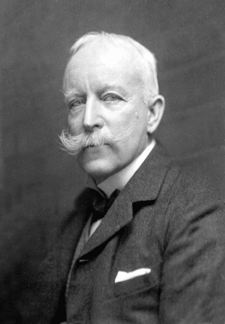
The new President for 1917 was Colonel Sir Thomas Hungerford Holdich. He was very much a military man - with a suitably impressive moustache as can be seen from the image.

When he took over as GA President, he was also serving as Vice-President of the RGS, with which he had been associated for over 50 years - another impressive service to geography being shown.

He was educated at Godolphin Grammar School and the Royal Military Academy, obtaining a commission in the Royal Engineers in 1862.

He saw active service in the Bhutan expedition of 1865, the Abyssinian campaign of 1867-68 and the Second Afghan War of 1878-79.

During peacetime, he was largely occupied with the survey of India, and served on the Afghan Boundary Commission of 1884-86, the Tasmar Boundary Commission of 1894, the Pamir Boundary Commission of 1895 and the Perso-Baluchistan Boundary Commission of 1896. He was also engaged in The Cordillera of the Andes Boundary Case by the governments of Argentina and Chile in 1902 to define the boundary along the Andes Mountains.

Holdich was awarded the Royal Geographical Society’s Gold Medal in 1887 and knighted in 1896.

As mentioned, Colonel Holdich was also Vice President of the Royal Geographical Society at the time, another person to have strong connections with both organisations.

As a military man, Colonel Holdich seemed to have a specific view on the value of Geography, particularly maps - bearing in mind these were produced by the Ordnance Survey, so had a military background to them as well.
He was a Royal Engineer, and had a role supervising surveying in India, as well as other locations in his career.
Holdich's Presidential address aparently had no obvious title.

He starts the address by talking about the concerns he had about speaking to geography educators.

"The science of geography covers so vast a field in all its varied aspects that it is impossible for any one man to be capable of expressing a useful opinion on many of the important questions involved in that careful consideration of the science as a whole which must necessarily result from a deep study of it such as you, as teachers of geography, have doubtless accorded to it. To put it shortly, you are far more capable of instructing me than I am of instructing you." 
(Holdich, 1917)

On the subject of maps he says:
"I say, with all confidence, that it is maps which afford us the surest outward and visible sign of a very real growth of public interest in the science of geography. They are indeed our best advertisement at present."
(Holdich, 1917)


Quite a bit of his Presidential Address dwelt on the present conflict (the First World War) and possible outcomes for different parts of the world, and the influence of these on the future map of the world. On the matter of geopolitics, which was perhaps beyond the realm of the classroom, he said to those attending:

"You are a band of geographical thinkers. I expect that many of you are what Mr. Mackinder calls 'map thinkers'. It is for the Geographical Association which you represent, and for the Geographical Society and schools of geography generally, to impress, and if possible educate, public opinion in important questions such as these..."
(Holdich, 1917)

Holdich described the war as being "a geographical education in itself" and invited the GA's members and volunteers to prepare for the post-war period. This would be a period of upheaval and challenge for all organisations.

He is described in an earlier Bibliographical Study as "a distinguished imperial surveyor", which was his particular area of interest.
https://books.google.co.uk/books?id=itckCwAAQBAJ&lpg=PT30&ots=Plar_gEAgW&dq=charles%20close%20OS%20geographer&pg=PT35#v=onepage&q=charles%20close%20OS%20geographer&f=false

Update

Holdich also referred to the importance of a home education, "which takes young children out of doors to observe natural features" and which teaches Boy Scouts to take stock of topographical details.

Image result for thomas hungerford holdichIn retirement he wrote about Indian and Afghan geography and his own experiences.

He was also an accomplished artist.

Holdich died in 1929, and his obituary was published in 'Geography'. It referred to his military service of course, as well as the other achievements.

References
Wikipedia: https://en.wikipedia.org/wiki/Thomas_Holdich

I edited the Wikipedia entry to add the fact that Colonel Holdich was the President of the Geographical Association. I shall do that for each President, as hardly any of their entries mentioned that before I started the blog.

Holdich, T. H. “PRESIDENTIAL ADDRESS TO THE GEOGRAPHICAL ASSOCIATION, 1917.” The Geographical Teacher, vol. 9, no. 1, 1917, pp. 13–24. JSTOR, JSTOR, www.jstor.org/stable/40554527.

Obituary: “SIR THOMAS HUNGERFORD HOLDICH. Ob. November 4th, 1929.” Geography, vol. 15, no. 4, 1929, pp. 308–308. JSTOR, www.jstor.org/stable/40557380.

Holdich's archive of correspondence with the RGS is stored in the RGS Archives and accessible to Fellows: https://discovery.nationalarchives.gov.uk/details/c/F33549

The Gates of India - a historical narrative: http://www.gutenberg.org/ebooks/42970

"The Englishman who got muddy in El Manso" - Chilean-Argentine diplomacy: https://www.elcordillerano.com.ar/noticias/2018/05/22/67758-el-ingles-que-se-lleno-de-barro-en-el-manso

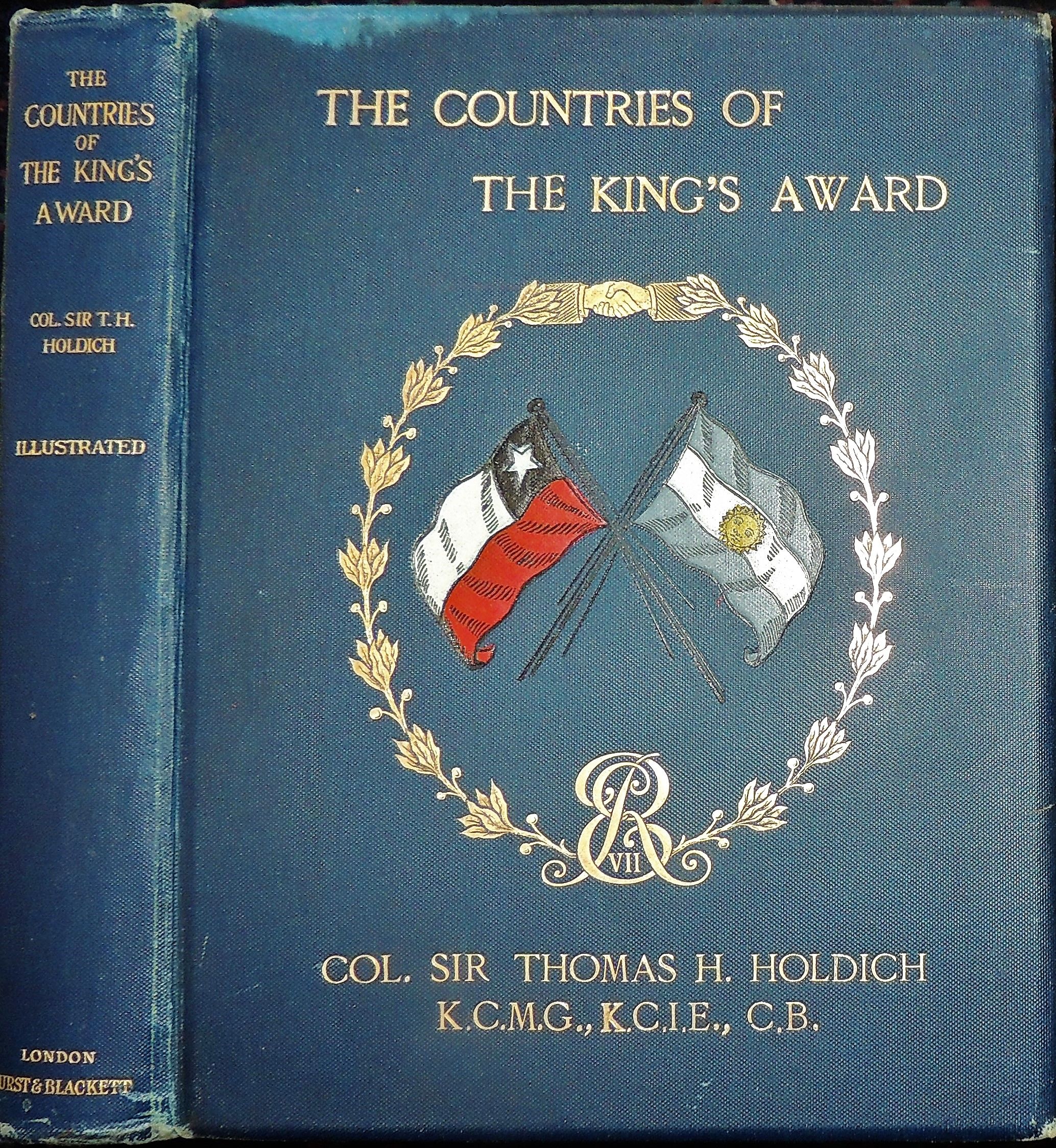
“Colonel Holdich, a true gentleman, immediately captivated everyone by his presence, his cordial treatment, impartiality and rectitude. The result of his intellectual restlessness and the affection that he had for South American countries was the work that he published in London under the name The Countries of the Kings Award. In it, in addition to recounting his trip, he describes in their geographical, social and political aspects the countries he visited ”.

Book on 'Political Frontiers and Boundary Making': https://www.amazon.co.uk/Political-Frontiers-Boundary-Hungerford-Holdich/dp/1347139095 - given the current concerns about national and international borders such as Trump's wall, this focus on borders remains important.

Image source: https://alchetron.com/Thomas-Holdich and Pinterest galleries.

As always, if anyone has further information relating to Colonel Holdich, please let me know so that I can expand on this post.

Updated August 2019

Holdich is also mentioned in "A History of the World in Twelve Maps" by Jerry Brotton (Penguin, 2012)
There is a chapter called 'Geopolitics' which mentions him, although it focusses on Halford Mackinder, who was also President, at a time when they were linked with the RGS. Brotton says that Mackinder "would almost single-handedly both transform the study of geography in England, and create a whole new way of understanding and using the subject: geopolitics".

When he climbed Mt. Kenya in 1899, Halford Mackinder was invited by Colonel Sir Thomas Holdich to speak at the RGS. Another Presidential connection. I shall highlight many more of those as the blog develops.

Updated August 2021

Thomas H. Holdich was superintendent of Frontier Surveys in India from 1842 to 1848. At the beginning of the twentieth century, he was selected to establish the boundary between Argentina and Chile in Patagonia. He successfully used geographical methods in the solution of a particular set of problems, arising out of territorial disputes between Russia and Afghanistan; Argentina and Chile.

Even the delimitation of the McMahon Line on the map (8 inch to the mile) by Great Britain and Tibet, delimiting the Tibet-Assam boundary in 1914 at Simla was another example of the application of geographical principles and skill to solve the vexed problem of the boundary which had remained ill-defined for centuries.

It was an example of ‘applied’ work, because it was designed to resolve the problem of boundary delimitation in the Eastern Himalayan region. The British geographers and scholars who were in India during their colonial period had done extensive works of ‘applied’ nature.


Updated August 2023

Some tweaks and amendments.

Margaret Mackintosh RIP

Updated post. Sad news at the end of last week from colleagues who have organised the Charney Conference over the years of the passing of Ma...