Showing posts with label Wartime. Show all posts

Monday, 23 December 2024

Ronald Lampitt - 'geographer'

Back in 2020, Brendan Conway responded to a post on this blog which mentioned the wartime work of quite a few former Presidents, often in aerial photography interpretation, although this is not an area that has been researched in any detail. 

It finished with a mention for the artist and illustrator Ronald Lampitt.

It's also known that Ronald Lampitt, much admired by geographers and certainly one of my favourite artists, worked in this area of intelligence. His 'geographical eye' and recurring tendency to view almost everything he illustrated from above seems likely to have been strongly influenced by his wartime work, but perhaps also by working with geographers? 

I'd never been able to find out much about his role during the war until recently when I stumbled across reference to his work by the scientific military intelligence expert RV Jones in his book 'Most Secret War'. It seems that he was very close to the V-weapon investigations as well, so there would be a possibility that he worked with Linton at some point. I summarised the findings in this thread:


https://twitter.com/mildthing99/status/1256611375411073024

Lampitt was recruited by Albert Hugh Smith, who was clearly very close to RV Jones. He later went on to become Professor of English at UCL and acclaimed scholar of Scandinavian Studies and English placenames, so he clearly had geographical interests. Perhaps he had links with Bill Mead at UCL who was also a Scandinavian expert?


There are plenty of examples of Lampitt's illustrations on the Ladyburd Fly Away Home website and social media feeds.

https://ladybirdflyawayhome.com/ronald-lampitt/

During the war he worked in Intelligence and although (perhaps inevitably) the nature of this work is unknown, it is possible that his wartime work helped develop his exceptional topographical accuracy and the ability to animate technical drawings into something visually rich and appealing.

The blog explores the wartime careers of quite a few post-war GA Presidents.

Mike Dempsey's blog post also shares his love of Lampitt and his work.

I can see that there is a potential book in unpicking the contributions made by several post-war Presidents, including Michael Wise, who was also President of the RGS, and an important post-war Geographer that many people will not be familar with.

Illustrations: Ronald Lampitt

Monday, 20 November 2023

Aerial Intelligence in WWII

There have been several GA Presidents who have been revealed as working in aerial intelligence during the Second World War. This is explored in their entries.

For example, Michael Wise graduated in 1939, and served in the Army in Europe and the Middle East during the Second World War, reaching the rank of Major and was awarded the Military Cross.

Wise was awarded the Military Cross for his conduct in the fierce battle of the Argenta Gap in April 1945 (see Jackson and Gleave 1988). His company’s forward ground was overrun by a surprise enemy attack and its headquarters were under threat. The citation for his medal refers to his ‘calm and confident bearing … [as] an inspiration to all members of his company, and his manner of dealing with a most difficult and dangerous situation is beyond praise’. 

During the war of 1939–45, intelligence was gleaned from aerial photographs by a newly founded organization that developed into the Allied Central Interpretation Unit. This was based primarily at Danesfield House (known as Royal Air Force Medmenham) some 50 km west of London, in Buckinghamshire.

David Leslie Linton gets a mention here. I know that he was involved in suggesting launch sites for the 'V1 and V2' weapons.

Work at Medmenham, although important for the war effort, required interpreters familiar with aerial photographs rather than geology as such – but geology did assist the search for storage sites for ‘V’ weapons, terrain interpretation for the 1944 Allied landings in Normandy, and in guiding plans to bomb German industrial complexes hidden underground.

W G V Balchin wrote a useful summary which I have mentioned in a previous blogpost. He mentioned some of those involved and why geographers were useful.

Geography has always been vital to the prosecution of war, in three ways: first, intelligence is critical; secondly logistics (geographical factors influence the deployment of men, materials and firepower); thirdly, in action (geographical factors enter in decisions on the disposition of forces, where to attack or defend, what routes to follow, where to land invasion craft and so on.

References

Balchin, W. G. V. “United Kingdom Geographers in the Second World War: A Report.” The Geographical Journal, vol. 153, no. 2, 1987, pp. 159–80. JSTOR, https://doi.org/10.2307/634869. Accessed 1 Nov. 2023.

https://www.proquest.com/openview/a4b517a601813d3c3c3fc825fb1fb8fb/1?pq-origsite=gscholar&cbl=1818801 - Linton's work


World War One.

Charles Close was of course involved in World War I.

In Great Britain, a Topographical Section, later renamed Geographical Section, was assigned to the general staff in 1904 (Geographical Section, General Staff or GSGS). Until 1911, this section was headed by Charles Frederick Close (1865-1952), who reformed organisation and training based on his experiences of surveying in India; after that, he took over as Director General of the Ordnance Survey.

The OS remembers the staff it lost every Remembrance Sunday.

Sunday, 5 November 2023

M. R. G. Conzen

Another post on people who were never President, but served the Association in various ways.

Conzen was born in 1907 and died in 2000.

1935–2000: Member of the Geographical Association - 65 years a member!

 Michael Conzen was born in Berlin, the only child of parents with strong artistic bents. Conzen decided that geography was going to be his subject through map reading, hiking in the countryside, and reading, not through the inspiration of his teachers. He entered the University of Berlin's famed Geographical Institute in 1926, when it was at the zenith of its intellectual reputation. He was taught by, amongst others, Albrecht Penck, Otto Schlüter, Hans Bobek and Alfred Wegener, the latter of whom gave lectures on his revolutionary theories of 'continental drift.

In 1933, Conzen fled Germany for London where his fiancée, and future wife, Freda, was studying. There was little call for geography teachers in depression-hit Britain and so, thanks to the advice proffered by the then Geographical Association President, H.J. Fleure, Conzen enrolled as one of the first two students on a new course in town and country planning at the University of Manchester, subsequently working for four years as a planner in Cheshir

Fleure's involvement was through the International Student Service that was engaged in trying to help the many young refugees entering Britain in the 1930s and 40s.

Freda was employed in the GA office, typing, packing up parcels for the lending library and the like; whilst, 'Con' was employed to redraw many of the maps for publication, and became one of the regular reviewers of books for Geography through the later 1930s (signed G.C.). This was good practice for writing academic geography in English and culminated with one of the few reviews published in Britain of Richard Hartshorne's The Nature of Geography in volume 2.

In 1946, Conzen moved to Newcastle where he began lecturing for GA Branches all over the north of England through the 1950s and 1960s.

He is survived by his son Michael, Professor of Geography at the University of Chicago.

Happy to learn more about Mr. Conzen's involvement with the GA.

Source:

Slater, Terry. “M.R.G. Conzen, 1907-2000.” Geography, vol. 85, no. 4, 2000, pp. 355–355. JSTOR, http://www.jstor.org/stable/40573480. Accessed 1 Nov. 2023.

https://www.birmingham.ac.uk/documents/college-les/gees/mrgconzencv.pdf

Conzen, M.R.G., 1958, “The Growth and Character of Whitby”, G.H.J., Daysh (Ed.), A Survey of Whitby and the Surrounding Area, Shakespeare Head Press, Eton, pp.49-89. 

http://spacesyntaxistanbul.itu.edu.tr/papers/invitedpapers/Jeremy_whitehand.pdf

Tuesday, 18 May 2021

Wartime - mass observation

Bill Mead, a future President of the GA wrote a letter in to the 'Geography' journal in March 1945. In it, he suggested that the disruption of the Second World War could be turned to advantage as there were doubtless lots of members of the GA who had been posted overseas, and whose experiences could perhaps be harnessed. I'm not sure whether his suggestion was taken up in an organised way,  but certainly many GA Presidents during the 1950s had seen active service, many of them in aerial surveillance and intelligence as can be seen in their entries on the blog. These fed into articles in 'Geography' through the 1940s and 1950s and undoubtedly shaped the next generation of geography teachers.

Source:

Mead, W. N. “CORRESPONDENCE.” Geography, vol. 30, no. 1, 1945, pp. 15–17. JSTOR, www.jstor.org/stable/40562423. Accessed 15 May 2021.

Wednesday, 5 August 2020

1974: Professor Harry Thorpe, OBE

Prof Harry ThorpeLast updated August 2023.

Harry Thorpe was a Professor of Human Geography at the University of Birmingham, where he spent his career.

Sheila Jones kindly provided me with some detail, including his first name. She said he was very supportive of her when she became President the following year. This also led me to a few other additions which has fleshed out the entry for Professor Thorpe.

Harry was born in Chesterfield, and went to Chesterfield Grammar School and then went to Durham University where he won their Maltby Prize as an undergraduate. As with many geographers at the time, he saw service in the war, and it's also good to see that he spent time as a school teacher at Accrington Grammar School, prior to the war.


In 1969, Professor Thorpe became the second chair of Geography at the University of Birmingham.

He made a particular study of Rural Settlements, and contributed chapters to a number of texts. I love the opening paragraph to this chapter to explain why places are different.


Professor Thorpe also wrote other books on this theme.
Harry Thorpe was also involved in a government review of allotment ownership. A specific area to be interested in, but allotments have proved their worth for many during lockdown.

The decline in allotments led to a Government review of allotment provision in the UK chaired by Harry Thorpe, Professor of Geography at the University of Birmingham. Thorpe and his committee were responsible for establishing a new vision for post-war allotment provision, a radical shake-up with allotments to be seen as a rewarding, leisurely recreational activity.

From this University of Birmingham page.

As part of the ‘Dig for Victory’ and ‘Grow More Food’ campaigns, allotment holding had peaked during World War II to 1,452,000 plots over 143,000 acres in England and Wales. War time regulations regarding allotments had ended by 1950. The rise of the affluent society, the TV set and the motor car all contributed to the immediate post war down turn in allotments.
During the 1950s and 1960s allotments went into decline as people sought to buy their food from the new supermarkets and convenience stores rather than grow their own. The national decline led to a Government review of allotment provision in the UK chaired by Harry Thorpe, Professor of Geography at The University of Birmingham. Thorpe and his committee were responsible for establishing a new vision for post-war allotment provision in England and Wales
Alison Smith wrote this account, which has some references to Professor Thorpe.

At this time, as for most of the GA's history, the President was only involved for the one year, rather than the current structure which is that they serve as Junior Vice, Vice and Past Presidents either side of their Presidential year.

He was the Chairman of the GA's Birmingham Branch from 1953, making it one of the largest in the country. He was also President of the Worcester Branch, one of several that I have had the pleasure of speaking at.
He sadly died unexpectedly, following a protracted illness in February 1977, aged 64.

He was awarded the OBE for his services to allotments the previous year. I often think of Harry when I see a good set of allotments.

His obituary was published in 'Geography' and written by Gordon Warwick.

This provided a range of useful additional information on Harry's work for the GA as well.

References

No Wikipedia entry 

Cadbury's: https://theironroom.wordpress.com/2013/01/15/allotments-then-and-now/ - source of the image.
Image: Prof Harry Thorpe. Courtesy of Cadbury Research Library: Special Collections, University of Birmingham [UA10/10]


https://www.birmingham.gov.uk/directory_record/182654/harry_thorpe_professor_of_geography_at_the_university_of_birmingham

Obituary:
Warwick, Gordon T. “Obituary: HARRY THORPE, 1913-1977.” Geography, vol. 62, no. 3, 1977, pp. 222–223. JSTOR, www.jstor.org/stable/40568739. Accessed 20 July 2020.

If anyone knows any more about Professor Thorpe, please get in touch - this is a rather brief entry.

Updated November 2020
I followed a lead to his work on allotments - he was described by one person as the 'Beeching' of allotments because of his work on them which led to some disappearing ultimately...


This has a biography:

Harry Thorpe was born in Derbyshire in 1913 and was educated at Chesterfield Grammar School and Bede College, Durham. He was awarded a first class honours degree and the Maltby Prize. He was a demonstrator at Durham from 1933 to 1936 and began work on the historical geography of the county with particular reference to rural settlement. He gained an MLitt degree but his research was interrupted by the outbreak of war in 1939. He worked as a schoolteacher in Accrington for a short time, before being called up to the Royal Engineers. He served in the Geographical Section of the General Staff, later the Directorate of Military Survey, and in Sri Lanka, India, and Burma. He ended the war as Major, and gained a technical grasp of the map making process which helped him in his command, after the war, of a Territorial Army Squadron in Birmingham.

In 1946 he was chosen by R. H. Kinvig to be his senior assistant in the development and expansion of the department of geography at the University of Birmingham and he remained there for the rest of his career. He was appointed senior lecturer in 1951, reader in 1954, and professor in 1964. He was Head of Department from 1971. He continued his work in historical geography and gave special attention to the problems presented by rural settlement forms in the British Isles, undertaking comparative studies of rural settlement forms in north-west Europe, particularly Denmark. He also carried out research into the historical geography of settlement in the West Midlands and made studies of patterns of land use in Birmingham, Lichfield and Wormleighton. He worked with P. D. A Harvey on printed maps of Warwickshire. 

He was President of the Birmingham and Warwickshire Archaeological Society 1974-1976, and served as president of both the Birmingham and Worcester branches of the Geographical Association. He was president of the national Association from 1974-1975.

In the mid 1960s he was asked to serve as Chairman of a Departmental Committee in the Ministry of Housing and Local Government to inquire into the state of allotments and to suggest changes in policy. Many of the suggestions made in the Report were adopted. He continued this work and became recognised as a leading advocate in the campaign to transform the allotment into the 'leisure garden'. 

He was President of the National Society of Leisure Gardeners from 1970-1976, and President of the International Federation of Leisure Gardeners in 1974. 

He was awarded an OBE for his services in 1976. 

He first became ill in 1976 and died on 14 February 1977

http://calmview.bham.ac.uk/GetDocument.ashx?db=Catalog&fname=US137+Papers+of+Harry+Thorpe.pdf - PDF download

Source: Obituary in The Geographical Journal, Vol 143, No. 2 July 1977 pp.364-365 http://www.jstor.org/stable/1795950 accessed December 2012

Updated August 2023

Archive papers - books and jourmal articles listed.

Saturday, 1 August 2020

L J Jay - more details

I posted earlier in the week about L J Jay, who worked as the former GA librarian, and who wrote a great many reviews and contributions to 'Geography' - his initials were repeated many times in the journals across the decades. This has been substantially brought up to date with some new information from my former colleague at Solly Street: Frances Soar.

As we get nearer to the present day, you will see further contributions with a credit for the contributions of Frances Soar. She has very kindly offered to help with some updates as we get closer to her own time working at Solly Street.

Frances found a lot more information about L J Jay. Sometimes known as 'Jim' Jay.

Leslie Joseph Jay, born 25 Aug 1917 in Aston, Warks.  Parents Joseph Jay, described in 1939 as 'Inspector Engineering', and Martha (nee Green).
1936: Successful in the First Examination, Geography Dept, University of Birmingham (B'ham Daily Gazette, 2 Feb 1936)
1938: Awarded Geography Degree (II2) by the University of Birmingham (B'ham Daily Gazette, 30 Jun 1938)
1939: Passed the written examination for the Degree of MA (Birmingham Daily Post, 29 Jun 1939) 
1939: Living with his parents at 58 Caldwell Road, Birmingham.  Described as 'student, intending te[indistinct]'.  Possibly 'teacher' (From the WW2 Register, 1939)
1943 (25 Jan): Royal Navy 'Schoolmaster Candidate (entered for Hostilities only)' (Navy Lists for 1943ff).  Served at HMS Nabsford, a base in Australia for Royal Naval Aircraft maintenance.  [I've learnt more about RN ranks in the past hour than I ever thought I would need to know!]
1943: (4th quarter) Married Hilda Seal in Birmingham
1949: Awarded Master of Arts by University of Birmingham (Birmingham Daily Gazette, 30 Jun 1949)
1986 (24 Jan): Died Sheffield, having been living at 14 Overglade Gardens, Dore, Sheffield, leaving wife Hilda and children Heather and Paul 

He served in Australia during the war. While in Australia, he used his 'schoolmasterly' skills to edit and create a newsletter called Nabsford News.
The newsletters make entertaining reading if you take a look - lots of in-jokes for sure.
The newsletter copies were provided by L J Jay's son Paul.

You can also see several galleries of photos on the site, and one of them features L J - front row, first left.


29th April 1945: "The J6 Crowd" L to R: back row: Lt. (S) George Baker RNVR, Lt. Ted Folkard RNVR, Lt. (Sp. Br.) Bill Grant RNVR, Sub-Lt (A) Peter Bearcroft RNVR. Front row: Schoolmaster Jim Jay, Sub-Lt (A) I.Thomas RNVR, Sub-Lt (A) J. Pinch RNVR, Commissioned Store Officer Reg Goodhue.

An appreciation of L J Jay was printed in 'Geography' in 1986, written by former GA President Michael Wise. It turns out that he went to school with Michael Wise. There is a good mention of his geography teacher Mr. Cotton and also a mention for R H Kinvig

He wrote a humorous book on geography teaching called 'Geography teaching with a little latitude' which I've seen before, and was published in 1981. In it he said:
 "there is a ample scope for... an element of humour in the teaching of geography".
He taught at Wellingborough School apparently after the war before joining the University of Sheffield.

He joined the GA in 1943 and joined as Honorary Librarian in 1954. He stayed with the GA until 1973, also serving on the Council and Executive Committee. He was involved in the transfer of the library from Duke Street to Fulwood Road. He compiled the Dudley Stamp Index of 'Geography' articles with Hilary Todd.
He classified the work of Herbertson and wrote an appreciation of his work which I have previously added to the blog.
Before retirement he oversaw the transfer of the Fleure library to the University of Sheffield. A manuscript for a booklet for the GA called 'Starting to teach Geography' was completed just before his death.
The appreciation by Michael Wise ends with these two paragraphs:
One sentence there is a reminder for all teachers:

"he knew that gifts as a teacher were not sufficient without a continuous replenishment of the mind, without experimentation in method, without respect for pupils..."

Source:
Wise, M. J. “The Geographical Association.” Geography, vol. 71, no. 2, 1986, pp. 169–172. JSTOR, www.jstor.org/stable/40571093. Accessed 31 July 2020.

JAY, L. J. “A. J. Herbertson : His Services to School Geography.” Geography, vol. 50, no. 4, 1965, pp. 350–361. JSTOR, www.jstor.org/stable/40565960. Accessed 1 Aug. 2020.

Tuesday, 14 July 2020

Neville Scarfe

Updated August 2023

Neville Scarfe was an influential tutor at the Institute of Education who was connected with several GA Presidents, because of their own association with UCL. Molly Long, President in 1970 was closely connected with the Institute during her career.


A brief biography:

Neville Vincient Scarfe was born in 1909. 
In 1927 he achieved a first-class honours B.A. in Geography, at age 19 heading the honours list. The following year he acquired a teaching diploma, which from 1928 to 1931 he put to good use as senior geography master at Bemrose Grammar School, Derby. Thence he transferred to the University of Nottingham, where for four years he lectured in geography and earned a master’s degree as well. 

From 1935 to 1951 he worked as senior lecturer and head of geography at the University of London Institute of Education. From this last position he took leave of absence on war work (1939-1945), serving as director of press censorship, Ministry of Information, London. 

After the war a visiting professorship (1948-1949) at Syracuse University, New York State, and the task of co-ordinating the UNESCO International Seminar at McGill University preluded his five years (1951-1956) as Dean of Education at the University of Manitoba. From the latter position he submitted his application for the corresponding deanship at University of British Columbia.

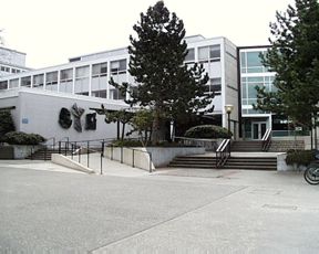
The Neville Scarfe Education Building (University of British Columbia)

The University, in Vancouver, has a Neville Scarfe building and Lecture Theatre. 
He was Dean of Education there for 18 years and achieved a huge amount.
https://studiohub.ca/on-the-boards/ubc-neville-scrafe-lecture-theatre

He contributed an article on games in geography to 'Geography' in 1971.
His son is an actor.
He died in 1985.
I wonder what he may have made of the current status of Canadian Geography. There is an excellent Royal Canadian Geographical Society, but geography doesn't have a high status in the school curriculum in Canada.

Source:
SCARFE, N. V. “Games, Models and Reality in the Teaching of Geography in School.” Geography, vol. 56, no. 3, 1971, pp. 191–205. JSTOR, www.jstor.org/stable/40567554. Accessed 6 July 2020.
Neville Scarfe and British Columbia


Throughout his career, Neville wrote over 100 articles and gave numerous speeches on education around the world. His intuition and progressive understanding of post-war learning instilled in the Faculty the idea that teachers are made, not born. With this spirit in mind, he created rigorous, specialized streams taught by enthusiastic professors to produce dynamic and informed educators. Always an advocate for educational reform, Neville was particularly critical of the findings of the 1960 Report of the Royal Commission on Education (the “Chant Report”), calling it “contradictory and conservative”*. He took particular issue with its recommendations for harsh discipline in classrooms and the assumption that children will behave belligerently unless taught otherwise.

Image source:

Further memories of Neville Scarfe welcome - he was an important geographer on both sides of the Atlantic and I am sure there is plenty more to come.

Updated August 2023


After World War II, Neville Scarfe returned to the Institute of Education of the University of London, where he taught the principles and practices of the teaching of geography. This sparked his interest in the philosophy of education—this was a pursuit he continued for the rest of his life, so it was probably what could be considered his main interest.


They included James Fairgrieve, who he described as 
"a down to earth geographer bent on assisting students to imagine world characteristics accurately, the better to imagine political and social problems"

https://snaccooperative.org/view/64845894

Scarfe was a proponent of play in education.
https://www.tandfonline.com/doi/abs/10.1080/00094056.1962.10726996

Friday, 19 June 2020

Geographers in Wartime

We are coming to a period when many survivors of the Second World War are in their 80s and 90s and the memories are fading.
Many geographers played an important part in the Second World War.
In 1985, the Royal Geographical Society asked W. G. V. Balchin, who was then the Chairman of the RGS' Education Committee (and a former GA President), the job of collating a report and interviewing survivors on their role.

A report was published in 1987 and can be read on JSTOR (free accounts available)

Balchin explains that geographers proved their worth already in the First World War. He also outlines how an understanding of geography is important during wartime, particular when preparing.

He mentions a number of people with connections to the GA and the Ordnance Survey's role is featured prominently of course.

There are several areas where Geographes are particularly mentioned as being important.
These included the aerial interpretation CIU unit which looked at aerial images and worked out what was on the ground and what had changed since the area had last been photographed.

People like Frank Debenham and David Linton worked in this field.

See previous blog post for more details on this.

Source:
Balchin, W. G. V. “United Kingdom Geographers in the Second World War: A Report.” The Geographical Journal, vol. 153, no. 2, 1987, pp. 159–180. JSTOR, www.jstor.org/stable/634869. Accessed 16 June 2020.

Thursday, 18 June 2020

G H Dury, David Linton and the CIU

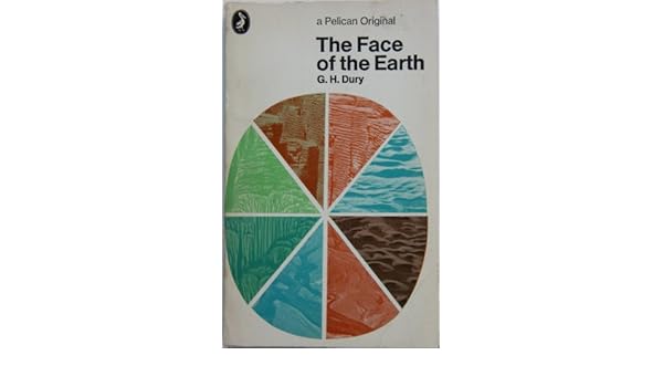
THE FACE OF THE EARTH.: Amazon.co.uk: G.H. DURY: 9780140204476: BooksWhen I took my'A' level Geography back in 1980-1982 - doesn't seem possible but it's true - I was asked to buy a Penguin copy of 'The Face of the Earth' by G H Dury. It was actually the same edition as the one shown here on the right.

George Harry Dury's name has cropped up in association with several GA Presidents.

Dury was a hydrologist, interested in rivers. and more widely in geomorphology. He was born in Northants, and studied at the University of London. He taught geography at Birkbeck College. He developed models which extended Bradshaw's Model for rivers.

Like David Leslie Linton, he was involved in air photography interpretation during the war - see Brendan Conway's excellent post on RAF Medmenham for more details on this. Also Balchin's report on wartime geographers features Medmenham. The Central Interpretation Unit (CIU) also included Professor Frank Debenham for example.

Thanks to Brendan Conway for some excellent additional research here as well on G H Dury's work in wartime. Here's what Brendan sent me a few months ago when I mentioned David Linton's wartime work.


One thing about the David Linton profile I found particularly interesting was his WWII work in photographic interpretation, especially in identifying the underground V-weapon factory in northern France (now La Coupole https://www.lacoupole-france.co.uk/history-centre.html).

It reminded me of something that I've noticed cropping up a few times - the role of geographers in WWII intelligence in places such as RAF Medmenham. Linton is one of several who played key roles in intelligence in a similar way to GIS experts in the Bellingcat organisation now.

Other geographers involved in similar WWII activity included H Clifford Darby and Kenneth Mason in Naval Intelligence (https://www.thebritishacademy.ac.uk/humanities-scholars-who-worked-military-intelligence-second-world-war) and G H Dury (George Harry Dury) in photographic interpretation (RAF Medmenham) (https://rgs-ibg.onlinelibrary.wiley.com/doi/abs/10.1111/j.0020-2754.1997.00398.x).

There's a good book about such work, including interesting references to RAF Medmenham by Jeremy Harwood called 'World War II from Above'. Harwood wrote an article about it 'Spies in the Skies: How Aerial Surveillance Tipped the Balance of WWII'. Here are some quotes indicating links with geographical expertise and how it was used:

'The staff—mostly an eclectic mix of boffins and academics with quite a few women among them—comprised some of the best brains in the country...Glyn Daniel, the first Cambridge archaeologist to be recruited to the Medmenham operation, described his new colleagues as "an ill-assembled collection of dons, artists, ballet designers, newspaper editors, and writers'.

'...the students were introduced to stereoscopic viewing. They were taught how to handle a stereoscopic viewing frame—this was universally referred to simply as a "Stereo." The two photographic prints that fitted into it were termed a "Stereo Pair." '

​Would Linton have worked with Constance Babington Smith?

'Constance Babington Smith was one of them. As well as being the photographic interpreter who first spotted a V1 Flying Bomb on its way for testing, she was the first to spot the Messerschmitt Me 163 rocket fighter, the Heinkel He 28, the world's first jet fighter, and the revolutionary Messerschmitt Me 262, the twin-engine jet fighter that, fortunately for British and American airmen, Hitler insisted be redesigned to be deployed as a fighter-bomber. She and her team detected other top-secret German aircraft prototypes into the bargain'.

Painstaking interpretation would culminate in the meticulous creation of 3D landscape models used to prepare for bombing raids and battles. There's an interesting reference to the challenging geographical learning required by aircrews:

'By the time the war ended, Medmenham's model makers had churned out more than 1,400 models. Some, like the models of the Möhne, Eder, and Sorpedams used to brief the Dam Busters prior to their famous 1943 air attack, were extremely elaborate. Such was the reliance Bomber Command placed on them that, according to Paul Brickhill, author of The Dam Busters, the aircrews taking part in the attack were instructed to "look at these until your eyes stick out and you've got every detail photographed on your mind." '

It's also known that Ronald Lampitt, much admired by geographers and certainly one of my favourite artists, worked in this area of intelligence. His 'geographical eye' and recurring tendency to view almost everything he illustrated from above seems likely to have been strongly influenced by his wartime work, but perhaps also by working with geographers? I'd never been able to find out much about his role during the war until last week when I stumbled across reference to his work by the scientific military intelligence expert RV Jones in his book 'Most Secret War'. It seems that he was very close to the V-weapon investigations as well, so there would be a possibility that he worked with Linton at some point. I summarised the findings in this thread:

Lampitt was recruited by Albert Hugh Smith, who was clearly very close to RV Jones. He later went on to become Professor of English at UCL and acclaimed scholar of Scandinavian Studies and English placenames, so he clearly had geographical interests. Perhaps he had links with Bill Mead at UCL who was also a Scandinavian expert?
Image

Delighted to see the link to Ronald Lampitt - a favourite of mine who I wrote about for the Ordnance Survey's magazine back in the day. I have a much loved copy of the book, and it will definitely have a place in my Presidential lecture in 2022.
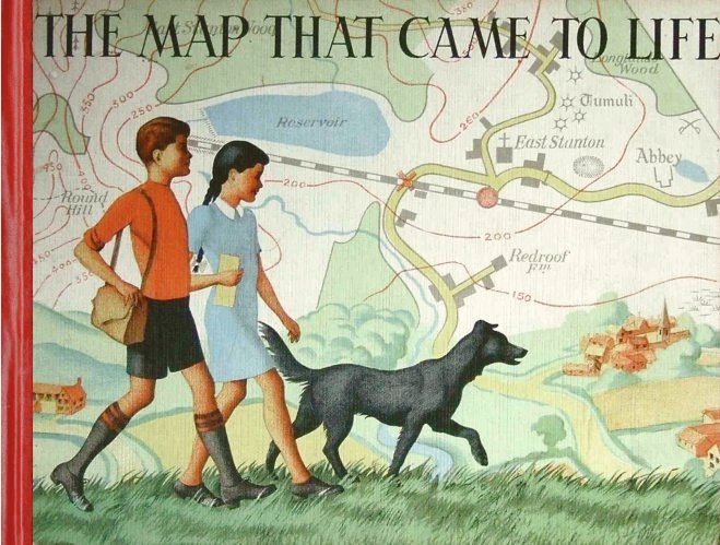
Lampitt's illustrations were included in the book which came out in 1948
I wonder if the author also worked in the same sort of setting.
In The Map that Came to Life the map is portrayed as an objective, precise and above all truthful mirror of nature. And this inherent trustworthiness enabled maps to become important features of the lives of successive generations of people.

More on the author and the book here.

Lampitt’s war service was spent with RAF Intelligence. He created meticulous, hand-drawn maps for allied bomber crews, based on aerial reconnaissance photographs. It was this period of his life that started Lampitt’s fascination with aerial views, which he would later use to great effect in The Map That Came To Life.

Sources: 
Wikipedia page.
https://en.wikipedia.org/wiki/G._H._Dury

Balchin, W. G. V. “United Kingdom Geographers in the Second World War: A Report.” The Geographical Journal, vol. 153, no. 2, 1987, pp. 159–180. JSTOR, www.jstor.org/stable/634869. Accessed 16 June 2020.

Dury, G. H. “Geography and Geomorphology: The Last Fifty Years.” Transactions of the Institute of British Geographers, vol. 8, no. 1, 1983, pp. 90–99. JSTOR, www.jstor.org/stable/622279. Accessed 16 June 2020.

Thanks to Brendan Conway for the additions to this post.
If anyone knows more about these wartime geographers please get in touch.

Friday, 22 May 2020

1966: Professor Stanley Henry Beaver

Last updated August 2023

Professor Stanley Henry Beaver was an academic geographer, who was particularly associated with the LSE and Keele University, as well as being a great supporter of the work of the GA.

A prolific author, he authored books on a wide range of topics, from Sand and Gravel, to more general human geographies of the world, and geomorphology.
He had a very long association with the GA, as did many Presidents of course, working with them for over 30 years before becoming President in a number of roles, and providing content for journals.
He was involved with L Dudley Stamp's Land Utilisation Survey, and co-authored many of the reports that came out of that survey in the 1930s and beyond.

He also became involved in the planning and delivery of the Annual Conference in 1933, after Dr. H J Wood stood down.
During the 1930s, the GA Conference actually moved around a lot more than it had previously, where it was mostly held at the LSE. The 1930s saw it in cities including Liverpool, Glasgow, Nottingham and Sheffield. In 1932, the conference was even planned to be overseas in Heidelburg, but political and currency problems meant it had to be cancelled.

He had an association with the RGS (as many other GA Presidents have) and the IBG.

When he left the LSE he was succeeded by Michael Wise: another former GA President.

He also co-wrote a classic book with another GA President, L Dudley Stamp called 'The British Isles' as part of the 'Regional Geography' series.

He was born in London in 1907, and went to UCL where he graduated with first class honours in Geography in 1928. He completed his Diploma in Education in 1929, and according to an obituary published in the Transactions of the IBG, was influenced by L. W. Lyde, who apparently regarded geography as:
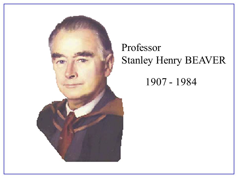
Image result for Professor Stanley Henry Beaver
"a body of knowledge coupled with an attitude of mind". 

He worked at the LSE between 1929 and 1950,  along with L Dudley Stamp

For some time, I couldn't find a contemporary image of Stanley Beaver, but was fortunate to receive one from Dr. Philip Kivell which can be seen at the top of the blog post.

In 1962, he had a piece published in 'Geography' on the Le Play Society and their contribution to fieldwork.

By this time, he was Head of the Geography department at the University of Keele. He stayed at Keele until his retirement in 1974 when he became Emeritus Professor.


In it, he references the work of Patrick Geddes, who had A. J. Herbertson as his assistant.


I am grateful to Dr. Peter Knight for helping me get in touch with Dr. Philip Kivell, who very kindly gave me a range of additional details on Professor Beaver's career and personal life. 
What follows was provided very kindly by Dr. Kivell.

S.H.BEAVER 1907-1984
Stanley Henry Beaver was born in Willesden, North London in August 1907. He graduated from University College London in 1928 with first class honours in Geography having already been awarded the Morris Prize and a University Scholarship in Geology. His first academic post was at the London School of Economics, where a very productive period resulted in appointment as Ernest Cassel Reader in 1946. His major work at this time, together with L Dudley Stamp was “The British Isles: a geographic and economic survey” which went though many editions before and after the war and provided a geographical grounding for  many thousands of students. 
During the war he worked for Naval Intelligence and used his geographical training to produce a number of regional handbooks. 
He was appointed as the founding professor of Geography at the new University College of North Staffordshire, subsequently Keele University, in 1950. 
Here he built up the first new post- war Geography Department in the country, including being closely involved in the physical design of the building. 
This included finding a home for millions of RAF air photographs taken over Europe during the war, and the establishment of a meteorological station on the campus.
Beaver could fairly be described as a traditional geographer, a product of an age that largely pre-dated the increasing specialization that reshaped the discipline from the 1960s. 
Having said that, his interests and skills were enormously diverse.  Most obviously he was a Human Geographer concerned with economic and regional matters, but his interests also ranged widely over transport geography, land use and dereliction and he was equally well informed about climate, meteorology, and mineral extraction. He was a practical academic, always interested in how environments and human processes worked and in this context he helped enormously to put “The Potteries” region on the map of public and academic awareness.
He was a superb and well organised teacher and was always in demand as a guest speaker by organisations across the country. From a student point of view he was extremely well respected but perhaps not the most approachable teacher. He belonged to an era when staff- student relations were more formal and respectful so the informality and student politics of the 1960s and 70s did not always sit easily with him. 
He could appear austere and remote but those who experienced his excellent field excursions soon saw a more relaxed side of him and were perhaps party to his dry sense of humour, his love of puns and his stock of limericks. At heart he was kind and immensely supportive to his staff and colleagues.
Apart from his teaching and research Beaver played a very active role in numerous groups and committees. Some of these were tied up with the University and local region, but others were national or international.  For many years he chaired Keele University Grounds Committee, responsible for the largest, and some would say, most attractive university campus in the country. It was not unknown for him to open his office window to berate students who were walking on the grass. 
He was President of the Geographical Association, active in the RGS and in the founding of the IBG, the IGU and the Anglo-Polish seminars. 
As Chair of the Geography Board of the CNAA he played a major role in promoting the new Polytechnic sector. Amongst all of this he found time to translate several important French texts into English.
During his quarter century at Keele  Stanley lived on the campus with his wife Elsie, who also worked as curator in the departmental map library, and four children. He enjoyed his large garden which he said (tongue in cheek) lay astride the watersheds between the Trent, Severn and Weaver catchments. One of his enduring passions had been steam railways, about which he was enormously knowledgeable. When the locomotive Keele Hall was withdrawn from service in 1963 Stanley Beaver bought the nameplate and displayed it proudly in his new department. On numerous overseas travels he would manage to arrange a trip on the footplate of whatever local steam locomotive took his fancy.
Upon retirement he and Elsie bought a large house in Eccleshall , a few miles from the campus, where he continued to garden, to enjoy his stamp collection and to continue his involvement in local Staffordshire organisations, especially the CPRE. He and Elsie endowed separate funds for student prizes and for fieldwork in the local area. 
Stanley Beaver was undoubtably one of the great geographers of his generation.
Professor Beaver died in 1984.

References
http://worldcat.org/identities/lccn-n50006237/

Obituary: “Stanley Henry Beaver, 1907-1984.” Transactions of the Institute of British Geographers, vol. 10, no. 4, 1985, pp. 504–506. JSTOR, www.jstor.org/stable/621896

Beaver, S. H. “The Le Play Society and Field Work.” Geography, vol. 47, no. 3, 1962, pp. 225–240. JSTOR, www.jstor.org/stable/40565418

British Geography 1918-1945, Edited by Robert.W Steel - published in 1987.
Chapter 12 was by J A Patmore, where he gave a personal perspective on the period.

Article in Geography in 1978
BEAVER, S. (1978). Some Observations on the Climate and Weather of New Zealand. Geography, 63(1), 14-22. Retrieved August 25, 2020, from http://www.jstor.org/stable/4056883
Patmore describes Beaver in this chapter.
A chapter in this book is here:
https://books.google.co.uk/books?id=9NSDx4DxfVcC&lpg=PA76&ots=uk5vMrcPG4&dq=stanley%20henry%20beaver%20geographer&pg=PA76#v=onepage&q&f=false

RGS Archives: http://discovery.nationalarchives.gov.uk/details/c/F46114 - I won't be able to visit the archive for a while, but there are quite a lot of papers

Updated - May 2020

A few updates to add following the posting.

There was a connection revealed between Professor Beaver and another former GA President who will have his own entry in due course (sometime in 2021) Bob Digby.
Bob told me that:


Bob apparently spent the £25 in the Keele University bookshop, buying geography textbooks from the time.

I also discovered another bit of information on Professor Beaver, from when he was a student at UCL in the 1920s. He was taught by Lionel William Lyde, another high profile Geographer from the early part of the 20th century.

His wife Elsie Rogers was also a student at UCL, and her memories of Lyde's teaching were also featured in the same document.


Taken from UCL Geography Department Archives.

Keele University offers an Elsie Beaver Prize for the best undergraduate dissertation by final year student involving fieldwork in physical geography, so the connection to Beaver continues.
It seems that she worked in the Map Library at the University as Map Curator. 


Beaver was also taught by another former GA President: Edmund Garwood. More connections...

Source:
https://books.google.co.uk/books?id=7BQSBwAAQBAJ&lpg=PA16&ots=qyoQUQmILd&dq=lyde%20geography%20definition&pg=PA8#v=onepage&q&f=false
- this link is to one of the many Biogeographical Studies, which are 'proper' versions of what I'm doing on this blog.

I also found his own entry, after all that, in the Biogeographical Studies series.


This included an image of him, and also details of his links with the GA, as well as a lot more detail.

Beaver was Honorary conference organiser from 1934-1949 and also declared an intention to visit every branch in Britain while President - something I hoped to do, but didn't quite manage it.


https://books.google.co.uk/books?id=R-48DwAAQBAJ&lpg=PA130&ots=vx3Y5ASsYg&dq=lionel%20lyde%20UCL&pg=PA129#v=onepage&q=lionel%20lyde%20UCL&f=false 

As always, if you have further information relating to this President please get in touch. 

Thanks to Dr. Philip Kivell for the image of Professor Beaver used at the top of the blog and substantive text later on.
Thanks to Dr. Peter Knight for his assistance as well.

Updated March 2023

Mentioned on first page of J B Priestley's 'English Journey'.

Updated August 2023


This flagged up his involvement with Section E of the BAAS, which I have been investigating over the last few days and have found plenty of details in the Transactions of the IBG and elsewhere that show Beaver's substantial involvement in discussions around geography in schools and universities. 


GA Obituary

Rodgers, H. B. “The Geographical Association.” Geography, vol. 70, no. 1, 1985, pp. 77–80. JSTOR, http://www.jstor.org/stable/40571501. Accessed 24 Aug. 2023. 

Wednesday, 6 May 2020

Ellen Jenifer Rickard

Ellen Rickard seems to have been something of a pioneer for female geographers and teachers.


Her story was told in this book by the RGS-IBG. It describes her involvement with the GA, which included a place on the GA's council - one of the first female officers. She was particularly important during the war, taking over from J F Unstead (who also had his own post on the blog a few days ago). She was also connected with A J Herbertson, as were many during that period, when they became involved with the GA. She had a great many roles within the GA.

It would be lovely to be able to source an image of Ellen Rickard.


Source:
https://books.google.co.uk/books?id=p_xfuY8CJ48C&lpg=PT115&ots=xln_U09sEO&dq=%22marguerita%20oughton%22%20sheffield&pg=PP1#v=onepage&q=%22marguerita%20oughton%22%20sheffield&f=false


An Obituary was published in 1963

Oughton, M. “WILLIAM WALLACE.” Geography, vol. 48, no. 4, 1963, pp. 418–19. JSTOR, http://www.jstor.org/stable/40565722. Accessed 16 Sept. 2023.


Can download the book:

The book describes how Ellen Rickard was involved in the GA

pp.142-3 describes the work she did during the war years, which were difficult times for the GA.

Wednesday, 18 March 2020

1960: Professor Arthur Austin Miller

Updated October 2023.

A(rthur) Austin Miller was the first GA President of the 1960s - an era of great change for the Association

As with other Presidents in the decades following the Second World War, he had a military background as well as his academic one, and he had served during the First World War, in the Royal Flying Corps (although the war ended when he had just passed his 18th birthday) so he waited for the Second World War to go flying again, when he again saw active service. I wonder how many GA Presidents did that.

He was originally intending to study chemical engineering (similar to David Leslie Linton - the President in 1964), but became a geologist instead initially.
He was inspired to do this partly by lectures from another influential former GA President: E. J. Garwood.

He worked at Reading University, where he was described as a "doyen of geographical climatology."

He was a key contributor to a conference session on the future of geography in schools as long back as 1945, which was chaired by another former President Sidney Wooldridge, showing a long-term connection with the GA. Wooldridge seems to have mentored quite a few people who went on to become GA President.

Miller also served on the GA's council for several years during the 1940s and held several roles, as did many GA Presidents during this time - in fact deep involvement in the GA is a prerequisite for being elected as GA President really.

Miller was also a founding member of the Institute of British Geographers in 1933, joining several other GA Presidents in that respect in their link with this body, which later merged with the RGS to form the current RGS-IBG, and later became President.
This article provides a great deal more information about his role in the IBG.

Stoddart, D. R. “Progress in Geography: The Record of the I. B. G.” Transactions of the Institute of British Geographers, vol. 8, no. 1, 1983, pp. 1–13. JSTOR, www.jstor.org/stable/622270 - source of the image above

Miller's IBG Presidential Address was given in 1948, and was on the dissection and analysis of maps.


He talks about the value of maps to geographers....


I liked the explanation that there were 24 lantern slides used to illustrate this lecture (although they weren't produced in Transactions sadly, although links to places where they had been published were included)

He also described the early days of geographers using the statistician's tools and introducing some numeracy.

Hugh Robert Mill is mentioned here too.


In 1947, he wrote an article for the GA's journal 'Geography' where he talked about the importance of exploring current affairs (an early mention for the idea of 'floating topicality' that Jeff Stanfield has talked about).
Here's a section from the article:

 Geography, Alive and Dead : the Teacher and the Text-book 


Although we pride ourselves that we have left behind the devastating dullness of the old geography it still happens sometimes that pupils, generally the duller and less imaginative among them, lose interest. And whose fault can this be but our own ? 

Often the root cause is too great a reliance on the text-book, which, of necessity, must attempt to reduce a complex scene to simplicity, order and tidiness ; life withers and the sap dries up in the process.
We read an account, in an advanced text-book, of the South Wales coalfield.


Within the few thousand words it can afford it is compelled to compress the geological structure, the types of coal, the output, the valley forms, the resultant settlement pattern, the communications, the industries, the exports and much more. These, of course, are very important, and constitute the minimum of firm knowledge that the pupil should retain. But what sort of a picture does it give of "man's" life in a pit village ?

It tells him nothing of the daily round, the long tramp or ride to the pithead, the sickening drop in the cage, the darkness until the eyes accustom to the dimness underground, the long dirty walk to the coal face, the distant rumble of the tub train approaching, the deafening bombardment of noise at the coal face by pneumatic picks and conveyor belt, the hewer stripped to the waist with the sweat trickling into his eyes and the, black smear of coal dust where he wipes it away with the back of his hand, the crouching in the darkness waiting for the shots to be fired, the anxious counting of the explosions, the danger of roof-falls and explosion of gas, the bravery and self-sacrifice of rescue parties, the tragedy and heroism of men and families in distress or disaster, and, up above, the mean rows of insanitary cottages, the open drains, the long sidings full of waiting trucks, the hiss of steam and the clang of shunting engines, the great wheels spinning as the cage rushes up or down the shaft, the unemployment, the pubs, the clubs, the pithead baths, the dispensaries, the tuberculosis, the silicosis, the black lungs, and skin ingrained with coal dust, the football, the choirs, the dogs, the Sunday afternoons, the fresh air and the sunshine or rain out on the windy hilltops only a mile away, the fouling of nature by "man."

These are the flesh and blood needed to clothe the stark skeleton of the text-book summary and these the teacher can and must supply.
But how ?
Partly by using his own knowledge to amplify and vivify the text with lively description ; partly by giving reading of a wide scope, and partly by appealing through the eye with visual aid.

Those comments all seem reasonable.


Miller's GA Presidential Address was given in 1960, on Climate and the Geomorphic Cycle.


In the GA Annual Report of 1960, he was thanked for his hard work and attention to business. 

Membership had passed 5000 during this time, and was continuing its upward course.

During this year, a former President Lord Nathan had been working on redrafting the constitution of the Association, and worked on some Statutes and Standing Orders. The Governing Body, on which the President now serves explores and updates these documents which underpin the running of the Association.

Miller published several papers, and wrote a book on Climatology, and others on Everyday Meteorology and one called 'The Skin of the Earth'.

In 1945, for example, he contributed to a debate about the future of Geography at the first post-war Annual Conference. This was reported in 'Geography' as shown below:


I came across a copy of A Austin Miller's book on 'Climatology' in an Oxfam bookshop in Norwich.

From his Obituary:


As with many other Presidents of the Geographical Association, there were also connections with the Royal Geographical Society.
Miller was awarded their Murchison Medal for this contributions to geography.

He was also the first Miller to be president, with the current President Gill Miller sharing the surname.

References
GA Annual Report 1960
Obituary
https://www.jstor.org/stable/621417?seq=1#page_scan_tab_contents

Linton, David L. “Obituary: Emeritus Professor A. Austin Miller.” The Geographical Journal, vol. 134, no. 3, 1968, pp. 467–469. JSTOR, www.jstor.org/stable/1793043 - obituary by another former GA president.
Volume in his honour (scanned so lots of text errors, but readable - mentions of various other past Presidents early on, and foreword by L. Dudley Stamp - https://archive.org/stream/in.ernet.dli.2015.111768/2015.111768.Essays-In-Geography-For-Austin-Miller_djvu.txt )

“GEOGRAPHICAL ASSOCIATION. Annual Conference Discussions on the Future for Geography.” Geography, vol. 30, no. 2, 1945, pp. 50–62. JSTOR, www.jstor.org/stable/40563427

Miller, A. Austin. “THE GEOGRAPHER AND CURRENT AFFAIRS.” Geography, vol. 32, no. 2, 1947, pp. 77–83. JSTOR, www.jstor.org/stable/40546378

Miller, A. Austin. “The Dissection and Analysis of Maps: Presidential Address.” Transactions and Papers (Institute of British Geographers), no. 14, 1948, pp. 1–13. JSTOR, www.jstor.org/stable/621257.

MILLER, A. AUSTIN. “Climate and the Geomorphic Cycle: Address to the Geographical Association.” Geography, vol. 46, no. 3, 1961, pp. 185–197. JSTOR, www.jstor.org/stable/40565260

Stoddart, D. R. “Progress in Geography: The Record of the I. B. G.” Transactions of the Institute of British Geographers, vol. 8, no. 1, 1983, pp. 1–13. JSTOR, www.jstor.org/stable/622270 - source of the image above

A copy of his book 'The Skin of the Earth' is shown below.


A fairly brief entry - let me know if you have further information on A Austin Miller.

Image: thanks to Professor Andrew Goudie (another former GA President) for sourcing the top image of Arthur Austin Miller for me, along with some other Presidents - much appreciated.

Update August 2021

Interesting tweet with a family connection added here, with his daughter Lindsey:


Updated October 2023

He was linked with Section E of the British Association - a very important aspect of the development of geography which is a thread running through the careers of quite a few GA Presidents.

In I956 he became President of Section E of the British Association for the Advancement of Science and was a member of the Association's Committee until 1965.

It sounds like he would have been up for a pint...

He co-authored this article from 1930.


An interesting story about a paper of Miller's that got rejected from the journal of Irish Geography: read the full paper here

http://78.137.164.74/~geograph/irishgeography/v37-1/herries.pdf

He had a daughter called Shirley who graduated from New Hall college, Cambridge.

Margaret Mackintosh RIP

Updated post. Sad news at the end of last week from colleagues who have organised the Charney Conference over the years of the passing of Ma...