Showing posts with label Second World War. Show all posts

Thursday, 18 December 2025

Professor Eric Brown

I'm still interested in adding further details of people and connections with the GA - the blog is not over, although the main phase has been completed in terms of writing biographies of all former Presidents.
Please get in touch if you have things you might want to add.

I came across this obituary of Professor Eric Brown from 2018, who had a number of connections with the GA and the RGS.

An edited version of a remarkable career, with plenty of RGS and IBG related work as well.

Eric Herbert Brown died at Berkhamsted on 5 January 2018 at the age of 95. He taught geography at University College London for almost four decades, inspiring generations of undergraduates and mentoring dozens of research students. His doctoral work, published as The Relief and Drainage of Wales (1960) earned him the Back Award of the Royal Geographical Society and has become a classic work in physical geography. Eric was President of the Institute of British Geographers in 1978 and served as Honorary Secretary of the RGS from 1977 to 1987, and then Vice-President (1988–1989). He edited Geography Yesterday and Tomorrow (1980) to commemorate the 150th anniversary of the Society. 

The son of Samuel and Ada Brown, Eric was born on 8 December 1922 at Melton Mowbray, Leicestershire. His exploration of the surrounding countryside, on foot or on bicycle, awakened his interest in geography, and a game of “brook jumping” introduced him to the meandering of streams. Having excelled in his secondary education at King Edward VII Grammar School in Melton Mowbray, he was accepted to study geography at King's College London. His first academic year was spent as an academic evacuee in Bristol, where he was tutored by Sidney Wooldridge who had a profound influence on his approach to geography and his subsequent career. From 1941 to 1945, Eric was a Royal Air Force pilot, after training at several bases in Britain and Canada. As a member of 517 Squadron, Coastal Command, he was involved in anti-U Boat operations over the Bay of Biscay and collected meteorological data on long patrols over the Atlantic to assist forecasting of weather in Europe. This contributed to the forecast from which General Eisenhower decided to postpone D-Day by 24 hours. 

Based in Pembrokeshire, Eric met a local farmer's daughter named Eileen Reynolds whom he married in 1945. After the war, he resumed studies at the King's College-London School of Economics Joint School of Geography and obtained a first class degree in 1947.

Following Wooldridge's advice, Eric accepted an assistant lectureship at the University College of Wales, Aberystwyth, where Emrys Bowen was professor. With support from geologist Alan Wood, Eric researched the geomorphology of Cardiganshire for his MSc (University of Wales, 1949), and started work on his doctoral project covering Wales (University of London, 1955). He made field observations throughout Wales, usually travelling by motorbike. His investigations impressed Professor Henry Clifford Darby, whom he had met at an IBG conference, and he was invited to join UCL. After advice from Wooldridge, Eric began teaching in London in January 1950. 

Throughout his career, Eric's main teaching responsibilities lay with geomorphology and North America, the latter popular course being shared with Bill Mead. 

Beyond the British Isles, Eric gained field experience in Poland in the early 1960s of periglacial features and the techniques of geomorphological mapping developed there during the 1950s. This led to him making a significant contribution to all of the four meetings (one of only three such “regulars”) between November 1958 and January 1961 that began by proposing a Land Form Survey of Britain, and ended with the agreement to establish the British Geomorphological Research Group (BGRG). The minutes of these meetings reveal Eric to have been a strong advocate for the Polish style of geomorphological mapping (of landforms) rather than the morphological mapping (of slope attributes) favoured by some others; as well as for the foundation of the BGRG (together with David Linton and Wooldridge). 

Eric retired in 1988 but retained many links with UCL and especially the Remote Sensing Unit. In 2002 his long and dedicated service to geography was marked by an honorary doctorate from the University of York, where his former student Sir Ron Cooke was vice-chancellor. Eric continued to be an active member of his local community in Berkhamsted, including its branch of the Geographical Association. He attended academic events at the RGS-IBG and meetings of the Geographical Club. 

He deepened his appreciation of rugby football and fine wines. UCL Geography emeriti enjoyed regular “pub lunches” until last year, when Eric would recall wartime experiences as if they were yesterday. A visit, with Bill Mead, to Gerry and Marion Ward in the south of France became an annual fixture. After the death of Eileen in 1984, he lived alone for three decades, moving into a retirement home only for his final months. Professor Eric Brown is survived by his daughters, Jane and Megan, and by his grandchildren in whom he took great pride.

Monday, 23 December 2024

Ronald Lampitt - 'geographer'

Back in 2020, Brendan Conway responded to a post on this blog which mentioned the wartime work of quite a few former Presidents, often in aerial photography interpretation, although this is not an area that has been researched in any detail. 

It finished with a mention for the artist and illustrator Ronald Lampitt.

It's also known that Ronald Lampitt, much admired by geographers and certainly one of my favourite artists, worked in this area of intelligence. His 'geographical eye' and recurring tendency to view almost everything he illustrated from above seems likely to have been strongly influenced by his wartime work, but perhaps also by working with geographers? 

I'd never been able to find out much about his role during the war until recently when I stumbled across reference to his work by the scientific military intelligence expert RV Jones in his book 'Most Secret War'. It seems that he was very close to the V-weapon investigations as well, so there would be a possibility that he worked with Linton at some point. I summarised the findings in this thread:


https://twitter.com/mildthing99/status/1256611375411073024

Lampitt was recruited by Albert Hugh Smith, who was clearly very close to RV Jones. He later went on to become Professor of English at UCL and acclaimed scholar of Scandinavian Studies and English placenames, so he clearly had geographical interests. Perhaps he had links with Bill Mead at UCL who was also a Scandinavian expert?


There are plenty of examples of Lampitt's illustrations on the Ladyburd Fly Away Home website and social media feeds.

https://ladybirdflyawayhome.com/ronald-lampitt/

During the war he worked in Intelligence and although (perhaps inevitably) the nature of this work is unknown, it is possible that his wartime work helped develop his exceptional topographical accuracy and the ability to animate technical drawings into something visually rich and appealing.

The blog explores the wartime careers of quite a few post-war GA Presidents.

Mike Dempsey's blog post also shares his love of Lampitt and his work.

I can see that there is a potential book in unpicking the contributions made by several post-war Presidents, including Michael Wise, who was also President of the RGS, and an important post-war Geographer that many people will not be familar with.

Illustrations: Ronald Lampitt

Monday, 20 November 2023

Aerial Intelligence in WWII

There have been several GA Presidents who have been revealed as working in aerial intelligence during the Second World War. This is explored in their entries.

For example, Michael Wise graduated in 1939, and served in the Army in Europe and the Middle East during the Second World War, reaching the rank of Major and was awarded the Military Cross.

Wise was awarded the Military Cross for his conduct in the fierce battle of the Argenta Gap in April 1945 (see Jackson and Gleave 1988). His company’s forward ground was overrun by a surprise enemy attack and its headquarters were under threat. The citation for his medal refers to his ‘calm and confident bearing … [as] an inspiration to all members of his company, and his manner of dealing with a most difficult and dangerous situation is beyond praise’. 

During the war of 1939–45, intelligence was gleaned from aerial photographs by a newly founded organization that developed into the Allied Central Interpretation Unit. This was based primarily at Danesfield House (known as Royal Air Force Medmenham) some 50 km west of London, in Buckinghamshire.

David Leslie Linton gets a mention here. I know that he was involved in suggesting launch sites for the 'V1 and V2' weapons.

Work at Medmenham, although important for the war effort, required interpreters familiar with aerial photographs rather than geology as such – but geology did assist the search for storage sites for ‘V’ weapons, terrain interpretation for the 1944 Allied landings in Normandy, and in guiding plans to bomb German industrial complexes hidden underground.

W G V Balchin wrote a useful summary which I have mentioned in a previous blogpost. He mentioned some of those involved and why geographers were useful.

Geography has always been vital to the prosecution of war, in three ways: first, intelligence is critical; secondly logistics (geographical factors influence the deployment of men, materials and firepower); thirdly, in action (geographical factors enter in decisions on the disposition of forces, where to attack or defend, what routes to follow, where to land invasion craft and so on.

References

Balchin, W. G. V. “United Kingdom Geographers in the Second World War: A Report.” The Geographical Journal, vol. 153, no. 2, 1987, pp. 159–80. JSTOR, https://doi.org/10.2307/634869. Accessed 1 Nov. 2023.

https://www.proquest.com/openview/a4b517a601813d3c3c3fc825fb1fb8fb/1?pq-origsite=gscholar&cbl=1818801 - Linton's work


World War One.

Charles Close was of course involved in World War I.

In Great Britain, a Topographical Section, later renamed Geographical Section, was assigned to the general staff in 1904 (Geographical Section, General Staff or GSGS). Until 1911, this section was headed by Charles Frederick Close (1865-1952), who reformed organisation and training based on his experiences of surveying in India; after that, he took over as Director General of the Ordnance Survey.

The OS remembers the staff it lost every Remembrance Sunday.

Tuesday, 18 May 2021

Wartime - mass observation

Bill Mead, a future President of the GA wrote a letter in to the 'Geography' journal in March 1945. In it, he suggested that the disruption of the Second World War could be turned to advantage as there were doubtless lots of members of the GA who had been posted overseas, and whose experiences could perhaps be harnessed. I'm not sure whether his suggestion was taken up in an organised way,  but certainly many GA Presidents during the 1950s had seen active service, many of them in aerial surveillance and intelligence as can be seen in their entries on the blog. These fed into articles in 'Geography' through the 1940s and 1950s and undoubtedly shaped the next generation of geography teachers.

Source:

Mead, W. N. “CORRESPONDENCE.” Geography, vol. 30, no. 1, 1945, pp. 15–17. JSTOR, www.jstor.org/stable/40562423. Accessed 15 May 2021.

Friday, 19 June 2020

Geographers in Wartime

We are coming to a period when many survivors of the Second World War are in their 80s and 90s and the memories are fading.
Many geographers played an important part in the Second World War.
In 1985, the Royal Geographical Society asked W. G. V. Balchin, who was then the Chairman of the RGS' Education Committee (and a former GA President), the job of collating a report and interviewing survivors on their role.

A report was published in 1987 and can be read on JSTOR (free accounts available)

Balchin explains that geographers proved their worth already in the First World War. He also outlines how an understanding of geography is important during wartime, particular when preparing.

He mentions a number of people with connections to the GA and the Ordnance Survey's role is featured prominently of course.

There are several areas where Geographes are particularly mentioned as being important.
These included the aerial interpretation CIU unit which looked at aerial images and worked out what was on the ground and what had changed since the area had last been photographed.

People like Frank Debenham and David Linton worked in this field.

See previous blog post for more details on this.

Source:
Balchin, W. G. V. “United Kingdom Geographers in the Second World War: A Report.” The Geographical Journal, vol. 153, no. 2, 1987, pp. 159–180. JSTOR, www.jstor.org/stable/634869. Accessed 16 June 2020.

Thursday, 18 June 2020

G H Dury, David Linton and the CIU

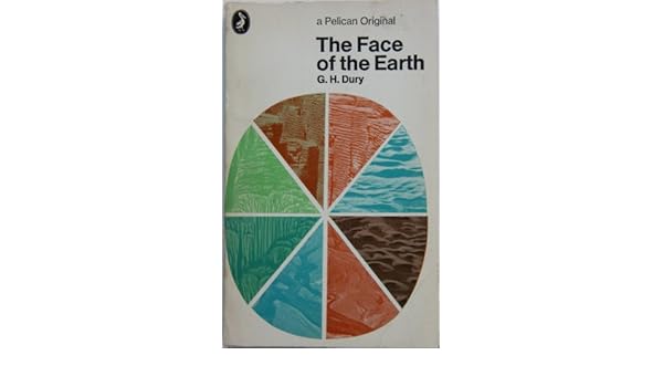
THE FACE OF THE EARTH.: Amazon.co.uk: G.H. DURY: 9780140204476: BooksWhen I took my'A' level Geography back in 1980-1982 - doesn't seem possible but it's true - I was asked to buy a Penguin copy of 'The Face of the Earth' by G H Dury. It was actually the same edition as the one shown here on the right.

George Harry Dury's name has cropped up in association with several GA Presidents.

Dury was a hydrologist, interested in rivers. and more widely in geomorphology. He was born in Northants, and studied at the University of London. He taught geography at Birkbeck College. He developed models which extended Bradshaw's Model for rivers.

Like David Leslie Linton, he was involved in air photography interpretation during the war - see Brendan Conway's excellent post on RAF Medmenham for more details on this. Also Balchin's report on wartime geographers features Medmenham. The Central Interpretation Unit (CIU) also included Professor Frank Debenham for example.

Thanks to Brendan Conway for some excellent additional research here as well on G H Dury's work in wartime. Here's what Brendan sent me a few months ago when I mentioned David Linton's wartime work.


One thing about the David Linton profile I found particularly interesting was his WWII work in photographic interpretation, especially in identifying the underground V-weapon factory in northern France (now La Coupole https://www.lacoupole-france.co.uk/history-centre.html).

It reminded me of something that I've noticed cropping up a few times - the role of geographers in WWII intelligence in places such as RAF Medmenham. Linton is one of several who played key roles in intelligence in a similar way to GIS experts in the Bellingcat organisation now.

Other geographers involved in similar WWII activity included H Clifford Darby and Kenneth Mason in Naval Intelligence (https://www.thebritishacademy.ac.uk/humanities-scholars-who-worked-military-intelligence-second-world-war) and G H Dury (George Harry Dury) in photographic interpretation (RAF Medmenham) (https://rgs-ibg.onlinelibrary.wiley.com/doi/abs/10.1111/j.0020-2754.1997.00398.x).

There's a good book about such work, including interesting references to RAF Medmenham by Jeremy Harwood called 'World War II from Above'. Harwood wrote an article about it 'Spies in the Skies: How Aerial Surveillance Tipped the Balance of WWII'. Here are some quotes indicating links with geographical expertise and how it was used:

'The staff—mostly an eclectic mix of boffins and academics with quite a few women among them—comprised some of the best brains in the country...Glyn Daniel, the first Cambridge archaeologist to be recruited to the Medmenham operation, described his new colleagues as "an ill-assembled collection of dons, artists, ballet designers, newspaper editors, and writers'.

'...the students were introduced to stereoscopic viewing. They were taught how to handle a stereoscopic viewing frame—this was universally referred to simply as a "Stereo." The two photographic prints that fitted into it were termed a "Stereo Pair." '

​Would Linton have worked with Constance Babington Smith?

'Constance Babington Smith was one of them. As well as being the photographic interpreter who first spotted a V1 Flying Bomb on its way for testing, she was the first to spot the Messerschmitt Me 163 rocket fighter, the Heinkel He 28, the world's first jet fighter, and the revolutionary Messerschmitt Me 262, the twin-engine jet fighter that, fortunately for British and American airmen, Hitler insisted be redesigned to be deployed as a fighter-bomber. She and her team detected other top-secret German aircraft prototypes into the bargain'.

Painstaking interpretation would culminate in the meticulous creation of 3D landscape models used to prepare for bombing raids and battles. There's an interesting reference to the challenging geographical learning required by aircrews:

'By the time the war ended, Medmenham's model makers had churned out more than 1,400 models. Some, like the models of the Möhne, Eder, and Sorpedams used to brief the Dam Busters prior to their famous 1943 air attack, were extremely elaborate. Such was the reliance Bomber Command placed on them that, according to Paul Brickhill, author of The Dam Busters, the aircrews taking part in the attack were instructed to "look at these until your eyes stick out and you've got every detail photographed on your mind." '

It's also known that Ronald Lampitt, much admired by geographers and certainly one of my favourite artists, worked in this area of intelligence. His 'geographical eye' and recurring tendency to view almost everything he illustrated from above seems likely to have been strongly influenced by his wartime work, but perhaps also by working with geographers? I'd never been able to find out much about his role during the war until last week when I stumbled across reference to his work by the scientific military intelligence expert RV Jones in his book 'Most Secret War'. It seems that he was very close to the V-weapon investigations as well, so there would be a possibility that he worked with Linton at some point. I summarised the findings in this thread:

Lampitt was recruited by Albert Hugh Smith, who was clearly very close to RV Jones. He later went on to become Professor of English at UCL and acclaimed scholar of Scandinavian Studies and English placenames, so he clearly had geographical interests. Perhaps he had links with Bill Mead at UCL who was also a Scandinavian expert?
Image

Delighted to see the link to Ronald Lampitt - a favourite of mine who I wrote about for the Ordnance Survey's magazine back in the day. I have a much loved copy of the book, and it will definitely have a place in my Presidential lecture in 2022.
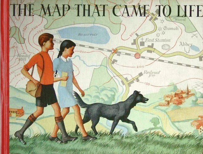
Lampitt's illustrations were included in the book which came out in 1948
I wonder if the author also worked in the same sort of setting.
In The Map that Came to Life the map is portrayed as an objective, precise and above all truthful mirror of nature. And this inherent trustworthiness enabled maps to become important features of the lives of successive generations of people.

More on the author and the book here.

Lampitt’s war service was spent with RAF Intelligence. He created meticulous, hand-drawn maps for allied bomber crews, based on aerial reconnaissance photographs. It was this period of his life that started Lampitt’s fascination with aerial views, which he would later use to great effect in The Map That Came To Life.

Sources: 
Wikipedia page.
https://en.wikipedia.org/wiki/G._H._Dury

Balchin, W. G. V. “United Kingdom Geographers in the Second World War: A Report.” The Geographical Journal, vol. 153, no. 2, 1987, pp. 159–180. JSTOR, www.jstor.org/stable/634869. Accessed 16 June 2020.

Dury, G. H. “Geography and Geomorphology: The Last Fifty Years.” Transactions of the Institute of British Geographers, vol. 8, no. 1, 1983, pp. 90–99. JSTOR, www.jstor.org/stable/622279. Accessed 16 June 2020.

Thanks to Brendan Conway for the additions to this post.
If anyone knows more about these wartime geographers please get in touch.

Thursday, 11 June 2020

Cuchlaine A M King

Professor Cuchlaine Audrey Muriel King died in December 2019.
She was an expert in glaciation and I remember using her book on periglaciation when I started teaching in the late 1980s and wondering how you pronounced her name... She was very proud of her name.
There was also her book with John Cole, who I blogged about recently, on Quantitative Methods which I also remember being in the departmental library back then.
She studied at Cambridge University and earned her bachelor's degree in geography in 1942. She then joined the Women's Royal Naval Service and became a meteorologist and surveyor for the duration of World War II. After her service, she returned to Cambridge and researched sand movement on beaches, earning her doctorate in 1949.

King spent her career studying the influence of glaciers on landscape evolution. She went on expeditions to Skaftafell in Iceland in 1953 and 1954 to study the glaciers there. It was unusual at that time for young women to be allowed to participate in fieldwork in such remote, rudimentary areas of Iceland. The expeditions resulted in a series of papers in 1955 and 1956. Because of her gender, her participation in fieldwork trips was discouraged. However, she participated in research on Baffin Island in the 1960s and the Austerdalsbreen glacier in Norway, and led fieldwork expeditions of her own throughout the Arctic. She published several books throughout her career.

A Yorkshire Post piece said:
With characteristic modesty, she said more than once that her “only achievement” had been to “pave the way for gender equality in Arctic exploration,” recalling the research she undertook on Baffin Island in the far north of Canada in the mid-1960s with the eminent geologist, Prof Jack D Ives, a former student of hers at Nottingham University.

This piece threw up another link:

King was taught by Professor Frank Debenham, another former GA President - from 1952 in fact.
In 1959, King began teaching at the University of Nottingham, where she remained for the rest of her career. A research laboratory is named in her honour.
King was one of the earliest women to become a professor of geography in the United Kingdom, and she retired in 1982 - she may have gained that honour earlier if not for discrimination. Cuchlaine King was honoured with the David Linton Award of the British Society for Geomorphology in 1991.

Cuchlaine King specialised in physical geography. She learned topographic surveying and had a special interest in beach sand movement, completing a doctorate on the topic in 1949

The Linton Award is named after the former GA President who has appeared already on this blog.
A full obituary was published in the latest issue of the Geographical Journal of the RGS-IBG.

To finish, a story I liked:

Enjoying a picnic while on a field trip to Lunedale in the Pennines, Cuchlaine King and her group of geography students were approached by an inquisitive sheep. It came close enough for Cuchlaine to offer it a bite of her sandwich, which it accepted with gusto.
“That was so sweet,” one of the students said. “What sort of sandwich was it?” “Lamb,” came the reply.

Sources
Wikipedia page: https://en.wikipedia.org/wiki/Cuchlaine_King

https://books.google.co.uk/books?id=9Pc-KlQ3I54C&lpg=PA90&dq=cuchlaine%20king%20nottingham&pg=PA90#v=onepage&q&f=false

Brian Whalley wrote an obituary for 'The Guardian'

Monday, 14 October 2019

1942-1945: Thomas Cotterill Warrington

Updated August 2023

Part way through the Second World War, the Presidency moved to Thomas Cotterill Warrington - a post he was to hold for three years to steady the ship.

He was asked if he would like the Presidency at the Annual Meeting in Exeter in 1942 (detailed in the previous blogpost) in recognition of his long and valuable services to the Association.

Prior to that, he had held other posts within the GA, notably taking on the Honorary Librarian post following the retirement of H J Fleure, and the increase in use of the library connected with the move to Manchester.

In this role, he spent much time on "the arrangement of books, the answering of many queries, the selection of reviewers and so on. The filling of our shelves with annual volumes of journals made it necessary to discard books clearly known to be of little value.." 

Books were sometimes lost or re-arranged as the premises of the time had to be used for evening classes - which must have been a source of some frustration for Warrington.
He also helped with the accounts of the Association during the 1940s: https://www.jstor.org/stable/i40024392

One additional challenge for the GA during the Second World War was that the GA's membership dropped as teachers enrolled to fight in the various armed forces. Bombing in London meant that the conference moved out of the city of London too, away from the LSE. More on this in later blog posts on the impact of the war.

In 1942, conference had moved to Exeter, but fortunately missed Hitler's famous Baedeker raids on the city. In 1943, it was held in Cambridge. In that year, there was the 50th anniversary of the founding of the Association (see separate blogpost), but it was a sombre affair under the circumstances of the war, and some time before it was properly celebrated).

Warrington had written about the origins of the Geographical Association in 'Geography' on the 50th anniversary of its founding, which formed his Presidential Address for that year (1943)

His initials can be found all over copies of 'Geography' through the 1930s and 1940s, often with reviews of books or documents relating to GA activity and committees and other reports.

In an Address from 1943, he went back to the GA's origins, as Fleure and others had done before him, and discussed the beginnings of the GA. 

This is well worth reading to go along with the other documents that I've mentioned during the blog which reference the early years of the Association - it's always good to look backwards before contemplating the future.


The piece was only published in 1953, some ten years later, and is an excellent summary of some of the key personalities in the GA, including more details on the role of people like Douglas Freshfield and Halford MacKinder.

He also thanked other unsung heroes of the time, including J. S. Masterman and Miss E. J. Rickard

His Obituary, written by H J Fleure, who seems to have written a great many of them in his long career at the GA, provides the fullest story of his life within the Association and outside it.

He was a teacher, and finally Headteacher at Leek Grammar School until 1934. This is important as there were few teacher Presidents during this time.


Following the founding of the IBG in 1933, Warrington was involved in close working with them. He also selected the four maps which the OS made available to GA members at a special discount price. These areas he selected were:
- the Cairngorms
- Wenlock and the Wrekin
- South Welsh Valleys
- part of the Sussex Downs

His Presidential Address was on the theme of renewing geography, and linked with Sir Isaac Newton. It was the 3rd centenary of his birth in 1942 when Newton was born.

He was influential in greater use of Ordnance Survey maps in education during this time.
Warrington was a member of Council from 1930-1954.

He died in 1963, aged 94, but had actually first joined the Association in 1904 - that is some service to the Association!!


During the immediate Post-War period, the work of former President Patrick Abercrombie also became very important, as London was rebuilt following severe damage in the Blitz, and his plans were also adopted or discussed in other cities.

References

Obituary: Written by Fleure, H. J. “THOMAS COTTERILL WARRINGTON.” Geography, vol. 49, no. 1, 1964, pp. 56–57. JSTOR, www.jstor.org/stable/40565763
Source of the image of T C Warrington


Warrington, T. C. “THE BEGINNINGS OF THE GEOGRAPHICAL ASSOCIATION. From an Address to the Geographical Association at Its Jubilee Conference. Cambridge, 10th-15th August, 1943.” Geography, vol. 38, no. 4, 1953, pp. 221–230. JSTOR, www.jstor.org/stable/40564701

Mackinder, Halford J., et al. “THE DEVELOPMENT OF GEOGRAPHY.” Geography, vol. 28, no. 3, 1943, pp. 69–77. JSTOR, www.jstor.org/stable/40563379
Fleure, H. J (1953) https://www.jstor.org/stable/40564702

Rex Walford's book was an important source here as well.

Details on the 1943 Conference: “ANNUAL CONFERENCE, 1943.” Geography, vol. 28, no. 3, 1943, pp. 86–87. JSTOR, www.jstor.org/stable/40563381

If you know more about T. C. Warrington's time as President, please get in touch. This is quite a brief entry. I wish I knew more about the GA during this period in History.

Updated May 2021
Thanks to Alastair Owens for sharing two images of a programme from the 1945 Conference which he found. It is an amazing document.


This document will have its own blog post as well....

1942 - Exeter Conference and some Everest connections

Updated August 2023

From Balchin's centenary book. 

Some familiar names there.

The dinner and council meeting were held at Hope Hall, which is still used by the University (see image at the bottom of the post)

This was to avoid the wartime raids on London, although Exeter was also targeted during the Baedeker raids.


Hope Hall, Exeter University

Hugh Ruttledge's book was published in the 1930s.
He led two expeditions to Everest: in 1933 and 1936, so this would have been an exciting session to have heard: a decade and a bit after the disappearance of Mallory and Irvine.

In 1934 Ruttledge was awarded a Royal Geographical Society Founder's Medal; his citation read 'For his journeys in the Himalayas and his leadership of the Mount Everest Expedition, 1933.' Although the Mount Everest committee set up an inquiry into the reasons for the failure of the expedition, Ruttledge was not blamed, almost all members of the expedition expressing their admiration and fondness for him.


1933 Expedition

The highest point attained on this attempt was 8,570 m (28,116 f), but the route was found to be too difficult and the vital camp V that should have been reached on a rare day with fair weather – 20 May – was, as a result of disagreements between team members, never established.

It was during this expedition that Wyn-Harris found the ice axe which belonged to Andrew Irvine, who had disappeared on the peak on the 1924 British Expedition with George Mallory.

I've seen that Ice Axe at Shrewsbury School and Charterhouse has some Mallory artefacts.


Image: Alan Parkinson, shared under CC license - I love it when connections like this come to light...

1936 Expedition

Although the North Col was reached, a combination of high winds, storms and waist-deep snow made progress above 7,000 m difficult and, with the monsoon arriving early, Ruttledge called off the expedition.

Tenzing Norgay wrote of Ruttledge and the 1936 expedition:[9]

Mr Ruttledge was too old to be a high climber, but he was a wonderful man, gentle and warm-hearted, and all the Sherpas were very glad to be with him. This was a very big expedition, with more sahibs than there had ever been before, and a total of sixty Sherpas, which was five times as many as in 1935.

Source: Wikipedia entry

Ruttledge moved down to Devon, hence the local connection with Exeter presumably.

Wednesday, 9 October 2019

The GA and the Second World War (cont.)

Rex Walford's book has a chapter exploring the 1940s and 1950s.
He explains how membership dropped during WWII as teachers enrolled in the forces, but publications and conference kept going, with Mackinder still active in his 80s. This was a period when the nature of the subject, and the different elements were much discussed. Was it a science or a humanity?
During the War, there was much preparation for post-war period and reconstruction.
There was also disruption from 1930 onwards because of evalucation of children from the London area, and other industrial cities which were potentially targets.

1940: The GA postponed the Annual Conference scheduled to be held in London in January. The Conference was held in March 1940 in Blackpool. In December the High School of Commerce in Manchester, containing the GA’s Library and Offices, was saved from an air raid fire by the courage of the caretaker, Mr. Sim, who brought the blaze to a halt by working a hose for several hours. The Land Utilisation Survey, used by the County War Agricultural Executive Committees charged with the task of increasing food production, lost many valuable records in a London air raid. 

The 1944 Education Act was one part of the post-war changes that affected geography teaching.
It was led by Rab Butler, and introduced the 11+ and a tripartite system promising "secondary education for all" but in different institutions depending on 'ability'.

This produced a number of different potential geography 'curricula' to prepare for. There was also a focus on Primary geography, and textbooks were produced for this age range, often involving quite stereotypical stories of young people such as "Bombo of the Congo", but even this was a little more enlightened in its coverage than some of the earlier textbooks had been. Oliver Garnett, sister of GA President to-be Alice, wrote the 'Foundations of School Geography' book used in many schools.
Textbooks by authors such as Thomas Pickles and Preece and Wood were much used in secondary schools.

E. W. 'Bill' Young was teaching at Norwich School when he started writing his series called 'Our World' before teaming up with J. H. Lowry to write books that I remember using in the 1960s at school. These included Sample Studies, such as the Kazakhs of the Steppes and Tooktoo of the Eskimos. More on that to come later... these persisted for decades.

There was also pressure from Social Studies to amalgamate, which placed geography's identity under question. The GA was part of the work to maintain its place within the curriculum, and see a change from Regions towards the Models which appeared during the 1960s. More on that to come as the blog develops and further Presidents show their influence.

Bill Marsden's paper (see references) describes some changes during this period:

Wooldridge was to resurface as a key figure in the geography versus geographical education encounters of the post-war period. He was a trenchant peer critic. In 1950 he addressed the IBG and scorned the contentment of his audience with ‘agreeably titillating’ articles on subjects of minor interest which made ‘no claim whatsoever to scholarship’ (Stoddart, 1983, p. 5). 
To Wooldridge a firm physical basis was the sine qua non of a high quality geography. He claimed that the social/urban orientation of the subject was becoming too strong. Geography, he maintained, was about ‘place’ and not about ‘man’ (Graves, 1975, p. 56). 
On the educational front he abhorred the analogous post-war trends towards introducing social studies into the curriculum. These he blamed on geographical educationists. The tendencies threatened to take ‘the ge- out of geography’, as he put it (1949, pp. 9–18). Social studies would On Taking the Geography Out of Geographical Education Some Historical Pointers in Geography Page 7 of 15 ‘destroy the value of geography as an important medium of education’ asserted the Education Committee of the RGS (1950, p. 181), in a report reputedly the work of Wooldridge. Like Geikie, he argued that the priority in schools should be detailed fieldwork in the rural landscape, developing a ‘laboratory spirit and the careful, indeed minute study of limited areas’ (1955, p. 80)

More on Wooldridge in a future blog post.

There was plenty of note in a chronology by G R Crone.


and this too


Image: my own school exercise book from 1976 ish

Reference

Walford, Rex. “On the Frontier with the New Model Army: Geography Publishing from the 1960s to the 1990s.” Geography, vol. 74, no. 4, 1989, pp. 308–320. JSTOR, www.jstor.org/stable/40571739.

Boardman, David, and Michael McPartland. “A Hundred Years of Geography Teaching: From Regions to Models: 1944—1969.” Teaching Geography, vol. 18, no. 2, 1993, pp. 65–68. JSTOR, www.jstor.org/stable/23753284

https://www.open.edu/openlearn/ocw/pluginfile.php/631169/mod_resource/content/1/geog_sk6_06t_5.pdf

Crone, G. R. “British Geography in the Twentieth Century.” The Geographical Journal, vol. 130, no. 2, 1964, pp. 197–220. JSTOR, www.jstor.org/stable/1794582.

Wednesday, 25 September 2019

1937: Professor Leslie Patrick Abercrombie (later Sir)

Sir (Leslie) Patrick Abercrombie - NPG x82059.jpg
Last updated June 2024

Patrick Abercrombie was a major person in the development of town planning, and was another of the Presidents who were chosen because of their public profile, rather than a connection with geography teaching per se.
I remember learning about his work in a module on planning which formed part of my degree in the early 1980s.
His name has since cropped up with respect to BAAS Section E and links with Sir Peter Hall, who is referenced quite a bit on the blog.  

He was born in Cheshire, and studied at Liverpool School of Architecture.

His work's legacy persists today and is still influential in discussions around town planning.

When he became GA President, the Second World War was approaching, but there was still a lot of change occurring in the British landscape.

Following the Second World War, Abercrombie became a leading person in the rebuilding of London and other places. This was also a time when planning was a big focus of the BAAS Section E.

His work led to the New Towns Act which has left a legacy of cities across the UK, and work on other cities which have been influenced by the movement, spreading worldwide.


From his Wikipedia page (shared under CC license)

Sir Patrick trained as an architect before becoming the Professor of Civic Design at the University of Liverpool School of Architecture in 1915, and later Professor of Town Planning at University College London. 

Afterwards, he made award-winning designs for Dublin city centre and was involved in the replanning of several other cities, including Hull.

He was also closely involved in the founding of the Council for the Preservation of Rural England (CPRE). After its formation in December 1926, he served as its Honorary Secretary. This is yet another important institution with a link to a GA President.

When Abercrombie became GA President, he had not yet completed his most famous work, which was yet to come after the Second World War.

His Presidential Address was entitled 'Geography, the basis of Planning'.

ABERCROMBIE, PATRICK. “GEOGRAPHY, THE BASIS OF PLANNING.” Geography, vol. 23, no. 1, 1938, pp. 1–8. JSTOR, http://www.jstor.org/stable/40560522. Accessed 24 Aug. 2023.

Duncan Hawley (and other geologists) need to look away from this extract.


He championed the idea of a Green Belt around London, and contributed to the Royal Commission on the Distribution of the Industrial Population, the report of which (Barlow Report) appeared in 1940. Green Belts are very much in the news in the summer of 2023 in terms of their suggested impact on new housing which is needed.

He is perhaps best known for the post-Second World War replanning of London. He created the County of London Plan (1943) and the Greater London Plan (1944) which are commonly referred to as the Abercrombie Plan. 

I've seen the plan / map referred to as the potato map.

He appears in the film The Proud City presenting his plan to the public - a rare film of a GA President talking:

The Proud City. Patrick Abercrombie from Planum. The Journal of Urbanism on Vimeo.


In 1945 he published A Plan for the City & County of Kingston upon Hull, with the assistance of Sir Edwin Lutyens. Lutyens had died the year before publication whilst much of the plan was being finalised, and the plan was ultimately rejected by the Councillors of Hull.

From the Abercrombie Plan came the New Towns movement which included the building of Harlow and Crawley. He produced the Clyde Valley Regional Plan in 1946 with Robert H Matthews that proposed the new towns of East Kilbride and Cumbernauld.

During the postwar years, Sir Patrick was commissioned by the British government to redesign Hong Kong.
In 1956 he was also commissioned by Haile Selassie to draw up plans for the capital of Ethiopia, Addis Ababa.

Patrick Abercrombie was Knighted in 1945.  In 1948 he became the first president of the newly formed group the International Union of Architects, or the UIA (Union Internationale des Architectes). The group now annually awards the Sir Patrick Abercrombie Prize, for excellence in town planning. In 1950 he received the AIA Gold Medal. The University of Liverpool's Department of Civic Design also continues to award an Abercrombie Prize annually to its top-performing student.

He died in 1957.

A Blue Plaque has been erected at a house formerly occupied by Patrick Abercrombie (lived there 1915-1935), in Oxton, Merseyside. 

References
Wikipedia: https://en.wikipedia.org/wiki/Patrick_Abercrombie

Source of image - Creative Commons

I amended the entry to add his GA Presidency - something I have done for each GA President who has a Wikipedia page.

Presidential Address: https://www.jstor.org/stable/40560522?seq=1#page_scan_tab_contents

David Matless piece: Matless, David. “Appropriate Geography: Patrick Abercrombie and the Energy of the World.” Journal of Design History, vol. 6, no. 3, 1993, pp. 167–178. JSTOR, www.jstor.org/stable/1316006.

https://www.ft.com/content/97afa1b2-44a3-11e4-ab0c-00144feabdc0

https://www.theguardian.com/uk-news/davehillblog/2014/mar/22/london-county-plan-abercrombie-forshaw

https://www.oxfordreference.com/view/10.1093/oi/authority.20110803095343737

Update (late September 2019)
Thoughts on Abercrombie's legacy from Brendan Conway

Update (October 2019)
Image result for jenkins history londonAbercrombie's legacy is also discussed in the new Short History of London by Simon Jenkins - a current read of mine.
The author is not a fan of the period where a lot of the historical streets of London were replaced, buildings removed, and threats to other buildings such as St. Pancras, in the period after the Second World War.
Abercrombie talked about London's past as a time of 'obsolescence, bad and unsuitable housing, uncorrelated road systems and inequality in the distribution of open spaces'.

I have a copy of a book which features the plan. A green belt was proposed to stop the expansion of the city, and there would be up to five 'ringways' to take traffic around the city centre.
People would be moved out of the city to new towns to take the pressure of the centre. The 1947 Town and Country Planning Act gave Abercrombie the power to change the lives of the 7 million inhabitants of the city, but it met opposition from the realities of a city which had survived the Blitz and needed to be rebuilt and given a new energy.

Jenkins' books is well worth reading.

In G. R. Crone's chronology of Geography in the 20th Century, there is a brief mention of Abercrombie's Presidential address.


Reference
Crone, G. R. “British Geography in the Twentieth Century.” The Geographical Journal, vol. 130, no. 2, 1964, pp. 197–220. JSTOR, www.jstor.org/stable/1794582.

Update
A video describing the plan.


 And a dramatised film describing the rebuilding of Plymouth based on Abercrombie's planning after the war.


Updated November 2020

In November 2019, Abercrombie got an English Heritage blue plaque unveiled at his house in his honour. Here's the ceremony...


Updated August 2021
A plan for a future Dublin - from 1922

Updated July 2022

I'm adding in additional perspectives on the work of Presidents and the people themselves as I find them, particularly where they may be problematic and relate to the current need to decolonise the subject itself but also revisit what are accepted narratives.
This thread is an interesting one with respect to the reasoning behind some of Abercrombie's planning decisions - this is of course a great responsibility.


Updated August 2023


Abercrombie met Patrick Geddes... another person linked with the GA...


Abercrombie was apparently influenced by Feng Shui

Matless, David. “Appropriate Geography: Patrick Abercrombie and the Energy of the World.” Journal of Design History, vol. 6, no. 3, 1993, pp. 167–78. JSTOR, http://www.jstor.org/stable/1316006. Accessed 24 Aug. 2023.

A piece in Nature from 1938 by S H Beaver (another former GA President to be...)

THE Geographical Association's annual conference usually has a theme corresponding to the interests of its president for the time being, and since in its choice of presidents the Association does not confine itself to academic geographers, considerable service to the subject is often done by this importation of a new viewpoint. This year the keynote of the Conference held at the London School of Economics on January 4–6 was the part that geography can play in planning. The presidential address, delivered by Prof. Patrick Abercrombie, professor of town planning at University College, London, was entitled “Geography, the Basis of Planning” ; and a symposium on town and rural planning was the principal individual item in the programme. To a certain extent these items in the Conference may be considered as corollary to the important discussion on “Planning the Land of Britain”, which was held at the Nottingham meeting of the British Association, as reported in NATURE of November 6, 1937, p. 791.


On his work on the Green Belt


Updated June 2024

Plenty of Tweets shared by the @createstreets account....


This post talks about the Green Belt as being 'The curse of Patrick Abercrombie' 

Also a comment on his plans for Hong Kong.


Monday, 23 September 2019

The GA and the Second World War - an introduction

I came across an article by Rex Walford in 1993 called 'Mackinder, the GA in Wartime and the National Curriculum' which provided more details on the activities of the GA during the First World War and also the Second World War.

This also provided more information on Mackinder himself.
Fleure, in his 60th Anniversary look back also mentioned this period, which has also appeared in the biographies of Presidents from that time.

The start of the war saw a decline in membership, and branch activity ceased. "The shadow of war fell in 1939" according to Fleure.
One additional challenge for the GA during the Second World War was that membership dropped as teachers enrolled to fight in the various armed forces. Bombing in London meant that the conference moved out of the city of London too, away from the LSE. 
The GA tried to hold its annual meetings and continue publishing the journals, although they were made shorter due to a lack of printing materials and capacity.

In an air raid on Manchester, in December 1940, the High School of Commerce was damaged by a huge fire, and the Library and Office were only saved from disaster, according to Fleure, "by the courage and devotion of a caretaker called Mr. Sim who brought the racing flames to a halt by keeping a hose at work for hours, while he was supposed to be away from duty".

T. C. Warrington was asked if he would like the Presidency in 1942 in recognition of his long and valuable services during the early period of the war. He was to hold the role for several years. The GA Conference was held in Exeter in 1942 as a consequence.

In the first post-war Annual Conference, there was a debate on the future of Geography, and the war was mentioned by A Austin Miller, who was to become President.


One development after the war was the arrival of the Secondary Modern School, as outlined by Boscow.


Reference

Walford, Rex: ' Mackinder, the GA in Wartime and the National Curriculum' (Geography, Vol 78, 1993)https://www.jstor.org/stable/40572493

Fleure, H. J (1953) https://www.jstor.org/stable/40564702

Boscow, H. “GEOGRAPHY IN THE SECONDARY MODERN SCHOOL.” Geography, vol. 32, no. 1, 1947, pp. 13–17. JSTOR, www.jstor.org/stable/40562541.
“GEOGRAPHICAL ASSOCIATION. Annual Conference Discussions on the Future for Geography.” Geography, vol. 30, no. 2, 1945, pp. 50–62. JSTOR, www.jstor.org/stable/40563427.

I'd love to know more about the GA during this period in history.

Margaret Mackintosh RIP

Updated post. Sad news at the end of last week from colleagues who have organised the Charney Conference over the years of the passing of Ma...