Updated August 2023
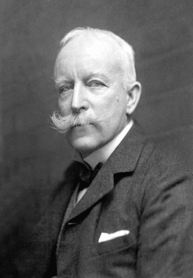
Colonel Charles Close was a Geographer and Surveyor, and the GA had somebody as President, for the first time in a while, who could be said to be a Geographer both at heart, and in occupation.
Charles (Arden) Close served as Director General of the Ordnance Survey from 1911 to 1922.
(10 August 1865 – 19 December 1952)
There are several biographies of him online, which provide plenty more detail on his achievements, and the way that he prepared the OS for the demands of the First World War, which were particular impressive and showed his attention to detail:
Biography here.
A detailed biography here (PDF download)
Amongst the offices which he held were those of President of the International Union of Geography from 1934 to 1938, President of Section E (geography) of the British Association in 1911, President of the Geographical Association in 1927, President of the Royal Geographical Society, 1927 to 1930 (he was also on the RGS Council for 35 years) and was also Chairman of the Palestine Exploration Fund for fifteen years. He was Honorary Secretary of the International Geographical Congress.
This link to the RGS is also something which has been very important over the years, and Close seems to have been linked more closely with them than the GA.
Following text is from his Wikipedia page (shared under CC license)
Colonel Sir Charles Frederick Arden-Close, was a British geographer. He was Director General of the Ordnance Survey from 1911 to 1922. His insistence on attention to detail saw the improvement of many attitudes and methods at the Ordnance Survey. Close's planning saw the production of many maps now viewed as pinnacles in the classic period of map making.
He was born Charles Frederick Close and changed his surname to Arden-Close in 1938 so as to comply with a bequest.
He was born in Jersey, the eldest of the eleven children of Major-General Frederick Close (1830–1899) After receiving his commission in the Royal Engineers in 1884, he saw service in the School of Military Engineering, and served in Gibraltar and India.
In 1889 Close was posted to the survey of India where he carried out topographic work in Burma and triangulation in Mandalay. There was a further posting to eastern Nigeria, to survey the border with the German Cameroon. After appointment to the Ordnance Survey he carried out much work in central, eastern and southern Africa. Close led a small surveying unit in the Second Boer War, and returned to Chatham in 1902 to become chief instructor of surveying at the School of Military Engineering. His Text Book of Topographical and Geographical Surveying, published in 1905 became the standard textbook on the subject.
Close served as Head of MO4, the Geographical Section of the General Staff, at the War Office until 1911.
In 1911, he was appointed Director General of the Ordnance Survey, a post he held until 1922. He introduced more rigorous scientific methods at the Ordnance Survey and proceeded with a second levelling of the United Kingdom. He was intent on producing one-inch maps of revolutionary appearance, including colour printing and precise printing methods. Because of the high cost of production Close had to compromise his aims and a simpler style was adopted.
Which one are you?
Close continued to support the GA following his Presidential year, which was described as a great success by all accounts.
The Annual Report of 1928 mentioned his ongoing support for the Association.
The Charles Close Society is still in operation, and is for those who are interested in Ordnance Survey Maps.
Thanks to John Davies with whom I corresponded about Charles Close, and Elaine Owen of the OS for her input and suggestions.

Close died in Winchester in 1952.
1927 also saw a few other events.
First was the death of Sir John Keltie.
1927 also saw an experiment in publications beyond the journals. Two research publications were created: one on a Historical Geography of Ireland and one on the Deccan Plateau, but sales were poor.
There is an interesting connection between Charles Close and my current work with the Ordnance Survey's GetOutside Campaign.
References
Wikipedia: https://en.wikipedia.org/wiki/Charles_Close - source of some of the page above
I added his GA Presidency role to the page.
OS website: https://www.ordnancesurvey.co.uk/docs/ebooks/map-makers-to-britain-since-1791.pdf (PDF download)
There is a Charles Close Society for the study of OS Maps which shows his influence persists even now.
Fleure, H. J. “ANNUAL REPORT.” Geography, vol. 14, no. 4, 1928, pp. 338–341. JSTOR, www.jstor.org/stable/40558279.
If anyone knows anything more about Charles Close and his work with the GA, please get in touch.
Update November 2019
Charles Close collaborated with the famous illustrator Ellis Martin.
He launched the One Inch Map for Tourists which sold well.
Update December 2019
Charles Close's obituary was published in 'Geography', written by H. J. Fleure.

Updated July 2022


 The outcome was:
He was born in Jersey, the eldest of the eleven children of Major-General Frederick Close (1830–1899) After receiving his commission in the Royal Engineers in 1884, he saw service in the School of Military Engineering, and served in Gibraltar and India.
In 1889 Close was posted to the survey of India where he carried out topographic work in Burma and triangulation in Mandalay. There was a further posting to eastern Nigeria, to survey the border with the German Cameroon. After appointment to the Ordnance Survey he carried out much work in central, eastern and southern Africa. Close led a small surveying unit in the Second Boer War, and returned to Chatham in 1902 to become chief instructor of surveying at the School of Military Engineering. His Text Book of Topographical and Geographical Surveying, published in 1905 became the standard textbook on the subject.
Close served as Head of MO4, the Geographical Section of the General Staff, at the War Office until 1911.
In 1911, he was appointed Director General of the Ordnance Survey, a post he held until 1922. He introduced more rigorous scientific methods at the Ordnance Survey and proceeded with a second levelling of the United Kingdom. He was intent on producing one-inch maps of revolutionary appearance, including colour printing and precise printing methods. Because of the high cost of production Close had to compromise his aims and a simpler style was adopted.
This design set the standard for subsequent one-inch series.
Charles Close married in 1913 and had two sons and a daughter. He was knighted in 1918, in recognition of the Ordnance Survey's efforts during World War I during which over 30 million maps were produced.
He was elected a Fellow of the Royal Society in 1919.
Charles Close married in 1913 and had two sons and a daughter. He was knighted in 1918, in recognition of the Ordnance Survey's efforts during World War I during which over 30 million maps were produced.
He was elected a Fellow of the Royal Society in 1919.
Upon retirement in 1922 he became secretary of the International Geographical Congress and was also a long-serving Fellow of the RGS and in 1927 was awarded their Victoria Gold Medal and was later elected President (1927–30).
The announcement of his appointment in the Geographical Teacher:

In the same year, he became the President of the GA, Close became the first person to write an article in the newly named journal 'Geography' journal - the name change was mentioned in a recent blog post.
He described the different types of people who go to Geography conferences in his address on Population and Migration.


In the same year, he became the President of the GA, Close became the first person to write an article in the newly named journal 'Geography' journal - the name change was mentioned in a recent blog post.
He described the different types of people who go to Geography conferences in his address on Population and Migration.

Which one are you?
Close continued to support the GA following his Presidential year, which was described as a great success by all accounts.
"Geography untouched by the human hand is dull to an extraordinary degree"
Sir Charles Close, Royal Geographical Society, 1932
The Annual Report of 1928 mentioned his ongoing support for the Association.
The Charles Close Society is still in operation, and is for those who are interested in Ordnance Survey Maps.
Thanks to John Davies with whom I corresponded about Charles Close, and Elaine Owen of the OS for her input and suggestions.

Close died in Winchester in 1952.
1927 also saw a few other events.
First was the death of Sir John Keltie.
1927 also saw an experiment in publications beyond the journals. Two research publications were created: one on a Historical Geography of Ireland and one on the Deccan Plateau, but sales were poor.
There is an interesting connection between Charles Close and my current work with the Ordnance Survey's GetOutside Campaign.
References
Wikipedia: https://en.wikipedia.org/wiki/Charles_Close - source of some of the page above
I added his GA Presidency role to the page.
OS website: https://www.ordnancesurvey.co.uk/docs/ebooks/map-makers-to-britain-since-1791.pdf (PDF download)
There is a Charles Close Society for the study of OS Maps which shows his influence persists even now.
Fleure, H. J. “ANNUAL REPORT.” Geography, vol. 14, no. 4, 1928, pp. 338–341. JSTOR, www.jstor.org/stable/40558279.
If anyone knows anything more about Charles Close and his work with the GA, please get in touch.
Update November 2019
Charles Close collaborated with the famous illustrator Ellis Martin.
He launched the One Inch Map for Tourists which sold well.
Update December 2019
Charles Close's obituary was published in 'Geography', written by H. J. Fleure.

Updated July 2022
A good quote:
"Geography untouched by the human hand is dull to an extraordinary degree"--Sir Charles Close, British Royal Geographical Society, 1932
— Dreamlander Jason Thompson (@mockman) December 5, 2015
Updated August 2023
A few tweaks and amendments and additional labels added.
I looked at the development of the International Population Union - linked with the UN - Close was the President for 6 years - was that of the UK National congress of the IPU?
A M Carr Saunders (another former GA President) mentioned it in an article in Nature:
Source:International Population Congress in Paris. Nature 140, 471 (1937). https://doi.org/10.1038/140471a0
I also followed up some more on the MO4 - the Geographical arm of the War Office, or the Military Survey.


Source:
Updated August 2023
Close was not always as strong a supporter of 'geography' as he was when President (presumably).
In 1911, he was at a meeting of BAAS Section E.
This was linked to the changed nature of the papers presented, partly down to former GA Presidents who said that listening to travel papers wasn't necessarily advancing the discipline....


Charles W. J. Withers, et al. “Geography’s Other Histories? Geography and Science in the British Association for the Advancement of Science, 1831-c.1933.” Transactions of the Institute of British Geographers, vol. 31, no. 4, 2006, pp. 433–51. JSTOR, http://www.jstor.org/stable/4639988. Accessed 24 Aug. 2023.