Showing posts with label Ordnance Survey. Show all posts

Saturday, 11 July 2026

PTI Geography Symposium - 9th-10th July

I have been sharing my thoughts from the first Geography Symposium organised by the PTI in association with the GA and the RGS (who hosted the event).

We had just heard Bill McGuire's bleak prognosis for our climate and I noticed this above the rear entrance door to the Ondaatje Theatre. This commemorates the work of Charles Close (who was also a GA President) who was in office as RGS President when the Society celebrated its centenary. We are preparing for the bicentenary of the RGS in 2030.


Saturday, 31 January 2026

EDINA opens up Digimap for Schools to 1 million more pupils

A press release from the Ordnance Survey.
I've worked with Ordnance Survey and EDINA for many years.

Ordnance Survey (OS) will reach out to 1,800 primary and secondary schools serving some of the most deprived areas of Great Britain to offer a free education resource for the teaching of geography.

Digimap for Schools was launched just over 15 years ago in partnership between OS and EDINA, at The University of Edinburgh. It is a flagship digital platform that provides interactive mapping tools for the teaching of geography, and other core education areas, in primary and secondary schools. It helps pupils and teachers develop digital and data skills, and explore modern and historical maps as well as aerial imagery. 

Around one-sixth of schools in England - more than 18 million pupils - have used the service since 2020.

The new offer means Digimap for Schools will reach more than one million schoolchildren in the most deprived areas across Britain, alongside three million who currently have access to the service. A programme of training will also be offered to educators, alongside the development of a new network of practising teachers to provide effective teaching support.

Free access to Digimap for Schools was previously sponsored by the government for schools rated Ofsted 3 or 4. This year, the eligibility criteria has been widened to include 1,800 schools in the lowest 8% of deprived areas in England and, for the first time, in Scotland and Wales. This will include cities such as Birmingham, Manchester, Cardiff, and Glasgow. 

The new offer has been secured by Government Digital Service, under the Public Sector Geospatial Agreement.

"It is fundamental that we support the effective teaching of geography in schools, building confidence when using interactive mapping tools, and fostering critical technical skills to grow our future geographers. We are delighted to announce the extension of Digimap for Schools to those with the greatest need in England, Scotland, and Wales. We encourage headteachers to take advantage of this offer and introduce Digimap for Schools into their classrooms this year."

Nick Bolton, Chief Executive of Ordnance Survey

© Crown copyright and database rights. Ordnance Survey 2026
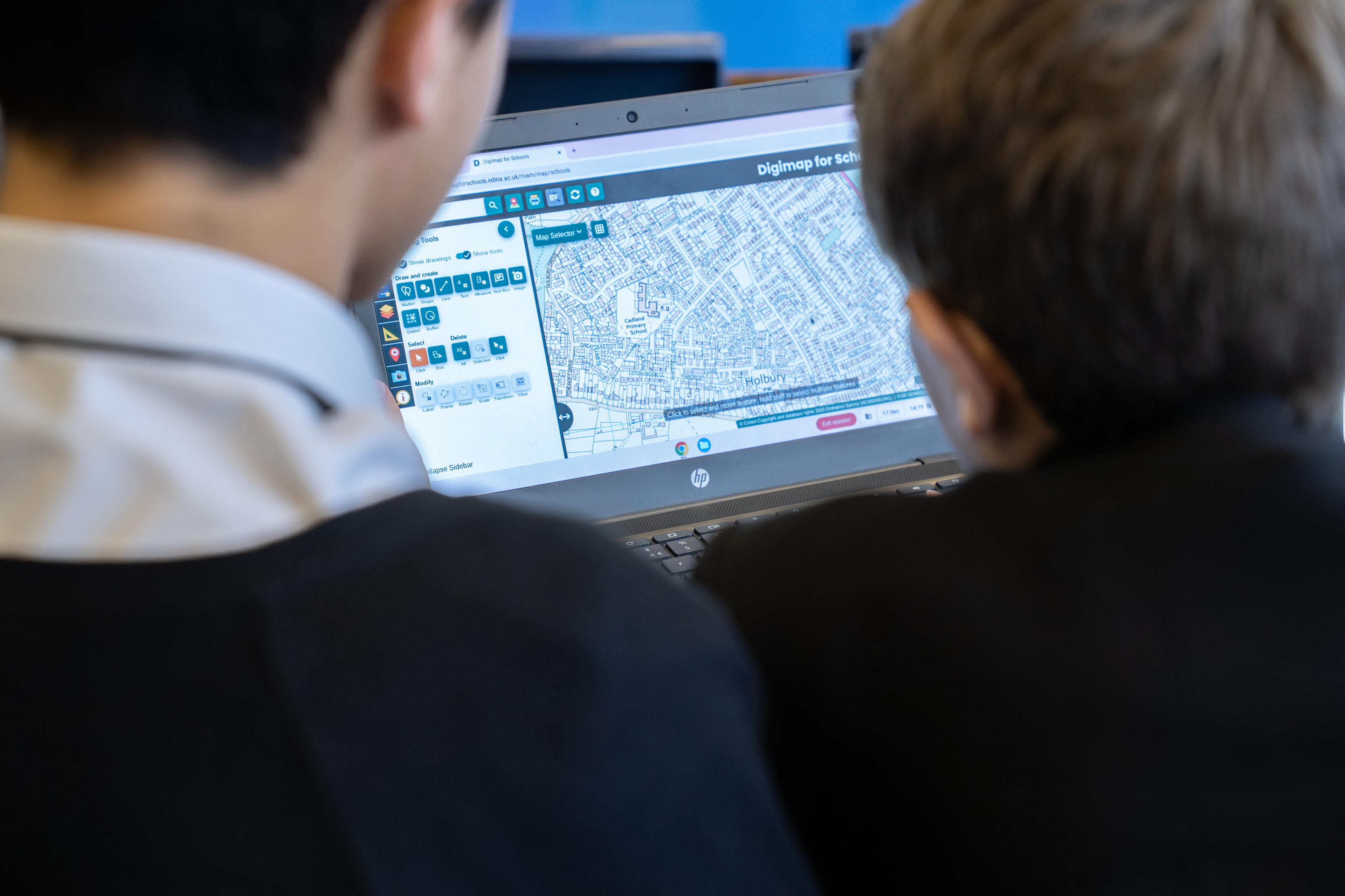
Secondary school pupils working with Digimap for Schools

“Geography plays an important role in helping young people understand the world around them. Our members tell us that digital tools like Digimap for Schools are invaluable for geography teachers to enrich the curriculum learning experience and put data analysis directly into the hands of pupils. We welcome this initiative for schools in deprived areas, as well as the expansion into Scotland and Wales, and encourage all eligible schools to sign-up."
Steve Brace, Chief Executive of the Geographical Association

Digimap for Schools is aligned with the national curricula across Great Britain and enables students aged five to 16 and above to understand and investigate their world while gaining crucial digital and data skills. It is supported by access to a huge library of free learning resources, also available in Welsh, that are designed to aid teaching and support teachers in preparing impactful and interesting lessons, as well as allowing for student-led self-study. 

OS recently published an impact report on its commitment to lifelong learning in geography and geospatial. It also collaborates closely with organisations such as the Royal Geographical Society and the Geographical Association on a wide range of activities including the teaching of geography in schools, educational outcomes, and promoting geography.

Headteachers of eligible schools will be directly contacted about the new offer in the next month. For further information about the Digimap for Schools free access scheme visit: https://digimapforschools.edina.ac.uk/about/imd/.

Monday, 9 August 2021

Dr. Vanessa Lawrence - Honorary Vice President

For a period, the GA had several Honorary Vice Presidents, and they have also been featuring on the blog.
Vanessa Lawrence was formerly an Honorary Vice President of the GA. I met Vanessa several times, including at the SAGT Conference, where she was speaking in a year when I was also presenting.
She also presented me with my Ordnance Survey Award at the RGS-IBG back in 2008.

She is a board member of the Turing Institute, from which the following biography is taken:

Dr Vanessa Lawrence CB works internationally as a senior advisor to governments, inter-governmental organisations including the World Bank and large private sector organisations. She is a Director of Location International Ltd which provides strategic advice and full operational capacity globally, to the public and private sectors, as to how to gain from improving their own use of location information to enhance their decision-making and to meet the ever-changing needs of their customers and stakeholders.

In addition, Vanessa is a Non-Executive Director of the Satellite Applications Catapult, the innovation centre for satellite use in the United Kingdom, on the advisory boards of Seraphim Space LLP, the Space venture capital fund backed by the British Business Bank, the Spatial Finance Initiative, the Urban Big Data Centre and also she is the Honorary Colonel of 135 Geographic Squadron Royal Engineers.Vanessa is a Trustee of the Royal Geographical Society, an Adjunct Professor at the University of Southampton and a Patron of MapAction, the UK-based international charity which specialises in supplying geographical information for humanitarian relief operations.

From 2000-2014, she was the Director General and CEO Ordnance Survey, Britain’s National Mapping Authority and the advisor to the British Government for issues involving mapping, surveying and geographic information. She is the longest-serving Director General and CEO of Ordnance Survey since 1875.

From 2011-2015, Vanessa was a founding co-chair of the United Nations Committee of Experts on Global Geospatial Information Management (UN-GGIM).

In January 2008, Vanessa was appointed as a Companion of The Most Honourable Order of the Bath (CB) in the Queen’s New Year Honours List.


Image above was taken back in June 2008 at the RGS-IBG

Roger Jeans, then Education Manager, Ordnance Survey - I remember his retirement 'do' at conference.
Louise Ellis, fellow Ordnance Survey award recipient 2008
Dr. Vanessa Lawrence, then Director General and Chief Executive of Ordnance Survey (and also Honorary Vice President of the GA)
Me....

References

Thursday, 18 June 2020

G H Dury, David Linton and the CIU

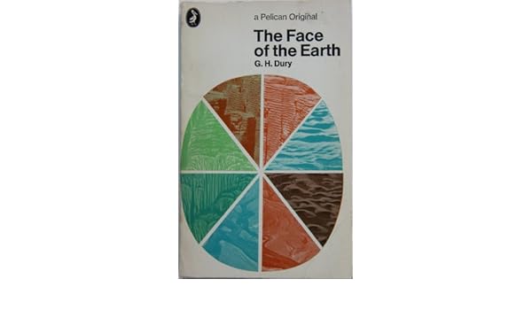
THE FACE OF THE EARTH.: Amazon.co.uk: G.H. DURY: 9780140204476: BooksWhen I took my'A' level Geography back in 1980-1982 - doesn't seem possible but it's true - I was asked to buy a Penguin copy of 'The Face of the Earth' by G H Dury. It was actually the same edition as the one shown here on the right.

George Harry Dury's name has cropped up in association with several GA Presidents.

Dury was a hydrologist, interested in rivers. and more widely in geomorphology. He was born in Northants, and studied at the University of London. He taught geography at Birkbeck College. He developed models which extended Bradshaw's Model for rivers.

Like David Leslie Linton, he was involved in air photography interpretation during the war - see Brendan Conway's excellent post on RAF Medmenham for more details on this. Also Balchin's report on wartime geographers features Medmenham. The Central Interpretation Unit (CIU) also included Professor Frank Debenham for example.

Thanks to Brendan Conway for some excellent additional research here as well on G H Dury's work in wartime. Here's what Brendan sent me a few months ago when I mentioned David Linton's wartime work.


One thing about the David Linton profile I found particularly interesting was his WWII work in photographic interpretation, especially in identifying the underground V-weapon factory in northern France (now La Coupole https://www.lacoupole-france.co.uk/history-centre.html).

It reminded me of something that I've noticed cropping up a few times - the role of geographers in WWII intelligence in places such as RAF Medmenham. Linton is one of several who played key roles in intelligence in a similar way to GIS experts in the Bellingcat organisation now.

Other geographers involved in similar WWII activity included H Clifford Darby and Kenneth Mason in Naval Intelligence (https://www.thebritishacademy.ac.uk/humanities-scholars-who-worked-military-intelligence-second-world-war) and G H Dury (George Harry Dury) in photographic interpretation (RAF Medmenham) (https://rgs-ibg.onlinelibrary.wiley.com/doi/abs/10.1111/j.0020-2754.1997.00398.x).

There's a good book about such work, including interesting references to RAF Medmenham by Jeremy Harwood called 'World War II from Above'. Harwood wrote an article about it 'Spies in the Skies: How Aerial Surveillance Tipped the Balance of WWII'. Here are some quotes indicating links with geographical expertise and how it was used:

'The staff—mostly an eclectic mix of boffins and academics with quite a few women among them—comprised some of the best brains in the country...Glyn Daniel, the first Cambridge archaeologist to be recruited to the Medmenham operation, described his new colleagues as "an ill-assembled collection of dons, artists, ballet designers, newspaper editors, and writers'.

'...the students were introduced to stereoscopic viewing. They were taught how to handle a stereoscopic viewing frame—this was universally referred to simply as a "Stereo." The two photographic prints that fitted into it were termed a "Stereo Pair." '

​Would Linton have worked with Constance Babington Smith?

'Constance Babington Smith was one of them. As well as being the photographic interpreter who first spotted a V1 Flying Bomb on its way for testing, she was the first to spot the Messerschmitt Me 163 rocket fighter, the Heinkel He 28, the world's first jet fighter, and the revolutionary Messerschmitt Me 262, the twin-engine jet fighter that, fortunately for British and American airmen, Hitler insisted be redesigned to be deployed as a fighter-bomber. She and her team detected other top-secret German aircraft prototypes into the bargain'.

Painstaking interpretation would culminate in the meticulous creation of 3D landscape models used to prepare for bombing raids and battles. There's an interesting reference to the challenging geographical learning required by aircrews:

'By the time the war ended, Medmenham's model makers had churned out more than 1,400 models. Some, like the models of the Möhne, Eder, and Sorpedams used to brief the Dam Busters prior to their famous 1943 air attack, were extremely elaborate. Such was the reliance Bomber Command placed on them that, according to Paul Brickhill, author of The Dam Busters, the aircrews taking part in the attack were instructed to "look at these until your eyes stick out and you've got every detail photographed on your mind." '

It's also known that Ronald Lampitt, much admired by geographers and certainly one of my favourite artists, worked in this area of intelligence. His 'geographical eye' and recurring tendency to view almost everything he illustrated from above seems likely to have been strongly influenced by his wartime work, but perhaps also by working with geographers? I'd never been able to find out much about his role during the war until last week when I stumbled across reference to his work by the scientific military intelligence expert RV Jones in his book 'Most Secret War'. It seems that he was very close to the V-weapon investigations as well, so there would be a possibility that he worked with Linton at some point. I summarised the findings in this thread:

Lampitt was recruited by Albert Hugh Smith, who was clearly very close to RV Jones. He later went on to become Professor of English at UCL and acclaimed scholar of Scandinavian Studies and English placenames, so he clearly had geographical interests. Perhaps he had links with Bill Mead at UCL who was also a Scandinavian expert?
Image

Delighted to see the link to Ronald Lampitt - a favourite of mine who I wrote about for the Ordnance Survey's magazine back in the day. I have a much loved copy of the book, and it will definitely have a place in my Presidential lecture in 2022.
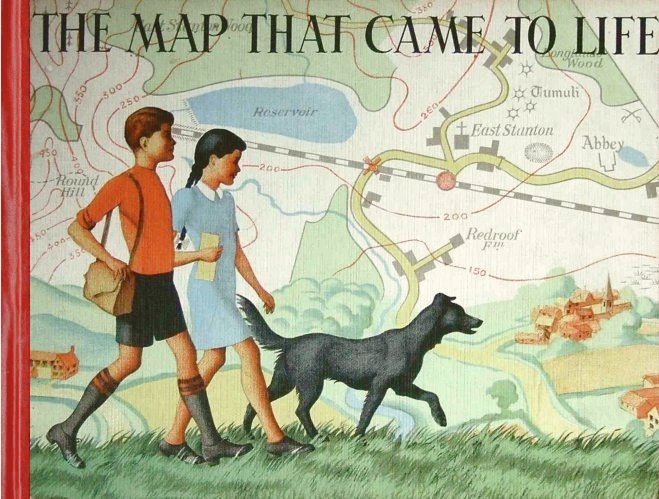
Lampitt's illustrations were included in the book which came out in 1948
I wonder if the author also worked in the same sort of setting.
In The Map that Came to Life the map is portrayed as an objective, precise and above all truthful mirror of nature. And this inherent trustworthiness enabled maps to become important features of the lives of successive generations of people.

More on the author and the book here.

Lampitt’s war service was spent with RAF Intelligence. He created meticulous, hand-drawn maps for allied bomber crews, based on aerial reconnaissance photographs. It was this period of his life that started Lampitt’s fascination with aerial views, which he would later use to great effect in The Map That Came To Life.

Sources: 
Wikipedia page.
https://en.wikipedia.org/wiki/G._H._Dury

Balchin, W. G. V. “United Kingdom Geographers in the Second World War: A Report.” The Geographical Journal, vol. 153, no. 2, 1987, pp. 159–180. JSTOR, www.jstor.org/stable/634869. Accessed 16 June 2020.

Dury, G. H. “Geography and Geomorphology: The Last Fifty Years.” Transactions of the Institute of British Geographers, vol. 8, no. 1, 1983, pp. 90–99. JSTOR, www.jstor.org/stable/622279. Accessed 16 June 2020.

Thanks to Brendan Conway for the additions to this post.
If anyone knows more about these wartime geographers please get in touch.

Friday, 21 February 2020

1950s - Committees were busy, and plenty of other changes

Balchin's Centenary volume describes some of the work of the GAs Phase Committees during the 1950s, a time when financial pressures forced the GA to raise the annual subscription to a guinea from 1955.

  • Secondary Schools Committee published a new handbook in 1952, then turned to producing school atlases. It's chairman for 25 years, Mr. C B Thurston, stepped down apparently 'reluctantly' in 1953.
  • The Primary Schools Committee revised 'Geography in the Primary School' in 1953.
  • The Public and Preparatory Schools Committee opened its membership to women teachers in 1951.
  • The Training College Section organised a series of one day conferences to meet the criticism that 'much of the geography teaching in secondary modern schools was being undertaken by individuals without any geography training' (Balchin, p.43)
  • Visual Aids Section produced 'The Geography Room in the Secondary School' in 1954, and started to investigate the use of OS Map extracts with aerial photographs which were to become a feature of Geography exams for decades to come.
  • Two new committees were formed: Further Education (1953) and Field Studies (1954)
  • The Executive Committee was continuing discussions with the BBC about geography school programming. At this time, there was a feeling that changes were happening too quickly for textbooks to keep up and that radio and TV could help.
One particular way that the GA tried to keep teachers up to date with the pace of change in the modern world was a feature called 'This Changing World' which was introduced into the 'Geography' journal in 1954, edited by Leonard Sydney Suggate followed by G. J Butland when Suggate retired to New Zealand, as described in his blog post.

The 1950s also saw the passing of several former GA Presidents who have previously appeared on the blog:

  • Dr. Hugh Robert Mill in 1950 (who was closely associated with the GA from its founding)
  • James Fairgrieve in 1953 (over 40 years of service to the GA)
  • Dr O J R Howarth in 1954 (over 40 years of service to the GA)
  • Sir John Linton Myres in 1954

These led to the appointment of other GA Presidents to come to key roles: L Dudley Stamp, E G Bowen and W.G.V Balchin.

Finally, Balchin reminds us that the 1950s were a time when the country was recovering from WWII - rationing had ceased and rebuilding of bombed cities was underway. Membership climbed steadily and the GA was settled in its new home city of Sheffield.

The Annual Conferences were still being organised by the very efficient R. C Honeybone and Dr. J H Bird and attendance was close to 1000.
Professor Emeritus E G R Taylor reached the age of 80 in 1959, and funds were raised for an annual lecture in her name.


Image: early Handbook, on display in Solly St - image by Alan Parkinson

Thursday, 1 August 2019

1927: Colonel Sir Charles Close KBE CB CMG FRS (later Arden Close)


Updated August 2023


Colonel Charles Close was a Geographer and Surveyor, and the GA had somebody as President, for the first time in a while, who could be said to be a Geographer both at heart, and in occupation.

Charles (Arden) Close served as Director General of the Ordnance Survey from 1911 to 1922.

(10 August 1865 – 19 December 1952) 

There are several biographies of him online, which provide plenty more detail on his achievements, and the way that he prepared the OS for the demands of the First World War, which were particular impressive and showed his attention to detail:
Biography here.
A detailed biography here (PDF download)

Amongst the offices which he held were those of President of the International Union of Geography from 1934 to 1938, President of Section E (geography) of the British Association in 1911, President of the Geographical Association in 1927, President of the Royal Geographical Society, 1927 to 1930 (he was also on the RGS Council for 35 years) and was also Chairman of the Palestine Exploration Fund for fifteen years. He was Honorary Secretary of the International Geographical Congress.

This link to the RGS is also something which has been very important over the years, and Close seems to have been linked more closely with them than the GA.

Following text is from his Wikipedia page (shared under CC license)

Colonel Sir Charles Frederick Arden-Close, was a British geographer. He was Director General of the Ordnance Survey from 1911 to 1922. His insistence on attention to detail saw the improvement of many attitudes and methods at the Ordnance Survey. Close's planning saw the production of many maps now viewed as pinnacles in the classic period of map making. 

He was born Charles Frederick Close and changed his surname to Arden-Close in 1938 so as to comply with a bequest.

He was born in Jersey, the eldest of the eleven children of Major-General Frederick Close (1830–1899) After receiving his commission in the Royal Engineers in 1884, he saw service in the School of Military Engineering, and served in Gibraltar and India.

In 1889 Close was posted to the survey of India where he carried out topographic work in Burma and triangulation in Mandalay. There was a further posting to eastern Nigeria, to survey the border with the German Cameroon. After appointment to the Ordnance Survey he carried out much work in central, eastern and southern Africa. Close led a small surveying unit in the Second Boer War, and returned to Chatham in 1902 to become chief instructor of surveying at the School of Military Engineering. His Text Book of Topographical and Geographical Surveying, published in 1905 became the standard textbook on the subject.

Close served as Head of MO4, the Geographical Section of the General Staff, at the War Office until 1911.

In 1911, he was appointed Director General of the Ordnance Survey, a post he held until 1922.
He introduced more rigorous scientific methods at the Ordnance Survey and proceeded with a second levelling of the United Kingdom. He was intent on producing one-inch maps of revolutionary appearance, including colour printing and precise printing methods. Because of the high cost of production Close had to compromise his aims and a simpler style was adopted.
This design set the standard for subsequent one-inch series.

Charles Close married in 1913 and had two sons and a daughter. He was knighted in 1918, in recognition of the Ordnance Survey's efforts during World War I during which over 30 million maps were produced.
He was elected a Fellow of the Royal Society in 1919.
Upon retirement in 1922 he became secretary of the International Geographical Congress and was also a long-serving Fellow of the RGS and in 1927 was awarded their Victoria Gold Medal and was later elected President (1927–30).

The announcement of his appointment in the Geographical Teacher:


In the same year, he became the President of the GA, Close became the first person to write an article in the newly named journal 'Geography' journal - the name change was mentioned in a recent blog post.
He described the different types of people who go to Geography conferences in his address on Population and Migration.

Which one are you?

Close continued to support the GA following his Presidential year, which was described as a great success by all accounts.

"Geography untouched by the human hand is dull to an extraordinary degree"
Sir Charles Close, Royal Geographical Society, 1932

The Annual Report of 1928 mentioned his ongoing support for the Association.

The Charles Close Society is still in operation, and is for those who are interested in Ordnance Survey Maps.
Thanks to John Davies with whom I corresponded about Charles Close, and Elaine Owen of the OS for her input and suggestions.


Close died in Winchester in 1952.

1927 also saw a few other events.
First was the death of Sir John Keltie.
1927 also saw an experiment in publications beyond the journals. Two research publications were created: one on a Historical Geography of Ireland and one on the Deccan Plateau, but sales were poor.

There is an interesting connection between Charles Close and my current work with the Ordnance Survey's GetOutside Campaign.

References

Wikipedia: https://en.wikipedia.org/wiki/Charles_Close - source of some of the page above

I added his GA Presidency role to the page.

OS website: https://www.ordnancesurvey.co.uk/docs/ebooks/map-makers-to-britain-since-1791.pdf (PDF download)

There is a Charles Close Society for the study of OS Maps which shows his influence persists even now.

Fleure, H. J. “ANNUAL REPORT.” Geography, vol. 14, no. 4, 1928, pp. 338–341. JSTOR, www.jstor.org/stable/40558279.

If anyone knows anything more about Charles Close and his work with the GA, please get in touch.

Update November 2019
Charles Close collaborated with the famous illustrator Ellis Martin.
He launched the One Inch Map for Tourists which sold well.


Update December 2019

Charles Close's obituary was published in 'Geography', written by H. J. Fleure.


Updated July 2022
A good quote:


Updated August 2023

A few tweaks and amendments and additional labels added.

I looked at the development of the International Population Union - linked with the UN - Close was the President for 6 years - was that of the UK National congress of the IPU?

A M Carr Saunders (another former GA President) mentioned it in an article in Nature:

Source:
International Population Congress in Paris. Nature 140, 471 (1937). https://doi.org/10.1038/140471a0

I also followed up some more on the MO4 - the Geographical arm of the War Office, or the Military Survey.


Source:

Updated August 2023

Close was not always as strong a supporter of 'geography' as he was when President (presumably).
In 1911, he was at a meeting of BAAS Section E.
This was linked to the changed nature of the papers presented, partly down to former GA Presidents who said that listening to travel papers wasn't necessarily advancing the discipline....


The outcome was:


Source:

Charles W. J. Withers, et al. “Geography’s Other Histories? Geography and Science in the British Association for the Advancement of Science, 1831-c.1933.” Transactions of the Institute of British Geographers, vol. 31, no. 4, 2006, pp. 433–51. JSTOR, http://www.jstor.org/stable/4639988. Accessed 24 Aug. 2023.

Beaver, S. H. “Geography in the British Association for the Advancement of Science.” The Geographical Journal, vol. 148, no. 2, 1982, pp. 173–81. JSTOR, https://doi.org/10.2307/633769. Accessed 24 Aug. 2023.


Thursday, 27 June 2019

Ordnance Survey and the GA

If a picture is worth a thousand words, then a map is worth a million.

The GA and the OS have a long association going back over a century.


At the 1903 AGM, there was a presentation of OS mapping and efforts were made to secure discounts for teachers on map sheets.
Many articles in 'The Geographical Teacher' at the time were on the use of mapping, and books and information on using them in the classroom were best sellers.

Reading through the various AGMs and other presentations at gatherings of the Association, one sees regular articles referring to the use of OS maps, and the need for teachers to have access to them, at a time when perhaps they were less commonly used than now.

Download a history of the OS here. (PDF)

In Fleure's retrospective of 60 years of the GA, there is a section on the relationship with the OS, which he describes as:
"a most valuable coadjutor of the teachers and the Association. From the early years of the century it has devised schemes for supplying quantities of ordnance maps of a school district to a public authority school in the area at a cheap rate. This virtual alliance between the OS and the Association was to develop later on to the great gain of geographical education and of the Association."

In 1927, the President was Colonel Sir Charles Close, who also served as Director General of the Ordnance Survey from 1911, through the First World War.

I'm currently working as an Ordnance Survey GetOutside Champion, and have previously worked to produce resources for Digimap for Schools, Digimap for Colleges, and the OS Mapstream service.

Plenty more on the OS to come as we move through the 20th Century. See below for updates.

References

Fleure, H.J. (1953) "Sixty years of geography and education", Geography, vol.38, pp.231-264

https://www.ordnancesurvey.co.uk/docs/ebooks/map-makers-to-britain-since-1791.pdf (PDF download)

Balchin's Centenary book provided further updates.

Updates
In the early 1930s the GA came to an agreement with the OS that exmaination maps would be provided to schools once the examination results had been published, These were to prove very helpful and also provided relatively cheaply.

Margaret Mackintosh RIP

Updated post. Sad news at the end of last week from colleagues who have organised the Charney Conference over the years of the passing of Ma...