Last updated October 2023
E C Marchant was a teacher at Marlborough College, a Headteacher in India and HM Inspector of Schools, but also a cartographer and scholar who travelled with J A Steers.
I was not able to find out as much about Ernest Cecil Marchant as I was about some of the other, older Presidents, which is a feature of this period generally, but eventually developed a suitable post with the thanks of others.
Marchant had featured in a previous article from 1960, describing a conference in Manchester, where he spoke in his position as HMI. He was also mentioned by Michael J Storm, when he became President 20 years later, who was also a school inspector.
I then discovered a link with Marlborough College, C C Carter and Cyril Norwood. This led me to go back to the very helpful Archivist at the college - see later.
https://www.geos.ed.ac.uk/~rsgs/cgi-bin/ifa_series1.pl?series=3624
The link, which can be seen above describes a bequest of lantern slides to the Royal Scottish Geographical Society, who I may have to visit perhaps as well during my Presidential year to discover any further artefacts they may have relating to previous GA Presidents with a Scottish connection in particular.
This collection was donated to the RSGS in 1997 when Marlborough College was undergoing refurbishment. The materials date largely from between WW1 and WW2. At that time the Geography Department at Marlborough College was directed by E C Marchant who later became Senior Inspector of Schools. He was assisted by C C Carter whose text "Landforms and Life" was one of the best sellers for a generation. Carter and Marchant established a tradition in which Geography was firmly rooted in practical work and case studies long before these became so fashionable elsewhere. A great deal of mapwork was done, and the relief models were clearly made to illustrate famous areas, such as the Isle of Purbeck.
The archivist Grainne proved very helpful once again and provided further details for me.
In 1972, he led a Working Party of the GA and RGS exploring Geography and Careers.
"The eminent French geographer, Henri Baulig, insisted that there was nothing in the realm of the natural sciences which gave a more fundamental training of the mind than "placing the student in front of a landscape, or a map or photograph, and inviting him, drawing also on his previous knowledge, to make certain individual deductions and to be prepared to defend his conclusions. He may not get very far: certain aspects of the problem may escape him : but his conclusions will be none the less valuable; for they will be based on his own observations, supported by previous knowledge, and arrived at through the chain of argument by which he links up the one with the other."
Source: MARCHANT, E. C. “Geography for Careers. REPORT OF THE FINDINGS OF A WORKING PARTY OF THE GEOGRAPHICAL ASSOCIATION AND ROYAL GEOGRAPHICAL SOCIETY.” Geography, vol. 57, no. 4, 1972, pp. 327–332. JSTOR, www.jstor.org/stable/40567916. Accessed 3 June 2020.
Marchant died in September 1979, aged 77.
References
No Wikipedia page - perhaps one needs to be made for Marchant.
Shepherd, W. H. “A One-Day Conference on the Teaching of Geography: A REPORT.” Geography, vol. 45, no. 4, 1960, pp. 300–303. JSTOR, JSTOR, www.jstor.org/stable/40565188.
Obituary in Geography by J W Morris
Morris, J. (1980). MR. E. C. MARCHANT. Geography, 65(1), 58-58. Retrieved August 26, 2020, from http://www.jstor.org/stable/40570277

Book: https://www.goodreads.com/book/show/3554461-the-teaching-of-geography-at-school-level
Thanks to Grainne for her help with this entry.
More on Daly College:
Daly College website also had a small photo of Marchant when he was the Principal from 1939-1945, before returning to the UK to work in school inspection.

He was mentioned in a Principal's report from 2007, attended by his children apparently.
The fourth and last personality I will highlight is a former Principal who again has nothing named in his memory. Mr. E C Marchant, with the support of the then President, Nawab of Bhopal, and the then Vice President, the Maharaja of Panna, visualised an independent and egalitarian India and had the courage to transform the Daly College from a Chief’s College into a Public School. He not only reorganised the system along modern day lines but met with the Heads of some other schools and thus made the Daly College a founder member of the Indian Public Schools Conference.
He helped found the Indian Public Schools' Conference in 1939, and attended the inaugural meeting.

He was made a Companion of the Order of the British Empire (CIE) in the Birthday Honours List in 1946.
Companion of the Order of the Indian Empire (CIE)
If anyone has further information on E C Marchant (ECM) please get in touch.

The Low Isles, from a survey by M.A. Spende, T.A. Stephenson, and E.C. Marchant, 1929.
Great Barrier Reef Expedition 1928-1929 Scientific Reports, Volume III, No. 2
I was not able to find out as much about Ernest Cecil Marchant as I was about some of the other, older Presidents, which is a feature of this period generally, but eventually developed a suitable post with the thanks of others.
Marchant had featured in a previous article from 1960, describing a conference in Manchester, where he spoke in his position as HMI. He was also mentioned by Michael J Storm, when he became President 20 years later, who was also a school inspector.
I then discovered a link with Marlborough College, C C Carter and Cyril Norwood. This led me to go back to the very helpful Archivist at the college - see later.
https://www.geos.ed.ac.uk/~rsgs/cgi-bin/ifa_series1.pl?series=3624
The link, which can be seen above describes a bequest of lantern slides to the Royal Scottish Geographical Society, who I may have to visit perhaps as well during my Presidential year to discover any further artefacts they may have relating to previous GA Presidents with a Scottish connection in particular.
This collection was donated to the RSGS in 1997 when Marlborough College was undergoing refurbishment. The materials date largely from between WW1 and WW2. At that time the Geography Department at Marlborough College was directed by E C Marchant who later became Senior Inspector of Schools. He was assisted by C C Carter whose text "Landforms and Life" was one of the best sellers for a generation. Carter and Marchant established a tradition in which Geography was firmly rooted in practical work and case studies long before these became so fashionable elsewhere. A great deal of mapwork was done, and the relief models were clearly made to illustrate famous areas, such as the Isle of Purbeck.
Lantern slides were used to illustrate teaching and practical work, largely surveying, was employed.
Acknowledgements to Christopher Joseph, Head of Geography, Marlborough College for text.
During this time, in the late 1960s, the GA's Council was being chaired by H. J. Fleure.
Marchant is also quoted in Ivor Goodson's book, with some thoughts from inspections.
In it, he talks about the role of the teacher, with some interesting quotes, from the perspective of the school inspector, and also relating to his travels in what he called the 'Old World'.
He started by mentioning Professor Haggett, who had spoken at the IBG conference he had attended the previous year in Sheffield, and said that although it had been fascinating the discussions that had taken place had mostly been beyond what most teachers would usefully apply.
I wonder what impact that work had on schools from the perspective of the school inspectorate of the time.
He said of the geography teacher that, "he (sic) must remember that he is preparing the majority of his pupils not for degrees in geography, but pretty soon for living to the full, and perchance for contributing to the full, in a bafflingly complex and ever-changing world".
This was an era of the quantitative revolution, and the Madingley Conferences, which I have blogged about previously, which happened about this time. Marchant's views are interesting.
He referred to the comments of Joseph Acton Morris in 1965 who called for more reality in teaching.
He said of some teachers that they "deceive themselves intop believing that once a pupil has drawn a sketch map or looked at one in a textbook, he knows what a landscape looks like, and what it is like to live there." He shared a map of most of the SE which was labelled "Fruit and Vegetables", and of a textbook in a primary school on the Geography of Norfolk which had a map labelled "Wheat and Turkeys".
A few other quotes from his address:
"we have a vital responsibility to ensure that our subject is not superficial, but is intellectually rigorous".
He also introduced me to a new word: pabulum.

He talked of a student whose "mind had been cloyed with a pabulum of what were, to him, quite meaningless abstractions".
He says that this (the late 60s) was "the era of mathematical geography".
Marchant also wrote a book called 'The Teaching of Geography at School level' which contained his thinking, based on his experience of school inspection.
He also co-wrote a book on geography of Europe with another GA President: C C Carter, with whom he was connected at Marlborough College. Carter was also mentioned in his Presidential address, where he talked about the need to have the grammar in geography to help with the rigour of dealing with its vocabulary.
At this point, I had no image or further information, but contacted Marlborough College.
Acknowledgements to Christopher Joseph, Head of Geography, Marlborough College for text.
During this time, in the late 1960s, the GA's Council was being chaired by H. J. Fleure.
Marchant is also quoted in Ivor Goodson's book, with some thoughts from inspections.
The advances in university geography after the Second World War partly aided the acceptance of geography as a subject suitable for the most able children, but problems remained. In 1967 Marchant noted: 'Geography is at last attaining to intellectual respectability in the academic streams of our secondary schools. But the battle is not quite over'. He instanced the continuing problem: 'May I quote from just two reports written in 1964, one of a girls' grammar school and the other on a well-known boys' independent school. First, 'geography is at present... an alternative to Latin, which means that a number of girls cease to take it at the end of the third year... there is no work available at A level'. Or second, perhaps a more intriguing situation: 'In the ‘O’ level forms, the subject is taken only by those who are neither classicists, nor modern linguists, nor scientists. The sixth form is then drawn from this rather restricted group with the addition of a few scientists who failed to live up to expectations'
To seal its acceptance by the universities and high status sixth forms, geography had to embrace new paradigms and associated rhetoric. The supreme paradox is that the crisis in school geography in the late 1960s led not to change which might have involved more school pupils but to changes in the opposite direction in pursuit of total academic acceptance. This push for university status centred around the 'new geography', which moved away from regional geography to more quantitative data and model building. The battle for new geography represented a major clash between those traditions in geography representing more pedagogic and utilitarian traditions (notably the fieldwork geographers and some regionalists) and those pushing for total academic acceptance.
Marchant's Presidential Address connected with his interest in school inspection - which I guess went down well with the audience - and was called 'Some responsibilities of the Teacher of Geography'.In it, he talks about the role of the teacher, with some interesting quotes, from the perspective of the school inspector, and also relating to his travels in what he called the 'Old World'.
He started by mentioning Professor Haggett, who had spoken at the IBG conference he had attended the previous year in Sheffield, and said that although it had been fascinating the discussions that had taken place had mostly been beyond what most teachers would usefully apply.
I wonder what impact that work had on schools from the perspective of the school inspectorate of the time.
He said of the geography teacher that, "he (sic) must remember that he is preparing the majority of his pupils not for degrees in geography, but pretty soon for living to the full, and perchance for contributing to the full, in a bafflingly complex and ever-changing world".
This was an era of the quantitative revolution, and the Madingley Conferences, which I have blogged about previously, which happened about this time. Marchant's views are interesting.
He referred to the comments of Joseph Acton Morris in 1965 who called for more reality in teaching.
He said of some teachers that they "deceive themselves intop believing that once a pupil has drawn a sketch map or looked at one in a textbook, he knows what a landscape looks like, and what it is like to live there." He shared a map of most of the SE which was labelled "Fruit and Vegetables", and of a textbook in a primary school on the Geography of Norfolk which had a map labelled "Wheat and Turkeys".
A few other quotes from his address:
"we have a vital responsibility to ensure that our subject is not superficial, but is intellectually rigorous".
He also introduced me to a new word: pabulum.

He talked of a student whose "mind had been cloyed with a pabulum of what were, to him, quite meaningless abstractions".
He says that this (the late 60s) was "the era of mathematical geography".
Marchant also wrote a book called 'The Teaching of Geography at School level' which contained his thinking, based on his experience of school inspection.
He also co-wrote a book on geography of Europe with another GA President: C C Carter, with whom he was connected at Marlborough College. Carter was also mentioned in his Presidential address, where he talked about the need to have the grammar in geography to help with the rigour of dealing with its vocabulary.
At this point, I had no image or further information, but contacted Marlborough College.
The archivist Grainne proved very helpful once again and provided further details for me.
Ernest Cecil Marchant
Perse School
Scholar of St John’s College, Cambridge
1st class Geography Pr.1
Marlborough College 1931-38

CIE 1946
HM Inspector of Schools
The link with the Perse School proved to be interesting as that is local to me, in Cambridge.
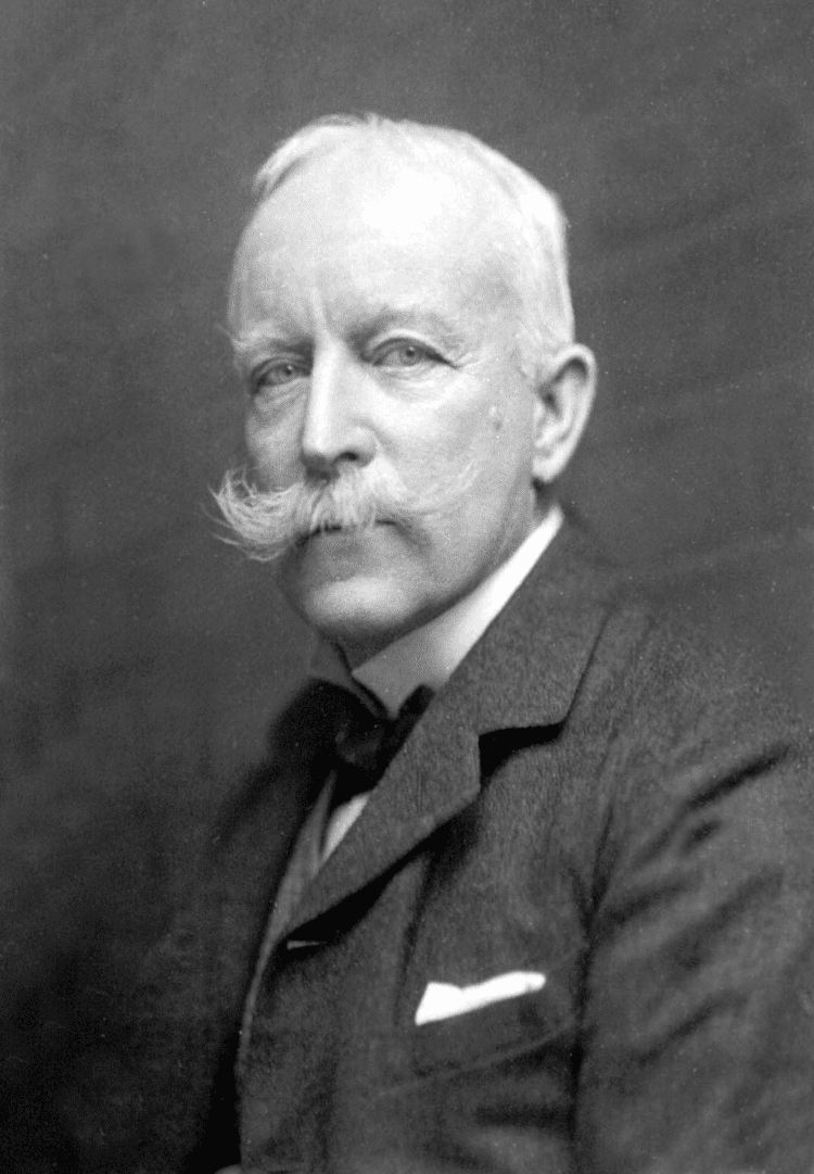
I also managed to get an image from Grainne, taken as part of a staff photo. ECM is the gentleman in the middle of the photo.In 1972, he led a Working Party of the GA and RGS exploring Geography and Careers.
"The eminent French geographer, Henri Baulig, insisted that there was nothing in the realm of the natural sciences which gave a more fundamental training of the mind than "placing the student in front of a landscape, or a map or photograph, and inviting him, drawing also on his previous knowledge, to make certain individual deductions and to be prepared to defend his conclusions. He may not get very far: certain aspects of the problem may escape him : but his conclusions will be none the less valuable; for they will be based on his own observations, supported by previous knowledge, and arrived at through the chain of argument by which he links up the one with the other."
Source: MARCHANT, E. C. “Geography for Careers. REPORT OF THE FINDINGS OF A WORKING PARTY OF THE GEOGRAPHICAL ASSOCIATION AND ROYAL GEOGRAPHICAL SOCIETY.” Geography, vol. 57, no. 4, 1972, pp. 327–332. JSTOR, www.jstor.org/stable/40567916. Accessed 3 June 2020.
Marchant died in September 1979, aged 77.
References
No Wikipedia page - perhaps one needs to be made for Marchant.
Shepherd, W. H. “A One-Day Conference on the Teaching of Geography: A REPORT.” Geography, vol. 45, no. 4, 1960, pp. 300–303. JSTOR, JSTOR, www.jstor.org/stable/40565188.
Presidential Address
MARCHANT, E. C. “Some Responsibilities of the Teacher of Geography.” Geography, vol. 53, no. 2, 1968, pp. 129–144. JSTOR, www.jstor.org/stable/40566906.Obituary in Geography by J W Morris
Morris, J. (1980). MR. E. C. MARCHANT. Geography, 65(1), 58-58. Retrieved August 26, 2020, from http://www.jstor.org/stable/40570277

Book: https://www.goodreads.com/book/show/3554461-the-teaching-of-geography-at-school-level
Thanks to Grainne for her help with this entry.
More on Daly College:
Daly College website also had a small photo of Marchant when he was the Principal from 1939-1945, before returning to the UK to work in school inspection.

He was mentioned in a Principal's report from 2007, attended by his children apparently.
The fourth and last personality I will highlight is a former Principal who again has nothing named in his memory. Mr. E C Marchant, with the support of the then President, Nawab of Bhopal, and the then Vice President, the Maharaja of Panna, visualised an independent and egalitarian India and had the courage to transform the Daly College from a Chief’s College into a Public School. He not only reorganised the system along modern day lines but met with the Heads of some other schools and thus made the Daly College a founder member of the Indian Public Schools Conference.
He helped found the Indian Public Schools' Conference in 1939, and attended the inaugural meeting.

He was made a Companion of the Order of the British Empire (CIE) in the Birthday Honours List in 1946.
Companion of the Order of the Indian Empire (CIE)
If anyone has further information on E C Marchant (ECM) please get in touch.
Updated July 2022
A small piece in Marchant's obituary mentions the Great Barrier Reef exhibition, which he undertook with J A Steers.
This led me back to that expedition
And a Maplab article with an example of a map that he produced.Inventive cartographer E.C. Marchant charted the Great Barrier Reef during a 1928-1929 expedition with a plane table composed of wooden board, a camera stand, and…floss? 🤨 #GreatBarrierReef #Cartography @CityLab https://t.co/7FiGPYoM3x
— USC Spatial Sciences (@USC_SSI) July 9, 2019

The Low Isles, from a survey by M.A. Spende, T.A. Stephenson, and E.C. Marchant, 1929.
Great Barrier Reef Expedition 1928-1929 Scientific Reports, Volume III, No. 2
Updated August 2023
He lived at 7 Melbourne Place, Cambridge in 1911- his father was born in Downham Market - a town I pass through on the way to work.
Updated October 2023
He took part in a 1960 conference in May, at Manchester University, attended by 200 teachers.
The opening lecture was given by Mr. E. C. Marchant, H.M.I., who spoke on Geography and Education. Mr. Marchant suggested that the impact of geography on the education of the pupil might be looked at at three levels
1. The level of purely factual information
2. The level of intellectual training
he late Mr. C. C. Carter, remembering his own training in the classics, wrote a Geographical Grammar which had to be learnt as a preliminary to a course in geography, by which means he hoped to impose a rigorous training equivalent to the one he himself had enjoyed. Mr. Marchant believed that there is a "grammar" of geography and that it is salutary to the discipline of the subject that that grammar be at some time acquired. However, modern language teaching largely derives the grammar from the language, not the language from the grammar; and scientific method requires that generalizations be built up empirically, not learnt at the outset. Working from the particular to the general is desirable also in order to enlist the active interest of the child. In geography, field work and its methods - observation, recording, interpretation of pictures and statistics - are important illustrations of this.
3. The level of geography as a humanity
If in addition to selection the geographer can use the overtones of words to evoke the spirit of a region then he is truly being both a scientist and a humanist. Roxby, Fleure, Mill and Vidal de la Blache have used the evocative power of words.
"Mankind must be made much more aware of the world it lives in, its rigorous limitations and its limited possibilities. Above all it must be assisted and persuaded to think of the world as a whole"
D. L. Linton