Showing posts with label Maps. Show all posts

Wednesday, 31 December 2025

Alice Coleman's Second Land Use Survey - now online

I previously posted about work carried out by Bruce Mitchell to make the maps from the 2nd land use survey available on the National Library of Scotland's website.


The following section of text is taken from the 60th anniversary 'history' of the GA's Thanet Branch, written by Derek Wilson. Available to download from the GA website.

The first Land Utilisation Survey of Britain was a comprehensive survey of land use in Great Britain in the 1930s. This survey was the first such comprehensive survey in Britain since the Domesday Book survey in the 11th Century.
Dudley Stamp, reader and later professor of geography at the London School of Economics instigated the survey. Preliminary experimental work was done in 1929, the survey got going in earnest in 1930 and most of the field work was completed in the field season of 1931.
In the 25 years since the Land Utilisation Survey was carried out in East Kent, many changes, both urban and rural, took place in the intervening period. Two members of the committee of the GA's Thanet branch (Alice Coleman and Ken Maggs) felt an urge to record an up-to-date picture and ambitiously planned a survey of nearly 500 square miles, i.e. the area of East Kent. 

Eleven other members gave their assistance with the project and it was completed in mid 1959. 

Alice Coleman was invited to give a lecture on the results at the Geographical Association’s National Conference in January 1960.

Then began a period of constructive activity. Alice Coleman and Ken Maggs illustrated and the IOTGA published a 32 page handbook. This handbook, which cost 2s 6d (in old money), had to be reprinted 3 times due to demand and orders were received as far afield as Sweden, Ontario and Pakistan.

Alice Coleman's survey employed a much more detailed classification than Stamp's in both urban and rural areas, giving 64 categories grouped into 13 groupings. 

Keen and competent geographers welcomed the project whole-heartedly. There was a reaction in a few quarters that it was almost incredulous that a single Geographical Association could aspire to so much. 

Indeed, the parent Geographical Association declared that it was impossible for such a project to be undertaken by a branch and their first impulse was to take it over themselves. Fortunately, its ultimate decision proved favourable in that it acceded to the request by the IOTGA not to take the survey over and to offer any unofficial help within its power. 

The Royal Geographical Society was most gracious in granting help. Its distinguished platform was offered to Alice Coleman for a lecture in March 1960 and its exhibition gallery was devoted to a display on Land Use for several weeks.

Around 3000 volunteers completed much of the field work covering some 90% of England and Wales. 

Several members of the Isle of Thanet Geographical Association contributed to this national survey. 
They included: Pam Dunford, Clare Lukehurst, Ken Maggs, P Mitchel, Mr and Miss Palin, Janet Pigg and Miss G Brand and Marjorie Woodward covering the areas Fordingbridge, Mitcham and the Isle of Purbeck, Croyden and Edenbridge, Ashford in Kent, Exmoor and Cranbrook respectively.

The Nature Conservancy provided the salaries of two full-time surveyors to map the vegetation in the the remote moorland areas. Funds for preparing maps for the printer were granted by University College, Swansea and the Pantyfedwyn Trust. These totalled £1000. The evolving printing fund, which was so generously opened by Professor Stamp’s gift of £2000 was augmented by Broadstairs, Deal and Ramsgate Councils and by the School which mapped the Princes Risborough Sheet. Secretarial, postage and other expenses were met by Professor Stamp and Alice Coleman, whilst the University College of Wales at Aberystwyth provided secretarial and administrative expenses for the Welsh Regiona Organiser.

Unfortunately, coverage of only around 10% of the country was published at 1:25,000 due to printing problems (only 115 sheets had been completed when the programme was suspended in 1977). 

Nevertheless published sheets included the whole of Greater London and industrial Thames-side, giving a snapshot of London at its peak as a centre of manufacturing. The handing down of tradition demanded the printed word. 

This was one of the principal aims of “Panorama”. It was hoped to record the Isle of Thanet Branch activities of the Geographical Association, particularly the results of research projects and to make them available to build on further in future years.

The actual printing of the first volume was undertaken by the members themselves. A type-setting party was set up to deal with the exacting task. The printing squad included Alice Coleman, Marjorie Woodward, Peggy Hopkins, Mrs Greig, John Lane, Alan Simmons, Michael and John Cuckney, Vera Wiggett, Carol Coatman, A Check, A Neve, Mary Tully, Mary Towes, J Frier, Linda Beecham, Carol Mizon, Kathleen Cunningham and Ken and Mrs Maggs.

During the decade, there were 11 volumes printed; volumes 1 to 4 were edited by Ken Maggs, volumes 5 to 8 by Clare Lukehurst, Volume 9 by John Evans, volume 10 by Alice Coleman and volume 11 jointly by Alice Coleman and Prof WGV Balchin. 

We are looking for copies of Panorama magazines to complete a collection. Some are proving difficult to track down.


Here's the one of Ely, showing the site of my school buildings, which didn't exist at the time, as they started to be added in the 1970s.


If anyone has any copies of the missing 'Panorama' magazine issues, please get in touch.

Thursday, 10 July 2025

Meaningful Maps in the Primary Classroom

I presented at a GA Primary Teachmeet yesterday, hosted by GA President Hina Robinson on the importance of maps in the Primary classroom.

My presentation is here.


Thanks to those who presented and attended. A recording will be placed on the GA's YouTube channel in a short while. 

Tuesday, 3 October 2023

A Modern Domesday Book: the Land Utilisation Survey of Dudley Stamp

A website section on the LSE website which appeared in June 2023.

It's written by Anna Towlson to go with an exhibition of mapping earlier in the year (which I missed completely). She works at the LSE.

A reminder that Dudley Stamp was GA President in 1950, well after he started work on the survey. He was also a million selling textbook author.

It outlines the background to the survey:

Sir Dudley Stamp’s aim was to undertake a detailed field-by-field survey of England, Wales and Scotland to find out exactly what the surface of the land was being used for. The idea grew out of his work as Chairman of the Regional Studies Committee of the Geographical Association in the late 1920s. British agriculture had been facing a long and severe depression, mainly because of the increase in world food supplies and competition from cheaper producers. Many towns and cities had been growing at a steady rate since the industrial revolution, with low profits and low wages in the countryside speeding the drift of labour from the land.

Stamp envisaged the Survey as acting as, in his phrase, a “modern Domesday Book”. This comparison caused some confusion at the time, in that it led some people to think that the Survey was part of a large tax-gathering exercise. But in many ways it is very apt: it was a comprehensive national survey that was designed to be of contemporary use as an administrative tool, but it also formed a permanent record of the country’s landscape at a particular time, something that is now of enormous historical value.

Stamp envisaged that much of the field work would be done by volunteers, mainly children from local schools and colleges. He also saw the project as a national educational exercise, an opportunity to interest young people in their local environment, to develop their observational and map reading skills, and to give them what Stamp called “a training in citizenship”, with each region playing its part in a nationwide scheme.

Few people had the profile and the force of will of Stamp to pull off such an ambitious project.

In autumn 1930 he contacted the directors of education in counties across the whole of Britain to explain the project and ask them to coordinate work in their areas. He then spent the next year touring the country to talk to head teachers and education committees and taking out parties to demonstrate field work methods. He estimated that in this first year he covered almost 2,000 miles a month, with his wife acting as chauffeur. By mid-1931, the Survey was underway in most counties in England, and by early 1932 in Wales and Scotland also.

Consider these statistics:

Stamp estimated that there were about 20,000 sheets to cover, with each sheet taking two to three days to complete. Field surveying started in October 1930, but most of the work was done between 1931 and 1934. During this period Stamp continued to tour the country extensively, meeting with local officials and offering encouragement to field workers. The Survey also issued regular bulletins to the volunteers to keep them informed on the progress of the project as a whole and to clarify questions or problems with the surveying.

By January 1932 some 400 sheets had been returned, and by January 1934 this had risen to over 15,000. The bulk of the fieldwork was finished by the end of 1935, with a flying squad of surveyors, mainly geography students or former geography students from London University, finishing off remoter areas that local volunteers could not cover. This stage of the project was clearly an enormous undertaking and by the end Stamp estimated that it had involved about a quarter of a million school children, as well as teachers and other adults.


One of the key people in the survey, and much forgotten is Eunice Wilson.

She is pictured in the blog post.

Eunice Biki Wilson, 1984. IMAGELIBRARY/755. LSE.

She started at the LSE as a cartographic assistant on the LUS. It was an interesting post that soon absorbed her talent and imagination and she rapidly developed skills that made her a pioneer of cartographic illustration. As new applications were found for the LUS in the field of land use planning, and as its work intensified, Biki eventually found herself as Chief Cartographer in charge of a new drawing office attached to the Land Use Division of Ministry of Agriculture

The survey results proved their value during and after the Second World War.

NLS has maps of Scotland and elsewhere.

The very last area to be surveyed was part of the Isle of Arran in September 1941, although all other areas were recorded by 1939. The surveys were extensively cross-checked by the team, even including Stamp with his wife as chauffeur: ‘I must have covered thousands of miles myself, often standing up on the front seat of my car with my head through the sunshine roof and a roll of six-inch maps in front of me’ (Stamp, 1948). The maps were also cross-checked with adjacent sheets when reduced to the one-inch scale.

Here's the map that features my village in Norfolk


Sources:

Stamp L.D. (1931). 'The Land Utilization Survey of Britain'. The Geographical Journal, 78, 40-47.

Stamp L.D. (1948, with later editions in 1950 and 1962). The Land of Britain: its use and misuse (Longman, London).

Monday, 18 September 2023

Dr Edward Christie Willatts OBE

Another unsung hero, linked with the work of Dudley Stamp and the Land Utilisation Survey but a great deal more besides.


Image from the 1930s. Could that be Edna Green too?

Image source: https://www.flickr.com/photos/lselibrary/3983645366/in/photolist-752dYN

Edward Christie Willatts, geographer and cartographer, born July 4 1908; died January 8 2000

Christie Willatts, who has died aged 91, was recruited by the wartime government to run a geographic information system in the days before the term itself was invented. He was well qualified to do so. He had been the organising force behind Britain's first land utilisation survey. From 1941, until his retirement in 1973, he used his energy, unrivalled knowledge and skill as a presenter of geographical facts, to help planners and decision-makers across Whitehall do their job better.

Professor Dudley Stamp recruited him to run the survey he had conceived of land-use across Great Britain. Willatts recruited and enthused thousands of volunteers, writing their instructions, supplying their maps, and then checking the results. 

He did this by travelling the country by motorcycle and sidecar with fellow geographer Edna Green, whom he married in 1937. 
When the government requisitioned the survey offices at LSE, he commandeered a barrow to wheel all the maps and records to Bacon's, their printers in nearby Fetter Lane. When these were blitzed, Willatts set up a drawing office in his own home.

The Royal Geographical Society awarded him the Gill Memorial in 1950 for research, and he was appointed an OBE in 1958. He helped to found, and later became an honorary member, of the British Cartographic Society.

Source:

Obituary from 2000: https://www.theguardian.com/news/2000/mar/17/guardianobituaries4

He also helped J A Steers with his survey of the coastline of England and Wales.

His Obituary in 'Geography' was written by GA President Professor Michael Wise

Willatts had trained as a teacher 1930-31 and, at a time when good teaching posts were difficult to find, had received an attractive offer from Hulme Grammar School, Manchester. As he was already undertaking fieldwork for the LUS in Surrey, Willatts seized the new opportunity offered by Stamp for a year at an annual salary of £200. The decision brought great good fortune to the LUS. Willatts' work involved visiting education officers to win support, recruiting schools and student volunteers to undertake the field work, writing and publishing leaflets and instructions, supplying the six inches to the mile quarter sheets, collating and analysing the completed sheets, arranging the publication of the one-inch maps and, later, the production of the County Reports.


Source:

“Dr E.C ‘Christie’ Willatts, OBE 1908-2000: An Obituary.” Geography, vol. 85, no. 2, 2000, pp. 166–166. JSTOR, http://www.jstor.org/stable/40573410. Accessed 16 Sept. 2023.
E. C. Willatts (1946) "Some Geographical Factors in the Palestine Problem" The Geographical Journal,Vol. 108, No. 4/6 (Oct. - Dec., 1946), pp. 146-173 (32 pages)
J. R. James, Sheila F. Scott, E. C. Willatts (1961) "Land Use and the Changing Power Industry in England and Wales", The Geographical Journal, Vol. 127, No. 3 (Sep., 1961), pp. 286-309
E. C. Willatts (1971) "Planning and Geography in the Last Three Decades" The Geographical Journal, Sep., 1971, Vol. 137, No. 3 (Sep., 1971), pp. 311-330

Other references:


A piece in the BCS journal:


Christie Willatts inspired and helped to train almost an entire generation of cartographers at a time when there were no formal qualifications in the subject outside geography and surveying. Forced on him by the wartime situation he recruited many young women some straight from school and who count themselves fortunate to have had such a teacher. Having begun his postgraduate career by training as a teacher and having held parttime university teaching posts at LSE and Birkbeck College in London, his role became one of combining research with trainingwithin the Civil Service. His national contribution lay (with Dudley Stamp) in the completion of the aims of the LUS, then of laying the groundwork for a national atlas and lastly of raising the profile of geographical cartography in Britain, with decisionmakers and national institutions.

Saturday, 20 August 2022

Professor Eva G R Taylor

Updated August 2023

Eva Taylor was the first woman to hold a Chair in Geography in the UK: at Birkbeck.


Eva G R Taylor worked with R J Unstead on work on regions and within the Birkbeck Geography department.

She was a ground-breaking female geographer and historian.

Regional geography was a key idea in geography for many decades, even through to the 1980s when I started my teaching career.


Source:

British Geography, edited by Robert Steel. (PDF download)

PROFESSOR Eva G. R. Taylor, an Honorary Member of the Institute since 1954, died in Wokingham on 5 July 1966, aged 85. She was a Fellow of Birkbeck College and Victoria Medallist of the Royal Geographical Society. From 1930 to 1934 she was Professor and Head of the Department of Geography in the University of London, and in 1944 became Professor Emeritus.

There are links here to a range of former GA Presidents and also A J Herbertson.

Image source:

https://www.cambridge.org/core/services/aop-cambridge-core/content/view/2F941C5513B80DB4D1C8F4BCEF0F6B57/S0373463300042946a.pdf/div-class-title-eva-g-r-taylor-div.pdf

https://en.wikipedia.org/wiki/Eva_Germaine_Rimington_Taylor

According to this, the first woman to hold an academic chair of geography in the United Kingdom.

From the document above:

In a broadcast talk about town-planning, Professor Taylor once said that to plan a new town on the lines she was criticizing was like 'trying to stop Tommy growing by refusing to buy him a new pair of boots'. It was typical of her forthright use of English. 

Many people know and respect her as a geographer and historian, but to many she is endeared by her absolute mastery of language: no stylist in the prissy sense of the word, but a writer in whom two great literary virtues were eminently found. First, the absolute reflection of the writer in the words—so that her tone and personality come through so unmistakably that no other person could have written them. And secondly, so complete a certainty of what she had to say that the language she used took on a natural, unforced, direct form that gave it immense pungency and punch. 

That clarity of mind extended not simply to the construction of each sentence but to the whole plan of the essay or book—an essentially classical virtue even more admirable when found in a person who had a poor opinion of the exclusively classical—to put it in terms that are probably historically out of date and that would (God rest her) perhaps infuriate her, an Oxford rather than a Cambridge virtue. As a historian, Professor Taylor was constantly dealing with movements, inventions, discoveries, manifesting themselves in persons: and no matter which of her writings you turn to, you will find (and this is what gives her writing such ease and clarity) that she never wrote until she had a clear picture of the personality behind the person. There are no lay figures in her work. It is supreme craftsmanship, even supreme artistry. 

RENE HAGU

Updated August 2023

Obituary in Transactions of the IBG

“Eva Germaine Rimington Taylor.” Transactions of the Institute of British Geographers, no. 45, 1968, pp. 181–86. JSTOR, http://www.jstor.org/stable/621401. Accessed 24 Aug. 2023.


She was the President of Section E

She started out as a Chemistry Teacher

In 1905, while attending a vacation course in education at Oxford, she was introduced to geographical field studies. Early in 1906, she moved to a teaching post at a convent school in Oxford in order to complete her study for the Diploma in Education. In October of the same year, she became a student at the School of Geography and two years later obtained the Certificate of Regional Geography and the Diploma of Geography, both with a mark of distinction. 

From 1908 to 1910, she served as a private research assistant to A. J. Herbertson who 'considered her the most brilliant and able of the many women students trained under him at Oxford' (H. O. Beckit, in a testimonial dated 27 April 1916). 

She spent the years 1910 to 1916 writing school text-books and drafting wall-maps (in collaboration with J. F. Unstead whom she first met at Oxford in 1906); and in starting her family. From 1916 to 1918, she lectured in geography and in educational method at Clapham Training College for Teachers and at the Froebel Educational Institute. In 1920, she gave a course of lectures at Queen Mary College (then the East London College).

Also published in 'The Geographical Teacher' - 1916

Taylor, E. G. R. “THE FIRST STEPS IN GEOGRAPHY TEACHING.” The Geographical Teacher, vol. 8, no. 4, 1916, pp. 224–30. JSTOR, http://www.jstor.org/stable/40554496. Accessed 24 Aug. 2023.

Worth a read.

Source:

Beaver, S. H. “Geography in the British Association for the Advancement of Science.” The Geographical Journal, vol. 148, no. 2, 1982, pp. 173–81. JSTOR, https://doi.org/10.2307/633769. Accessed 24 Aug. 2023.

Eva Taylor lectures were started in 1960.
The one described here was chaired by another former GA President: Michael Wise.
Of the speaker here he described his work during the war...


Wise, M. J., et al. “Planning and Geography in the Last Three Decades: Discussion.” The Geographical Journal, vol. 137, no. 3, 1971, pp. 330–38. JSTOR, https://doi.org/10.2307/1797270. Accessed 24 Aug. 2023.

Further memories of Eva Taylor are very much welcome.

"Professor Eva Taylor of Birkbeck College London University, the foremost authority on Tudor geography, arranged a facsimile publication and provided commentary on Forty Plates from John Speed’s Pocket Atlas of 1627.

Professor Emeritus Taylor, 1879–1966, was the first female professor of geography in the U.K., published prolifically, and was also renowned for her unconventional use of a walking stick: 

An academia.edu bio describes how “she used to point it at students when asking a question, as well as using it to hail taxies or even to hook Professor Darby’s leg to join her taxi from a crowd of people waiting.”

“Her writings were characterized by the extensive use of original sources and documentary evidence and they were always a delight to read.” This included “her two monumental volumes of the mathematical practitioners of Tudor and Stuart England (1954), and then those of Hanoverian England (1966)….”

Source: https://simanaitissays.com/2022/03/15/touring-tudor-england-with-professor-eva-taylor-and-google-maps/


And another biography here:

Taylor continued working well into her 80s, dying at Wokingham on July 5, 1966.

https://www.encyclopedia.com/women/encyclopedias-almanacs-transcripts-and-maps/taylor-eva-1879-1966

https://www.hakluyt.com/downloadable_files/Journal/DeClercqTaylor.pdf - an updated version of a lecture given in 2005. Mentions Bill Mead.

She was a partner of one of the Dunhills of tobacco fame it seems.

A Bill Mead mention of her lecturing at the GA Conference here (in 1946 just after WWII)


Another Eva Taylor lecture transcript:

Friday, 21 May 2021

Tocuaro Revisited

Thanks to Angus Willson for sending me some copies of Tocuaro in a parcel of things from the 80s and 90s and his time as a consultant on a range of projects and working with Worldaware from 2000-2005.

Tocuaro is a Mexican village and a KS2 Case Study of a distant place which sold well.

Its authors included former GA President Wendy Morgan, along with Vincent Bunce, Fiona Gibbs and David Wakefield. The Book was accompanied by a Teacher Guide, and is in full colour and illustrated with lots of photos, maps and diagrams. A large accompanying map is also available.

Barnaby Bear has visited the area too.

The book was published in 1998 and can still be purchased from the GA Store.

This full colour book for key stage 2 children explores the geography, history and environment of the village through the lives of three generations of the Horta family. It also covers the eruption of the nearby Paricutin volcano in 1943, and the pollution of Lake Patzcuaro, an important local issue.


It has previously been picked up and used by QCA as an exemplar: 

http://www.schoolslinks.co.uk/geo22.pdf

A search reveals that a lot of Primary schools have been inspired by the book to complete a range of creative tasks. The Horta family and their masks have inspired some art work as well.

Additional resources already exist on Twinkl.

It occurred to me that it might be time to update the book and see what changes had taken place in Tocuaro in the last 25 years, perhaps with a new edition for 2023. I had a quick look at Tocuaro using some web maps and will see what I can uncover and compare with the way the village was represented in the book.

Thursday, 13 May 2021

David R Wright

Not a GA President, but someone bound up with the work of the Association in many ways is David R Wright. He produced a series of best selling map books and atlases, and also worked as a PGCE tutor at the University of East Anglia, which was where I first met him in the early 90s. As you can see from the article below, he was also another geographer associated with St Catharine' College (and always remember to spell that with an 'a' by the way...) and to have Gus Caesar as a tutor. Gus was very much connected with a whole range of former GA Presidents including Margaret Roberts.


He contributed to a range of GA publications and articles, always on the theme of mapping.

The last time I saw David was at the Royal Geographical Society in 2008. He was receiving an award, as was I. He was unwell at the time, and sadly died the year after.

The following text and the accompanying image are copyright RGS-IBG

David Wright, who died on 20 November 2009 after a battle with cancer, was a geographer and author whose work inspired children around the world.

David graduated from Cambridge University and then trained as a teacher, undertaking an MA in Geography in Education from London University, Institute of Education. He taught in Stevenage and Pittsburgh before moving to Norfolk in 1969 as a lecturer in Geography at Keswick Hall College of Education, which was later merged with the University of East Anglia, where he worked for 12 years. He took early retirement in 1994 to further his research and writing, becoming a self-employed author, school inspector, adviser and consultant.

Throughout his career David was a champion of the use of equal area maps in teaching and in publications of all types and his (W)Right World Map was launched in 2007. He also advocated the use of stamps in engaging young people with an interest in places and examples of a virtual journey using stamps can be found on Discovering the Arctic 

I have this pencilled in for an activity in my new KS2 Schemes which I am developing with colleagues in a unit called 66 North.

Throughout his career David’s concern has been to stimulate children’s interest in the world by creating pupil-orientated approaches to teaching geography and innovative ways of linking geography, environmental and sustainable development education, all rooted in his experiences of many different parts of the world.

David was a past chairman and president of the Norfolk branch of the Geographical Association and his contribution to geographical education was acknowledged in 2007 when he was awarded the accreditation of ‘Chartered Geographer’ by RGS-IBG. In 2008 he was awarded the ‘Ness Award’ by RGS-IBG for his work championing the wider understanding and popularisation of geography through his work with children.

David's obituary on behalf of the Geographical Association was written by Margaret Roberts and published in 'Geography'. It has often been the job of GA Presidents to have that sad duty.

David also wrote a book in the GA-published series 'Theory into Practice'.
It was called 'Maps with Latitude'

Reference
https://www.geog.cam.ac.uk/alumni/landmark/1/landmark1.pdf - p10


As always, if anyone has memories of David please get in touch, or add a comment. Many people will have used his work and books I am sure.

Wednesday, 18 March 2020

1960: Professor Arthur Austin Miller

Updated October 2023.

A(rthur) Austin Miller was the first GA President of the 1960s - an era of great change for the Association

As with other Presidents in the decades following the Second World War, he had a military background as well as his academic one, and he had served during the First World War, in the Royal Flying Corps (although the war ended when he had just passed his 18th birthday) so he waited for the Second World War to go flying again, when he again saw active service. I wonder how many GA Presidents did that.

He was originally intending to study chemical engineering (similar to David Leslie Linton - the President in 1964), but became a geologist instead initially.
He was inspired to do this partly by lectures from another influential former GA President: E. J. Garwood.

He worked at Reading University, where he was described as a "doyen of geographical climatology."

He was a key contributor to a conference session on the future of geography in schools as long back as 1945, which was chaired by another former President Sidney Wooldridge, showing a long-term connection with the GA. Wooldridge seems to have mentored quite a few people who went on to become GA President.

Miller also served on the GA's council for several years during the 1940s and held several roles, as did many GA Presidents during this time - in fact deep involvement in the GA is a prerequisite for being elected as GA President really.

Miller was also a founding member of the Institute of British Geographers in 1933, joining several other GA Presidents in that respect in their link with this body, which later merged with the RGS to form the current RGS-IBG, and later became President.
This article provides a great deal more information about his role in the IBG.

Stoddart, D. R. “Progress in Geography: The Record of the I. B. G.” Transactions of the Institute of British Geographers, vol. 8, no. 1, 1983, pp. 1–13. JSTOR, www.jstor.org/stable/622270 - source of the image above

Miller's IBG Presidential Address was given in 1948, and was on the dissection and analysis of maps.


He talks about the value of maps to geographers....


I liked the explanation that there were 24 lantern slides used to illustrate this lecture (although they weren't produced in Transactions sadly, although links to places where they had been published were included)

He also described the early days of geographers using the statistician's tools and introducing some numeracy.

Hugh Robert Mill is mentioned here too.


In 1947, he wrote an article for the GA's journal 'Geography' where he talked about the importance of exploring current affairs (an early mention for the idea of 'floating topicality' that Jeff Stanfield has talked about).
Here's a section from the article:

 Geography, Alive and Dead : the Teacher and the Text-book 


Although we pride ourselves that we have left behind the devastating dullness of the old geography it still happens sometimes that pupils, generally the duller and less imaginative among them, lose interest. And whose fault can this be but our own ? 

Often the root cause is too great a reliance on the text-book, which, of necessity, must attempt to reduce a complex scene to simplicity, order and tidiness ; life withers and the sap dries up in the process.
We read an account, in an advanced text-book, of the South Wales coalfield.


Within the few thousand words it can afford it is compelled to compress the geological structure, the types of coal, the output, the valley forms, the resultant settlement pattern, the communications, the industries, the exports and much more. These, of course, are very important, and constitute the minimum of firm knowledge that the pupil should retain. But what sort of a picture does it give of "man's" life in a pit village ?

It tells him nothing of the daily round, the long tramp or ride to the pithead, the sickening drop in the cage, the darkness until the eyes accustom to the dimness underground, the long dirty walk to the coal face, the distant rumble of the tub train approaching, the deafening bombardment of noise at the coal face by pneumatic picks and conveyor belt, the hewer stripped to the waist with the sweat trickling into his eyes and the, black smear of coal dust where he wipes it away with the back of his hand, the crouching in the darkness waiting for the shots to be fired, the anxious counting of the explosions, the danger of roof-falls and explosion of gas, the bravery and self-sacrifice of rescue parties, the tragedy and heroism of men and families in distress or disaster, and, up above, the mean rows of insanitary cottages, the open drains, the long sidings full of waiting trucks, the hiss of steam and the clang of shunting engines, the great wheels spinning as the cage rushes up or down the shaft, the unemployment, the pubs, the clubs, the pithead baths, the dispensaries, the tuberculosis, the silicosis, the black lungs, and skin ingrained with coal dust, the football, the choirs, the dogs, the Sunday afternoons, the fresh air and the sunshine or rain out on the windy hilltops only a mile away, the fouling of nature by "man."

These are the flesh and blood needed to clothe the stark skeleton of the text-book summary and these the teacher can and must supply.
But how ?
Partly by using his own knowledge to amplify and vivify the text with lively description ; partly by giving reading of a wide scope, and partly by appealing through the eye with visual aid.

Those comments all seem reasonable.


Miller's GA Presidential Address was given in 1960, on Climate and the Geomorphic Cycle.


In the GA Annual Report of 1960, he was thanked for his hard work and attention to business. 

Membership had passed 5000 during this time, and was continuing its upward course.

During this year, a former President Lord Nathan had been working on redrafting the constitution of the Association, and worked on some Statutes and Standing Orders. The Governing Body, on which the President now serves explores and updates these documents which underpin the running of the Association.

Miller published several papers, and wrote a book on Climatology, and others on Everyday Meteorology and one called 'The Skin of the Earth'.

In 1945, for example, he contributed to a debate about the future of Geography at the first post-war Annual Conference. This was reported in 'Geography' as shown below:


I came across a copy of A Austin Miller's book on 'Climatology' in an Oxfam bookshop in Norwich.

From his Obituary:


As with many other Presidents of the Geographical Association, there were also connections with the Royal Geographical Society.
Miller was awarded their Murchison Medal for this contributions to geography.

He was also the first Miller to be president, with the current President Gill Miller sharing the surname.

References
GA Annual Report 1960
Obituary
https://www.jstor.org/stable/621417?seq=1#page_scan_tab_contents

Linton, David L. “Obituary: Emeritus Professor A. Austin Miller.” The Geographical Journal, vol. 134, no. 3, 1968, pp. 467–469. JSTOR, www.jstor.org/stable/1793043 - obituary by another former GA president.
Volume in his honour (scanned so lots of text errors, but readable - mentions of various other past Presidents early on, and foreword by L. Dudley Stamp - https://archive.org/stream/in.ernet.dli.2015.111768/2015.111768.Essays-In-Geography-For-Austin-Miller_djvu.txt )

“GEOGRAPHICAL ASSOCIATION. Annual Conference Discussions on the Future for Geography.” Geography, vol. 30, no. 2, 1945, pp. 50–62. JSTOR, www.jstor.org/stable/40563427

Miller, A. Austin. “THE GEOGRAPHER AND CURRENT AFFAIRS.” Geography, vol. 32, no. 2, 1947, pp. 77–83. JSTOR, www.jstor.org/stable/40546378

Miller, A. Austin. “The Dissection and Analysis of Maps: Presidential Address.” Transactions and Papers (Institute of British Geographers), no. 14, 1948, pp. 1–13. JSTOR, www.jstor.org/stable/621257.

MILLER, A. AUSTIN. “Climate and the Geomorphic Cycle: Address to the Geographical Association.” Geography, vol. 46, no. 3, 1961, pp. 185–197. JSTOR, www.jstor.org/stable/40565260

Stoddart, D. R. “Progress in Geography: The Record of the I. B. G.” Transactions of the Institute of British Geographers, vol. 8, no. 1, 1983, pp. 1–13. JSTOR, www.jstor.org/stable/622270 - source of the image above

A copy of his book 'The Skin of the Earth' is shown below.


A fairly brief entry - let me know if you have further information on A Austin Miller.

Image: thanks to Professor Andrew Goudie (another former GA President) for sourcing the top image of Arthur Austin Miller for me, along with some other Presidents - much appreciated.

Update August 2021

Interesting tweet with a family connection added here, with his daughter Lindsey:


Updated October 2023

He was linked with Section E of the British Association - a very important aspect of the development of geography which is a thread running through the careers of quite a few GA Presidents.

In I956 he became President of Section E of the British Association for the Advancement of Science and was a member of the Association's Committee until 1965.

It sounds like he would have been up for a pint...

He co-authored this article from 1930.


An interesting story about a paper of Miller's that got rejected from the journal of Irish Geography: read the full paper here

http://78.137.164.74/~geograph/irishgeography/v37-1/herries.pdf

He had a daughter called Shirley who graduated from New Hall college, Cambridge.

Tuesday, 7 January 2020

Thought for the Day


Arthur Austin Miller, 1948

Miller, A. Austin. “The Dissection and Analysis of Maps: Presidential Address.” Transactions and Papers (Institute of British Geographers), no. 14, 1948, pp. 1–13. JSTOR, www.jstor.org/stable/621257

Saturday, 17 August 2019

1930: Basil Bentham Dickinson

Updated August 2021

As I created this blog certain names kept recurring in the documents I was reading from the time.

One person who finally became President in 1930 but was a supporter of the Geographical Association from its origination, perhaps even its 'prime' instigator was B B Dickinson.

This coincided with a change in the way that GA Presidents were chosen: from high profile figures who might be champions of the subject towards acknowledging the long-term service of key officers of the Association.

Dickinson's name was on the bottom of the letter which announced the meeting in Oxford where the GA was founded.

Interestingly, H. J. Fleure, in his look back at the GA, talks about the fact that after a decade or so of appointing high profile Presidents it now "felt strong enough during the decade 1930-40 to choose presidents belonging to its inner circle from time to time".

Basil Bentham Dickinson was a master at Rugby School, at a time when it was Independent schools that were at the forefront of keeping the flame of Geography alight in schools, and looking to support the subject as an academic discipline.

He worked for many years in the classroom, and was also connected with the RGS. He was the Honorary Secretary of the GA from 1893 (when it was founded) until 1900.

He then had to wait 30 years before he became the President.

The year before he had been unwell, and 'Geography' had a piece explaining that he had recovered his health enough to take up the offer of being the President.

Following the Association's founding, Dickinson spent a lot of time working on a geography syllabus that could be the basis for improving school geography, and worked tirelessly for the Association in a number of different roles for the next few decades. Some of these are outlined in this description below, taken from a book on 'Modern Geography' by Gary Dunbar, where he is described as a "prime mover" in the formation of the Association.


1930, when Dickinson finally took office, was a year of great change in the Association, as outlined in Fleure's retrospective of the first 60 years of the Association, and Balchin's Centenary History.

The Honorary Secretary (H. J. Fleure) was appointed to a post at Manchester University (which meant another change in the location of Fleure's Library as space was offered by Spurley Hey.)
When I was a schoolboy, there was a school in Sheffield called Spurley Hey, and it seems there may have been several as he was the Chief Education Officer of the city at the time.
The printing of the GA's journals was also transferred to a new printer at this time: to Percy Brothers in Manchester. The building where they operated, later known as Hotspur Press is still standing, just behind Oxford Street station, where I usually alight when visiting the GA Conference.

There was also the start of some changes to the Primary curriculum in 1930. In several areas, Primary schools which had formerly dealt with pupils up to the age of 14 were made into junior schools for pupils up to the age of 11.

In 1930, his Presidential Address was called 'Reminiscences' and looked back at his time working with the GA, and his thoughts on how geography had developed. He referenced many previous Presidents.


Dickinson died in 1941.

In this obituary, printed in 'Geography' in 1941, he was remembered therefore (quite rightly) as someone without whom the GA may not even exist.


References
DICKINSON, B. BENTHAM. “B. BENTHAM DICKINSON.” Geography, vol. 26, no. 1, 1941, pp. 39–39. JSTOR, www.jstor.org/stable/40489910.

Fleure's 60th piece reference

Fleure, H.J. (1953) "Sixty years of geography and education", Geography, vol.38, pp.231-264

FRESHFIELD, DOUGLAS W. “VALEDICTORY ADDRESS.” The Geographical Teacher, vol. 6, no. 1, 1911, pp. 5–9. JSTOR, www.jstor.org/stable/40554086.

https://rsgs.org/wp-content/uploads/2018/06/RSGS-The-Geographer-Spring-2018.pdf - RSGS journal article on the 125th Anniversary of the GA

Image: Copyright - Royal Geographical Society - taken from Balchin's Centenary of the Royal Geographical Society.

If you know more about B B Dickinson and his work for the GA, please get in touch. I'm sure there is more to discover about him.

Updated August 2021
I discovered his first name was Basil not Brian as I had thought.
His death was announced in the Rugby School Digital Archive in 'The Meteor' in 1941.


Saturday, 29 June 2019

Cartographic Predictions #1

Another in a whole range of 'occasional themes' for blogposts which will no doubt emerge over the next few years.

You will, I hope, be familiar with Worldmapper: the cartograms of Ben Hennig connected with the insight of Danny Dorling, Anna Barford and others.


In Halford Mackinder's Presidential Address of January 1916, he was referring to the creation of maps when he said this....

"I have no doubt that...sooner or later [someone] will take the step which will lead to our having maps showing where the musical ear is most prevalent in the world, where the artistic eye is most prevalent, where the fighting man is most cruel, and so forth; an endless series of cartographical answers to all the questions in regard to humanity that you might suggest..."

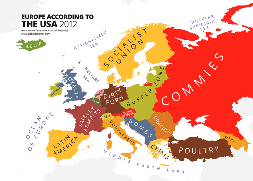
Or perhaps he was referring to maps like these: 'the world according to...' of which there are many.


Source: http://www.alphadesigner.com/
Buy the book with over 100 of these maps here: The Atlas of Prejudice

And in case you were wondering, the Worldmapper map shown at the top of the post is of global tea production.

Worldmapper maps are licensed under a Creative Commons Attribution - Non Commercial - ShareAlike 4.0 International License. For any commercial use (including in publishing) a map use license needs to be obtained.

Friday, 7 June 2019

1917: Colonel Sir Thomas Hungerford Holdich, KCMG, KCIE, CB, RE

Boundaries are the inevitable product of advancing civilisation; they are human inventions not necessarily supported by nature's dispositions, and as such they are only of solid value so long as they can be made strong enough and secure enough to prevent their violation and infringement.
Sir Thomas Hungerford Holdich (1916)


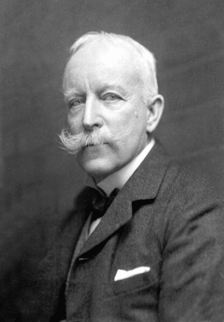
Thomas Holdich wwwholdichescomwpcontentuploads201306SirTLast update, August 2023

In 1917, Sir Halford Mackinder returned to focussing on his MP duties, although he was still heavily active in various roles at the GA, and continued to be so for many years, acting as President of the GA's Council through into the 1930s.

The new President for 1917 was Colonel Sir Thomas Hungerford Holdich. He was very much a military man - with a suitably impressive moustache as can be seen from the image.

When he took over as GA President, he was also serving as Vice-President of the RGS, with which he had been associated for over 50 years - another impressive service to geography being shown.

He was educated at Godolphin Grammar School and the Royal Military Academy, obtaining a commission in the Royal Engineers in 1862.

He saw active service in the Bhutan expedition of 1865, the Abyssinian campaign of 1867-68 and the Second Afghan War of 1878-79.

During peacetime, he was largely occupied with the survey of India, and served on the Afghan Boundary Commission of 1884-86, the Tasmar Boundary Commission of 1894, the Pamir Boundary Commission of 1895 and the Perso-Baluchistan Boundary Commission of 1896. He was also engaged in The Cordillera of the Andes Boundary Case by the governments of Argentina and Chile in 1902 to define the boundary along the Andes Mountains.

Holdich was awarded the Royal Geographical Society’s Gold Medal in 1887 and knighted in 1896.

As mentioned, Colonel Holdich was also Vice President of the Royal Geographical Society at the time, another person to have strong connections with both organisations.

As a military man, Colonel Holdich seemed to have a specific view on the value of Geography, particularly maps - bearing in mind these were produced by the Ordnance Survey, so had a military background to them as well.
He was a Royal Engineer, and had a role supervising surveying in India, as well as other locations in his career.
Holdich's Presidential address aparently had no obvious title.

He starts the address by talking about the concerns he had about speaking to geography educators.

"The science of geography covers so vast a field in all its varied aspects that it is impossible for any one man to be capable of expressing a useful opinion on many of the important questions involved in that careful consideration of the science as a whole which must necessarily result from a deep study of it such as you, as teachers of geography, have doubtless accorded to it. To put it shortly, you are far more capable of instructing me than I am of instructing you." 
(Holdich, 1917)

On the subject of maps he says:
"I say, with all confidence, that it is maps which afford us the surest outward and visible sign of a very real growth of public interest in the science of geography. They are indeed our best advertisement at present."
(Holdich, 1917)


Quite a bit of his Presidential Address dwelt on the present conflict (the First World War) and possible outcomes for different parts of the world, and the influence of these on the future map of the world. On the matter of geopolitics, which was perhaps beyond the realm of the classroom, he said to those attending:

"You are a band of geographical thinkers. I expect that many of you are what Mr. Mackinder calls 'map thinkers'. It is for the Geographical Association which you represent, and for the Geographical Society and schools of geography generally, to impress, and if possible educate, public opinion in important questions such as these..."
(Holdich, 1917)

Holdich described the war as being "a geographical education in itself" and invited the GA's members and volunteers to prepare for the post-war period. This would be a period of upheaval and challenge for all organisations.

He is described in an earlier Bibliographical Study as "a distinguished imperial surveyor", which was his particular area of interest.
https://books.google.co.uk/books?id=itckCwAAQBAJ&lpg=PT30&ots=Plar_gEAgW&dq=charles%20close%20OS%20geographer&pg=PT35#v=onepage&q=charles%20close%20OS%20geographer&f=false

Update

Holdich also referred to the importance of a home education, "which takes young children out of doors to observe natural features" and which teaches Boy Scouts to take stock of topographical details.

Image result for thomas hungerford holdichIn retirement he wrote about Indian and Afghan geography and his own experiences.

He was also an accomplished artist.

Holdich died in 1929, and his obituary was published in 'Geography'. It referred to his military service of course, as well as the other achievements.

References
Wikipedia: https://en.wikipedia.org/wiki/Thomas_Holdich

I edited the Wikipedia entry to add the fact that Colonel Holdich was the President of the Geographical Association. I shall do that for each President, as hardly any of their entries mentioned that before I started the blog.

Holdich, T. H. “PRESIDENTIAL ADDRESS TO THE GEOGRAPHICAL ASSOCIATION, 1917.” The Geographical Teacher, vol. 9, no. 1, 1917, pp. 13–24. JSTOR, JSTOR, www.jstor.org/stable/40554527.

Obituary: “SIR THOMAS HUNGERFORD HOLDICH. Ob. November 4th, 1929.” Geography, vol. 15, no. 4, 1929, pp. 308–308. JSTOR, www.jstor.org/stable/40557380.

Holdich's archive of correspondence with the RGS is stored in the RGS Archives and accessible to Fellows: https://discovery.nationalarchives.gov.uk/details/c/F33549

The Gates of India - a historical narrative: http://www.gutenberg.org/ebooks/42970

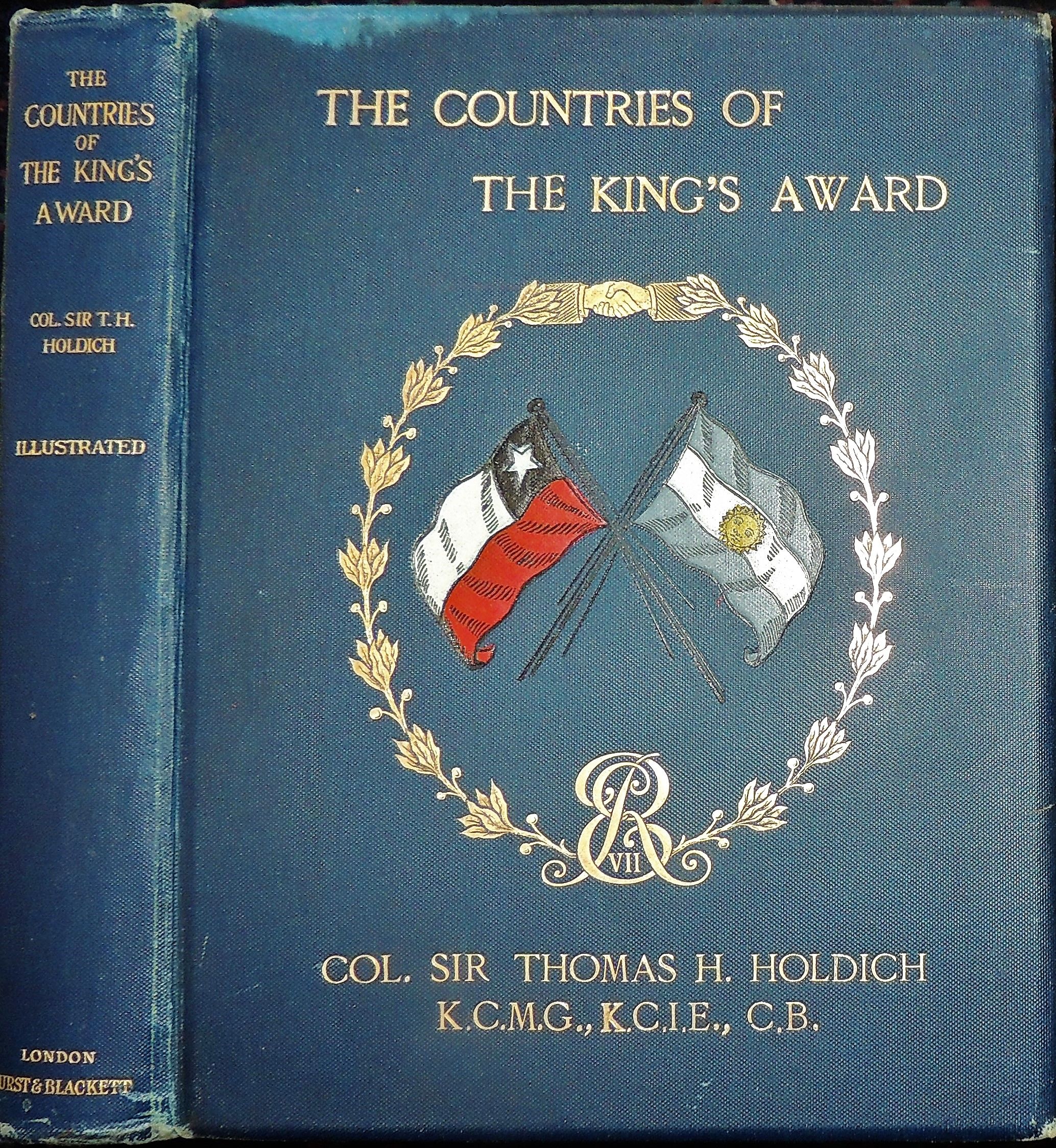
"The Englishman who got muddy in El Manso" - Chilean-Argentine diplomacy: https://www.elcordillerano.com.ar/noticias/2018/05/22/67758-el-ingles-que-se-lleno-de-barro-en-el-manso

“Colonel Holdich, a true gentleman, immediately captivated everyone by his presence, his cordial treatment, impartiality and rectitude. The result of his intellectual restlessness and the affection that he had for South American countries was the work that he published in London under the name The Countries of the Kings Award. In it, in addition to recounting his trip, he describes in their geographical, social and political aspects the countries he visited ”.

Book on 'Political Frontiers and Boundary Making': https://www.amazon.co.uk/Political-Frontiers-Boundary-Hungerford-Holdich/dp/1347139095 - given the current concerns about national and international borders such as Trump's wall, this focus on borders remains important.

Image source: https://alchetron.com/Thomas-Holdich and Pinterest galleries.

As always, if anyone has further information relating to Colonel Holdich, please let me know so that I can expand on this post.

Updated August 2019

Holdich is also mentioned in "A History of the World in Twelve Maps" by Jerry Brotton (Penguin, 2012)
There is a chapter called 'Geopolitics' which mentions him, although it focusses on Halford Mackinder, who was also President, at a time when they were linked with the RGS. Brotton says that Mackinder "would almost single-handedly both transform the study of geography in England, and create a whole new way of understanding and using the subject: geopolitics".

When he climbed Mt. Kenya in 1899, Halford Mackinder was invited by Colonel Sir Thomas Holdich to speak at the RGS. Another Presidential connection. I shall highlight many more of those as the blog develops.

Updated August 2021

Thomas H. Holdich was superintendent of Frontier Surveys in India from 1842 to 1848. At the beginning of the twentieth century, he was selected to establish the boundary between Argentina and Chile in Patagonia. He successfully used geographical methods in the solution of a particular set of problems, arising out of territorial disputes between Russia and Afghanistan; Argentina and Chile.

Even the delimitation of the McMahon Line on the map (8 inch to the mile) by Great Britain and Tibet, delimiting the Tibet-Assam boundary in 1914 at Simla was another example of the application of geographical principles and skill to solve the vexed problem of the boundary which had remained ill-defined for centuries.

It was an example of ‘applied’ work, because it was designed to resolve the problem of boundary delimitation in the Eastern Himalayan region. The British geographers and scholars who were in India during their colonial period had done extensive works of ‘applied’ nature.


Updated August 2023

Some tweaks and amendments.

Margaret Mackintosh RIP

Updated post. Sad news at the end of last week from colleagues who have organised the Charney Conference over the years of the passing of Ma...