Leonard Sydney Suggate, who became GA President in 1955 published several regional Geography books along with L Dudley Stamp.
The 1950s were interesting times for the GA in the post-war period, as with the years following the First World War, when many changes happened as a result of the recovery from war.
Suggate originally worked in the printing trade, but then studied psychology before taking the University of London's Teacher's Diploma in geography.
This led to him becoming a teacher, a fairly rare beast as we have seen so far with the blog.
In 1928, he started to make some changes at Clement Danes School.
When the school moved to a new site, Suggate created a special "Geography room" with a light table (which I remember from geography classrooms I sat in during the 1970s) and cases for equipment and showing artefacts.
I liked the story from his obituary, regarding his apparently indicipherable handwriting. A student asked what he had written at the bottom of their work, to which he replied "you must improve your handwriting, obviously...."
One of the projects that he started (along with another President Leonard Brooks was to develop a scheme where schools could "adopt" ships and send letters to their Captains. It was called the Ship Adoption Society. This has been featured in more detail in the entry for Leonard Brooks, as he mentioned it in his Presidential Address.
Also in 1955, he attended the 125th Anniversary dinner of the Royal Geographical Society, along with other former Presidents such as L Dudley Stamp and J A Steers.
 His Presidential year's conference is also described here - in this Nature piece.
Suggate wrote a series of books, which went into several editions.
He described his Presidential election as "at once an exciting and sobering elevation", which I sympathised with.
His Presidential Address was on the theme of geography teaching in Grammar Schools, making it of particular relevance to his audience no doubt.

Two years after completing his GA Presidency, Suggate and his wife emigrated to New Zealand at the age of 67, to join their two sons.
The 1950s were interesting times for the GA in the post-war period, as with the years following the First World War, when many changes happened as a result of the recovery from war.
Suggate originally worked in the printing trade, but then studied psychology before taking the University of London's Teacher's Diploma in geography.
This led to him becoming a teacher, a fairly rare beast as we have seen so far with the blog.
Few teachers become GA Presidents historically.
Suggate taught geography at Dorking High School, and later at St. Clement Danes Grammar School during the First World War (eventually retiring from there in 1949), which means he is one of a minority of people who had substantial experience of teaching geography before becoming President.
He took over the Presidency six years after retiring from what seems to have been an outstanding teaching career at a number of schools, and it is great to see that someone who was predominantly in the classroom for their career was able to step up to the role.
 He was very much influenced by the 'new' geography of Halford MacKinder, and used these ideas in his teaching as well (although by now they were not as new as they once were), writing about them in his work.
He also attended lectures by Mackinder, Garwood, Lyde and Unstead - familiar names from this blog. The War also provided for him an opportunity to radically rethink school geography. This is great to see someone taking on the chance to hear the important people of the time, and factor those ideas into his practice - something which teachers of today do with some success, building on the evidence of research and taking inspiration from academic geographers and practitioners.
There are several contributions that Suggate made to geography teaching in the post-war period.
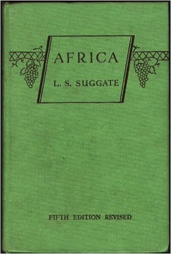
He wrote some of the first textbooks for the new analytical geography, such as 'Africa' - pictured to the right (one of the first school texts on the continent), and which ran to several editions.
He also campaigned for the use of maps and photos to be made available to candidates in school geography examinations, as well as greater use of visual aids in teaching.
He served concurrently on the Council of the RGS as well as the GA, and was elected a Fellow of the Royal Geographical Society in 1921. Another GA President to have a strong connection with the RGS.
He was also a Chief Examiner for the London General School Certificate - another GA President with significant examining experience as well.
He served on the RGS Education Committee as well, which is of interest as another connection between the two organisations. The work of the RGS's Education Committee continues to be important, and I was involved in supporting the application of several representatives for RGS Council positions in the last few years.
Suggate attended the GA Conference every year apparently, "pipe in hand" - no smoking allowed these days of course.
He was also a Labour party councillor for Hendon.
Suggate taught geography at Dorking High School, and later at St. Clement Danes Grammar School during the First World War (eventually retiring from there in 1949), which means he is one of a minority of people who had substantial experience of teaching geography before becoming President.
He took over the Presidency six years after retiring from what seems to have been an outstanding teaching career at a number of schools, and it is great to see that someone who was predominantly in the classroom for their career was able to step up to the role.
He was very much influenced by the 'new' geography of Halford MacKinder, and used these ideas in his teaching as well (although by now they were not as new as they once were), writing about them in his work.He also attended lectures by Mackinder, Garwood, Lyde and Unstead - familiar names from this blog. The War also provided for him an opportunity to radically rethink school geography. This is great to see someone taking on the chance to hear the important people of the time, and factor those ideas into his practice - something which teachers of today do with some success, building on the evidence of research and taking inspiration from academic geographers and practitioners.
There are several contributions that Suggate made to geography teaching in the post-war period.
He wrote some of the first textbooks for the new analytical geography, such as 'Africa' - pictured to the right (one of the first school texts on the continent), and which ran to several editions.
He also campaigned for the use of maps and photos to be made available to candidates in school geography examinations, as well as greater use of visual aids in teaching.
He served concurrently on the Council of the RGS as well as the GA, and was elected a Fellow of the Royal Geographical Society in 1921. Another GA President to have a strong connection with the RGS.
He was also a Chief Examiner for the London General School Certificate - another GA President with significant examining experience as well.
He served on the RGS Education Committee as well, which is of interest as another connection between the two organisations. The work of the RGS's Education Committee continues to be important, and I was involved in supporting the application of several representatives for RGS Council positions in the last few years.
Suggate attended the GA Conference every year apparently, "pipe in hand" - no smoking allowed these days of course.
He was also a Labour party councillor for Hendon.
In 1928, he started to make some changes at Clement Danes School.
When the school moved to a new site, Suggate created a special "Geography room" with a light table (which I remember from geography classrooms I sat in during the 1970s) and cases for equipment and showing artefacts.
I liked the story from his obituary, regarding his apparently indicipherable handwriting. A student asked what he had written at the bottom of their work, to which he replied "you must improve your handwriting, obviously...."
One of the projects that he started (along with another President Leonard Brooks was to develop a scheme where schools could "adopt" ships and send letters to their Captains. It was called the Ship Adoption Society. This has been featured in more detail in the entry for Leonard Brooks, as he mentioned it in his Presidential Address.
Also in 1955, he attended the 125th Anniversary dinner of the Royal Geographical Society, along with other former Presidents such as L Dudley Stamp and J A Steers.
 His Presidential year's conference is also described here - in this Nature piece.
Suggate wrote a series of books, which went into several editions.
He described his Presidential election as "at once an exciting and sobering elevation", which I sympathised with.
His Presidential Address was on the theme of geography teaching in Grammar Schools, making it of particular relevance to his audience no doubt.

Two years after completing his GA Presidency, Suggate and his wife emigrated to New Zealand at the age of 67, to join their two sons.
There, he was also (at that age) Secretary of the Second Triennial Conference of the New Zealand Geographical Association, and continued to write for books. A well deserved and long retirement was enjoyed.

He died in 1970 - another GA President to live to an old age (81) and with 60 years of service to the GA.
I am grateful to Fiona Hirst, Archivist at Clement Danes School for the wonderful image of Leonard from the school magazine at the top of this entry. She very kindly sent me a range of documents and other information to help add detail to what was previously quite a slight entry on the blog compared to some of the previous ones.
An obituary was published in 'Geography' in 1971, written by A D Nicholls, who was a long standing colleagues as well as also being a Former GA President by that time - he is yet to appear here.

References
No Wikipedia entry available. Perhaps a further extension of this project would be to create them for the missing GA Presidents.
Nicholls, A. D. “LEONARD S. SUGGATE, B.Sc., A.K.C. 1889-1970.” Geography, vol. 56, no. 2, 1971, pp. 152–153. JSTOR, www.jstor.org/stable/40567514.
https://archive.org/details/in.ernet.dli.2015.224015/page/n5 - one of Suggate's books
SUGGATE, L.S. Aspects of Geography Teaching in the Grammar School Geography 1956 41 1-14
https://www.questia.com/library/journal/1G1-78392752/oskar-h-k-spate-1911-2000 - a pupil of Suggate's remembers his teaching
“The 125th Anniversary Dinner.” The Geographical Journal, vol. 121, no. 3, 1955, pp. 392–404. JSTOR, www.jstor.org/stable/1790929.

He died in 1970 - another GA President to live to an old age (81) and with 60 years of service to the GA.
I am grateful to Fiona Hirst, Archivist at Clement Danes School for the wonderful image of Leonard from the school magazine at the top of this entry. She very kindly sent me a range of documents and other information to help add detail to what was previously quite a slight entry on the blog compared to some of the previous ones.
An obituary was published in 'Geography' in 1971, written by A D Nicholls, who was a long standing colleagues as well as also being a Former GA President by that time - he is yet to appear here.

References
No Wikipedia entry available. Perhaps a further extension of this project would be to create them for the missing GA Presidents.
Nicholls, A. D. “LEONARD S. SUGGATE, B.Sc., A.K.C. 1889-1970.” Geography, vol. 56, no. 2, 1971, pp. 152–153. JSTOR, www.jstor.org/stable/40567514.
https://archive.org/details/in.ernet.dli.2015.224015/page/n5 - one of Suggate's books
SUGGATE, L.S. Aspects of Geography Teaching in the Grammar School Geography 1956 41 1-14
https://www.questia.com/library/journal/1G1-78392752/oskar-h-k-spate-1911-2000 - a pupil of Suggate's remembers his teaching
“The 125th Anniversary Dinner.” The Geographical Journal, vol. 121, no. 3, 1955, pp. 392–404. JSTOR, www.jstor.org/stable/1790929.
Something in the IoE archives: https://archive.ioe.ac.uk/DServe/dserve.exe?dsqIni=Dserve.ini&dsqApp=Archive&dsqDb=Catalog&dsqCmd=Show.tcl&dsqSearch=(RefNo==%27IE/JUB/B/1%27)
R. J. Harrison Church. “Obituary: Leonard Sydney Suggate, BSC, AKC.” The Geographical Journal, vol. 137, no. 1, 1971, pp. 136–137. JSTOR, www.jstor.org/stable/1795429.
Africa Book: https://archive.org/details/in.ernet.dli.2015.227333
If anyone knows anything else about this President, please get in touch. This is a relatively brief entry.
Thanks to Fiona Hirst for the additional details and image from the school magazine 'The Dane'
R. J. Harrison Church. “Obituary: Leonard Sydney Suggate, BSC, AKC.” The Geographical Journal, vol. 137, no. 1, 1971, pp. 136–137. JSTOR, www.jstor.org/stable/1795429.
Africa Book: https://archive.org/details/in.ernet.dli.2015.227333
If anyone knows anything else about this President, please get in touch. This is a relatively brief entry.
Thanks to Fiona Hirst for the additional details and image from the school magazine 'The Dane'
Updated August 2023