Showing posts with label Decolonising Geography. Show all posts

Thursday, 21 November 2024

New resources on the Climate crisis

Some brand new Global Inequalities and the Climate Crisis curriculum resources have been released by the Geographical Association.

This innovative resource package for key stage 3 was developed in partnership with OU Geography Project and academics Parvati Raghuram of the Open University, Melis Cin of Lancaster University and Manu Lekunze of Aberdeen University. 

The resource pack uses testimonies from Cameroonian people to construct a Cameroon country case study.

Our Global Inequalities and the Climate Crisis curriculum resources respond to the APPG for Africa Education Report (2022) by developing a detailed country case study, drawing on lived experiences of African citizens and situating Cameroon in a global context.


The resource responds to the All-Party Parliamentary Group for Africa’s Education report (2022), which found an ‘impoverished treatment of Africa in the school curriculum’, replete with misconceptions (APPG, 2022, p. 10). By developing a detailed case study of one country, informed by ethnographic narratives of lived experiences drawn from residents of that country, the resource seeks to support teachers of geography in providing more sensitive, anti-racist representations of Africa in their classrooms.

GICC consists of materials for five lessons, including lesson PowerPoints, worksheets, and suggested lesson plans. We have endeavored to plan the lessons in a way that is mindful of the geography teacher as curriculum maker, so we hope that teachers will take these resources and find their own ways to integrate them into their teaching in dialogue with colleagues in their school settings.

The story told in this unit of work has been assembled from a collaboration between academic researchers, school geography teachers and the GA. It is a subjective representation informed by ethnographic testimonies. There are other stories to be told about the relationship between global inequalities and the climate crisis, and other ways the story we tell here could have been narrated. We look forward to hearing about how these resources are used in the classroom.

The GICC team:

Melis Cin, Lancaster University

Alesha de Fonseka, Raffles World Academy Dubai UAE

Aliyou Haman, Aberdeen University

Manu Lekunze, Aberdeen University

Parvati Raghuram, Open University

Dan Whittall, Geographical Association

Chris Winter, Geographical Association

Saturday, 12 October 2024

Black History Month - a special podcast

GeogPod #83 is in support of Black History Month

In a special episode to celebrate Black History Month we join Professor Pat Noxolo from the University of Birmingham, Professor James Esson from Queen Mary University of London and Francisca Rockey, founding member of Black Geographers.

They discuss the intersections between race, gender and class that affect young people today. Topics include how to navigate complex ideas in a complex world, the importance of recognising different narratives, and the possibilities for change, revealed by the amazing work done by geography teachers.

Anti-racist work has been a means of support, comradeship and helping keep hold of talented people. Here are a few of the groups and resources mentioned in this episode:

Wednesday, 9 October 2024

Post-colonial geographies

 Download the document here (PDF link)

This document references the work of Robert Ogilvie Buchanan and Robert Steel: two former GA Presidents.

They were involved in developing universities across the Commonwealth through the 1950s and 60s.

R.O. Buchanan was born in New Zealand and came to Britain in 1925 to study at the LSE, where he was later chair of geography. Buchanan was one of the founders of the Institute of British Geographers and, like Steel, served on several committees throughout his career including the Association of Commonwealth Universities, the Geographical Association and the British Association for the Advancement of Science. These connections, combined with the hierarchical and informal processes of academic appointments across Britain and the wider colonial world, put both in pivotal positions for hiring decisions in Nigeria and for geographers seeking to (re)join UK academia.  

Steel regularly received requests for suggestions for appointments from contacts working in African universities.Many of those at Ibadan were appointed on recommendation: he was referee for Terry Coppock, visiting scholar at Ibadan 1964-1965, and advised Dick Hodder (lecturer at Ibadan 1956-1962) on how to make the necessary connections to apply. He was on the selection panel for the chair of geography and head of department role, appointing Michael Barbour to the position in 1962. Steel’s archives abound with informal letters reflecting the continuing value of ‘writing to friends’ in the appointments process across the former colonies in Africa, South East Asia and the Caribbean until the 1960s.

Source: Craggs, R., & Neate, H. (2019). Post-colonial careering and the discipline of geography: British geographers in Nigeria and the UK, 1945-1990. JOURNAL OF HISTORICAL GEOGRAPHY, 66, 31-42. https://doi.org/10.1016/j.jhg.2018.05.014

It was interesting to see that Buchanan was referenced....

Buchanan was a colourful character who refused to conform to the expectations of senior university administrators. According to his colleague Pugh, Buchanan ‘had a wide range of acquaintances in Ibadan Town … and never hesitated if he saw a party of drummers heading somewhere – he would follow …’. He would wear shirts ‘made from cloth from the local market with a pattern of rosebuds or Crown birds’. His lectures touched on issues of colonialism and development, and showed signs of the more radical critiques of his later scholarship. Eventually the UCI principal deemed that Buchanan’s clothing showed he was inappropriate for the job, leading to his departure in 1951 for LSE, then what was to become the University of Wellington in New Zealand.

Sunday, 1 September 2024

2024: Hina Robinson

For the third year out of the last four, the GA President will be a teacher, and a female state-school teacher for the second year in a row.

Hina Robinson is the new GA President for 2024-25


I sent Hina the questions that I had given to all other Presidents and used them to create the post below. I'm grateful to Hina for the level of detail she provided and taking the time to help create this entry on the blog.

When and where were you born? 

I was born in Edgware, North London in 1977. My parents were immigrants, having moved from Kenya the year before. So I always say my ethnic background is East African Asian.
The principle of my religion – Jainism – make for a passion in geography – we strongly believe in looking after the Earth and all that is on it. 

Where did you go to school / university?

Primary school was Deansbrook Infant and Juniors. 

My first memory of geography was actually being made to feel stupid – the first time I saw the British Isles on a globe and commenting that it was a bit small – my year 4 teacher was clearly not impressed!

The year six school journey to the Lake District started to get me thinking about landforms – the first time I had been to a National Park. Parents who are first generation immigrants spend a lot of time at work and so I had only been to local country parks before. 

Secondary school was Henrietta Barnett School in Hampstead Garden Suburb – regularly topping league tables! 
The school was very fortunate to have its own field centre in Dorset which everyone went to for a week in years 8, 9 and 10. On my first visit there we did some orientation with OS maps. One of the teachers commented that I must do that a lot as I was so good with maps – but it was my first time map reading! 

I was incredibly lucky to experience these field trips – influencing my attitude to field work. The teacher that inspired me to want to take geography further was Mrs McIsaac Hall. 
Looking back it was her passion for the subject that came across in lessons to make them so good. 
My A levels were Geography, Economics and Politics. 
An Iceland trip in year 13 fuelled my interest, and work experience in a secondary school geography department in year 12 made my career path clear!

I went to my insurance university – Salford and changed my degree choice to joint honours Geography and Economics. 
I’m still not sure this was the right decision as some of the economics which involved maths was particularly tough, however the link between the two subjects is so important and I was able to study units such as environmental economics. I loved cultural geography and environmental units alike. 

I went the PGCE route at Brunel University and was lucky enough to have Bob Digby and Graham Yates as my course tutors. 

What has your career been to date?

My first job was at the Eastwood School in Leigh on Sea. In my first year there I was teaching four different subjects. I stayed two years before moving to The King John School where I stayed for 20 years! In my time there I had various roles including Head of Geography. 
After returning from maternity leave this was not a role I could keep as I went part-time. However I was Rights Respecting Schools lead and eventually picked up key stage 4 Geography lead. 
Some of my colleagues were integral to my understanding and love of geography – Alan Greenway and Anna Edwards in particular. 
My move to my current school (Southend High School for Girls) saw me lose my responsibility point in geography (my choice!). However I joined a department with a clear passion for geography and I could not be happier in my role. 

Other roles I have undertaken in school link in with geography well, which is probably why I am passionate about them. 
Currently I am Rights Respecting Schools lead and Diversity lead. Both of these roles have a grounding in human geography and the desire to ensure that all have equal opportunities regardless of any protected characteristic or where they live. 

Wider than teaching, I became interested in doing more within the subject community in 2020 during the first Covid lockdown. Decolonising geography and also making it a more inclusive subject which appealed to all became passions of mine. This started through Twitter and getting to know other geographers remotely. My first taste of presenting was a Geogchat Teachmeet, thanks to Rachael Robinson who invited me to speak as part of her slot. Emma Rawlings Smith then invited me to write part of an article for Teaching Geography. I have presented a few times since online for various groups – GeReCo amongst others. I have also edited an 'A' level Revision Guide's 2nd edition and have given some awarding bodies some EDI guidance.


What is your Presidential theme, and why did you pick it? 

My theme is Connected Geographies. 

Geography is what explains how the world works – on a physical level but also how people have developed the world. Learning about our interconnectedness is key to sustainability and equity. Geography connects different subjects together – it is difficult to find another area of education that does not have some geographical element! To develop our students into global citizens who take care of their environment they need to understand how the world is interconnected. This is so important in tackling the misconceptions that cause so many issues across the world. 


Why does the GA matter to you? 

I have been a member of the GA for 26 years – ever since Bob Digby strongly advised membership during PGCE. 
I have read all the magazines and Teaching Geography since then! It was in 2021 when a member Trustee position came up that I first thought about doing more. Susan Pike was the person who encouraged me to do this! 
I attended my first conference online in 2021 and have presented at each one since. 
It was in 2022 when Emma Rawlings Smith suggested that I should think about the President's role, followed by Bob Digby. I had never even considered this was something I could do! I have tried to develop EDI within the GA.

The GA is integral to the education community – it is vital to have a body that can represent our subject at all levels and can provide support to all educators of geography – whatever stage they teach and whatever their experience.

I have learnt so much from Denise Freeman over the past year – she has been an inspiration in her passion for the role and I hope I can do it the same justice!


Images copyright: Hina Robinson / Geographical Association / Shaun Flannery

Monday, 12 August 2024

Decolonising geography - early days

While looking for something else I came across Daniel Clayton's paper from the University of St. Andrews.

In it he talks about the emergence of decolonising and the early proponents of looking back at the nature of Empire, with Felix Driver's work being mentioned prominently.

In the aftermath of World War II, two British geographers, Sidney Wooldridge and Ronald Harrison Church, implored colleagues to take the study of colonial geography more seriously.  Wooldridge (1947, 202) ventured that “it appears to me to throw a strong light on the position of Geography in this country that we are so calamitously and shamefully ignorant of our Colonial Empire”.  And Harrison Church (1951, 116-17) sought to make amends with a primer entitled Modern Colonization, noting that Africa was “ripe for rearrangement” (albeit colonial reform more than independence).  

As Britain’s sprawling empire shrank, the type of geographical study and imagery associated with it became less acceptable and feasible, and Alastair Bonnett (2003) asserts that geography soon abandoned its bequest as a “world discipline” and geographers sought to make their discipline ‘useful’ again by focusing on pressing domestic problems.  Yet geography was not taught at many of the new universities established across the United Kingdom in the post-war decades, in part because politicians continued to view the subject as having “a somewhat ‘dated’ look about it”, as Ron Johnston (2003, 69) puts it. 

 Indeed, the ‘conquest’ of Everest by Edmund Hillary and Tenzing Norgay in June 1953, coinciding with the Coronation of Queen Elizabeth II, was arguably the crowning glory of 1950s British geography and points to the post-war extension rather than liquidation of geography’s empire.  

The RGS was a proud sponsor of the Everest Expedition, and through to the 1970s its learned organ, The Geographical Journal, kept a populist foot in the imperial past by publishing excerpts “from the journal a hundred years ago”, most of which were manly tales of expeditionary derring-do.   

Source: (PDF link) to read the whole paper.

https://research-portal.st-andrews.ac.uk/files/263517541/Clayton_2019_AAAG_geography_sempire_AAM.pdf

Thursday, 12 October 2023

COVIC and Alfred Hugh Fisher

COVIC has been mentioned before on the blog.

It is the Colonial Office Visual Instruction Committee, and GA Presidents were involved in its work at the time.

This article in the Cambridge University Special Collections blog describes some work carried out at the start of the 20th century.

It was written by Sabrina Meneghini.

It describes a journey made around the British Empire by an artist called Alfred Hugh Fisher.

He was hired to take photographs and make paintings in order to create a visual record of the people, landscapes and geography of the vast empire. From these images COVIC produced a series of illustrated lectures and textbooks which were to be presented as geography lessons to schoolchildren.

The 6 books that resulted are held in the library.
The Indian volume was written by Halford MacKinder... who was not a native of India...


MacKinder was appointed for the supervision of the whole project, including the preparation of the textbooks. In 1910 he entered Parliament and consequently had less time to commit to COVIC, therefore the succeeding textbooks were authored by the economist Arthur John Sargent.

The texts inside each of the books are rich in historical and geographical descriptions. The front covers, with the illustrations and the titles showing either the natural products, the animals or the distinctive landscapes of the countries, provide information of the inside arousing readers’ curiosity.

The textbooks were accompanied by sets of lantern slides (no less than 350 per book) and the complete lists can be found at the end of each book.


In 1902 the Colonial Office was charged with creating a visual record of the British Empire. The COVIC produced sets of lantern slides which were to be presented as a series of geography lessons to school children. The project’s cultural exchange aims were twofold: British schools would receive images of the colonies, while colonial school children would receive and see slides from the Mother Country. In 1907 the Committee hired Alfred Hugh Fisher, an artist and newspaper illustrator, for a duration of three years. He was given the responsibility of creating a visual description of Britain’s overseas territories.

This was quite a commission.

The first two posts were from 2018, but there is a follow up from April 2023 by Sabrina, updating on her PhD research.

Sabrina recently completed her PhD at DeMontfort University, entitled Classroom Photographic Journeys: Alfred Hugh Fisher and the British Empire’s Development of Colonial-era Visual Education, which made heavy use of the Library’s Royal Commonwealth Society photographic collections.
Congratulations!

There are also diary and letter images.

His journey started in October 1907 in South Asia where he visited India (at the time of Fisher’s journey the term India included the areas in the Indian subcontinent administrated by the United Kingdom and ruled by the British Raj. It extended over present-day India, Pakistan, Bangladesh, Myanmar, and Sri Lanka), Burma [present Myanmar], Aden, Somaliland, and Cyprus. From July 1908 to May 1909, he travelled to Canada, Newfoundland, Weihaiwei, Hong Kong, Borneo, the Malay Peninsula and Singapore. In his last journey, from October 1909 to August 1910, he sailed from Gibraltar and Malta to Australia, New Zealand, Tasmania, and Fiji. COVIC purchased images from places he was not able to visit such as the West Indies [Caribbean], and South Africa. Some were acquired from official bodies, others from amateur photographers.

Fisher was the first and only photographer employed by COVIC.

Sabrina says that:
British geographer Halford John Mackinder, attempted to influence how Fisher’s work would shape COVIC’s with instructions on how and what to photograph. Fisher did not always follow these instructions and his own vision of the Empire can be seen through his artistic works.

In the section on India.

The type of images requested by Mackinder to Fisher in India had to show the stability and order of the colonial society. It was important to illustrate to British pupils the Empire’s most valuable possessions and the achievements accomplished by British in the Indian subcontinent. Fisher documented the various forms of cults in India, ancient buildings, princes and rulers from different Indian states, railways, engineering infrastructures, and scenes depicting the development of the colonial economy to demonstrate the good functioning of the Empire and the subservience of its subjects.

Fisher sent his documents in the hope that his biography would be written.
Some of the material can be accessed in digital form by following links from the main page above. Fascinating stuff.

This is a fascinating story and I'll try and track down the PhD in full as it sounds like it will be well worth finding out more...

Thursday, 23 February 2023

Lantern Slides - a new eBook

This can be downloaded from the site here.

The book mentions the research of Emily Hayes, who kindly contributed some ideas for my GA Presidents blog on the historical use of lantern slides by the RGS and the GA. The GA was founded to help share lantern slides.

She talks about the use of slides by Halford Mackinder, who remains a significant (if problematic) figure in the history of geographical thought:

One of the three case studies Hayes analyses to demonstrate the gradual engagement of the RGS with the lantern is the famous lecture ‘On the Scope and Methods of Geography’ given by a young Mackinder to the RGS in 1887. The geographer had been a key figure in the acceptance and employment of the lantern projector to promote geographical knowledge. In his presentation, in which images and text were synchronized, Mackinder demonstrated he was ready to fully embrace the technology. The debate on the use of lantern slides in geographical education saw Mackinder as one of the main supporters, who recognized the pedagogical potential of the technology to instruct children.

There is an interesting section which I hadn't read about before on how Halford Mackinder was asked by COVICS to produce some slides and lecture notes which became a series of illustrated books - the pictures being smaller versions of the slides used in the original lectures for the Colonial Office. This would doubtless be of interest to those concerned with de/colonising geography.

I need to spend a little more time reading this.

Source:
Mackinder, Halford J., ‘The Teaching of Geography from an Imperial Point of View, and the Use Which Could and Should be Made of Visual Instruction’, The Geographical Teacher, 6.30 (1911), 79–86.

Mackinder, Halford J., India. Eight Lectures Prepared for the Visual Instruction Committee of the Colonial Office(London: George Philip & Son, 1910).

Maddrell, Avril M. C., ‘Empire, Emigration and School Geography: Changing Discourses of Imperial Citizenship, 1880–1925’, Journal of Historical Geography 22.4 (1996), 381.

Sunday, 29 March 2020

1961: Mr. George Joseph Cons

Updated September 2023

Just a note on the 1961 Presidency from 'Geography'. 
It appears that Mr. George Joseph Cons was due to have been the president for this year, but unfortunately died quite suddenly in 1960 so was unable to take up the post.


Mr. G J Cons was the author of a Handbook on teaching, and was also a member of the Standing Committee for Visual Aids (which later become Teaching Aids)

He was a Senior Lecture in Geography at Goldmsiths' College.

Balchin's Centenary volume talks about him playing an active role in the Association for many years.
He is quoted in a paper on the teaching of war and peace.
Front Cover
Cons wrote that Geography is probably the best equipped subject for training the young in ‘world citizenship’ and internationalism (Cons, 1932)

This quote was included in a GA Handbook edited by Miss D M Forsaith

Cons also Chaired a number of events over the years, including a debate on the future of Geography at the 1945 conference.

He was the editor of a handbook for Geography Teachers, published by Methuen in the 1950s

Mr. Geoffrey Hutchings was elected as President in his place at the Spring meeting of the GA Council.

I noticed that he was obviously involved in helping make a number of short TV pieces.
I noticed a few fieldwork related pieces on the channel called Talking Pictures TV which shows brief vintage documentaries and films in between vintage films.


An Obituary was published in 'Geography'


Thanks to Brendan Conway for the tipoff to these films in these tweets.
Here's the 2nd tweet


And here is the film, from the Huntley Film Archives


References

W. Wallace (1956) Geography in further education, The Vocational Aspect of Education, 8:16, 40-46, DOI: 10.1080/03057875680000061

“GEOGRAPHICAL ASSOCIATION. Annual Conference Discussions on the Future for Geography.” Geography, vol. 30, no. 2, 1945, pp. 50–62. JSTOR, www.jstor.org/stable/40563427

Bull, G. B. J. “GEORGE JOSEPH CONS.” Geography, vol. 45, no. 1/2, 1960, pp. 123–124. JSTOR, www.jstor.org/stable/40565120
If anyone knows more about Mr. G. J. Cons, or has an image of him that would be appreciated.


Updated September 2023

The McNair Report gets a mention here.

H was linked with the NW Kent Branch of the GA.
He served for many years on the Education Committee of the GA.


https://www.raremaps.com/mapmaker/6716/G_J_Cons - an article that describes his map collecting.

Cons was a pioneer in pioneer in the field of geography films for schools and authored ‘Films and Living Geography’, Sight and Sound, 4/14 (Summer 1935)

The following is excerpted from Traces

A very different proposal comes from one of the few professional geographers involved in animated mapmaking for documentary films – G. J. Cons, who collaborated with the British Film Institute as scientific consultant for the production of educational documentaries. Referring to the series Indian Town Studies made by Gaumont-British Instructional, Cons highlights that ‘these films were made effective geographically by the use of animated maps’. It is evident that this effectiveness is based on the power of the trace since it allows a purely explanatory discourse which consists of the plain transmission of data and information even though no element really legitimises it. For him, there is little difference here between animated maps and informational images; the constitutive properties of motion and animation, whose consequences are far from being neutral, is relegated to a blurry allusion to a ‘living accurate’ vision. Does this prove the ineffectiveness of the attempt to acquire animated maps into the project of geography for ordering the world, or does it confirm Cons’ statement that ‘the genius of documentary film reveal[s] the screen as a magic casement through which our geographical vision of the Earth and its peoples is heightened’? In other terms, does the author’s faith in documentaries negate any concerns about the fabricated spectacle that animated maps present?

Apparently, and with a certain naivety, Cons seems to advocate a perfect analogy between the map, the mirror, and the screen – a position that may surprise coming from a professional geographer. However, as explained by Priya Jaikumar in an insightful essay on the series, the result is not the faithful and plain reproduction of Cons claims but rather an attestation of the role of animated maps in the building of that ideology that put together positivist, modernist, and colonial contents: ‘[t]owns in India were visualised to make them intelligible and transparent, with vision transforming a place, its people and fullness of their lives, into abstract space.’ Again, thanks also to the power of the trace the pretensions of correct visualisation and geographical accuracy have been overthrown and transformed into something completely different: the colonial fiction of mastery and control through alleged scientific instruments used in narrative and visual devices for making this very same fiction true.

Giuseppe Fidotta: Animated maps and the power of the trace.

He also participated in the creation of visual maps such as the one here.

https://www.raremaps.com/gallery/detail/65476/the-peopling-of-the-usa-cons


If anyone can find an image of G J Cons that would be appreciated.

Wednesday, 25 September 2019

1937: Professor Leslie Patrick Abercrombie (later Sir)

Sir (Leslie) Patrick Abercrombie - NPG x82059.jpg
Last updated June 2024

Patrick Abercrombie was a major person in the development of town planning, and was another of the Presidents who were chosen because of their public profile, rather than a connection with geography teaching per se.
I remember learning about his work in a module on planning which formed part of my degree in the early 1980s.
His name has since cropped up with respect to BAAS Section E and links with Sir Peter Hall, who is referenced quite a bit on the blog.  

He was born in Cheshire, and studied at Liverpool School of Architecture.

His work's legacy persists today and is still influential in discussions around town planning.

When he became GA President, the Second World War was approaching, but there was still a lot of change occurring in the British landscape.

Following the Second World War, Abercrombie became a leading person in the rebuilding of London and other places. This was also a time when planning was a big focus of the BAAS Section E.

His work led to the New Towns Act which has left a legacy of cities across the UK, and work on other cities which have been influenced by the movement, spreading worldwide.


From his Wikipedia page (shared under CC license)

Sir Patrick trained as an architect before becoming the Professor of Civic Design at the University of Liverpool School of Architecture in 1915, and later Professor of Town Planning at University College London. 

Afterwards, he made award-winning designs for Dublin city centre and was involved in the replanning of several other cities, including Hull.

He was also closely involved in the founding of the Council for the Preservation of Rural England (CPRE). After its formation in December 1926, he served as its Honorary Secretary. This is yet another important institution with a link to a GA President.

When Abercrombie became GA President, he had not yet completed his most famous work, which was yet to come after the Second World War.

His Presidential Address was entitled 'Geography, the basis of Planning'.

ABERCROMBIE, PATRICK. “GEOGRAPHY, THE BASIS OF PLANNING.” Geography, vol. 23, no. 1, 1938, pp. 1–8. JSTOR, http://www.jstor.org/stable/40560522. Accessed 24 Aug. 2023.

Duncan Hawley (and other geologists) need to look away from this extract.


He championed the idea of a Green Belt around London, and contributed to the Royal Commission on the Distribution of the Industrial Population, the report of which (Barlow Report) appeared in 1940. Green Belts are very much in the news in the summer of 2023 in terms of their suggested impact on new housing which is needed.

He is perhaps best known for the post-Second World War replanning of London. He created the County of London Plan (1943) and the Greater London Plan (1944) which are commonly referred to as the Abercrombie Plan. 

I've seen the plan / map referred to as the potato map.

He appears in the film The Proud City presenting his plan to the public - a rare film of a GA President talking:

The Proud City. Patrick Abercrombie from Planum. The Journal of Urbanism on Vimeo.


In 1945 he published A Plan for the City & County of Kingston upon Hull, with the assistance of Sir Edwin Lutyens. Lutyens had died the year before publication whilst much of the plan was being finalised, and the plan was ultimately rejected by the Councillors of Hull.

From the Abercrombie Plan came the New Towns movement which included the building of Harlow and Crawley. He produced the Clyde Valley Regional Plan in 1946 with Robert H Matthews that proposed the new towns of East Kilbride and Cumbernauld.

During the postwar years, Sir Patrick was commissioned by the British government to redesign Hong Kong.
In 1956 he was also commissioned by Haile Selassie to draw up plans for the capital of Ethiopia, Addis Ababa.

Patrick Abercrombie was Knighted in 1945.  In 1948 he became the first president of the newly formed group the International Union of Architects, or the UIA (Union Internationale des Architectes). The group now annually awards the Sir Patrick Abercrombie Prize, for excellence in town planning. In 1950 he received the AIA Gold Medal. The University of Liverpool's Department of Civic Design also continues to award an Abercrombie Prize annually to its top-performing student.

He died in 1957.

A Blue Plaque has been erected at a house formerly occupied by Patrick Abercrombie (lived there 1915-1935), in Oxton, Merseyside. 

References
Wikipedia: https://en.wikipedia.org/wiki/Patrick_Abercrombie

Source of image - Creative Commons

I amended the entry to add his GA Presidency - something I have done for each GA President who has a Wikipedia page.

Presidential Address: https://www.jstor.org/stable/40560522?seq=1#page_scan_tab_contents

David Matless piece: Matless, David. “Appropriate Geography: Patrick Abercrombie and the Energy of the World.” Journal of Design History, vol. 6, no. 3, 1993, pp. 167–178. JSTOR, www.jstor.org/stable/1316006.

https://www.ft.com/content/97afa1b2-44a3-11e4-ab0c-00144feabdc0

https://www.theguardian.com/uk-news/davehillblog/2014/mar/22/london-county-plan-abercrombie-forshaw

https://www.oxfordreference.com/view/10.1093/oi/authority.20110803095343737

Update (late September 2019)
Thoughts on Abercrombie's legacy from Brendan Conway

Update (October 2019)
Image result for jenkins history londonAbercrombie's legacy is also discussed in the new Short History of London by Simon Jenkins - a current read of mine.
The author is not a fan of the period where a lot of the historical streets of London were replaced, buildings removed, and threats to other buildings such as St. Pancras, in the period after the Second World War.
Abercrombie talked about London's past as a time of 'obsolescence, bad and unsuitable housing, uncorrelated road systems and inequality in the distribution of open spaces'.

I have a copy of a book which features the plan. A green belt was proposed to stop the expansion of the city, and there would be up to five 'ringways' to take traffic around the city centre.
People would be moved out of the city to new towns to take the pressure of the centre. The 1947 Town and Country Planning Act gave Abercrombie the power to change the lives of the 7 million inhabitants of the city, but it met opposition from the realities of a city which had survived the Blitz and needed to be rebuilt and given a new energy.

Jenkins' books is well worth reading.

In G. R. Crone's chronology of Geography in the 20th Century, there is a brief mention of Abercrombie's Presidential address.


Reference
Crone, G. R. “British Geography in the Twentieth Century.” The Geographical Journal, vol. 130, no. 2, 1964, pp. 197–220. JSTOR, www.jstor.org/stable/1794582.

Update
A video describing the plan.


 And a dramatised film describing the rebuilding of Plymouth based on Abercrombie's planning after the war.


Updated November 2020

In November 2019, Abercrombie got an English Heritage blue plaque unveiled at his house in his honour. Here's the ceremony...


Updated August 2021
A plan for a future Dublin - from 1922

Updated July 2022

I'm adding in additional perspectives on the work of Presidents and the people themselves as I find them, particularly where they may be problematic and relate to the current need to decolonise the subject itself but also revisit what are accepted narratives.
This thread is an interesting one with respect to the reasoning behind some of Abercrombie's planning decisions - this is of course a great responsibility.


Updated August 2023


Abercrombie met Patrick Geddes... another person linked with the GA...


Abercrombie was apparently influenced by Feng Shui

Matless, David. “Appropriate Geography: Patrick Abercrombie and the Energy of the World.” Journal of Design History, vol. 6, no. 3, 1993, pp. 167–78. JSTOR, http://www.jstor.org/stable/1316006. Accessed 24 Aug. 2023.

A piece in Nature from 1938 by S H Beaver (another former GA President to be...)

THE Geographical Association's annual conference usually has a theme corresponding to the interests of its president for the time being, and since in its choice of presidents the Association does not confine itself to academic geographers, considerable service to the subject is often done by this importation of a new viewpoint. This year the keynote of the Conference held at the London School of Economics on January 4–6 was the part that geography can play in planning. The presidential address, delivered by Prof. Patrick Abercrombie, professor of town planning at University College, London, was entitled “Geography, the Basis of Planning” ; and a symposium on town and rural planning was the principal individual item in the programme. To a certain extent these items in the Conference may be considered as corollary to the important discussion on “Planning the Land of Britain”, which was held at the Nottingham meeting of the British Association, as reported in NATURE of November 6, 1937, p. 791.

On his work on the Green Belt


Updated June 2024

Plenty of Tweets shared by the @createstreets account....


This post talks about the Green Belt as being 'The curse of Patrick Abercrombie' 

Also a comment on his plans for Hong Kong.


Saturday, 27 April 2019

1912: Dr George Robert Parkin, KCMG DCL LLD

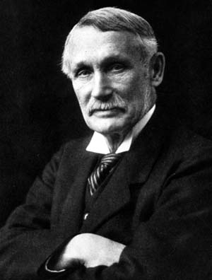
George Robert Parkin.jpgUpdated August 2023

Following the departure of Douglas Freshfield, the following President had a particular responsibility to oversee the next stage in the Association's development.

At this time, a decision was made to bring in distinguished outsiders with geographic interests to strengthen the standing of the Association.

George Robert Parkin was just such a person. 

He was the organising Secretary of the Rhodes Scholarship Trust when he was elected, having been a GA member for some time, and also contributing to 'The Geographical Teacher' using his knowledge of the Empire.

Rhodes is of course problematic by association.


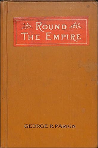
The book referred to seems to have been written in 1892 for use in schools, and was called 'Round the Empire'.

Cecil Rhodes himself was particularly problematic and there has been a campaign to have his name removed from buildings at a number of universities and statues removed. This Empire connection needs unpicking.

To see Mr. Parkin's Presidential Address, see the following link:

PARKIN, G. R. “THE PRESIDENTIAL ADDRESS.” The Geographical Teacher, vol. 6, no. 4, 1912, pp. 189–198. JSTOR, JSTOR, www.jstor.org/stable/40554149.

One might want to avoid reading p.192-3 of that address though, as it seems to express views that wouldn't be ideal to express today on the impact of the cold temperatures of Canada on immigration patterns.

One of the things that has started to emerge in the years since the turn of the 21st Century has been the connections between organisations and universities and some attitudes and activities which are no longer 'politically correct' and need to be addressed directly.

(See update at the end of the post)

Other quotes are more interesting and relevant perhaps:

 "There is one thing more that I should like to say. If you take an interest in the political thought of this country, it is absolutely impossible to make that adequate unless you teach the people geography. Anyone who does not know the essential needs of this country, that it draws its raw materials from the ends of the Earth and sends back its manufactures to the ends of the Earth, who does not know the sources of that supply, the conditions which exist on both sides, and the necessity of communication between the two in order to secure our national life, is not fit to be a voting citizen of this Empire."

The association with Cecil Rhodes is also one that has been revisited by a number of universities, including the University of Oxford with the Rhodes Must Fall campaign active at the moment.

George Robert Parkin was born in New Brunswick in Canada in 1846, the son of a Yorkshire farmer. His biography is an interesting one, and can be read in more detail on the Wikipedia page linked to below.

He travelled widely in his role with the Rhodes Scholarship, and became knowledgeable about the Empire and its geography. He seems to have been a Headmaster - hence the education connection.

He was awarded the KCMG in 1920, along with other honours in his lifetime. 

I wonder whether this practice of awarding honours to GA Presidents might be resurrected.

Parkin contributed a number of articles to 'The Geographical Journal' in its early volumes, often co-authored with Halford MacKinder. 
He also worked as a correspondent for 'The Times' newspaper in the late 1890s.

Interestingly, he was also involved in the production of a map of the Empire, published by Bartholomew.


Read the review of this resource and you can see that even back in 1903, the Mercator projection was not being favoured by the Geographers who used these maps, and wanted "a large, clear physical wall map of the World on an equal area projection", which "would be a boon to every progressive teacher of geography."

Also in 1912, according to 'The Geographical Teacher':

"The number of members is now 1,000, an increase of 38 during the year. While 137 old members have been lost by death, resignation, or lapse of payment of subscription, 175 new members have joined."

A reminder of the rapid turnover in membership that can often occur in any organisation, and which the GA is always mindful of.

Source: The Geographical Teacher, vol. 2, no. 2, 1903, pp. 93–93. JSTOR, www.jstor.org/stable/40554264.

References

https://en.wikipedia.org/wiki/George_Robert_Parkin - describes Parkin as an educator, imperialist and author.

I edited the Wikipedia entry to add the fact that he was the President of the Geographical Association. I shall do that for each President, as hardly any of their entries mentioned that before I started the blog.

PARKIN, G. R. “THE PRESIDENTIAL ADDRESS.” The Geographical Teacher, vol. 6, no. 4, 1912, pp. 189–198. JSTOR, JSTOR, www.jstor.org/stable/40554149.

Amazon page for 'Round the Empire' book: https://www.amazon.co.uk/Round-Empire-George-R-Parkin/dp/B001AV3JBU

Further research opportunity:

https://lib.unb.ca/archives/finding/parkin/parkin.html - University of Brunswick archive, which has some documents relating to Parkin

If anyone can supply further information relating to George Robert Parkin, please get in touch.

Update April 2019

Thanks to the GA's Chief Executive Alan Kinder for this perspective on the importance of reading outdated views involving 'environmental determinism' as they have not necessarily been consigned to History and are part of the ongoing EDI work the GA is engaged in:

Updated November 2019
Parkin wrote a book about the history of the Rhodes Scholarships, now the Rhodes Trust
https://archive.org/details/rhodesscholarsh01parkgoog/page/n11

More details here:
https://www.rhodeshouse.ox.ac.uk/about/history-of-the-rhodes-trust/

Updated November 2020

This is one of several tweets that I came across. Parkin's association with the Rhodes Scholarship and Oxford University is noted.

Updated July 2022

Updated August 2023 

Article in the New York Times archive from 1919 on post-war education.

A link to a book that he owned describes him as:

"a biographer of Sir John A. Macdonald and Headmaster of Upper Canada College"

1895: George R. Parkin appointed eighth principal of UCC

1923: Parkin Building opens

Named after Parkin?


John Macdonald was the first Prime-minister of Canada.

Margaret Mackintosh RIP

Updated post. Sad news at the end of last week from colleagues who have organised the Charney Conference over the years of the passing of Ma...