Showing posts with label Resources. Show all posts

Saturday, 11 April 2026

GA Conference 2026 #2: Day 2: Musical Geographies

Late morning on Day 2 of the conference was the session that Matt Podbury and I had prepared for the conference programme. 

This was connected with his work on GeographyPods.

Prior to that Matt and I sat in the exhibition area and spoke to lots and lots of geographers. 

We had been given a room that was too small. The Sched app was telling us that it would be overflowing and we tried to fit as many people in the room as we could - around 40. 

Here's Matt presenting his part of our session.

The presentation we used is up on Scribd and has been embedded on a post over on the World of Music blog.

It would be great if anyone reading this was able to fill in the Google Form below to help me with some of the posts I've been producing. There are also plenty of other forms on the blog in places. 

Please have a browse through the blog.

Wednesday, 25 February 2026

GEO Resources moved to the main GA website - along with the GA Blog

The GEO project: Geography Education Online is ending and the resources that were created for it - including some that I was pleased to work on - are all being added to the GA website for members to access.

Details in the image below - shared earlier by Steve Brace.

Use the filters here to find them.


Update

The GA's Blog is now also on the GA's main website.

Saturday, 31 January 2026

CoastCraft - Award winning

A reminder to check out CoastCraft!!

Learn about the features of coastal landscapes along with coastal processes.

Understand the characteristics of sand dune ecosystems, sand dune succession and how sand dunes are used as a nature-based solution for flooding and coastal erosion.

Explore a range of coastal management strategies to respond to predicted changes resulting from climate change and sea level rise.

Explore and visualise a range of potential futures influenced by the interactions with communities and stakeholders and the choices made by coastal managers. 

And did I mention that we won a BETT award!


The Judges praised Coast Craft as an 

“authentic digital learning experience that brings climate change and coastal geography vividly to life. By connecting curriculum content with real-world data and presenting it in a Minecraft-style environment, it enables pupils to learn through interactive simulations and understand the future impact of decision-making."


I worked on Coastcraft to create the Teacher Pack and also inform the creators about the best way to link to the curriculum, and what it should focus on. This work was as a consultant to the Geographical Association - another of many projects I've completed.

EDINA opens up Digimap for Schools to 1 million more pupils

A press release from the Ordnance Survey.
I've worked with Ordnance Survey and EDINA for many years.

Ordnance Survey (OS) will reach out to 1,800 primary and secondary schools serving some of the most deprived areas of Great Britain to offer a free education resource for the teaching of geography.

Digimap for Schools was launched just over 15 years ago in partnership between OS and EDINA, at The University of Edinburgh. It is a flagship digital platform that provides interactive mapping tools for the teaching of geography, and other core education areas, in primary and secondary schools. It helps pupils and teachers develop digital and data skills, and explore modern and historical maps as well as aerial imagery. 

Around one-sixth of schools in England - more than 18 million pupils - have used the service since 2020.

The new offer means Digimap for Schools will reach more than one million schoolchildren in the most deprived areas across Britain, alongside three million who currently have access to the service. A programme of training will also be offered to educators, alongside the development of a new network of practising teachers to provide effective teaching support.

Free access to Digimap for Schools was previously sponsored by the government for schools rated Ofsted 3 or 4. This year, the eligibility criteria has been widened to include 1,800 schools in the lowest 8% of deprived areas in England and, for the first time, in Scotland and Wales. This will include cities such as Birmingham, Manchester, Cardiff, and Glasgow. 

The new offer has been secured by Government Digital Service, under the Public Sector Geospatial Agreement.

"It is fundamental that we support the effective teaching of geography in schools, building confidence when using interactive mapping tools, and fostering critical technical skills to grow our future geographers. We are delighted to announce the extension of Digimap for Schools to those with the greatest need in England, Scotland, and Wales. We encourage headteachers to take advantage of this offer and introduce Digimap for Schools into their classrooms this year."

Nick Bolton, Chief Executive of Ordnance Survey

© Crown copyright and database rights. Ordnance Survey 2026
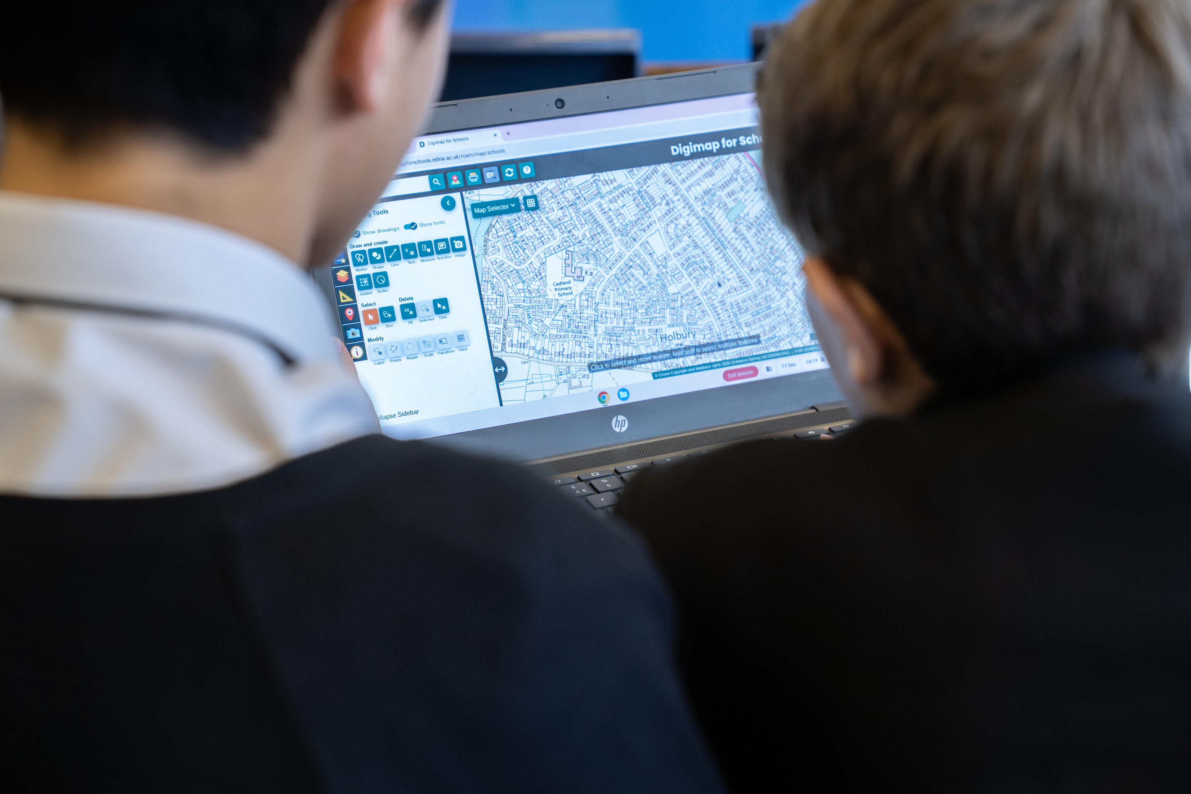
Secondary school pupils working with Digimap for Schools

“Geography plays an important role in helping young people understand the world around them. Our members tell us that digital tools like Digimap for Schools are invaluable for geography teachers to enrich the curriculum learning experience and put data analysis directly into the hands of pupils. We welcome this initiative for schools in deprived areas, as well as the expansion into Scotland and Wales, and encourage all eligible schools to sign-up."
Steve Brace, Chief Executive of the Geographical Association

Digimap for Schools is aligned with the national curricula across Great Britain and enables students aged five to 16 and above to understand and investigate their world while gaining crucial digital and data skills. It is supported by access to a huge library of free learning resources, also available in Welsh, that are designed to aid teaching and support teachers in preparing impactful and interesting lessons, as well as allowing for student-led self-study. 

OS recently published an impact report on its commitment to lifelong learning in geography and geospatial. It also collaborates closely with organisations such as the Royal Geographical Society and the Geographical Association on a wide range of activities including the teaching of geography in schools, educational outcomes, and promoting geography.

Headteachers of eligible schools will be directly contacted about the new offer in the next month. For further information about the Digimap for Schools free access scheme visit: https://digimapforschools.edina.ac.uk/about/imd/.

Thursday, 27 November 2025

25% Discount in the GA Shop

The Budget may have impacted your spending plans, but here's something to enjoy.


The GA has brought some Christmas cheer with our end of the year sale. With a 25% discount on all GA shop items, you can treat yourself to a special teacher present this holiday season.

This discount applies whether you are a GA member or not so everyone get the chance to make some holiday savings.

Use code EOY25 at check out to access this discount.

Monday, 24 November 2025

Coastcraft in use

Good to see the Coastcraft game that I helped create educational materials for (on behalf of the GA) was featured on ITV regional news. Thanks to the students and teachers who trialled the game and provided feedback.

Tuesday, 9 September 2025

Geographer for Hire

As regular readers of my LivingGeography blog will know, I've been reducing my time in the classroom - partly as a way to ensure that teaching stays sustainable for me at my advanced age, but also because I've been fortunate to have a range of interesting external projects in the last couple of years, including books, curriculum making with the Oak National project, BBC Bitesize work, work with the Environment Agency and my ongoing role at the Royal Geographical Society. I've shared this work in my Worldly Wednesdays posts during the year.

This year, I have gone down to three days teaching a week.

Most of those projects mentioned above have now come to an end, although a few new things have already been pencilled in for this year. This means that I have some time free some weeks this academic year to get involved in further projects and am always interested in something new.

If you think I could help you with a project, even if it's just for a few hours or days then feel free to get in touch and tell me more about what you have in mind. Below you can see some of the organisations and publishers I've worked with over the years. 

I haven't added the Geographical Association and the Royal Geographical Society because they're obvious.


My email is a DOT parkinson AT gmail.com

Also find me on LinkedIn.

Message me on BlueSky @geoblogs

Image: Alice Griffiths

Wednesday, 6 August 2025

Oak National - geography curriculum complete

I've been involved with this project for several years and it's finally at an end with the final bits of the curriculum to be uploaded ready for September. I wrote a bit, and reviewed quite a lot of both the primary and the KS3 along with a whole team of people.


You can find the Primary resources here.

Tuesday, 24 June 2025

Judith Mansell RIP

I heard the sad news today that Judith Mansell has passed away.

She was the first Education Officer of the Royal Geographical Society. She authored materials which are still available on the website to this day. She was involved in the creation of the Discovering Antarctica and Discovering the Arctic websites - the former was recently given a fresh relaunch at an event at the RGS.
She also worked on the Unlocking the Archives project - a major undertaking which received a large sum of National Lottery Funding.
She also helped with the creation of the Geography Ambassadors Scheme.


From the RGS News - 1999

She held the post from 1999 to 2010, working latterly with Steve Brace.

Prior to that she taught geography at Bishop's Hatfield Girls School for 11 years, having been educated at Harrow County Girls School.

She was on the project team for the Digital Learning for Key Stage 4 project which happened during the Action Plan for Geography, and was also a Trustee of the GA for some time. This was a joint project between the RGS and the GA and she was one of the people to work to support both organisations, something I think is really important at this time. She was also involved in the Young People's Geographies project in an advisory role, and contributed to the GA's journals as well, as well as TES.

She contributed to many conferences and CPD sessions during her time with both organisations, and also on committees of the AGI.

In Jeremy Krause's GA Presidential biography he talks about her contribution below:

Membership and Professional Development Committee (M&PD)
Prior to becoming Junior Vice President in 1999 I served as Hon Secretary to the GA’s M&PD Committee Chaired by Judy Mansell. This Committee no longer exists, but at this time it played the role described in its title. It carried overall responsibility for Membership and Professional Development activities such as Conference. It also held an overview of Local GA Branches. Each of these areas had a Hon Officer such as Paul McDermott for the GA’s Annual Conference. When it was decided to close down the Committee its activities moved either to Education Standing Committee (Education Group) or to paid staff at GA HQ.

She also wrote an obituary for David Wright - who contributed a great deal to Norfolk geography during his time at UEA.

From the GA Magazine, 2018 - talking about her work as the GA Branches Officer.


Update

Thanks to Claire Brown, who worked with Judy when she started out at the RGS. She says:

Judy was the Society's first Education Officer and the work that she started in that role has shaped our education programme today. Judy started our CPD programme for teachers, A Level study days, the first Young Geographer of the Year competition, and so much more.

An official RGS obituary of Judy is here.

And here's an appreciation of Judy by Steve Brace from the GA Magazine's Autumn 2025 issue.


Sunday, 20 April 2025

Free spiralised fieldwork resources from the GA

There is always a need for fieldwork resources and ideas.

The GA and FSC have teamed up to produce some and share them freely.


The GA fieldwork survey told us that:
  • teachers want new ideas for carrying out fieldwork within their school grounds and local area
  • they want to embed these ideas within their current curricula
  • they want resources that non-specialists can pick up and deliver
  • they want resources that will build progression and don’t just repeat the same techniques but in a different context

The sets of spiralised fieldwork resources were created to support teachers by creating a starting point for fieldwork that can be done in the school grounds and local area. They can be embedded in schemes of work, but also can provide suggestions for activities during transition days or simply when the sun is shining and you want to get outside!

There are four sets to get you started; two themes based on water and trees and woodlands and two techniques, Environmental Quality Assessment and questioning techniques. However, we will be adding more over the coming months.

Jon Cannell, GA Primary Curriculum Lead said:

‘The GA and FSC are extremely excited to release a brand-new collection of FREE resources to support the integration and progression of fieldwork through the geography curriculum. Each set of resources provides easy to use activities connected to key themes from across the geography curriculum as well as introducing geographical ways of thinking and understanding.’

Thursday, 21 November 2024

New resources on the Climate crisis

Some brand new Global Inequalities and the Climate Crisis curriculum resources have been released by the Geographical Association.

This innovative resource package for key stage 3 was developed in partnership with OU Geography Project and academics Parvati Raghuram of the Open University, Melis Cin of Lancaster University and Manu Lekunze of Aberdeen University. 

The resource pack uses testimonies from Cameroonian people to construct a Cameroon country case study.

Our Global Inequalities and the Climate Crisis curriculum resources respond to the APPG for Africa Education Report (2022) by developing a detailed country case study, drawing on lived experiences of African citizens and situating Cameroon in a global context.


The resource responds to the All-Party Parliamentary Group for Africa’s Education report (2022), which found an ‘impoverished treatment of Africa in the school curriculum’, replete with misconceptions (APPG, 2022, p. 10). By developing a detailed case study of one country, informed by ethnographic narratives of lived experiences drawn from residents of that country, the resource seeks to support teachers of geography in providing more sensitive, anti-racist representations of Africa in their classrooms.

GICC consists of materials for five lessons, including lesson PowerPoints, worksheets, and suggested lesson plans. We have endeavored to plan the lessons in a way that is mindful of the geography teacher as curriculum maker, so we hope that teachers will take these resources and find their own ways to integrate them into their teaching in dialogue with colleagues in their school settings.

The story told in this unit of work has been assembled from a collaboration between academic researchers, school geography teachers and the GA. It is a subjective representation informed by ethnographic testimonies. There are other stories to be told about the relationship between global inequalities and the climate crisis, and other ways the story we tell here could have been narrated. We look forward to hearing about how these resources are used in the classroom.

The GICC team:

Melis Cin, Lancaster University

Alesha de Fonseka, Raffles World Academy Dubai UAE

Aliyou Haman, Aberdeen University

Manu Lekunze, Aberdeen University

Parvati Raghuram, Open University

Dan Whittall, Geographical Association

Chris Winter, Geographical Association

Sunday, 15 September 2024

New(ish) GA resource on Sycamore Gap

A new(ish) resource which can be accessed and used by members of the Geographical Association. I am considering adding a section of this to my teaching this year.


Sycamore Gap is a significant landmark in Northumberland where three distinct features combined: a natural and dramatic dip in the physical landscape about halfway along the 80-mile run of Hadrian’s Wall, itself an ancient monument and reminder of the power of the Roman Empire, and until recently, a lone, 300-year-old Sycamore tree. The site has UNESCO designation and is a Scheduled Ancient Monument. Arguably, it will still be known as Sycamore Gap because of its story.

The tree has stood for hundreds of years, perfectly framed by the landscape, thrilling locals and visitors alike until it was deliberately cut down, under cover of darkness, sometime between the evening of 27 September 2023 and the following morning. 

The loss of the tree has caused an outcry and reaction of public grief.

These materials are designed to help children think about some of the issues this story raises. What do they know about Sycamore Gap? Where is it? Have they been there? Why and how do certain landmarks hold such meaning? What is the cultural impact of this and other significant landmarks on our lives? Whose place is this? Who decides what happens here?

While these materials provide a relevant and current context for developing geographical substantive, disciplinary and procedural knowledge, they also model how you might investigate other landmarks with particular significance to your own local community and landscape and the emotions they engender in people.

Complete Materials:PowerPoint
Teachers Notes
Photo Activity
Individual Resource Pages:

Sunday, 9 April 2023

Environment Agency - Rivercraft 2

Updated May 2023

The Environment Agency launched their Rivercraft resource in 2022, which explores the changes made along the River Ribble in Preston using the popular platform of Minecraft to allow students to explore the area.

More details here.

Find out more about it here too.

A new version of the resource is coming soon.

The Environment Agency is one of the GA's Strategic Partners. We worked with the creators of the new version of the game, called Rivercraft 2.

Update

The resource was launched and entered for an award.

The resource won in its category in the Geography in Government Awards!

Read the story here.

Thursday, 23 February 2023

Lantern Slides - a new eBook

This can be downloaded from the site here.

The book mentions the research of Emily Hayes, who kindly contributed some ideas for my GA Presidents blog on the historical use of lantern slides by the RGS and the GA. The GA was founded to help share lantern slides.

She talks about the use of slides by Halford Mackinder, who remains a significant (if problematic) figure in the history of geographical thought:

One of the three case studies Hayes analyses to demonstrate the gradual engagement of the RGS with the lantern is the famous lecture ‘On the Scope and Methods of Geography’ given by a young Mackinder to the RGS in 1887. The geographer had been a key figure in the acceptance and employment of the lantern projector to promote geographical knowledge. In his presentation, in which images and text were synchronized, Mackinder demonstrated he was ready to fully embrace the technology. The debate on the use of lantern slides in geographical education saw Mackinder as one of the main supporters, who recognized the pedagogical potential of the technology to instruct children.

There is an interesting section which I hadn't read about before on how Halford Mackinder was asked by COVICS to produce some slides and lecture notes which became a series of illustrated books - the pictures being smaller versions of the slides used in the original lectures for the Colonial Office. This would doubtless be of interest to those concerned with de/colonising geography.

I need to spend a little more time reading this.

Source:
Mackinder, Halford J., ‘The Teaching of Geography from an Imperial Point of View, and the Use Which Could and Should be Made of Visual Instruction’, The Geographical Teacher, 6.30 (1911), 79–86.

Mackinder, Halford J., India. Eight Lectures Prepared for the Visual Instruction Committee of the Colonial Office(London: George Philip & Son, 1910).

Maddrell, Avril M. C., ‘Empire, Emigration and School Geography: Changing Discourses of Imperial Citizenship, 1880–1925’, Journal of Historical Geography 22.4 (1996), 381.

Sunday, 9 October 2022

Geographers' Gaze Project

I worked on this project with Peter Fox, another former President for over a year and a half on and off, with several meetings at Solly Street and some other work remotely.

Isabel Richardson had done a great deal of preparatory work at Solly Street on the lantern slide collection, which used to number in the tens of thousands. Isabel had been cataloguing the collection.


The plan was to make use of a fund generously donated by former Honorary Treasurer Brian Ellis, to bring these images back out into the open, and provide some ideas for their use in the classroom as well as some context.

I worked with Peter Fox and we co-wrote the accompanying text for each image on the GA website.

The website area is now live, and there is also an article that I have written for the latest GA Magazine.

My original version of the text was a little longer than the final version, which we agreed needed to be a bit tighter to increase the instant accessibility of the resource.

For those who may want a little extra detail on the images, you can download the longer version from Slideshare here - it's over 30 pages long:

Friday, 21 May 2021

Tocuaro Revisited

Thanks to Angus Willson for sending me some copies of Tocuaro in a parcel of things from the 80s and 90s and his time as a consultant on a range of projects and working with Worldaware from 2000-2005.

Tocuaro is a Mexican village and a KS2 Case Study of a distant place which sold well.

Its authors included former GA President Wendy Morgan, along with Vincent Bunce, Fiona Gibbs and David Wakefield. The Book was accompanied by a Teacher Guide, and is in full colour and illustrated with lots of photos, maps and diagrams. A large accompanying map is also available.

Barnaby Bear has visited the area too.

The book was published in 1998 and can still be purchased from the GA Store.

This full colour book for key stage 2 children explores the geography, history and environment of the village through the lives of three generations of the Horta family. It also covers the eruption of the nearby Paricutin volcano in 1943, and the pollution of Lake Patzcuaro, an important local issue.


It has previously been picked up and used by QCA as an exemplar: 

http://www.schoolslinks.co.uk/geo22.pdf

A search reveals that a lot of Primary schools have been inspired by the book to complete a range of creative tasks. The Horta family and their masks have inspired some art work as well.

Additional resources already exist on Twinkl.

It occurred to me that it might be time to update the book and see what changes had taken place in Tocuaro in the last 25 years, perhaps with a new edition for 2023. I had a quick look at Tocuaro using some web maps and will see what I can uncover and compare with the way the village was represented in the book.

Monday, 5 April 2021

Cape Farewell

Cape Farewell was a project that grew out of the GeoVisions project. Fred Martin was on the GeoVisions sub group and wrote the pack.

It was a resource pack which was an important part of the work that we used for the OCR Pilot GCSE Geography as it had a focus on extreme environments. It had a spiral bound pack and a CD with a series of resources and images. It had heavy use for three years that we taught the Pilot GCSE. Here's a trailer video for a later phase of the project.

Cape Farewell - An introduction from Cape Farewell on Vimeo.

Cape Farewell changes the way we think about climate change. Climate change is a reality. Caused by us all, it is a cultural, social and economic problem and must move beyond scientific debate. Cape Farewell is committed to the notion that artists can engage the public in this issue, through creative insight and vision.

Artists and authors were taken to the Arctic, and there was also a link with Svalbard, which became a focus for my teaching.

The project itself explores the cultural response to climate change.


References

Mitchell, Alistair. Teaching Geography, vol. 30, no. 1, 2005, pp. 59–59. JSTOR, www.jstor.org/stable/23756577. Accessed 29 Mar. 2021.

Thanks to Fred Martin for his memories of the creation of this pack and the images which brought back a lot of memories for me. I left these packs behind when I left teaching - wished I'd kept a copy now, as there don't seem to be many around...


Thursday, 1 April 2021

2003: Building Sustainable Communities

Building Sustainable Communities was a GA project which was run in association with the Academy for Sustainable Communities, which later became the Homes and Communities Agency, but was then subsequently replaced again by Homes England... can't keep up with these governmental changes....

Building Sustainable Communities arose from two linked ideas. First of all the idea of living geography - at home and outside the front door - one of the GA's key concepts and one which we've developed over a number of years through our project work. The second was about participation now and for the future - how do students make a positive contribution to the community and how will they develop skills which will contribute to their future economic well-being?

The project also asked two questions: 'What is meant by sustainable communities?' and 'How do geographical skills lead to engagement?'
One of several projects involving the GA over the last few decades. They will feature on this blog in time.


To support the project, groups of teachers were engaged in action research in four regions - Kent and Medway, Milton Keynes and South Midlands, Humberside and Plymouth and South Devon.

The project was ultimately involved with the creation of  this DVD, which I still have a copy of.

This fed into the development of a unit in the OCR Pilot GCSE Geography, which was on Sustainable Communities.

More details here. (PDF download)

Main image: Eddington Sustainable Community in Cambridge - fieldwork day - Alan Parkinson - shared under CC license

Tuesday, 16 March 2021

2003 : Geography Pages

GA News in 2003 gave an early mention for the Geography Pages website, which I ran for over ten years, and which was one of the top 5 most visited Geography websites on the web for a while (as shown by statistics collected by the Royal Geographical Society) 

It started out as 'Mr P's Geography Pages', back in the day when I had dial up internet access through Liberty Surf and then Tiscali. I also sold it as a CD for a while. It led on to a number of other early opportunities for me to get involved in the wider geographical community.

Memories of GeographyPages welcome - I've posted a few already and will be posting a few more as we get nearer to the present day. 

Follow the link here to access it via Archive.org. The domain is currently hosted by Richard Allaway.

Margaret Mackintosh RIP

Updated post. Sad news at the end of last week from colleagues who have organised the Charney Conference over the years of the passing of Ma...